Tributary to Owen Creek - 197378 - Appendix
Site Location
PSCIS crossing 197378 is located on Tributary to Owen Creek, on Klate Lake. The site was located approximately 1km upstream from the confluence with Owen Creek, which drains the nearby Owen Lake. This crossing is the responsibility of West Fraser Mills Ltd.
Background
At crossing 197378, Tributary to Owen Creek is a third order stream with a watershed area upstream of the crossing of approximately 7.9km2. The elevation of the watershed ranges from a maximum of 2073m to 758m at the crossing (Table 5.23). A total of 3ha of lake and 48ha of wetland is modelled upstream. Upstream of crossing 197378, longnose dace, rainbow trout, mountain whitefish, and dolly varden have previously been recorded (MoE 2020b; Norris 2020). The nearby Owen Lake is approximately 300ha in size. Historical records of fish in this lake include rainbow trout, burbot, coho, sucker, dolly varden, lake trout, and whitefish.
fpr::fpr_table_wshd_sum(site_id = my_site) %>%
  fpr::fpr_kable(caption_text = paste0('Summary of derived upstream watershed statistics for PSCIS crossing ', my_site, '.'),
           footnote_text = 'Elev P60 = Elevation at which 60% of the watershed area is above',
scroll = F)| Site | Area Km | Elev Site | Elev Min | Elev Max | Elev Median | Elev P60 | Aspect |
|---|---|---|---|---|---|---|---|
| 197378 | 7.9 | 758 | 743 | 2073 | 920 | 885 | ENE |
| * Elev P60 = Elevation at which 60% of the watershed area is above |
A summary of habitat modelling outputs is presented in Table 5.24. A map of the watershed is provided in map attachment 093L.104.
| Habitat | Potential | Remediation Gain | Remediation Gain (%) |
|---|---|---|---|
| ST Network (km) | 12.3 | 12.3 | 100 |
| ST Lake Reservoir (ha) | 2.8 | 2.8 | 100 |
| ST Wetland (ha) | 48.3 | 48.3 | 100 |
| ST Slopeclass03 Waterbodies (km) | 1.8 | 0.0 | 0 |
| ST Slopeclass03 (km) | 0.3 | 0.3 | 100 |
| ST Slopeclass05 (km) | 0.9 | 0.9 | 100 |
| ST Slopeclass08 (km) | 7.9 | 7.9 | 100 |
| ST Spawning (km) | 0.0 | 0.0 | – |
| ST Rearing (km) | 0.9 | 0.9 | 100 |
| CH Spawning (km) | 0.0 | 0.0 | – |
| CH Rearing (km) | 0.0 | 0.0 | – |
| CO Spawning (km) | 0.6 | 0.6 | 100 |
| CO Rearing (km) | 0.6 | 0.6 | 100 |
| CO Rearing (ha) | – | 0.0 | – |
| SK Spawning (km) | 0.0 | 0.0 | – |
| SK Rearing (km) | 0.0 | 0.0 | – |
| SK Rearing (ha) | – | 0.0 | – |
| All Spawning (km) | 0.6 | 0.6 | 100 |
| All Rearing (km) | 0.9 | 0.9 | 100 |
| All Spawning Rearing (km) | 0.9 | 0.9 | 100 |
| * Model data is preliminary and subject to adjustments. |
Stream Characteristics at Crossing
At the time of the survey, PSCIS crossing 197378 was un-embedded, non-backwatered and ranked as a barrier to upstream fish passage according to the provincial protocol (MoE 2011b) (Table 5.25). Water temperature was 11\(^\circ\)C, pH was 7.6 and conductivity was 84uS/cm.
| Location and Stream Data |
|
Crossing Characteristics | – |
|---|---|---|---|
| Date | 2021-09-07 | Crossing Sub Type | Round Culvert |
| PSCIS ID | 197378 | Diameter (m) | 1 |
| External ID | – | Length (m) | 15 |
| Crew | AI KP TP VJ | Embedded | No |
| UTM Zone | 9 | Depth Embedded (m) | – |
| Easting | 645084.9 | Resemble Channel | No |
| Northing | 5998822 | Backwatered | No |
| Stream | Tributary to Owen Creek | Percent Backwatered | – |
| Road | Klate Lake | Fill Depth (m) | 2.5 |
| Road Tenure | West Fraser R04075 | Outlet Drop (m) | 0.1 |
| Channel Width (m) | 2.4 | Outlet Pool Depth (m) | 0.6 |
| Stream Slope (%) | 3 | Inlet Drop | Yes |
| Beaver Activity | Yes | Slope (%) | 1 |
| Habitat Value | Medium | Valley Fill | Deep Fill |
| Final score | 24 | Barrier Result | Barrier |
| Fix type | Replace with New Open Bottom Structure | Fix Span / Diameter | 10 |
Photos: From top left clockwise: Road/Site Card, Barrel, Outlet, Downstream, Upstream, Inlet.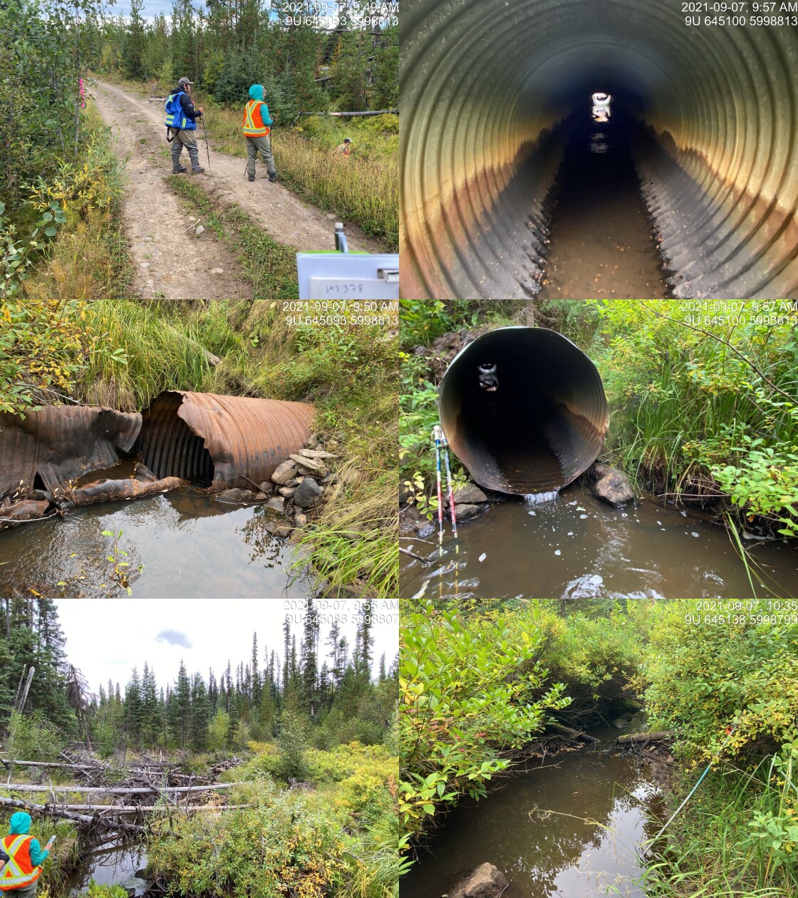
|
|||
| Comments: Damage to pipe. Wetland type area. 9:49 |
Stream Characteristics Downstream
The stream was surveyed downstream from crossing 197378 for 450m (Figures 5.36 - 5.37). The average channel width was 2.4m, the average wetted width was 1.9m, and the average gradient was 2.5%.Total cover amount was rated as abundant with overhanging vegetation dominant. Cover was also present as small woody debris and undercut banks.The dominant substrate was gravels with fines sub-dominant. There was a high percentage of crown closure, with riparian shrubs but a thin, coniferous forest further upland. There was an numerous pockets of gravels suitable for rainbow and dolly varden spawning. The stream appeared to have stable flows with no notable erosion. Overall, the habitat was rated as medium value for salmonid rearing and spawning.
Stream Characteristics Upstream
The stream was surveyed upstream from crossing 197378 for 665m (Figures 5.38 - 5.41). The average channel width was 1.8m, the average wetted width was 1.5m, and the average gradient was 3%.Total cover amount was rated as abundant with undercut banks dominant. Cover was also present as small woody debris, large woody debris, overhanging vegetation, and instream vegetation.The dominant substrate was gravels with fines sub-dominant. This was a small stream containing multiple beaver influenced wetland areas with dams. The stream was comprised of two seperate channels mapped as converging approximatley 100m upstream of the crossing. The dominant channel was the stream mapped as furthest north in the freshwater atlas. It was surveyed in an upstream direction to the location of a beaver influenced wetland. Several pockets of gravel suitable for resident rainbow and dolly varden spawning were present. Surveyors noted “nice runs” and good flow volume. The habitat was rated as medium value with moderate rearing potential. Surveyors visited the southern channel at a point approximately 350m upstream of the FSR but the stream channel at this location was very small with fine sediment substrate.
Structure Remediation and Cost Estimate
Should restoration/maintenance activities proceed, replacement of PSCIS crossing 197378 with a bridge (10m span) is recommended. The cost of the work is estimated at $200,000 for a cost benefit of 2.8 linear m/$1000 and 5 m2/$1000.
Conclusion
There was 0.6km of habitat modelled upstream of crossing 197378 with areas surveyed rated as medium value for salmonid rearing and spawning. 197378 was ranked as a moderate priority for proceeding to design for replacement. Historical data indicates multiple resident fish present upstream within this relatively small system but sampling using electrofishing could be utilized to scope for coho use of the system.
tab_hab_summary %>%
  filter(Site  == my_site) %>%
  # select(-Site) %>%
  fpr::fpr_kable(caption_text = paste0('Summary of habitat details for PSCIS crossing ', my_site, '.'),
scroll = F) | Site | Location | Length Surveyed (m) | Channel Width (m) | Wetted Width (m) | Pool Depth (m) | Gradient (%) | Total Cover | Habitat Value |
|---|---|---|---|---|---|---|---|---|
| 197378 | Downstream | 450 | 2.4 | 1.9 | 0.2 | 2.5 | abundant | medium |
| 197378 | Upstream | 665 | 1.8 | 1.5 | – | 3.0 | abundant | medium |
my_photo1 = fpr::fpr_photo_pull_by_str(str_to_pull = '_d1_')

my_caption1 = paste0('Typical habitat downstream of PSCIS crossing ', my_site, '.')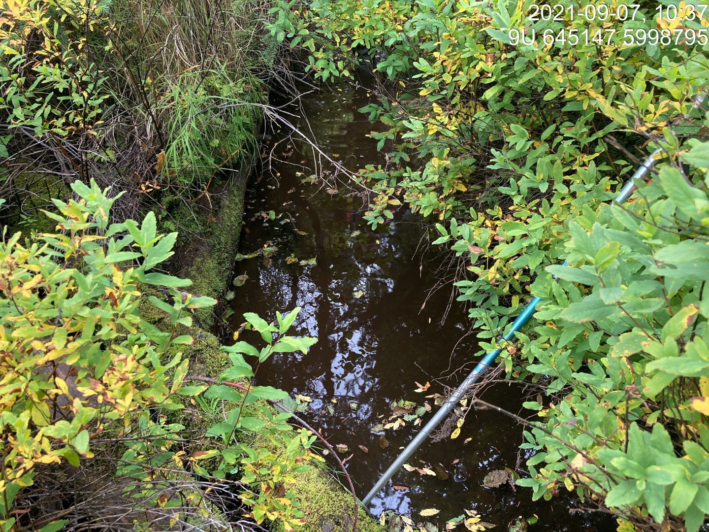
Figure 5.36: Typical habitat downstream of PSCIS crossing 197378.
my_photo2 = fpr::fpr_photo_pull_by_str(str_to_pull = '_d2_')

my_caption2 = paste0('Typical habitat downstream of PSCIS crossing ', my_site, '.')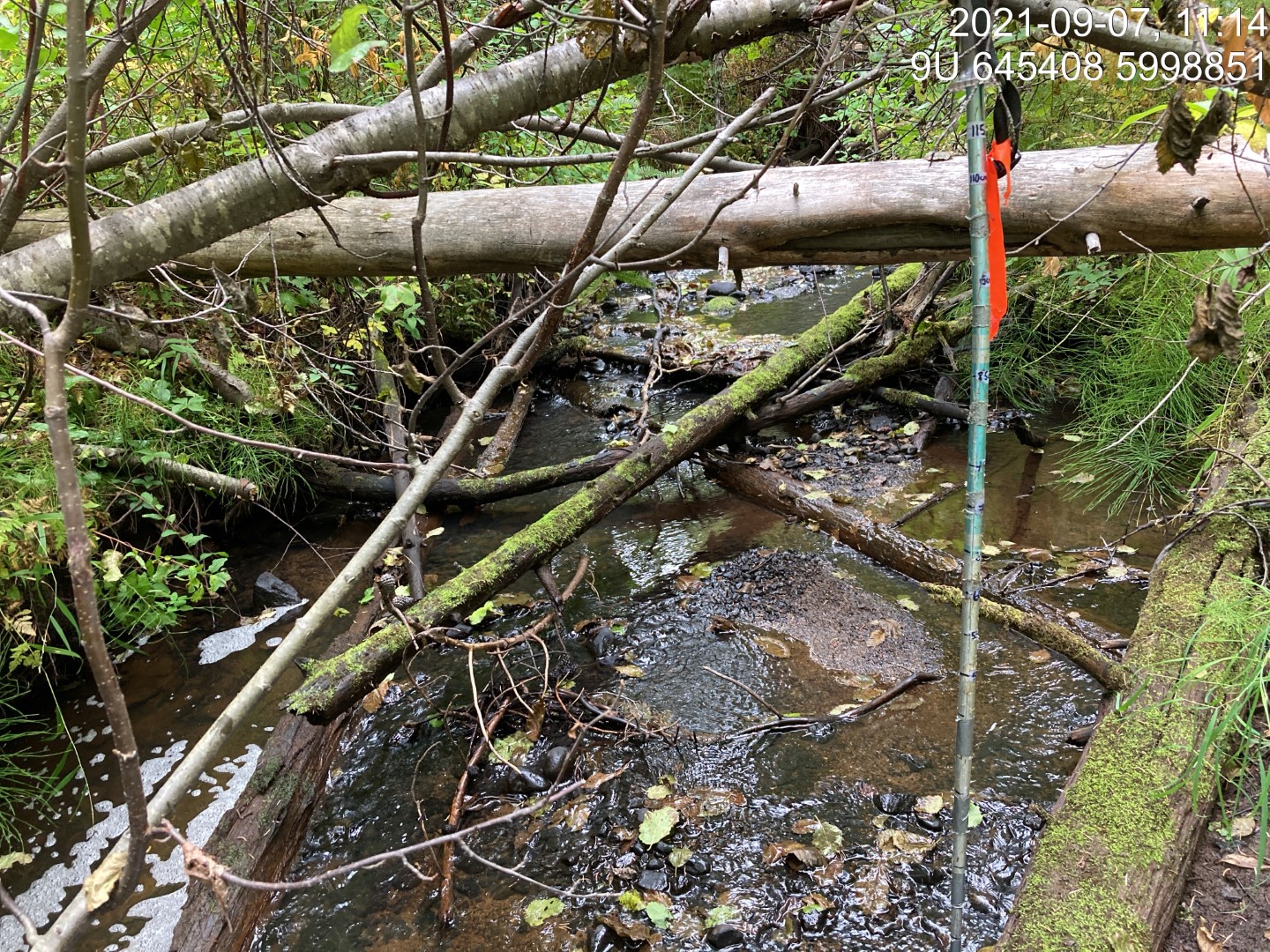
Figure 5.37: Typical habitat downstream of PSCIS crossing 197378.
my_caption <- paste0('Left: ', my_caption1, ' Right: ', my_caption2)

knitr::include_graphics(my_photo1)
knitr::include_graphics("fig/pixel.png")
knitr::include_graphics(my_photo2)
my_photo1 = fpr::fpr_photo_pull_by_str(str_to_pull = '_u1_')
my_caption1 = paste0('Habitat upstream of PSCIS crossing ', my_site, '.')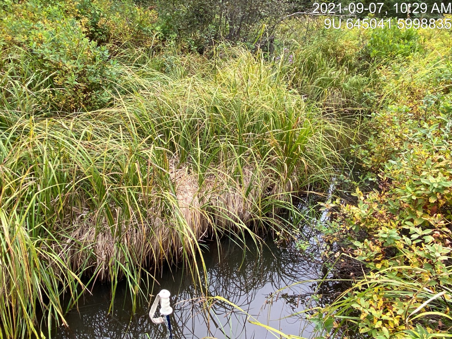
Figure 5.38: Habitat upstream of PSCIS crossing 197378.
my_photo2 = fpr::fpr_photo_pull_by_str(str_to_pull = '_u6_')

my_caption2 = paste0('Habitat upstream of PSCIS crossing ', my_site, '.')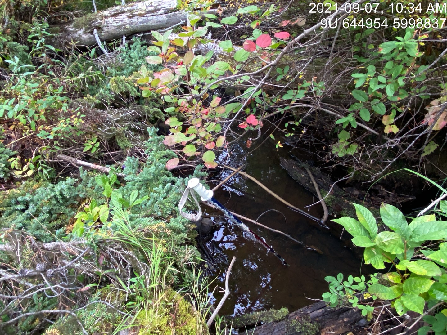
Figure 5.39: Habitat upstream of PSCIS crossing 197378.
my_caption <- paste0('Left: ', my_caption1, ' Right: ', my_caption2)

knitr::include_graphics(my_photo1)
knitr::include_graphics("fig/pixel.png")
knitr::include_graphics(my_photo2)
my_photo1 = fpr::fpr_photo_pull_by_str(str_to_pull = '_u3_')
my_caption1 = paste0('Typical habitat upstream of PSCIS crossing ', my_site, '.')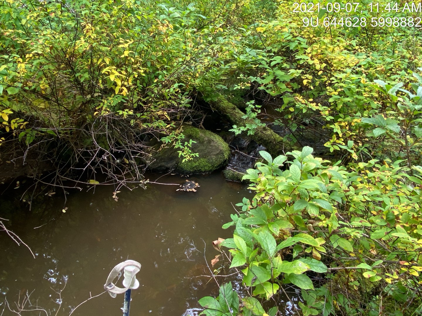
Figure 5.40: Typical habitat upstream of PSCIS crossing 197378.
my_photo2 = fpr::fpr_photo_pull_by_str(str_to_pull = '_u5_')

my_caption2 = paste0('Beaver influenced wetland approximatley 600m upstream of PSCIS crossing ', my_site, '.')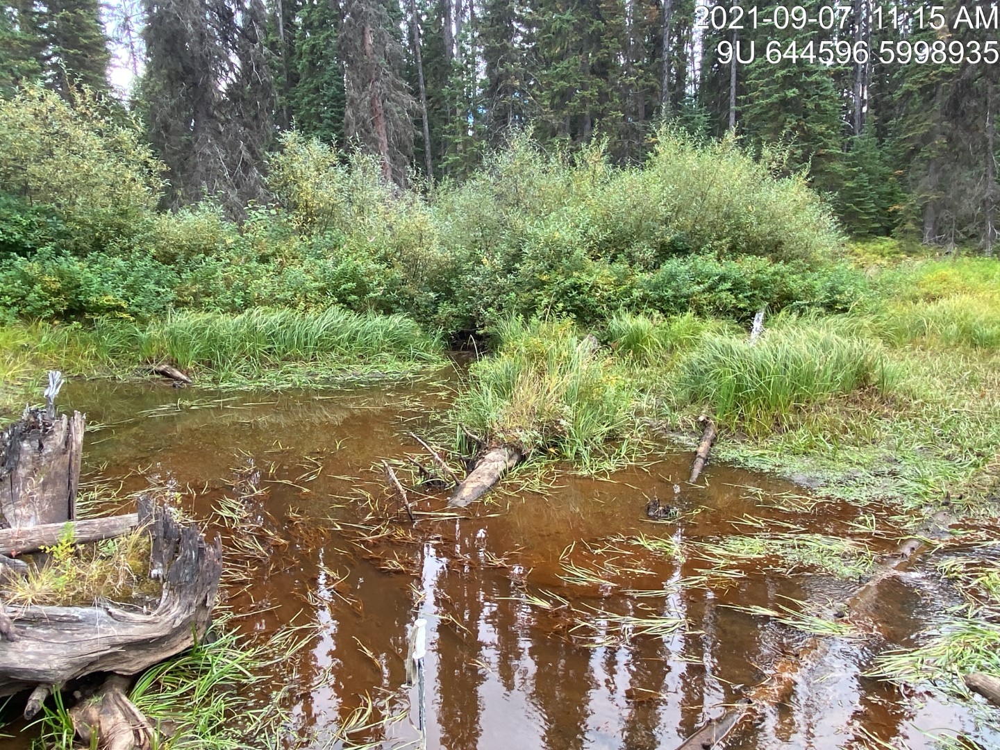
Figure 5.41: Beaver influenced wetland approximatley 600m upstream of PSCIS crossing 197378.
my_caption <- paste0('Left: ', my_caption1, ' Right: ', my_caption2)

knitr::include_graphics(my_photo1)
knitr::include_graphics("fig/pixel.png")
knitr::include_graphics(my_photo2)