Appendix - Phase 1 Fish Passage Assessment Data and Photos
| Location and Stream Data |
|
Crossing Characteristics | – |
|---|---|---|---|
| Date | 2021-08-30 | Crossing Sub Type | Bridge |
| PSCIS ID | 197900 | Diameter (m) | 13.5 |
| External ID | 1805532 | Length (m) | 6 |
| Crew | AI | Embedded | – |
| UTM Zone | 9 | Depth Embedded (m) | – |
| Easting | 685314.1 | Resemble Channel | – |
| Northing | 6030317 | Backwatered | – |
| Stream | Crow Creek | Percent Backwatered | – |
| Road | CN Railway | Fill Depth (m) | – |
| Road Tenure | Canadian National | Outlet Drop (m) | – |
| Channel Width (m) | – | Outlet Pool Depth (m) | – |
| Stream Slope (%) | – | Inlet Drop | – |
| Beaver Activity | – | Slope (%) | – |
| Habitat Value | – | Valley Fill | – |
| Final score | 0 | Barrier Result | Passable |
| Fix type | – | Fix Span / Diameter | – |
Photos: PSCIS ID 197900. From top left clockwise: Road/Site Card, Barrel, Outlet, Downstream, Upstream, Inlet.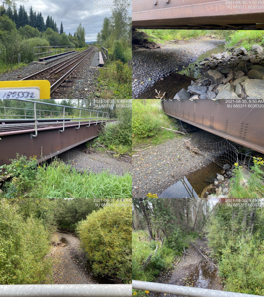
|
|||
| Comments: Bridge. 9:46 |
| Location and Stream Data |
|
Crossing Characteristics | – |
|---|---|---|---|
| Date | 2021-08-30 | Crossing Sub Type | Bridge |
| PSCIS ID | 197901 | Diameter (m) | 8 |
| External ID | 1801185 | Length (m) | 4 |
| Crew | AI KP | Embedded | – |
| UTM Zone | 9 | Depth Embedded (m) | – |
| Easting | 684767 | Resemble Channel | – |
| Northing | 6029867 | Backwatered | – |
| Stream | Crow Creek | Percent Backwatered | – |
| Road | Private | Fill Depth (m) | – |
| Road Tenure | Unclassified | Outlet Drop (m) | – |
| Channel Width (m) | – | Outlet Pool Depth (m) | – |
| Stream Slope (%) | – | Inlet Drop | – |
| Beaver Activity | – | Slope (%) | – |
| Habitat Value | – | Valley Fill | – |
| Final score | 0 | Barrier Result | Passable |
| Fix type | – | Fix Span / Diameter | – |
Photos: PSCIS ID 197901. From top left clockwise: Road/Site Card, Barrel, Outlet, Downstream, Upstream, Inlet.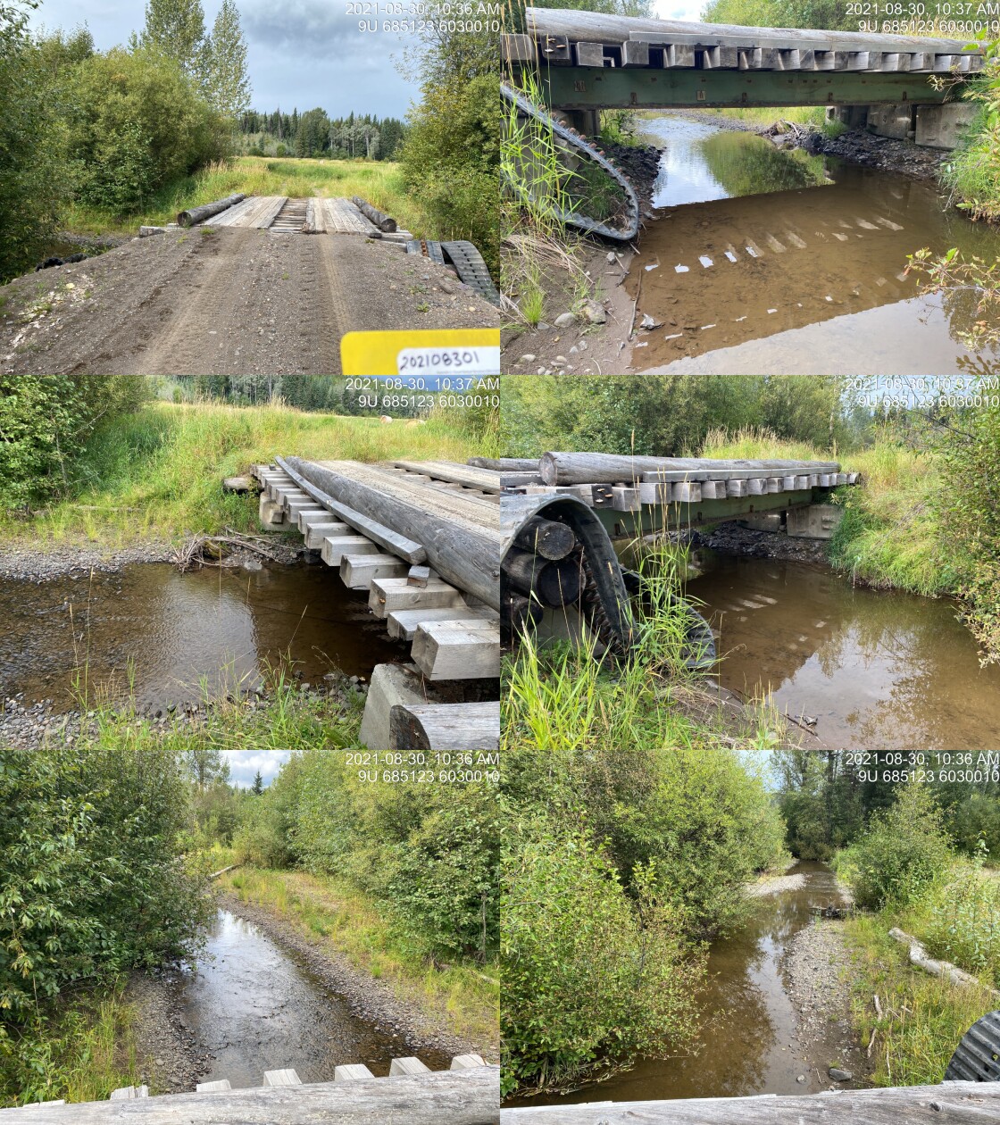
|
|||
| Comments: Bridge. 10:36 |
| Location and Stream Data |
|
Crossing Characteristics | – |
|---|---|---|---|
| Date | 2021-08-30 | Crossing Sub Type | Round Culvert |
| PSCIS ID | 197902 | Diameter (m) | 0.6 |
| External ID | 1800360 | Length (m) | 14 |
| Crew | AI KP | Embedded | No |
| UTM Zone | 9 | Depth Embedded (m) | – |
| Easting | 685353.3 | Resemble Channel | No |
| Northing | 6030520 | Backwatered | No |
| Stream | Tributary to Bulkley River | Percent Backwatered | – |
| Road | Rose Lake Cuttoff Road | Fill Depth (m) | 1 |
| Road Tenure | MoTi Local | Outlet Drop (m) | 0.1 |
| Channel Width (m) | 1.5 | Outlet Pool Depth (m) | 0.1 |
| Stream Slope (%) | 7 | Inlet Drop | No |
| Beaver Activity | No | Slope (%) | 3.5 |
| Habitat Value | Low | Valley Fill | Deep Fill |
| Final score | 26 | Barrier Result | Barrier |
| Fix type | Replace Structure with Streambed Simulation CBS | Fix Span / Diameter | 3 |
Photos: PSCIS ID 197902. From top left clockwise: Road/Site Card, Barrel, Outlet, Downstream, Upstream, Inlet.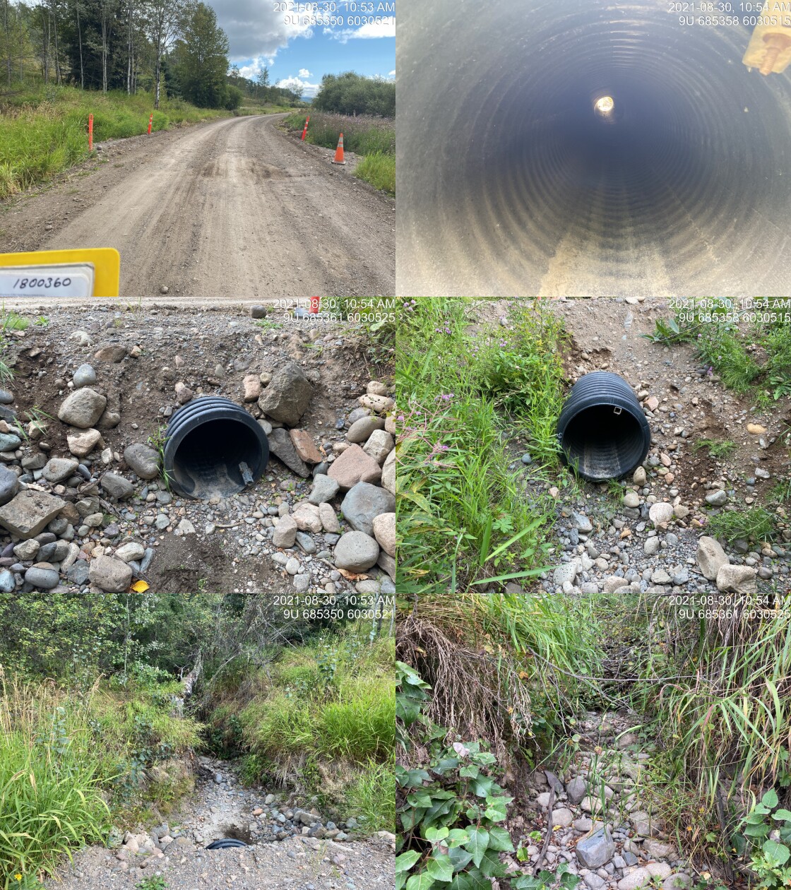
|
|||
| Comments: Dry, small channel. 10:53 |
| Location and Stream Data |
|
Crossing Characteristics | – |
|---|---|---|---|
| Date | 2021-08-30 | Crossing Sub Type | Round Culvert |
| PSCIS ID | 197903 | Diameter (m) | 0.9 |
| External ID | 1800180 | Length (m) | 23 |
| Crew | AI KP | Embedded | No |
| UTM Zone | 9 | Depth Embedded (m) | – |
| Easting | 683420.7 | Resemble Channel | No |
| Northing | 6032258 | Backwatered | No |
| Stream | Tributary to Bulkley River | Percent Backwatered | – |
| Road | Rose Lake Cuttoff Road | Fill Depth (m) | 1 |
| Road Tenure | MoTi Local | Outlet Drop (m) | 0 |
| Channel Width (m) | 1.5 | Outlet Pool Depth (m) | 0 |
| Stream Slope (%) | 12 | Inlet Drop | Yes |
| Beaver Activity | No | Slope (%) | 3.5 |
| Habitat Value | Low | Valley Fill | Deep Fill |
| Final score | 29 | Barrier Result | Barrier |
| Fix type | Replace Structure with Streambed Simulation CBS | Fix Span / Diameter | 3 |
Photos: PSCIS ID 197903. From top left clockwise: Road/Site Card, Barrel, Outlet, Downstream, Upstream, Inlet.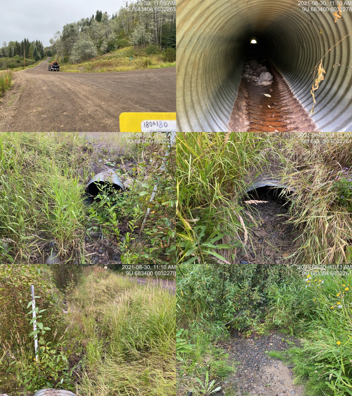
|
|||
| Comments: Dry, small stream. Runs in ditch beside the road. 11:09 |
| Location and Stream Data |
|
Crossing Characteristics | – |
|---|---|---|---|
| Date | 2021-08-30 | Crossing Sub Type | Round Culvert |
| PSCIS ID | 197904 | Diameter (m) | 0.9 |
| External ID | 1800372 | Length (m) | 15 |
| Crew | AI | Embedded | No |
| UTM Zone | 9 | Depth Embedded (m) | – |
| Easting | 681279 | Resemble Channel | No |
| Northing | 6032345 | Backwatered | No |
| Stream | Tributary to Bulkley River | Percent Backwatered | – |
| Road | Crow Creek Road | Fill Depth (m) | 1.5 |
| Road Tenure | Resource | Outlet Drop (m) | 0 |
| Channel Width (m) | 2 | Outlet Pool Depth (m) | 0 |
| Stream Slope (%) | 4 | Inlet Drop | No |
| Beaver Activity | No | Slope (%) | 8 |
| Habitat Value | Low | Valley Fill | Deep Fill |
| Final score | 29 | Barrier Result | Barrier |
| Fix type | Replace with New Open Bottom Structure | Fix Span / Diameter | 10 |
Photos: PSCIS ID 197904. From top left clockwise: Road/Site Card, Barrel, Outlet, Downstream, Upstream, Inlet.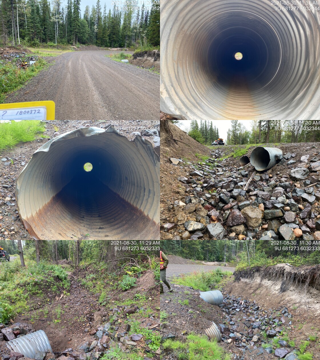
|
|||
| Comments: Dry with dredged channel. Double pipe (0.9 x 0.9). 11:26 |
| Location and Stream Data |
|
Crossing Characteristics | – |
|---|---|---|---|
| Date | 2021-08-30 | Crossing Sub Type | Bridge |
| PSCIS ID | 197905 | Diameter (m) | 10 |
| External ID | 1803682 | Length (m) | 5 |
| Crew | AI KP | Embedded | – |
| UTM Zone | 9 | Depth Embedded (m) | – |
| Easting | 682026.1 | Resemble Channel | – |
| Northing | 6028531 | Backwatered | – |
| Stream | Crow Creek | Percent Backwatered | – |
| Road | Maxan Creek FSR | Fill Depth (m) | – |
| Road Tenure | FLNR DND 7735 | Outlet Drop (m) | – |
| Channel Width (m) | – | Outlet Pool Depth (m) | – |
| Stream Slope (%) | – | Inlet Drop | – |
| Beaver Activity | – | Slope (%) | – |
| Habitat Value | – | Valley Fill | – |
| Final score | 0 | Barrier Result | Passable |
| Fix type | – | Fix Span / Diameter | – |
Photos: PSCIS ID 197905. From top left clockwise: Road/Site Card, Barrel, Outlet, Downstream, Upstream, Inlet.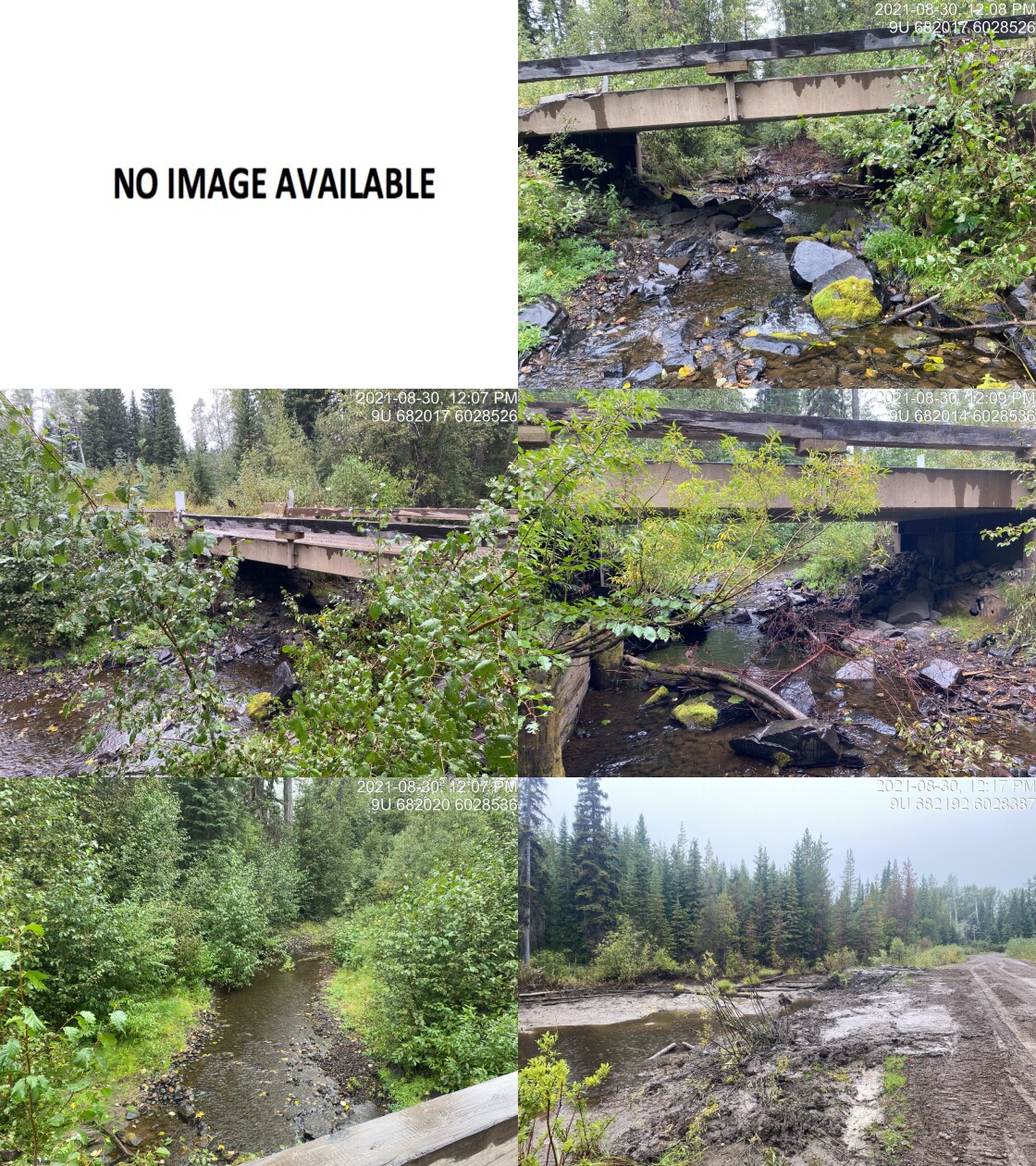
|
|||
| Comments: Bridge. 12:05 |
| Location and Stream Data |
|
Crossing Characteristics | – |
|---|---|---|---|
| Date | 2021-08-30 | Crossing Sub Type | Round Culvert |
| PSCIS ID | 197906 | Diameter (m) | 0.5 |
| External ID | 1803706 | Length (m) | 30 |
| Crew | AI KP | Embedded | No |
| UTM Zone | 9 | Depth Embedded (m) | – |
| Easting | 683683.9 | Resemble Channel | No |
| Northing | 6024930 | Backwatered | No |
| Stream | Tributary to Maxan Creek | Percent Backwatered | – |
| Road | Maxan Creek FSR | Fill Depth (m) | 3 |
| Road Tenure | FLNR DND 7735 | Outlet Drop (m) | 0.6 |
| Channel Width (m) | 1.2 | Outlet Pool Depth (m) | 0.3 |
| Stream Slope (%) | 3 | Inlet Drop | No |
| Beaver Activity | No | Slope (%) | 3.5 |
| Habitat Value | Low | Valley Fill | Deep Fill |
| Final score | 42 | Barrier Result | Barrier |
| Fix type | Replace Structure with Streambed Simulation CBS | Fix Span / Diameter | 3 |
Photos: PSCIS ID 197906. From top left clockwise: Road/Site Card, Barrel, Outlet, Downstream, Upstream, Inlet.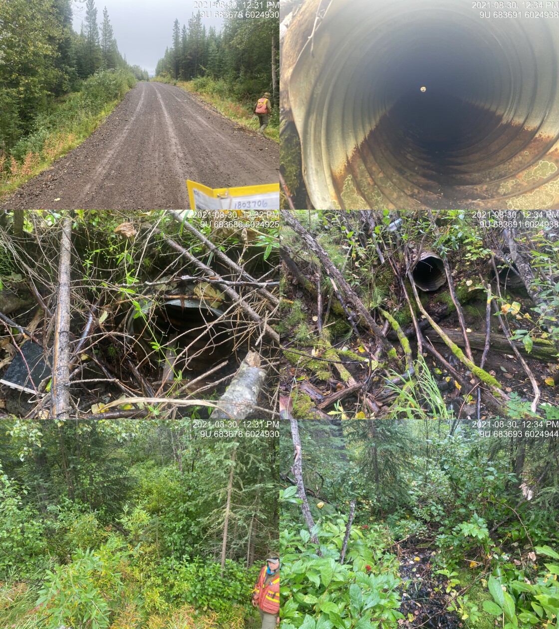
|
|||
| Comments: Dry channel. Two pipes (0.5 x 0.5). FISS site downstream. 12:29 |
| Location and Stream Data |
|
Crossing Characteristics | – |
|---|---|---|---|
| Date | 2021-08-30 | Crossing Sub Type | Round Culvert |
| PSCIS ID | 197907 | Diameter (m) | 1.2 |
| External ID | 1802611 | Length (m) | 23 |
| Crew | AI KP | Embedded | No |
| UTM Zone | 9 | Depth Embedded (m) | – |
| Easting | 685706 | Resemble Channel | No |
| Northing | 6023769 | Backwatered | No |
| Stream | Tributary to Maxan Creek | Percent Backwatered | – |
| Road | Maxan Creek FSR | Fill Depth (m) | 1 |
| Road Tenure | Unknown | Outlet Drop (m) | 0 |
| Channel Width (m) | 1.3 | Outlet Pool Depth (m) | 0 |
| Stream Slope (%) | 2.5 | Inlet Drop | No |
| Beaver Activity | No | Slope (%) | 1 |
| Habitat Value | Low | Valley Fill | Deep Fill |
| Final score | 21 | Barrier Result | Barrier |
| Fix type | Replace Structure with Streambed Simulation CBS | Fix Span / Diameter | 3 |
Photos: PSCIS ID 197907. From top left clockwise: Road/Site Card, Barrel, Outlet, Downstream, Upstream, Inlet.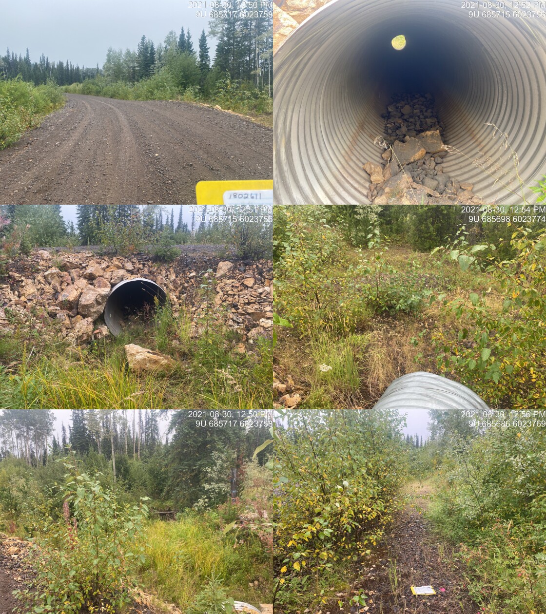
|
|||
| Comments: Dry channel at time of survey. Runs in ditch on low side of road. Recently replaces. 12:49 |
| Location and Stream Data |
|
Crossing Characteristics | – |
|---|---|---|---|
| Date | 2021-08-30 | Crossing Sub Type | Round Culvert |
| PSCIS ID | 197908 | Diameter (m) | 0.3 |
| External ID | 1803697 | Length (m) | 15 |
| Crew | AI KP | Embedded | No |
| UTM Zone | 9 | Depth Embedded (m) | – |
| Easting | 687646.9 | Resemble Channel | No |
| Northing | 6021923 | Backwatered | No |
| Stream | Tributary to Maxan Creek | Percent Backwatered | – |
| Road | Maxan Creek FSR | Fill Depth (m) | 1 |
| Road Tenure | FLNR DND 7735 | Outlet Drop (m) | 0.1 |
| Channel Width (m) | 1 | Outlet Pool Depth (m) | 0 |
| Stream Slope (%) | 2 | Inlet Drop | No |
| Beaver Activity | No | Slope (%) | 1.5 |
| Habitat Value | Low | Valley Fill | Deep Fill |
| Final score | 24 | Barrier Result | Barrier |
| Fix type | Replace Structure with Streambed Simulation CBS | Fix Span / Diameter | 3 |
Photos: PSCIS ID 197908. From top left clockwise: Road/Site Card, Barrel, Outlet, Downstream, Upstream, Inlet.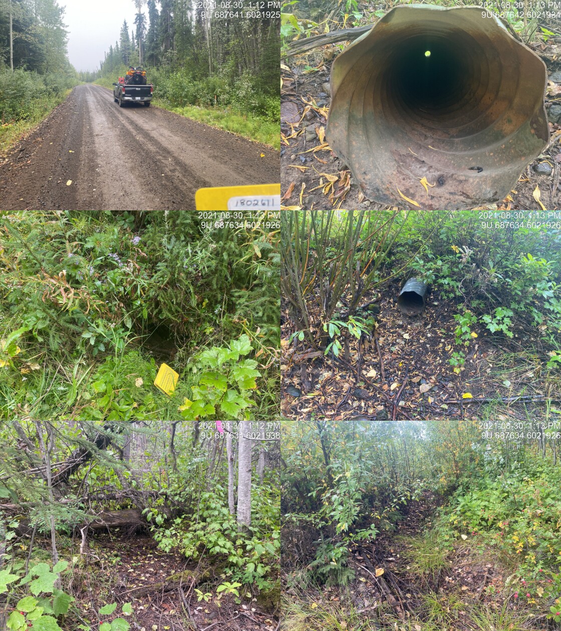
|
|||
| Comments: Dry channel at time of survey. Very small stream. ID # on card in road photo is incorrect. 13:10 |
| Location and Stream Data |
|
Crossing Characteristics | – |
|---|---|---|---|
| Date | 2021-08-30 | Crossing Sub Type | Round Culvert |
| PSCIS ID | 197909 | Diameter (m) | 0.6 |
| External ID | 1804693 | Length (m) | 16 |
| Crew | AI KP | Embedded | No |
| UTM Zone | 9 | Depth Embedded (m) | – |
| Easting | 687557 | Resemble Channel | No |
| Northing | 6020572 | Backwatered | No |
| Stream | Tributary to Maxan Creek | Percent Backwatered | – |
| Road | Maxan Creek FSR | Fill Depth (m) | 2.5 |
| Road Tenure | FLNR DND 7735 | Outlet Drop (m) | 0 |
| Channel Width (m) | 0.9 | Outlet Pool Depth (m) | 0.65 |
| Stream Slope (%) | 4 | Inlet Drop | Yes |
| Beaver Activity | Yes | Slope (%) | 3 |
| Habitat Value | Medium | Valley Fill | Deep Fill |
| Final score | 29 | Barrier Result | Barrier |
| Fix type | Replace Structure with Streambed Simulation CBS | Fix Span / Diameter | 3 |
Photos: PSCIS ID 197909. From top left clockwise: Road/Site Card, Barrel, Outlet, Downstream, Upstream, Inlet.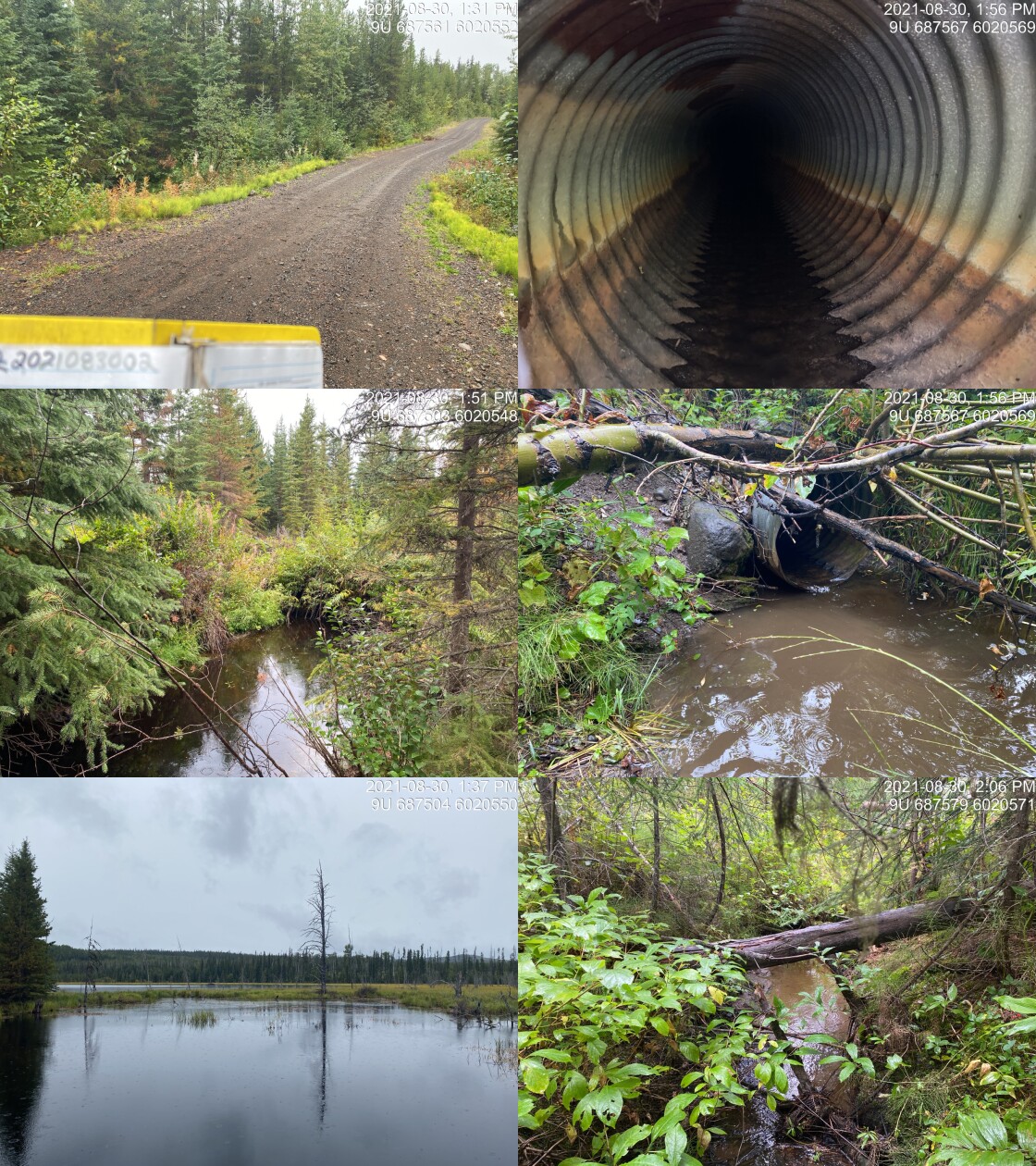
|
|||
| Comments: Habitat value is low to medium. Large beaver influenced lake upstream with two dams ~1.5m high at 10m and 30m upstream. Inlet blocked. Water at inlet is level with the top of the culvert. At 4m downstream is a 1m high beaver dam. 13:23 |
| Location and Stream Data |
|
Crossing Characteristics | – |
|---|---|---|---|
| Date | 2021-08-30 | Crossing Sub Type | Bridge |
| PSCIS ID | 197910 | Diameter (m) | 12 |
| External ID | 1804694 | Length (m) | 5 |
| Crew | AI KP | Embedded | – |
| UTM Zone | 9 | Depth Embedded (m) | – |
| Easting | 688604 | Resemble Channel | – |
| Northing | 6019911 | Backwatered | – |
| Stream | Tributary to Maxan Creek | Percent Backwatered | – |
| Road | Spur 30 | Fill Depth (m) | – |
| Road Tenure | FLNR DND 7735 | Outlet Drop (m) | – |
| Channel Width (m) | – | Outlet Pool Depth (m) | – |
| Stream Slope (%) | – | Inlet Drop | – |
| Beaver Activity | – | Slope (%) | – |
| Habitat Value | – | Valley Fill | – |
| Final score | 0 | Barrier Result | Passable |
| Fix type | – | Fix Span / Diameter | – |
Photos: PSCIS ID 197910. From top left clockwise: Road/Site Card, Barrel, Outlet, Downstream, Upstream, Inlet.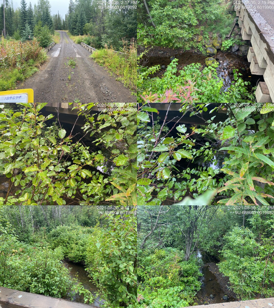
|
|||
| Comments: Bridge. 14:15 |
| Location and Stream Data |
|
Crossing Characteristics | – |
|---|---|---|---|
| Date | 2021-08-30 | Crossing Sub Type | Ford |
| PSCIS ID | 197911 | Diameter (m) | – |
| External ID | 2021083003 | Length (m) | – |
| Crew | AI | Embedded | – |
| UTM Zone | 9 | Depth Embedded (m) | – |
| Easting | 686933 | Resemble Channel | – |
| Northing | 6023054 | Backwatered | – |
| Stream | Foxy Creek | Percent Backwatered | – |
| Road | unnamed | Fill Depth (m) | – |
| Road Tenure | Unclassified | Outlet Drop (m) | – |
| Channel Width (m) | – | Outlet Pool Depth (m) | – |
| Stream Slope (%) | – | Inlet Drop | – |
| Beaver Activity | – | Slope (%) | – |
| Habitat Value | – | Valley Fill | – |
| Final score | 0 | Barrier Result | Unknown |
| Fix type | – | Fix Span / Diameter | – |
Photos: PSCIS ID 197911. From top left clockwise: Road/Site Card, Barrel, Outlet, Downstream, Upstream, Inlet.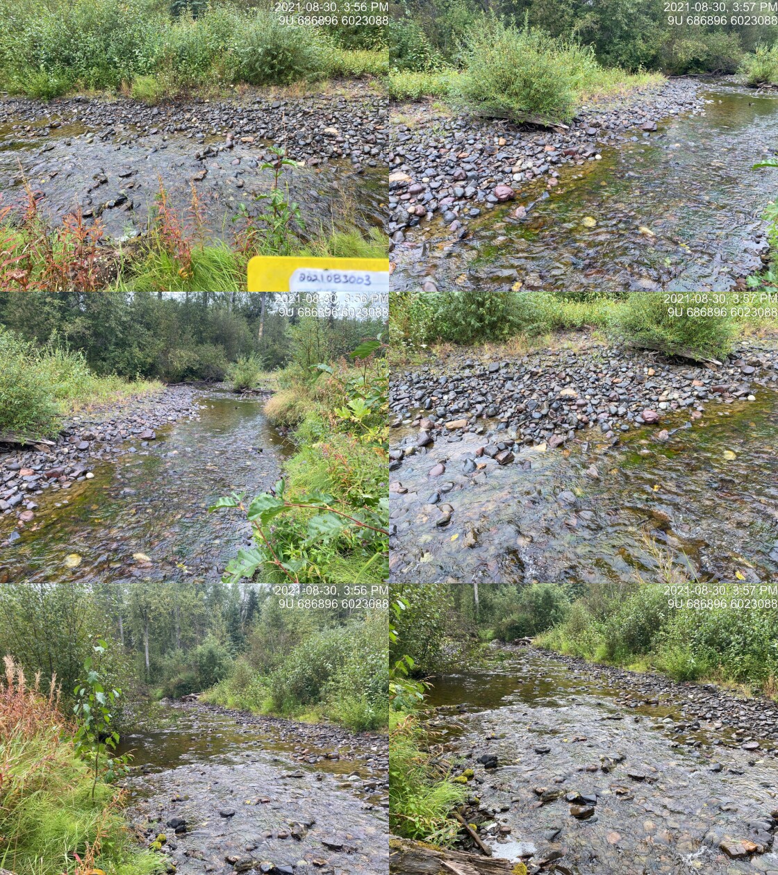
|
|||
| Comments: Ford. 15:55 |
| Location and Stream Data |
|
Crossing Characteristics | – |
|---|---|---|---|
| Date | 2021-08-31 | Crossing Sub Type | Bridge |
| PSCIS ID | 197912 | Diameter (m) | 12 |
| External ID | 1802106 | Length (m) | 7 |
| Crew | AI | Embedded | – |
| UTM Zone | 9 | Depth Embedded (m) | – |
| Easting | 670963 | Resemble Channel | – |
| Northing | 6046221 | Backwatered | – |
| Stream | Robert Hatch Creek | Percent Backwatered | – |
| Road | Private | Fill Depth (m) | – |
| Road Tenure | Unclassified | Outlet Drop (m) | – |
| Channel Width (m) | – | Outlet Pool Depth (m) | – |
| Stream Slope (%) | – | Inlet Drop | – |
| Beaver Activity | – | Slope (%) | – |
| Habitat Value | – | Valley Fill | – |
| Final score | 0 | Barrier Result | Passable |
| Fix type | – | Fix Span / Diameter | – |
Photos: PSCIS ID 197912. From top left clockwise: Road/Site Card, Barrel, Outlet, Downstream, Upstream, Inlet.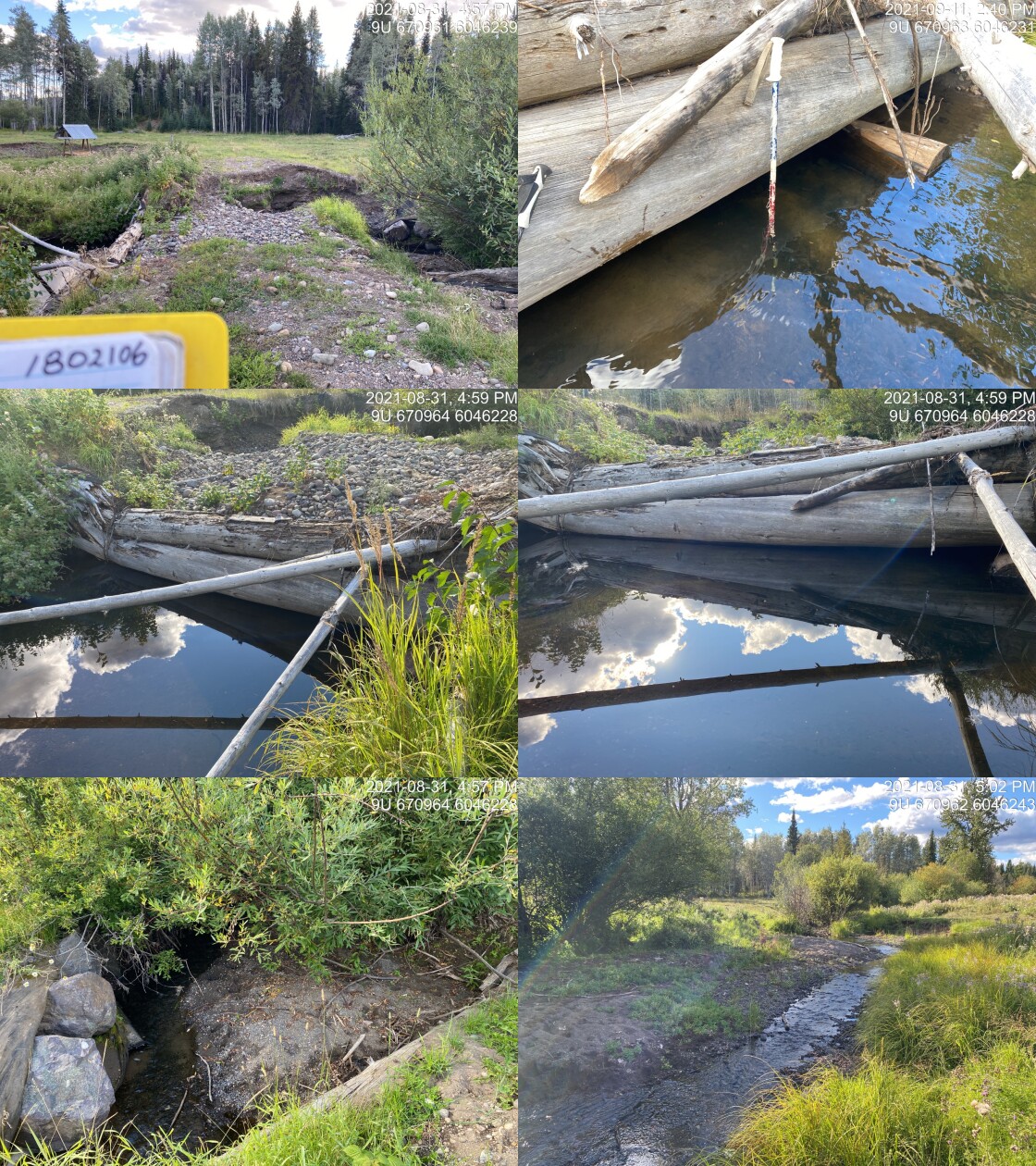
|
|||
| Comments: Bridge has collapsed and is impediment to upstream fish passage. Habitat confirmation conducted. 16:56 |
| Location and Stream Data |
|
Crossing Characteristics | – |
|---|---|---|---|
| Date | 2021-08-31 | Crossing Sub Type | Ford |
| PSCIS ID | 197913 | Diameter (m) | – |
| External ID | 1802088 | Length (m) | – |
| Crew | AI | Embedded | – |
| UTM Zone | 9 | Depth Embedded (m) | – |
| Easting | 669947 | Resemble Channel | – |
| Northing | 6047217 | Backwatered | – |
| Stream | Robert Hatch Creek | Percent Backwatered | – |
| Road | Private | Fill Depth (m) | – |
| Road Tenure | Unclassified | Outlet Drop (m) | – |
| Channel Width (m) | – | Outlet Pool Depth (m) | – |
| Stream Slope (%) | – | Inlet Drop | – |
| Beaver Activity | – | Slope (%) | – |
| Habitat Value | – | Valley Fill | – |
| Final score | 0 | Barrier Result | Unknown |
| Fix type | – | Fix Span / Diameter | – |
Photos: PSCIS ID 197913. From top left clockwise: Road/Site Card, Barrel, Outlet, Downstream, Upstream, Inlet.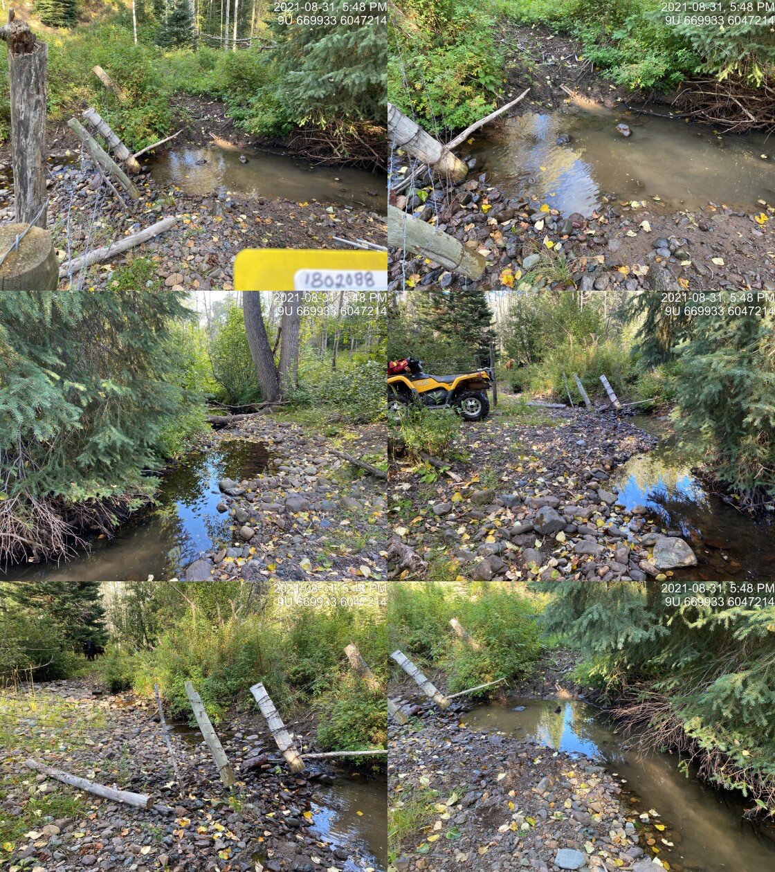
|
|||
| Comments: Ford. 17:46 |
| Location and Stream Data |
|
Crossing Characteristics | – |
|---|---|---|---|
| Date | 2021-08-31 | Crossing Sub Type | Ford |
| PSCIS ID | 197914 | Diameter (m) | – |
| External ID | 1802089 | Length (m) | – |
| Crew | AI | Embedded | – |
| UTM Zone | 9 | Depth Embedded (m) | – |
| Easting | 668873 | Resemble Channel | – |
| Northing | 6046967 | Backwatered | – |
| Stream | Johnny David Creek | Percent Backwatered | – |
| Road | Private | Fill Depth (m) | – |
| Road Tenure | Unclassified | Outlet Drop (m) | – |
| Channel Width (m) | – | Outlet Pool Depth (m) | – |
| Stream Slope (%) | – | Inlet Drop | – |
| Beaver Activity | – | Slope (%) | – |
| Habitat Value | – | Valley Fill | – |
| Final score | 0 | Barrier Result | Unknown |
| Fix type | – | Fix Span / Diameter | – |
Photos: PSCIS ID 197914. From top left clockwise: Road/Site Card, Barrel, Outlet, Downstream, Upstream, Inlet.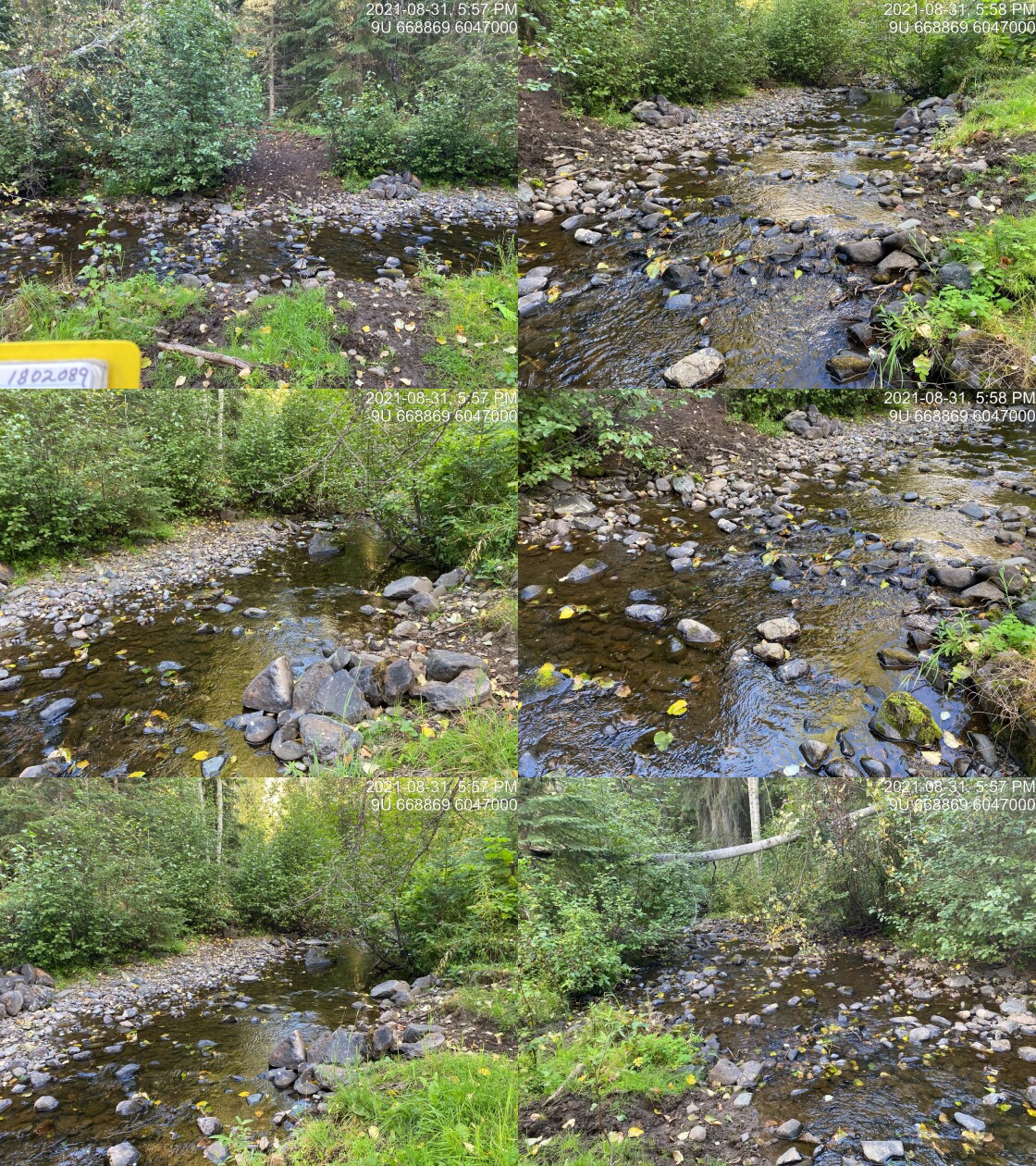
|
|||
| Comments: Ford. Area is extensively impacted by cattle trampling of banks. 17:56 |
| Location and Stream Data |
|
Crossing Characteristics | – |
|---|---|---|---|
| Date | 2021-09-01 | Crossing Sub Type | Ford |
| PSCIS ID | 197915 | Diameter (m) | – |
| External ID | 14000613 | Length (m) | – |
| Crew | AI | Embedded | – |
| UTM Zone | 9 | Depth Embedded (m) | – |
| Easting | 588885 | Resemble Channel | – |
| Northing | 6003123 | Backwatered | – |
| Stream | Tributary to Gosnell Creek | Percent Backwatered | – |
| Road | – | Fill Depth (m) | – |
| Road Tenure | Unknown | Outlet Drop (m) | – |
| Channel Width (m) | – | Outlet Pool Depth (m) | – |
| Stream Slope (%) | – | Inlet Drop | – |
| Beaver Activity | – | Slope (%) | – |
| Habitat Value | – | Valley Fill | – |
| Final score | 0 | Barrier Result | Unknown |
| Fix type | – | Fix Span / Diameter | – |
Photos: PSCIS ID 197915. From top left clockwise: Road/Site Card, Barrel, Outlet, Downstream, Upstream, Inlet.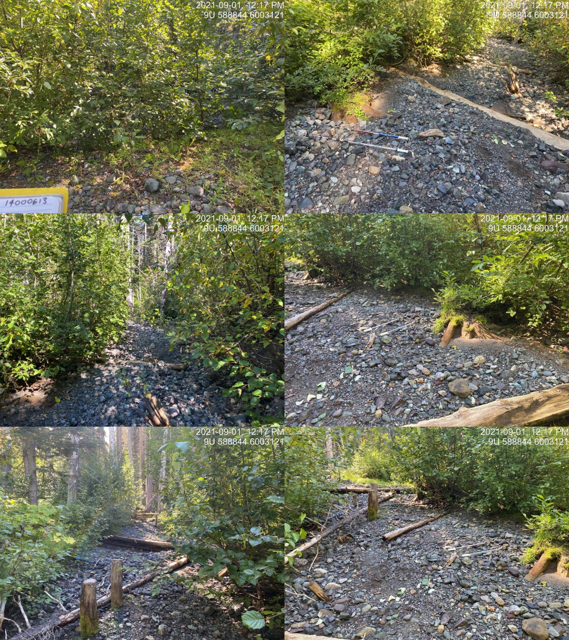
|
|||
| Comments: Ford. Road deactivated and grown in. Not ATV accessible beyond this point. 12:15 |
| Location and Stream Data |
|
Crossing Characteristics | – |
|---|---|---|---|
| Date | 2021-09-01 | Crossing Sub Type | Oval Culvert |
| PSCIS ID | 197916 | Diameter (m) | 1.95 |
| External ID | 14000621 | Length (m) | 16 |
| Crew | AI | Embedded | Yes |
| UTM Zone | 9 | Depth Embedded (m) | 0.15 |
| Easting | 589552.5 | Resemble Channel | Yes |
| Northing | 6003685 | Backwatered | No |
| Stream | Tributary to Gosnell Creek | Percent Backwatered | – |
| Road | Crystal Creek FSR | Fill Depth (m) | 2 |
| Road Tenure | Canfor R04078 | Outlet Drop (m) | 0 |
| Channel Width (m) | 2.8 | Outlet Pool Depth (m) | 0.05 |
| Stream Slope (%) | 7 | Inlet Drop | No |
| Beaver Activity | No | Slope (%) | 0.8 |
| Habitat Value | Medium | Valley Fill | Deep Fill |
| Final score | 14 | Barrier Result | Passable |
| Fix type | – | Fix Span / Diameter | – |
Photos: PSCIS ID 197916. From top left clockwise: Road/Site Card, Barrel, Outlet, Downstream, Upstream, Inlet.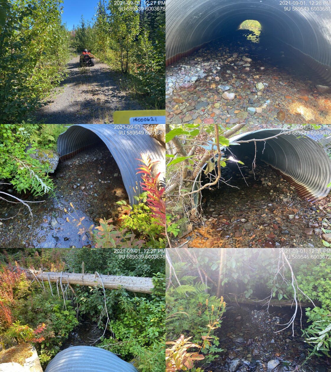
|
|||
| Comments: Old Crystal Ck FSR. Flat bottom structure. Good flow with abundant gravels and LWD. Nice stream. Appears passable to all life stages. Culvert slope was estimated with clinometer so may be slightly off. If slope was entered as 1% this crossing would rank as a "potential" barrier. 12:26 |
| Location and Stream Data |
|
Crossing Characteristics | – |
|---|---|---|---|
| Date | 2021-09-01 | Crossing Sub Type | Bridge |
| PSCIS ID | 197917 | Diameter (m) | 12.5 |
| External ID | 14000614 | Length (m) | 5 |
| Crew | AI | Embedded | – |
| UTM Zone | 9 | Depth Embedded (m) | – |
| Easting | 590839.4 | Resemble Channel | – |
| Northing | 6004385 | Backwatered | – |
| Stream | Tributary to Gosnell Creek | Percent Backwatered | – |
| Road | Crystal Creek FSR | Fill Depth (m) | – |
| Road Tenure | Canfor R04078 | Outlet Drop (m) | – |
| Channel Width (m) | – | Outlet Pool Depth (m) | – |
| Stream Slope (%) | – | Inlet Drop | – |
| Beaver Activity | – | Slope (%) | – |
| Habitat Value | – | Valley Fill | – |
| Final score | 0 | Barrier Result | Passable |
| Fix type | – | Fix Span / Diameter | – |
Photos: PSCIS ID 197917. From top left clockwise: Road/Site Card, Barrel, Outlet, Downstream, Upstream, Inlet.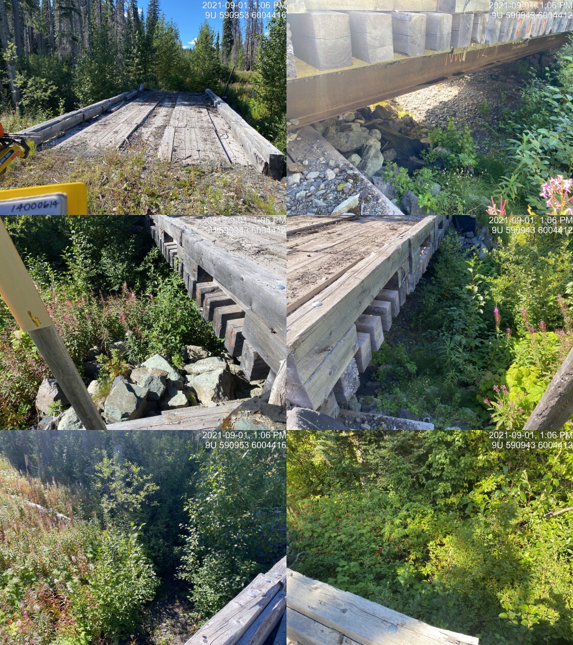
|
|||
| Comments: Dry channel at time of survey. Should this bridge be removed and girders salvaged? 13:05 |
| Location and Stream Data |
|
Crossing Characteristics | – |
|---|---|---|---|
| Date | 2021-09-01 | Crossing Sub Type | Bridge |
| PSCIS ID | 197918 | Diameter (m) | 9 |
| External ID | 14000944 | Length (m) | 5 |
| Crew | AI | Embedded | – |
| UTM Zone | 9 | Depth Embedded (m) | – |
| Easting | 591400.3 | Resemble Channel | – |
| Northing | 6004533 | Backwatered | – |
| Stream | Tributary to Gosnell Creek | Percent Backwatered | – |
| Road | Crystal Creek FSR | Fill Depth (m) | – |
| Road Tenure | FLNR DND 9785 | Outlet Drop (m) | – |
| Channel Width (m) | – | Outlet Pool Depth (m) | – |
| Stream Slope (%) | – | Inlet Drop | – |
| Beaver Activity | – | Slope (%) | – |
| Habitat Value | – | Valley Fill | – |
| Final score | 0 | Barrier Result | Passable |
| Fix type | – | Fix Span / Diameter | – |
Photos: PSCIS ID 197918. From top left clockwise: Road/Site Card, Barrel, Outlet, Downstream, Upstream, Inlet.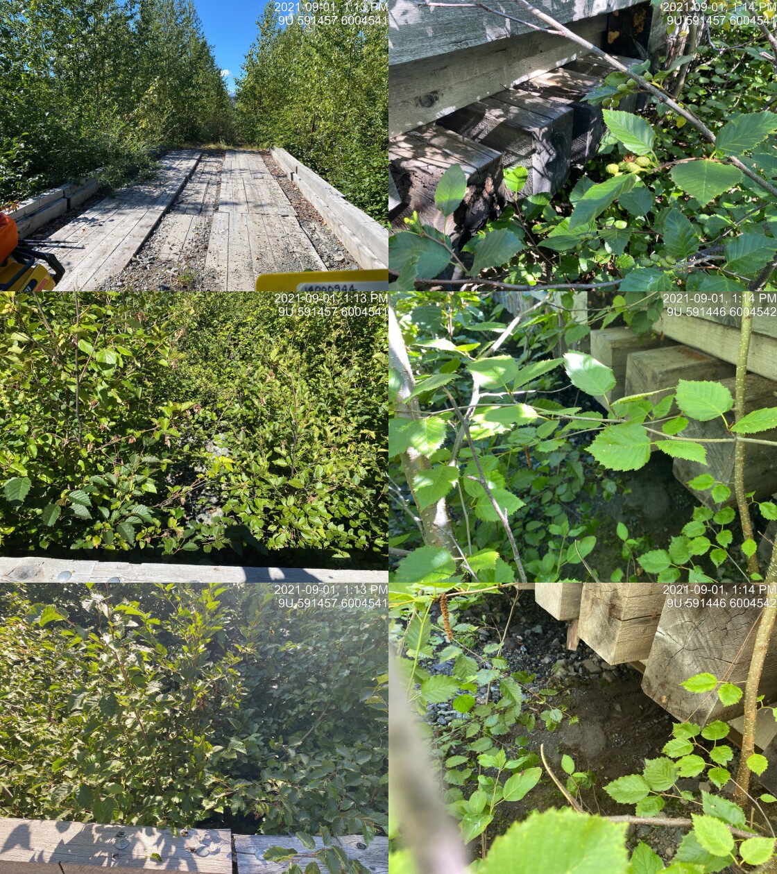
|
|||
| Comments: Bridge. Wood abutments and girders. 13:12 |
| Location and Stream Data |
|
Crossing Characteristics | – |
|---|---|---|---|
| Date | 2021-09-01 | Crossing Sub Type | Ford |
| PSCIS ID | 197919 | Diameter (m) | – |
| External ID | 14001249 | Length (m) | – |
| Crew | AI | Embedded | – |
| UTM Zone | 9 | Depth Embedded (m) | – |
| Easting | 591715 | Resemble Channel | – |
| Northing | 6005282 | Backwatered | – |
| Stream | Tributary to Gosnell Creek | Percent Backwatered | – |
| Road | Spur | Fill Depth (m) | – |
| Road Tenure | – | Outlet Drop (m) | – |
| Channel Width (m) | – | Outlet Pool Depth (m) | – |
| Stream Slope (%) | – | Inlet Drop | – |
| Beaver Activity | – | Slope (%) | – |
| Habitat Value | – | Valley Fill | – |
| Final score | 0 | Barrier Result | Unknown |
| Fix type | – | Fix Span / Diameter | – |
Photos: PSCIS ID 197919. From top left clockwise: Road/Site Card, Barrel, Outlet, Downstream, Upstream, Inlet.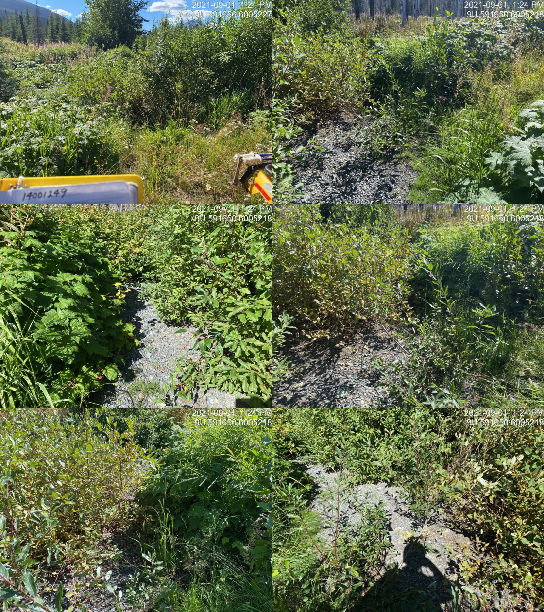
|
|||
| Comments: Ford. 13:24 |
| Location and Stream Data |
|
Crossing Characteristics | – |
|---|---|---|---|
| Date | 2021-09-01 | Crossing Sub Type | Bridge |
| PSCIS ID | 197920 | Diameter (m) | 14 |
| External ID | 14000725 | Length (m) | 5 |
| Crew | AI | Embedded | – |
| UTM Zone | 9 | Depth Embedded (m) | – |
| Easting | 598299.8 | Resemble Channel | – |
| Northing | 6007626 | Backwatered | – |
| Stream | Tributary to Gosnell Creek | Percent Backwatered | – |
| Road | Crystal Creek FSR | Fill Depth (m) | – |
| Road Tenure | Canfor R04078 | Outlet Drop (m) | – |
| Channel Width (m) | – | Outlet Pool Depth (m) | – |
| Stream Slope (%) | – | Inlet Drop | – |
| Beaver Activity | – | Slope (%) | – |
| Habitat Value | – | Valley Fill | – |
| Final score | 0 | Barrier Result | Passable |
| Fix type | – | Fix Span / Diameter | – |
Photos: PSCIS ID 197920. From top left clockwise: Road/Site Card, Barrel, Outlet, Downstream, Upstream, Inlet.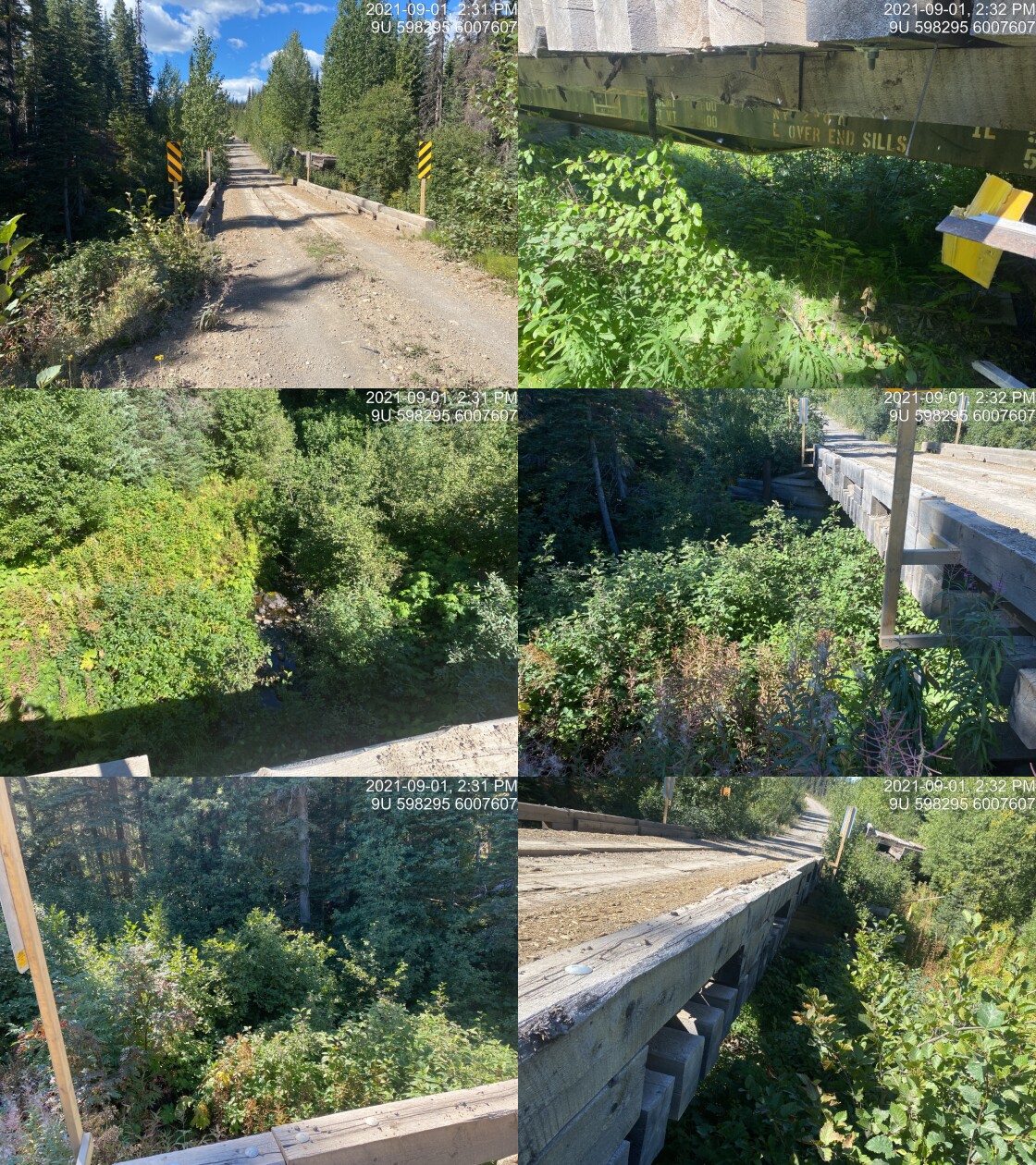
|
|||
| Comments: Bridge. 14:31 |
| Location and Stream Data |
|
Crossing Characteristics | – |
|---|---|---|---|
| Date | 2021-09-01 | Crossing Sub Type | Ford |
| PSCIS ID | 197921 | Diameter (m) | – |
| External ID | 14001542 | Length (m) | – |
| Crew | AI | Embedded | – |
| UTM Zone | 9 | Depth Embedded (m) | – |
| Easting | 595641.5 | Resemble Channel | – |
| Northing | 6007685 | Backwatered | – |
| Stream | Tributary to Gosnell Creek | Percent Backwatered | – |
| Road | Spur | Fill Depth (m) | – |
| Road Tenure | Resource | Outlet Drop (m) | – |
| Channel Width (m) | – | Outlet Pool Depth (m) | – |
| Stream Slope (%) | – | Inlet Drop | – |
| Beaver Activity | – | Slope (%) | – |
| Habitat Value | – | Valley Fill | – |
| Final score | 0 | Barrier Result | Unknown |
| Fix type | – | Fix Span / Diameter | – |
Photos: PSCIS ID 197921. From top left clockwise: Road/Site Card, Barrel, Outlet, Downstream, Upstream, Inlet.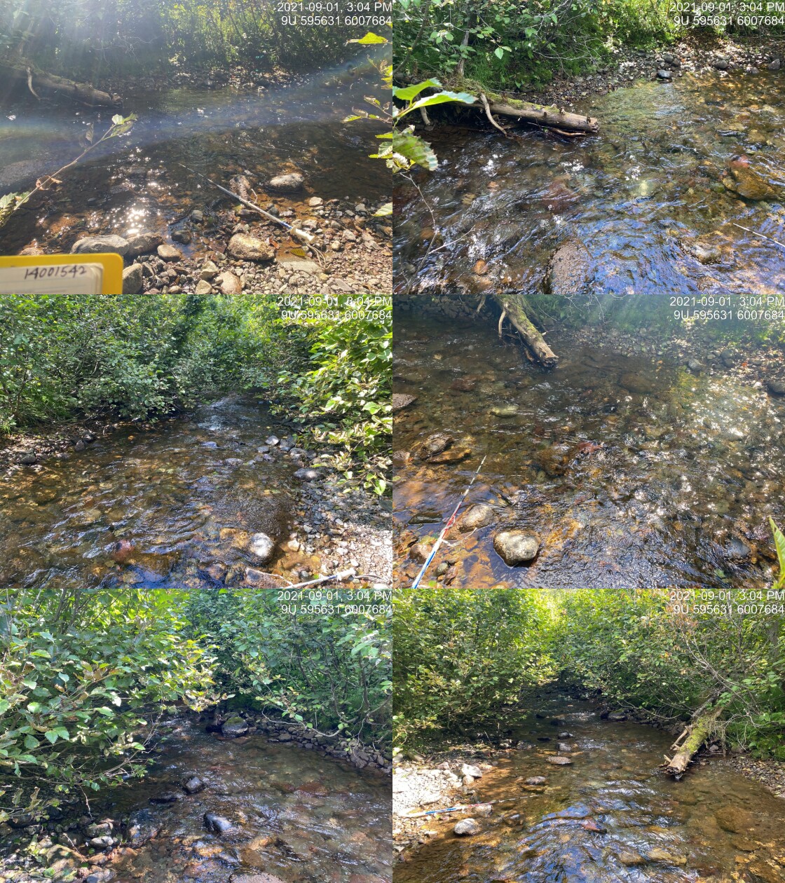
|
|||
| Comments: Road deactivated. 15:02 |
| Location and Stream Data |
|
Crossing Characteristics | – |
|---|---|---|---|
| Date | 2021-09-01 | Crossing Sub Type | Round Culvert |
| PSCIS ID | 197922 | Diameter (m) | 1 |
| External ID | 14000828 | Length (m) | 14 |
| Crew | AI | Embedded | Yes |
| UTM Zone | 9 | Depth Embedded (m) | 0.05 |
| Easting | 599394 | Resemble Channel | Yes |
| Northing | 6008489 | Backwatered | No |
| Stream | Tributary to Gosnell Creek | Percent Backwatered | – |
| Road | Spur | Fill Depth (m) | 1 |
| Road Tenure | Canfor R04078 | Outlet Drop (m) | 0 |
| Channel Width (m) | 0.8 | Outlet Pool Depth (m) | 0 |
| Stream Slope (%) | 0 | Inlet Drop | No |
| Beaver Activity | No | Slope (%) | 1 |
| Habitat Value | Low | Valley Fill | Deep Fill |
| Final score | 10 | Barrier Result | Passable |
| Fix type | – | Fix Span / Diameter | – |
Photos: PSCIS ID 197922. From top left clockwise: Road/Site Card, Barrel, Outlet, Downstream, Upstream, Inlet.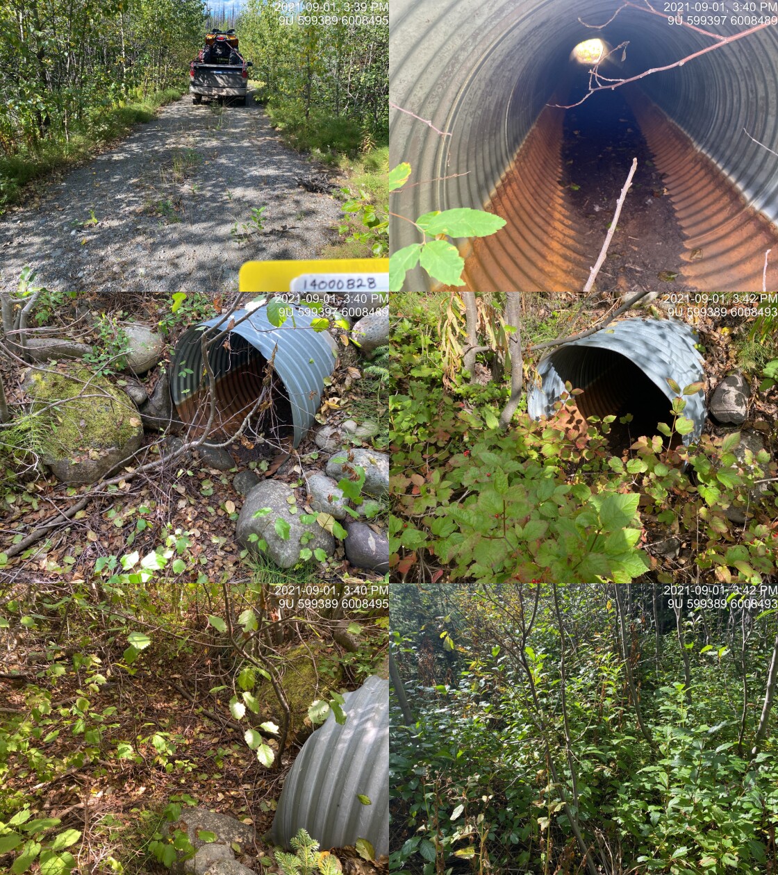
|
|||
| Comments: Dry at time of survey. Channel poorly defined. Likely flows for only short periods. 15:40 |
| Location and Stream Data |
|
Crossing Characteristics | – |
|---|---|---|---|
| Date | 2021-09-01 | Crossing Sub Type | Round Culvert |
| PSCIS ID | 197923 | Diameter (m) | 1.2 |
| External ID | 14000949 | Length (m) | 28 |
| Crew | AI | Embedded | No |
| UTM Zone | 9 | Depth Embedded (m) | – |
| Easting | 601529 | Resemble Channel | No |
| Northing | 6006865 | Backwatered | No |
| Stream | Tributary to Gosnell Creek | Percent Backwatered | – |
| Road | Crystal Creek FSR | Fill Depth (m) | 1 |
| Road Tenure | FLNR DND 9785 | Outlet Drop (m) | 0.5 |
| Channel Width (m) | 0.9 | Outlet Pool Depth (m) | 0.1 |
| Stream Slope (%) | 0.5 | Inlet Drop | No |
| Beaver Activity | No | Slope (%) | 0.5 |
| Habitat Value | Low | Valley Fill | Deep Fill |
| Final score | 23 | Barrier Result | Barrier |
| Fix type | Replace Structure with Streambed Simulation CBS | Fix Span / Diameter | 3 |
Photos: PSCIS ID 197923. From top left clockwise: Road/Site Card, Barrel, Outlet, Downstream, Upstream, Inlet.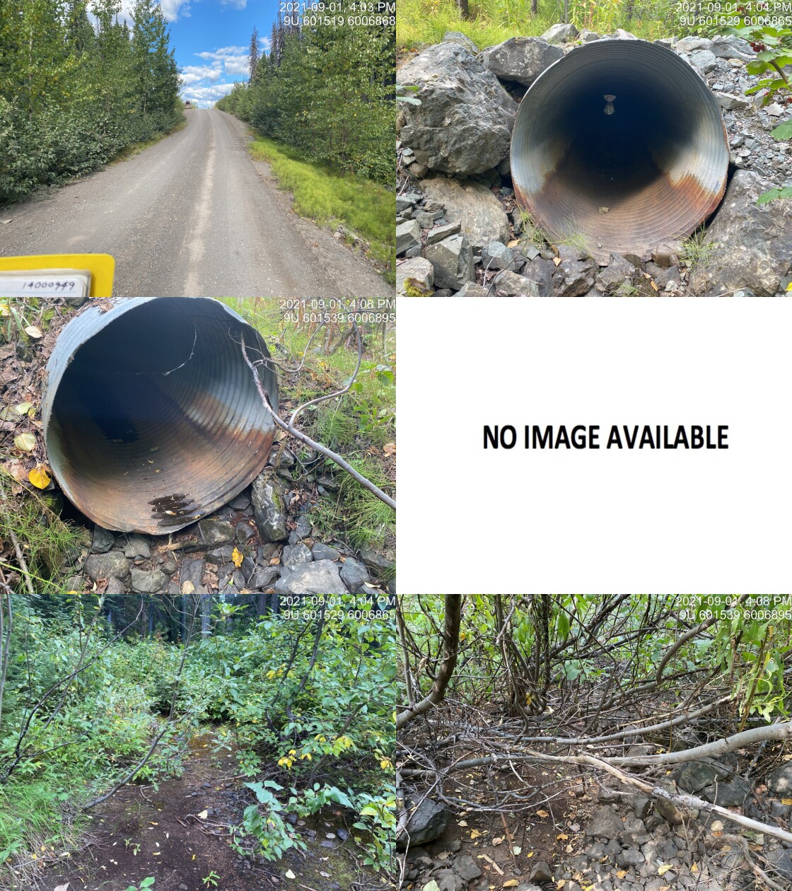
|
|||
| Comments: Fill depth estimated. 16:02 |
| Location and Stream Data |
|
Crossing Characteristics | – |
|---|---|---|---|
| Date | 2021-09-01 | Crossing Sub Type | Round Culvert |
| PSCIS ID | 197924 | Diameter (m) | 0.5 |
| External ID | 14000954 | Length (m) | 18 |
| Crew | AI | Embedded | No |
| UTM Zone | 9 | Depth Embedded (m) | – |
| Easting | 603333.1 | Resemble Channel | No |
| Northing | 6007072 | Backwatered | No |
| Stream | Tributary to Gosnell Creek | Percent Backwatered | – |
| Road | Crystal Creek FSR | Fill Depth (m) | 1.5 |
| Road Tenure | FLNR DND 9785 | Outlet Drop (m) | 0 |
| Channel Width (m) | 1.3 | Outlet Pool Depth (m) | 0 |
| Stream Slope (%) | 0.5 | Inlet Drop | No |
| Beaver Activity | No | Slope (%) | 1 |
| Habitat Value | Low | Valley Fill | Deep Fill |
| Final score | 24 | Barrier Result | Barrier |
| Fix type | Replace Structure with Streambed Simulation CBS | Fix Span / Diameter | 3 |
Photos: PSCIS ID 197924. From top left clockwise: Road/Site Card, Barrel, Outlet, Downstream, Upstream, Inlet.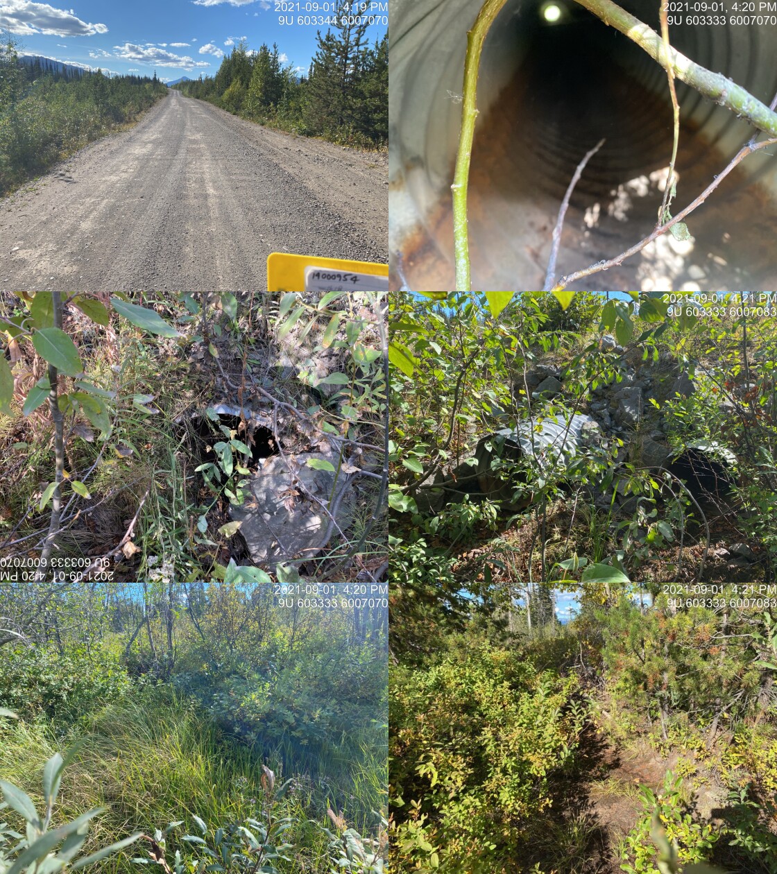
|
|||
| Comments: Dry. Channel partially covered in moss. Very like flows for only short periods of the year. 16:18 |
| Location and Stream Data |
|
Crossing Characteristics | – |
|---|---|---|---|
| Date | 2021-09-01 | Crossing Sub Type | Ford |
| PSCIS ID | 197925 | Diameter (m) | – |
| External ID | 14000908 | Length (m) | – |
| Crew | AI | Embedded | – |
| UTM Zone | 9 | Depth Embedded (m) | – |
| Easting | 604357.3 | Resemble Channel | – |
| Northing | 6009291 | Backwatered | – |
| Stream | Tributary to Gosnell Creek | Percent Backwatered | – |
| Road | – | Fill Depth (m) | – |
| Road Tenure | Canfor R04078 | Outlet Drop (m) | – |
| Channel Width (m) | – | Outlet Pool Depth (m) | – |
| Stream Slope (%) | – | Inlet Drop | – |
| Beaver Activity | – | Slope (%) | – |
| Habitat Value | – | Valley Fill | – |
| Final score | 0 | Barrier Result | Unknown |
| Fix type | – | Fix Span / Diameter | – |
Photos: PSCIS ID 197925. From top left clockwise: Road/Site Card, Barrel, Outlet, Downstream, Upstream, Inlet.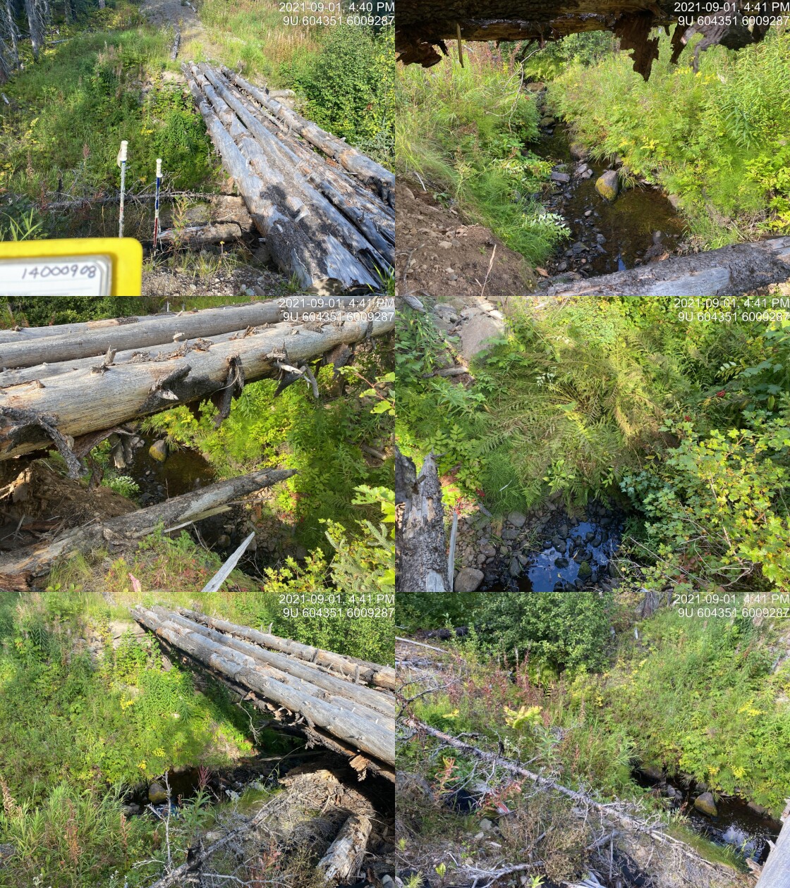
|
|||
| Comments: Ford. Quad bridge in place made from logs. 16:38 |
| Location and Stream Data |
|
Crossing Characteristics | – |
|---|---|---|---|
| Date | 2021-09-01 | Crossing Sub Type | Round Culvert |
| PSCIS ID | 197926 | Diameter (m) | 1.1 |
| External ID | 14001002 | Length (m) | 30 |
| Crew | AI | Embedded | Yes |
| UTM Zone | 9 | Depth Embedded (m) | 0.15 |
| Easting | 606615 | Resemble Channel | Yes |
| Northing | 6006104 | Backwatered | No |
| Stream | Tributary to Morice River | Percent Backwatered | – |
| Road | Morice West FSR | Fill Depth (m) | 2 |
| Road Tenure | FLNR DND 9785 | Outlet Drop (m) | 0 |
| Channel Width (m) | 2 | Outlet Pool Depth (m) | 0.1 |
| Stream Slope (%) | 5 | Inlet Drop | Yes |
| Beaver Activity | No | Slope (%) | 1 |
| Habitat Value | Medium | Valley Fill | Deep Fill |
| Final score | 22 | Barrier Result | Barrier |
| Fix type | Replace with New Open Bottom Structure | Fix Span / Diameter | 10 |
Photos: PSCIS ID 197926. From top left clockwise: Road/Site Card, Barrel, Outlet, Downstream, Upstream, Inlet.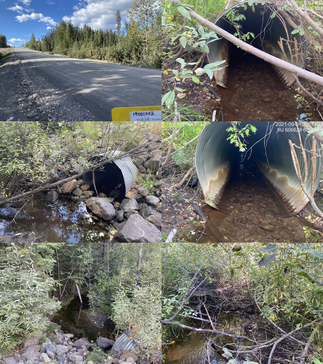
|
|||
| Comments: Observed 60mm fish swimming into the outlet. Nicely embedded. Inlet drop of large cobbles may be issue for smaller fish. 16:54 |
| Location and Stream Data |
|
Crossing Characteristics | – |
|---|---|---|---|
| Date | 2021-09-01 | Crossing Sub Type | Bridge |
| PSCIS ID | 197927 | Diameter (m) | 12 |
| External ID | 14001000 | Length (m) | 6 |
| Crew | AI | Embedded | – |
| UTM Zone | 9 | Depth Embedded (m) | – |
| Easting | 613231.1 | Resemble Channel | – |
| Northing | 6005506 | Backwatered | – |
| Stream | Tributary to Morice River | Percent Backwatered | – |
| Road | Morice West FSR | Fill Depth (m) | – |
| Road Tenure | FLNR DND 9785 | Outlet Drop (m) | – |
| Channel Width (m) | – | Outlet Pool Depth (m) | – |
| Stream Slope (%) | – | Inlet Drop | – |
| Beaver Activity | – | Slope (%) | – |
| Habitat Value | – | Valley Fill | – |
| Final score | 0 | Barrier Result | Passable |
| Fix type | – | Fix Span / Diameter | – |
Photos: PSCIS ID 197927. From top left clockwise: Road/Site Card, Barrel, Outlet, Downstream, Upstream, Inlet.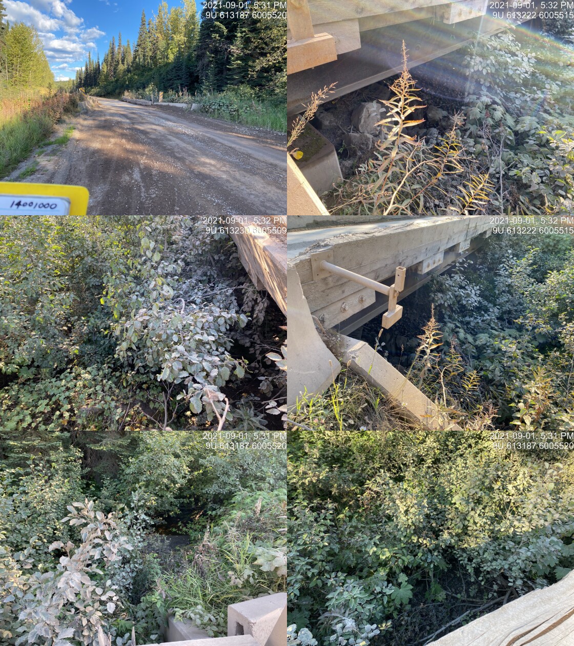
|
|||
| Comments: Bridge. 17:30 |
| Location and Stream Data |
|
Crossing Characteristics | – |
|---|---|---|---|
| Date | 2021-09-01 | Crossing Sub Type | Round Culvert |
| PSCIS ID | 197928 | Diameter (m) | 0.6 |
| External ID | 14000997 | Length (m) | 20 |
| Crew | AI | Embedded | No |
| UTM Zone | 9 | Depth Embedded (m) | – |
| Easting | 613579 | Resemble Channel | No |
| Northing | 6005551 | Backwatered | No |
| Stream | Tributary to Morice River | Percent Backwatered | – |
| Road | Morice West FSR | Fill Depth (m) | 2.5 |
| Road Tenure | FLNR DND 9785 | Outlet Drop (m) | 0.5 |
| Channel Width (m) | 1.2 | Outlet Pool Depth (m) | 0 |
| Stream Slope (%) | 5 | Inlet Drop | No |
| Beaver Activity | No | Slope (%) | 3.5 |
| Habitat Value | Low | Valley Fill | Deep Fill |
| Final score | 39 | Barrier Result | Barrier |
| Fix type | Replace Structure with Streambed Simulation CBS | Fix Span / Diameter | 3 |
Photos: PSCIS ID 197928. From top left clockwise: Road/Site Card, Barrel, Outlet, Downstream, Upstream, Inlet.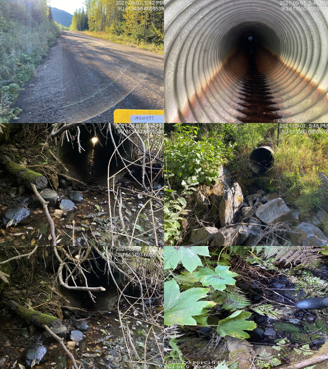
|
|||
| Comments: Dry. Small stream. DV point upstream in FISS. May be flowing at point upstream. 17:41 |
| Location and Stream Data |
|
Crossing Characteristics | – |
|---|---|---|---|
| Date | 2021-09-01 | Crossing Sub Type | Bridge |
| PSCIS ID | 197929 | Diameter (m) | 7 |
| External ID | 14000988 | Length (m) | 27 |
| Crew | AI | Embedded | – |
| UTM Zone | 9 | Depth Embedded (m) | – |
| Easting | 618098.1 | Resemble Channel | – |
| Northing | 6005788 | Backwatered | – |
| Stream | Tributary to Morice River | Percent Backwatered | – |
| Road | Morice West FSR | Fill Depth (m) | – |
| Road Tenure | FLNR DND 9785 | Outlet Drop (m) | – |
| Channel Width (m) | – | Outlet Pool Depth (m) | – |
| Stream Slope (%) | – | Inlet Drop | – |
| Beaver Activity | – | Slope (%) | – |
| Habitat Value | – | Valley Fill | – |
| Final score | 3 | Barrier Result | Passable |
| Fix type | – | Fix Span / Diameter | – |
Photos: PSCIS ID 197929. From top left clockwise: Road/Site Card, Barrel, Outlet, Downstream, Upstream, Inlet.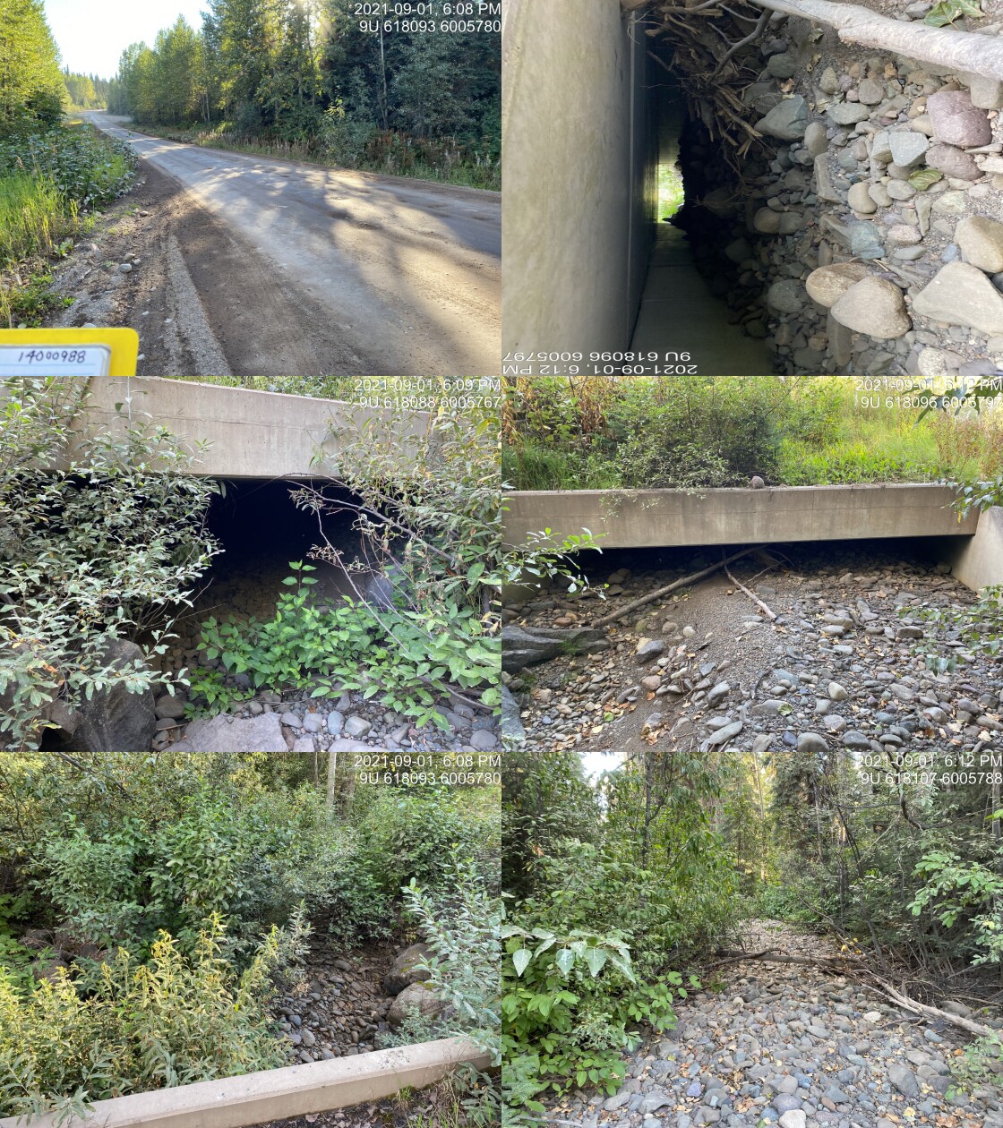
|
|||
| Comments: Bridge with only 0.7 clearance at outlet. 18:07 |
| Location and Stream Data |
|
Crossing Characteristics | – |
|---|---|---|---|
| Date | 2021-09-02 | Crossing Sub Type | Ford |
| PSCIS ID | 197930 | Diameter (m) | – |
| External ID | 14000931 | Length (m) | – |
| Crew | AI | Embedded | – |
| UTM Zone | 9 | Depth Embedded (m) | – |
| Easting | 601878.2 | Resemble Channel | – |
| Northing | 5984146 | Backwatered | – |
| Stream | Tributary to Nanika River | Percent Backwatered | – |
| Road | Spur | Fill Depth (m) | – |
| Road Tenure | Canfor R06951 | Outlet Drop (m) | – |
| Channel Width (m) | – | Outlet Pool Depth (m) | – |
| Stream Slope (%) | – | Inlet Drop | – |
| Beaver Activity | – | Slope (%) | – |
| Habitat Value | – | Valley Fill | – |
| Final score | 0 | Barrier Result | Unknown |
| Fix type | – | Fix Span / Diameter | – |
Photos: PSCIS ID 197930. From top left clockwise: Road/Site Card, Barrel, Outlet, Downstream, Upstream, Inlet.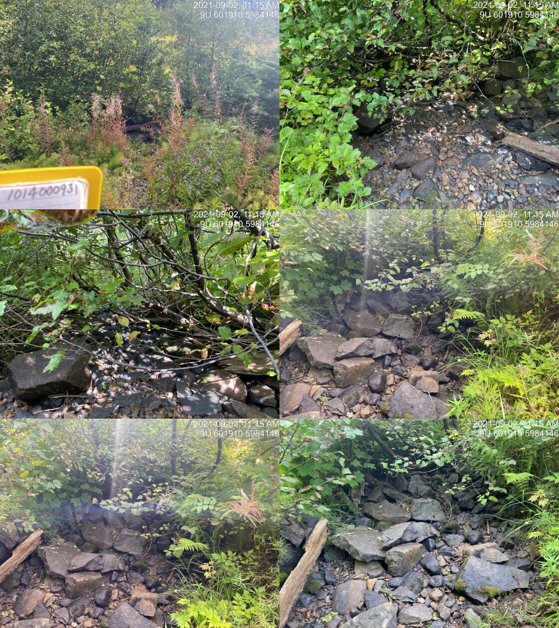
|
|||
| Comments: Ford. 11:14 |
| Location and Stream Data |
|
Crossing Characteristics | – |
|---|---|---|---|
| Date | 2021-09-02 | Crossing Sub Type | Round Culvert |
| PSCIS ID | 197931 | Diameter (m) | 0.5 |
| External ID | 14000932 | Length (m) | 17 |
| Crew | AI | Embedded | No |
| UTM Zone | 9 | Depth Embedded (m) | – |
| Easting | 602457.8 | Resemble Channel | No |
| Northing | 5984532 | Backwatered | No |
| Stream | Tributary to Nanika River | Percent Backwatered | – |
| Road | Spur | Fill Depth (m) | 0.3 |
| Road Tenure | Canfor R06951 | Outlet Drop (m) | 0 |
| Channel Width (m) | 0.4 | Outlet Pool Depth (m) | 0 |
| Stream Slope (%) | 7 | Inlet Drop | No |
| Beaver Activity | No | Slope (%) | 5 |
| Habitat Value | Low | Valley Fill | Deep Fill |
| Final score | 23 | Barrier Result | Barrier |
| Fix type | Replace Structure with Streambed Simulation CBS | Fix Span / Diameter | 3 |
Photos: PSCIS ID 197931. From top left clockwise: Road/Site Card, Barrel, Outlet, Downstream, Upstream, Inlet.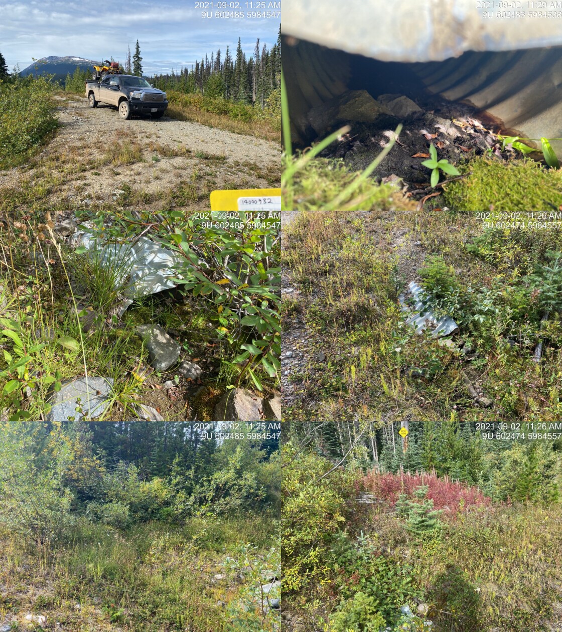
|
|||
| Comments: Cross ditch. Questioning fish point. Noted upstream in FISS. Not fish habitat. 11:24 |
| Location and Stream Data |
|
Crossing Characteristics | – |
|---|---|---|---|
| Date | 2021-09-02 | Crossing Sub Type | Bridge |
| PSCIS ID | 197932 | Diameter (m) | 8 |
| External ID | 14001721 | Length (m) | 2 |
| Crew | AI | Embedded | – |
| UTM Zone | 9 | Depth Embedded (m) | – |
| Easting | 603204.6 | Resemble Channel | – |
| Northing | 5988286 | Backwatered | – |
| Stream | Tributary to Nanika River | Percent Backwatered | – |
| Road | Spur | Fill Depth (m) | – |
| Road Tenure | Resource | Outlet Drop (m) | – |
| Channel Width (m) | – | Outlet Pool Depth (m) | – |
| Stream Slope (%) | – | Inlet Drop | – |
| Beaver Activity | – | Slope (%) | – |
| Habitat Value | – | Valley Fill | – |
| Final score | 0 | Barrier Result | Passable |
| Fix type | – | Fix Span / Diameter | – |
Photos: PSCIS ID 197932. From top left clockwise: Road/Site Card, Barrel, Outlet, Downstream, Upstream, Inlet.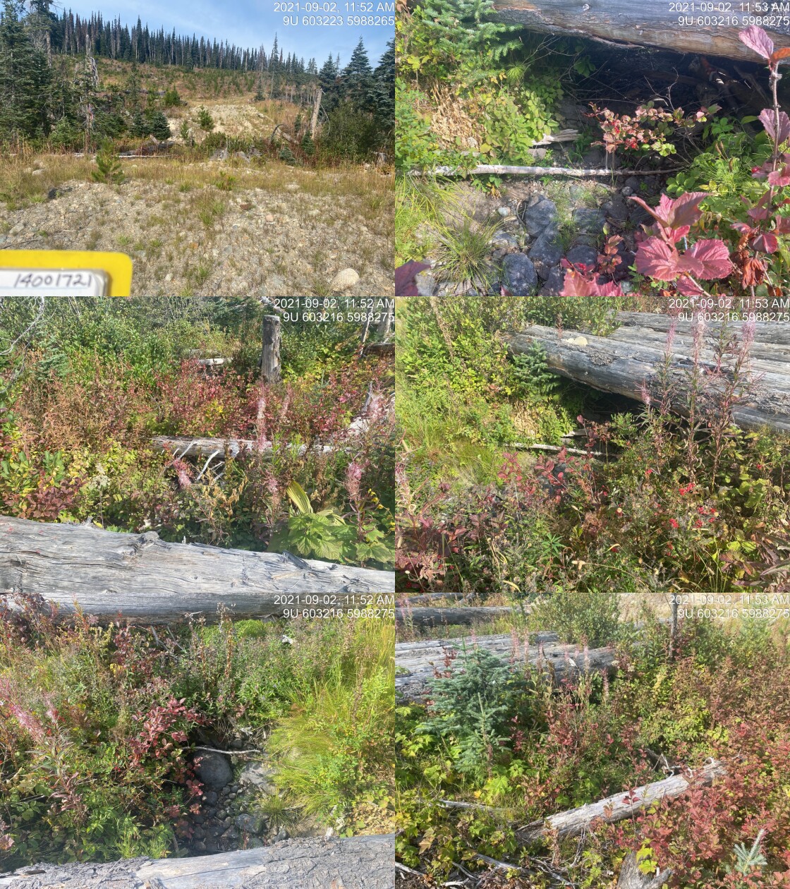
|
|||
| Comments: Temporary log bridge for ATVs. Within young cutblock. 11:51 |
| Location and Stream Data |
|
Crossing Characteristics | – |
|---|---|---|---|
| Date | 2021-09-02 | Crossing Sub Type | Bridge |
| PSCIS ID | 197933 | Diameter (m) | 13 |
| External ID | 14001775 | Length (m) | 2 |
| Crew | AI | Embedded | – |
| UTM Zone | 9 | Depth Embedded (m) | – |
| Easting | 607923.6 | Resemble Channel | – |
| Northing | 5987441 | Backwatered | – |
| Stream | Tributary to Nanika River | Percent Backwatered | – |
| Road | Spur | Fill Depth (m) | – |
| Road Tenure | Canfor R10644 | Outlet Drop (m) | – |
| Channel Width (m) | – | Outlet Pool Depth (m) | – |
| Stream Slope (%) | – | Inlet Drop | – |
| Beaver Activity | – | Slope (%) | – |
| Habitat Value | – | Valley Fill | – |
| Final score | 0 | Barrier Result | Passable |
| Fix type | – | Fix Span / Diameter | – |
Photos: PSCIS ID 197933. From top left clockwise: Road/Site Card, Barrel, Outlet, Downstream, Upstream, Inlet.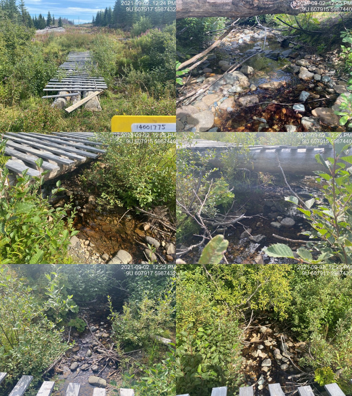
|
|||
| Comments: Quad bridge of logs and 2x6. 12:23 |
| Location and Stream Data |
|
Crossing Characteristics | – |
|---|---|---|---|
| Date | 2021-09-02 | Crossing Sub Type | Round Culvert |
| PSCIS ID | 197934 | Diameter (m) | 0.4 |
| External ID | 14001414 | Length (m) | 6 |
| Crew | AI | Embedded | No |
| UTM Zone | 9 | Depth Embedded (m) | – |
| Easting | 607342.9 | Resemble Channel | No |
| Northing | 5987705 | Backwatered | No |
| Stream | Tributary to Nanika River | Percent Backwatered | – |
| Road | Spur | Fill Depth (m) | 0.2 |
| Road Tenure | Canfor R10644 | Outlet Drop (m) | 0 |
| Channel Width (m) | 1 | Outlet Pool Depth (m) | 0.2 |
| Stream Slope (%) | 0 | Inlet Drop | No |
| Beaver Activity | No | Slope (%) | 0 |
| Habitat Value | Low | Valley Fill | Deep Fill |
| Final score | 16 | Barrier Result | Potential |
| Fix type | Replace Structure with Streambed Simulation CBS | Fix Span / Diameter | 3 |
Photos: PSCIS ID 197934. From top left clockwise: Road/Site Card, Barrel, Outlet, Downstream, Upstream, Inlet.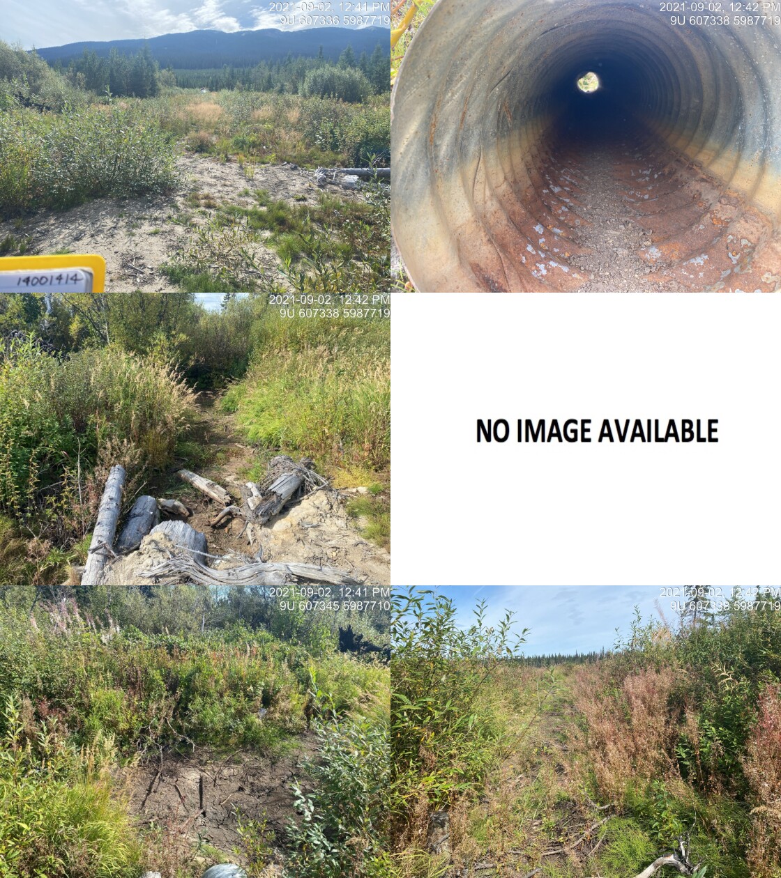
|
|||
| Comments: Temporary road to cutblock. Suspect main stream flows elsewhere. This is dry currently but wetland type depression. Channel poorly defined. Drains to ground. 12:40 |
| Location and Stream Data |
|
Crossing Characteristics | – |
|---|---|---|---|
| Date | 2021-09-02 | Crossing Sub Type | Bridge |
| PSCIS ID | 197935 | Diameter (m) | 5 |
| External ID | 14001411 | Length (m) | 11 |
| Crew | AI | Embedded | – |
| UTM Zone | 9 | Depth Embedded (m) | – |
| Easting | 607303.3 | Resemble Channel | – |
| Northing | 5987119 | Backwatered | – |
| Stream | Tributary to Nanika River | Percent Backwatered | – |
| Road | Spur | Fill Depth (m) | – |
| Road Tenure | Canfor R10644 | Outlet Drop (m) | – |
| Channel Width (m) | – | Outlet Pool Depth (m) | – |
| Stream Slope (%) | – | Inlet Drop | – |
| Beaver Activity | – | Slope (%) | – |
| Habitat Value | – | Valley Fill | – |
| Final score | 0 | Barrier Result | Passable |
| Fix type | – | Fix Span / Diameter | – |
Photos: PSCIS ID 197935. From top left clockwise: Road/Site Card, Barrel, Outlet, Downstream, Upstream, Inlet.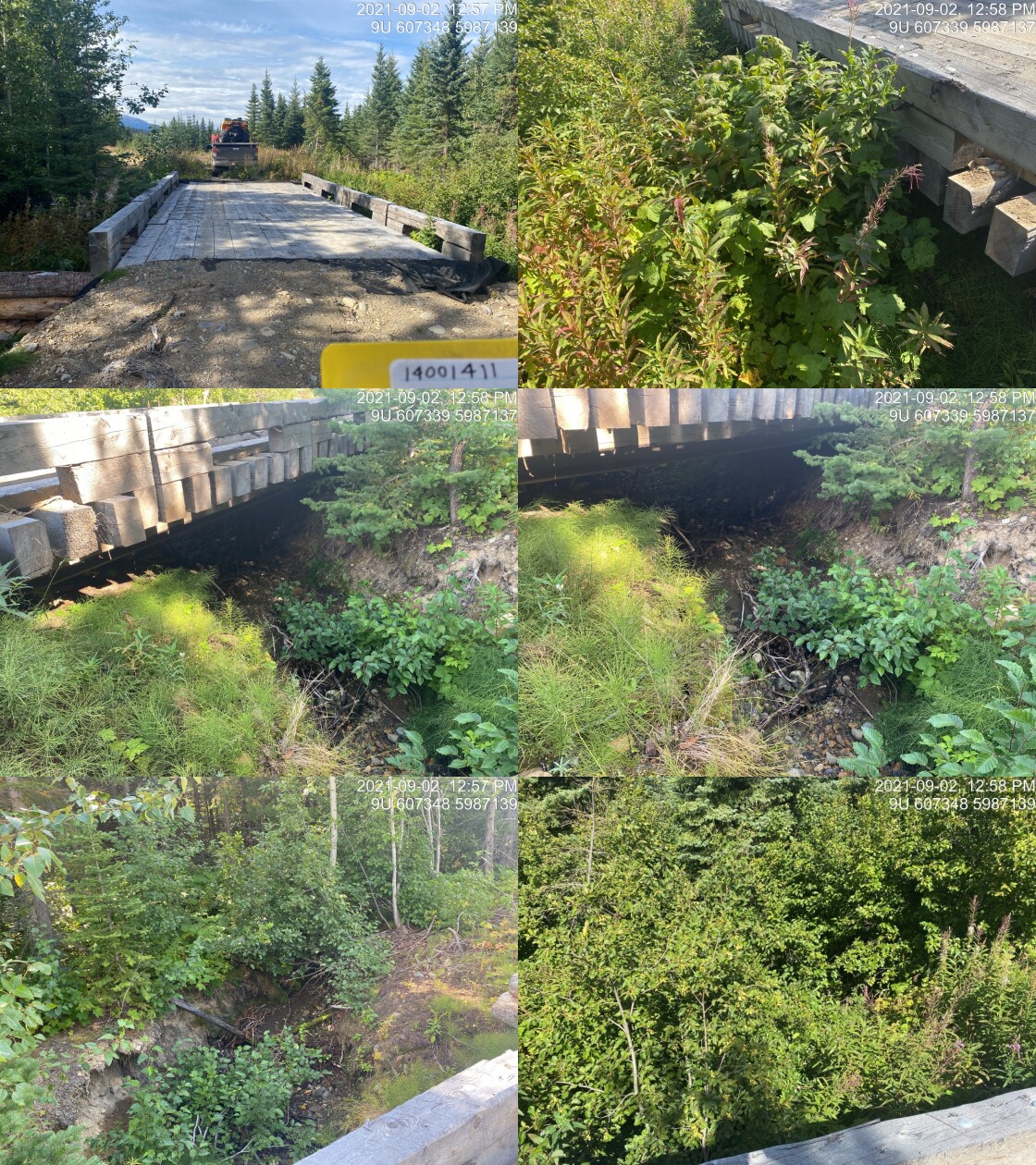
|
|||
| Comments: Temporary bridge with wood abutments. 12:56 |
| Location and Stream Data |
|
Crossing Characteristics | – |
|---|---|---|---|
| Date | 2021-09-02 | Crossing Sub Type | Round Culvert |
| PSCIS ID | 197936 | Diameter (m) | 1 |
| External ID | 2021090299 | Length (m) | 15 |
| Crew | AI | Embedded | No |
| UTM Zone | 9 | Depth Embedded (m) | – |
| Easting | 598684 | Resemble Channel | No |
| Northing | 5984563 | Backwatered | No |
| Stream | – | Percent Backwatered | – |
| Road | Spur | Fill Depth (m) | 0.3 |
| Road Tenure | Canfor R08817 | Outlet Drop (m) | 0.1 |
| Channel Width (m) | 0.9 | Outlet Pool Depth (m) | 0.25 |
| Stream Slope (%) | 10 | Inlet Drop | No |
| Beaver Activity | No | Slope (%) | 3.5 |
| Habitat Value | Low | Valley Fill | Deep Fill |
| Final score | 23 | Barrier Result | Barrier |
| Fix type | Replace Structure with Streambed Simulation CBS | Fix Span / Diameter | 3 |
Photos: PSCIS ID 197936. From top left clockwise: Road/Site Card, Barrel, Outlet, Downstream, Upstream, Inlet.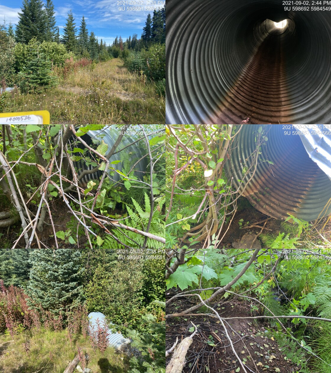
|
|||
| Comments: Quad access. Dry. Fish points upstream. Very small system. 14:36 |
| Location and Stream Data |
|
Crossing Characteristics | – |
|---|---|---|---|
| Date | 2021-09-02 | Crossing Sub Type | Round Culvert |
| PSCIS ID | 197937 | Diameter (m) | 1 |
| External ID | 14000536 | Length (m) | 16 |
| Crew | AI | Embedded | No |
| UTM Zone | 9 | Depth Embedded (m) | – |
| Easting | 598400.6 | Resemble Channel | No |
| Northing | 5984485 | Backwatered | No |
| Stream | Tributary to Nanika River | Percent Backwatered | – |
| Road | Spur | Fill Depth (m) | 1 |
| Road Tenure | Canfor R08817 | Outlet Drop (m) | 0.2 |
| Channel Width (m) | 0.8 | Outlet Pool Depth (m) | 0.01 |
| Stream Slope (%) | 5 | Inlet Drop | No |
| Beaver Activity | No | Slope (%) | 2.5 |
| Habitat Value | Low | Valley Fill | Deep Fill |
| Final score | 23 | Barrier Result | Barrier |
| Fix type | Replace Structure with Streambed Simulation CBS | Fix Span / Diameter | 3 |
Photos: PSCIS ID 197937. From top left clockwise: Road/Site Card, Barrel, Outlet, Downstream, Upstream, Inlet.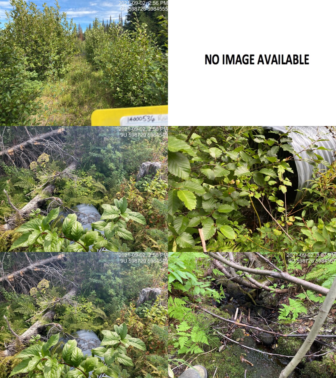
|
|||
| Comments: Quad road (remove?). Some flow. Fish points upstream. 14:55 |
| Location and Stream Data |
|
Crossing Characteristics | – |
|---|---|---|---|
| Date | 2021-08-31 | Crossing Sub Type | Round Culvert |
| PSCIS ID | 197938 | Diameter (m) | 0.9 |
| External ID | 2021083150 | Length (m) | 22 |
| Crew | KP AI | Embedded | No |
| UTM Zone | 9 | Depth Embedded (m) | – |
| Easting | 691169 | Resemble Channel | No |
| Northing | 6031458 | Backwatered | Yes |
| Stream | Bulkley River Side Channel | Percent Backwatered | 100 |
| Road | Railway | Fill Depth (m) | 3 |
| Road Tenure | Canadian National | Outlet Drop (m) | 0 |
| Channel Width (m) | 3 | Outlet Pool Depth (m) | 0.85 |
| Stream Slope (%) | 0 | Inlet Drop | No |
| Beaver Activity | Yes | Slope (%) | 0.2 |
| Habitat Value | Medium | Valley Fill | Deep Fill |
| Final score | 19 | Barrier Result | Potential |
| Fix type | Replace Structure with Streambed Simulation CBS | Fix Span / Diameter | 3 |
Photos: PSCIS ID 197938. From top left clockwise: Road/Site Card, Barrel, Outlet, Downstream, Upstream, Inlet.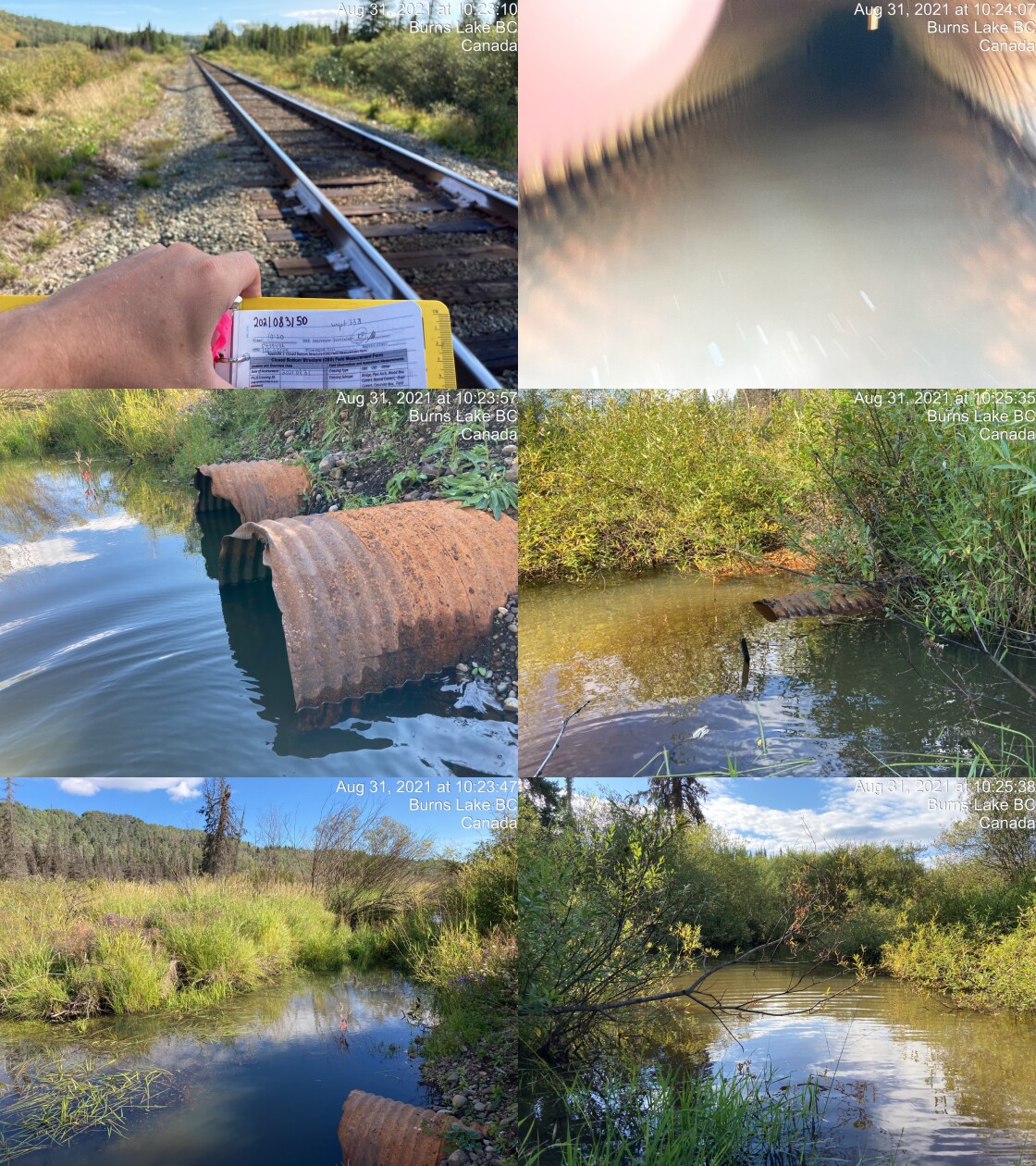
|
|||
| Comments: Side channel of main stream. Shallow. Old beaver dam ~15m upstream. 100% backwatered. Top of outlet culvert is covered. 10:20 |
| Location and Stream Data |
|
Crossing Characteristics | – |
|---|---|---|---|
| Date | 2021-09-02 | Crossing Sub Type | Bridge |
| PSCIS ID | 197939 | Diameter (m) | 10 |
| External ID | 2021090202 | Length (m) | 5 |
| Crew | AI | Embedded | – |
| UTM Zone | 9 | Depth Embedded (m) | – |
| Easting | 605230 | Resemble Channel | – |
| Northing | 5992698 | Backwatered | – |
| Stream | Tributary to McBride River | Percent Backwatered | – |
| Road | Spur | Fill Depth (m) | – |
| Road Tenure | Unknown | Outlet Drop (m) | – |
| Channel Width (m) | – | Outlet Pool Depth (m) | – |
| Stream Slope (%) | – | Inlet Drop | – |
| Beaver Activity | – | Slope (%) | – |
| Habitat Value | – | Valley Fill | – |
| Final score | 0 | Barrier Result | Passable |
| Fix type | – | Fix Span / Diameter | – |
Photos: PSCIS ID 197939. From top left clockwise: Road/Site Card, Barrel, Outlet, Downstream, Upstream, Inlet.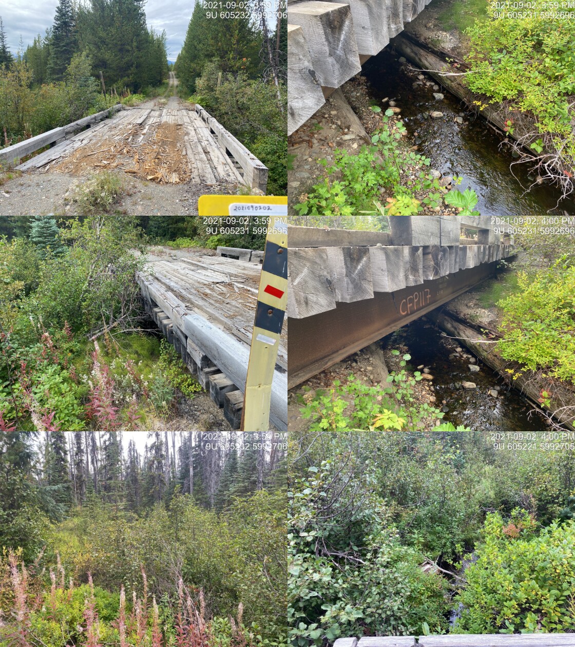
|
|||
| Comments: Good flow. Nice stream. Not sure why it didn’t map. 15:57 |
| Location and Stream Data |
|
Crossing Characteristics | – |
|---|---|---|---|
| Date | 2021-09-02 | Crossing Sub Type | Ford |
| PSCIS ID | 197940 | Diameter (m) | – |
| External ID | 14000312 | Length (m) | – |
| Crew | AI | Embedded | – |
| UTM Zone | 9 | Depth Embedded (m) | – |
| Easting | 602253.5 | Resemble Channel | – |
| Northing | 5994059 | Backwatered | – |
| Stream | Tributary to McBride River | Percent Backwatered | – |
| Road | Spur | Fill Depth (m) | – |
| Road Tenure | Canfor R10640 | Outlet Drop (m) | – |
| Channel Width (m) | – | Outlet Pool Depth (m) | – |
| Stream Slope (%) | – | Inlet Drop | – |
| Beaver Activity | – | Slope (%) | – |
| Habitat Value | – | Valley Fill | – |
| Final score | 0 | Barrier Result | Unknown |
| Fix type | – | Fix Span / Diameter | – |
Photos: PSCIS ID 197940. From top left clockwise: Road/Site Card, Barrel, Outlet, Downstream, Upstream, Inlet.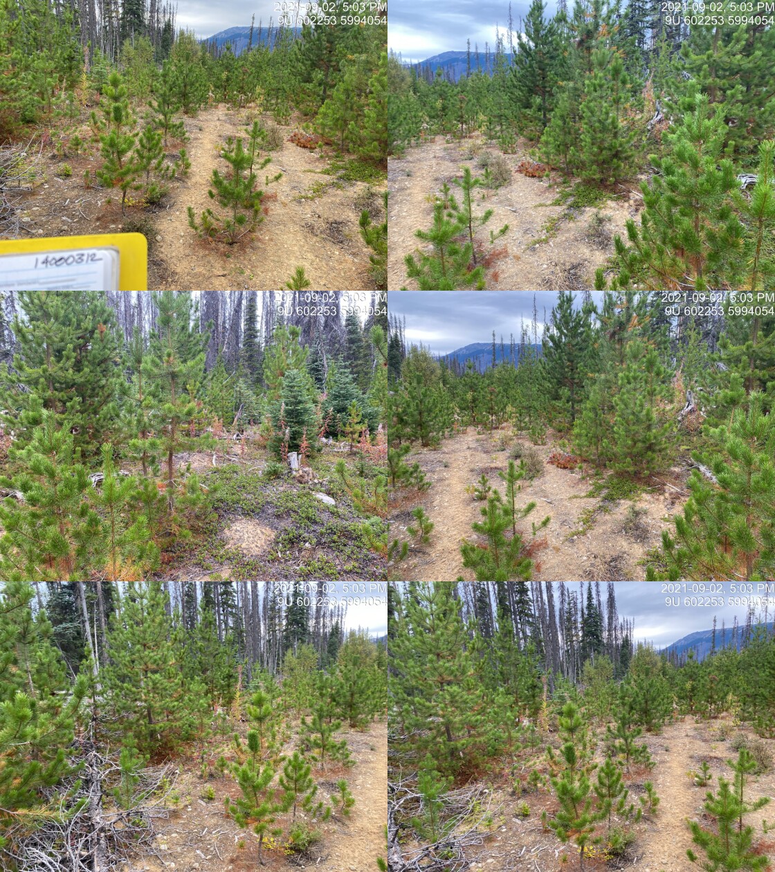
|
|||
| Comments: Road deactivated. No visible channel. 17:02 |
| Location and Stream Data |
|
Crossing Characteristics | – |
|---|---|---|---|
| Date | 2021-09-02 | Crossing Sub Type | Ford |
| PSCIS ID | 197941 | Diameter (m) | – |
| External ID | 14000477 | Length (m) | – |
| Crew | AI | Embedded | – |
| UTM Zone | 9 | Depth Embedded (m) | – |
| Easting | 602529 | Resemble Channel | – |
| Northing | 5994071 | Backwatered | – |
| Stream | Tributary to McBride River | Percent Backwatered | – |
| Road | Spur | Fill Depth (m) | – |
| Road Tenure | Canfor R10640 | Outlet Drop (m) | – |
| Channel Width (m) | – | Outlet Pool Depth (m) | – |
| Stream Slope (%) | – | Inlet Drop | – |
| Beaver Activity | – | Slope (%) | – |
| Habitat Value | – | Valley Fill | – |
| Final score | 0 | Barrier Result | Unknown |
| Fix type | – | Fix Span / Diameter | – |
Photos: PSCIS ID 197941. From top left clockwise: Road/Site Card, Barrel, Outlet, Downstream, Upstream, Inlet.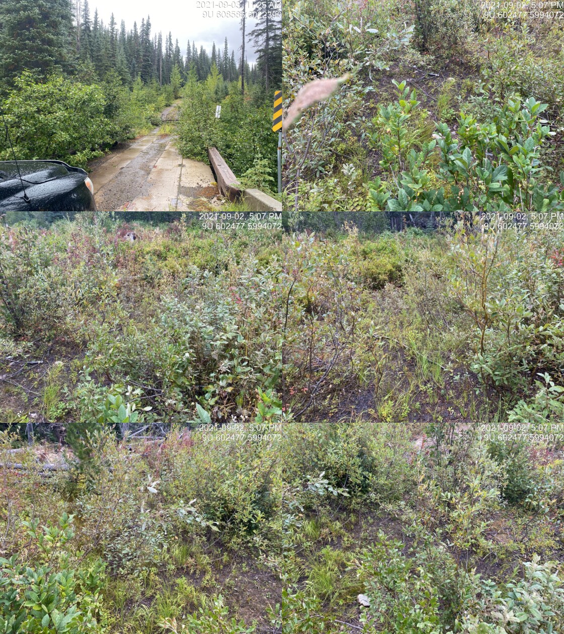
|
|||
| Comments: Road deactivated. Channel moist. 17:06 |
| Location and Stream Data |
|
Crossing Characteristics | – |
|---|---|---|---|
| Date | 2021-09-03 | Crossing Sub Type | Bridge |
| PSCIS ID | 197942 | Diameter (m) | 18 |
| External ID | 14000564 | Length (m) | 5 |
| Crew | AI | Embedded | – |
| UTM Zone | 9 | Depth Embedded (m) | – |
| Easting | 608289.8 | Resemble Channel | – |
| Northing | 6021336 | Backwatered | – |
| Stream | Tributary to Thaulit River | Percent Backwatered | – |
| Road | Chisholm FSR | Fill Depth (m) | – |
| Road Tenure | West Fraser R05232 | Outlet Drop (m) | – |
| Channel Width (m) | – | Outlet Pool Depth (m) | – |
| Stream Slope (%) | – | Inlet Drop | – |
| Beaver Activity | – | Slope (%) | – |
| Habitat Value | – | Valley Fill | – |
| Final score | 0 | Barrier Result | Passable |
| Fix type | – | Fix Span / Diameter | – |
Photos: PSCIS ID 197942. From top left clockwise: Road/Site Card, Barrel, Outlet, Downstream, Upstream, Inlet.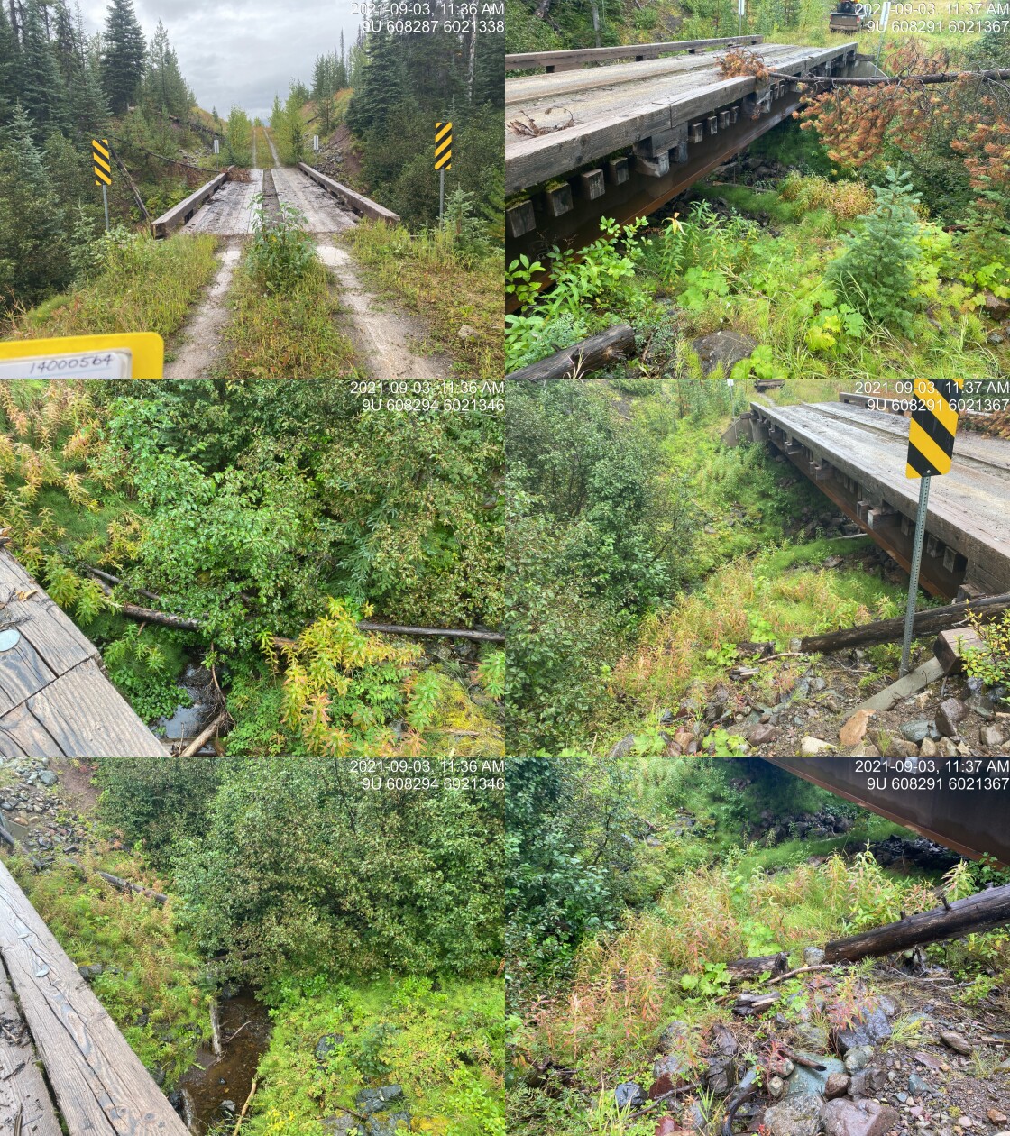
|
|||
| Comments: Thautil River. 11:34 |
| Location and Stream Data |
|
Crossing Characteristics | – |
|---|---|---|---|
| Date | 2021-09-03 | Crossing Sub Type | Bridge |
| PSCIS ID | 197943 | Diameter (m) | 18 |
| External ID | 14000689 | Length (m) | 5 |
| Crew | AI | Embedded | – |
| UTM Zone | 9 | Depth Embedded (m) | – |
| Easting | 608006.4 | Resemble Channel | – |
| Northing | 6018209 | Backwatered | – |
| Stream | Hagman Creek | Percent Backwatered | – |
| Road | Chisholm FSR | Fill Depth (m) | – |
| Road Tenure | FLNR DND 9946 | Outlet Drop (m) | – |
| Channel Width (m) | – | Outlet Pool Depth (m) | – |
| Stream Slope (%) | – | Inlet Drop | – |
| Beaver Activity | – | Slope (%) | – |
| Habitat Value | – | Valley Fill | – |
| Final score | 0 | Barrier Result | Passable |
| Fix type | – | Fix Span / Diameter | – |
Photos: PSCIS ID 197943. From top left clockwise: Road/Site Card, Barrel, Outlet, Downstream, Upstream, Inlet.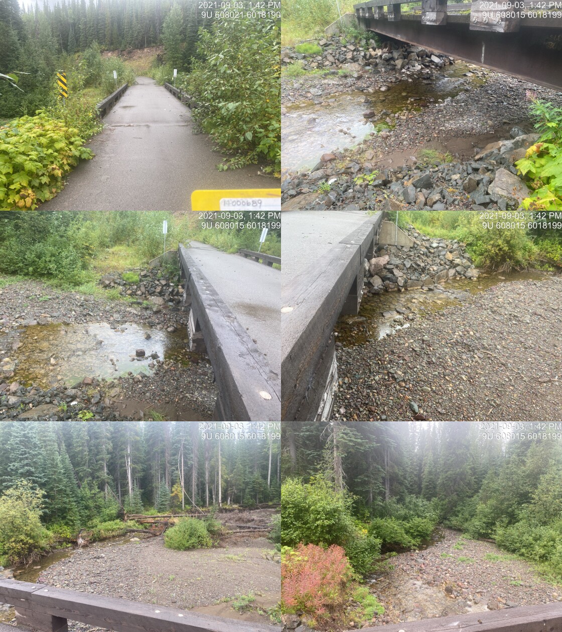
|
|||
| Comments: Bridge. 13:40 |
| Location and Stream Data |
|
Crossing Characteristics | – |
|---|---|---|---|
| Date | 2021-09-03 | Crossing Sub Type | Round Culvert |
| PSCIS ID | 197944 | Diameter (m) | 0.5 |
| External ID | 14000695 | Length (m) | 16 |
| Crew | AI | Embedded | No |
| UTM Zone | 9 | Depth Embedded (m) | – |
| Easting | 607829 | Resemble Channel | No |
| Northing | 6016958 | Backwatered | No |
| Stream | Tributary to Thaulit River | Percent Backwatered | – |
| Road | Chisholm FSR | Fill Depth (m) | 2.5 |
| Road Tenure | FLNR DND 9946 | Outlet Drop (m) | 0.7 |
| Channel Width (m) | 2.2 | Outlet Pool Depth (m) | 0.3 |
| Stream Slope (%) | 6.5 | Inlet Drop | No |
| Beaver Activity | No | Slope (%) | 4.5 |
| Habitat Value | Medium | Valley Fill | Deep Fill |
| Final score | 39 | Barrier Result | Barrier |
| Fix type | Replace with New Open Bottom Structure | Fix Span / Diameter | 10 |
Photos: PSCIS ID 197944. From top left clockwise: Road/Site Card, Barrel, Outlet, Downstream, Upstream, Inlet.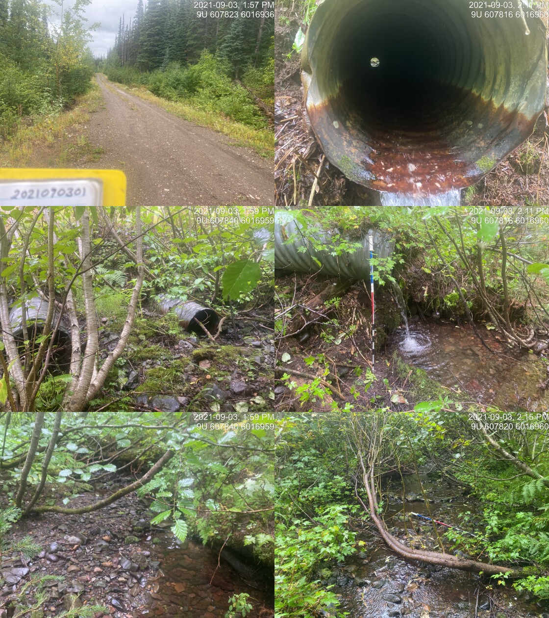
|
|||
| Comments: Models as non-fish but DV below. 13:55 |
| Location and Stream Data |
|
Crossing Characteristics | – |
|---|---|---|---|
| Date | 2021-09-03 | Crossing Sub Type | Round Culvert |
| PSCIS ID | 197945 | Diameter (m) | 0.6 |
| External ID | 14000684 | Length (m) | 15 |
| Crew | AI | Embedded | No |
| UTM Zone | 9 | Depth Embedded (m) | – |
| Easting | 607024.3 | Resemble Channel | No |
| Northing | 6013942 | Backwatered | No |
| Stream | Tributary to Thaulit River | Percent Backwatered | – |
| Road | Chisholm FSR | Fill Depth (m) | 0.5 |
| Road Tenure | FLNR DND 9946 | Outlet Drop (m) | 0.1 |
| Channel Width (m) | 1 | Outlet Pool Depth (m) | 0.1 |
| Stream Slope (%) | 1 | Inlet Drop | No |
| Beaver Activity | No | Slope (%) | 1 |
| Habitat Value | Low | Valley Fill | Deep Fill |
| Final score | 24 | Barrier Result | Barrier |
| Fix type | Replace Structure with Streambed Simulation CBS | Fix Span / Diameter | 3 |
Photos: PSCIS ID 197945. From top left clockwise: Road/Site Card, Barrel, Outlet, Downstream, Upstream, Inlet.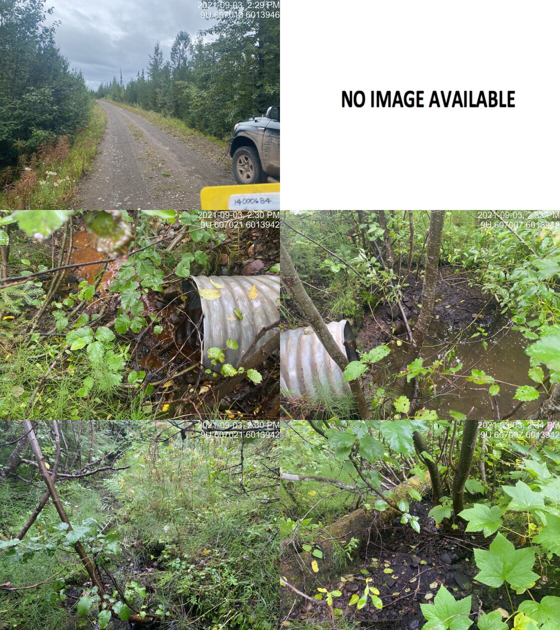
|
|||
| Comments: Small intermittent drainage. 14:28 |
| Location and Stream Data |
|
Crossing Characteristics | – |
|---|---|---|---|
| Date | 2021-09-03 | Crossing Sub Type | Oval Culvert |
| PSCIS ID | 197946 | Diameter (m) | 1.5 |
| External ID | 14000678 | Length (m) | 26 |
| Crew | AI | Embedded | Yes |
| UTM Zone | 9 | Depth Embedded (m) | 0.15 |
| Easting | 608209 | Resemble Channel | Yes |
| Northing | 6010247 | Backwatered | Yes |
| Stream | Tributary to Thaulit River | Percent Backwatered | 95 |
| Road | Chisholm FSR | Fill Depth (m) | 3 |
| Road Tenure | FLNR DND 9946 | Outlet Drop (m) | 0 |
| Channel Width (m) | 1.4 | Outlet Pool Depth (m) | 0.15 |
| Stream Slope (%) | 0 | Inlet Drop | No |
| Beaver Activity | No | Slope (%) | 0.5 |
| Habitat Value | Medium | Valley Fill | Deep Fill |
| Final score | 8 | Barrier Result | Passable |
| Fix type | – | Fix Span / Diameter | – |
Photos: PSCIS ID 197946. From top left clockwise: Road/Site Card, Barrel, Outlet, Downstream, Upstream, Inlet.
|
|||
| Comments: WP375. Sedges almost completely block culvert. Likely passable at near all flows for all species and life stages. 14:47 |
| Location and Stream Data |
|
Crossing Characteristics | – |
|---|---|---|---|
| Date | 2021-09-03 | Crossing Sub Type | Bridge |
| PSCIS ID | 197947 | Diameter (m) | 8 |
| External ID | 14000680 | Length (m) | 5 |
| Crew | AI | Embedded | – |
| UTM Zone | 9 | Depth Embedded (m) | – |
| Easting | 612913.4 | Resemble Channel | – |
| Northing | 6009067 | Backwatered | – |
| Stream | Tributary to Morice River | Percent Backwatered | – |
| Road | Chisholm FSR | Fill Depth (m) | – |
| Road Tenure | FLNR DND 9946 | Outlet Drop (m) | – |
| Channel Width (m) | – | Outlet Pool Depth (m) | – |
| Stream Slope (%) | – | Inlet Drop | – |
| Beaver Activity | – | Slope (%) | – |
| Habitat Value | – | Valley Fill | – |
| Final score | 0 | Barrier Result | Passable |
| Fix type | – | Fix Span / Diameter | – |
Photos: PSCIS ID 197947. From top left clockwise: Road/Site Card, Barrel, Outlet, Downstream, Upstream, Inlet.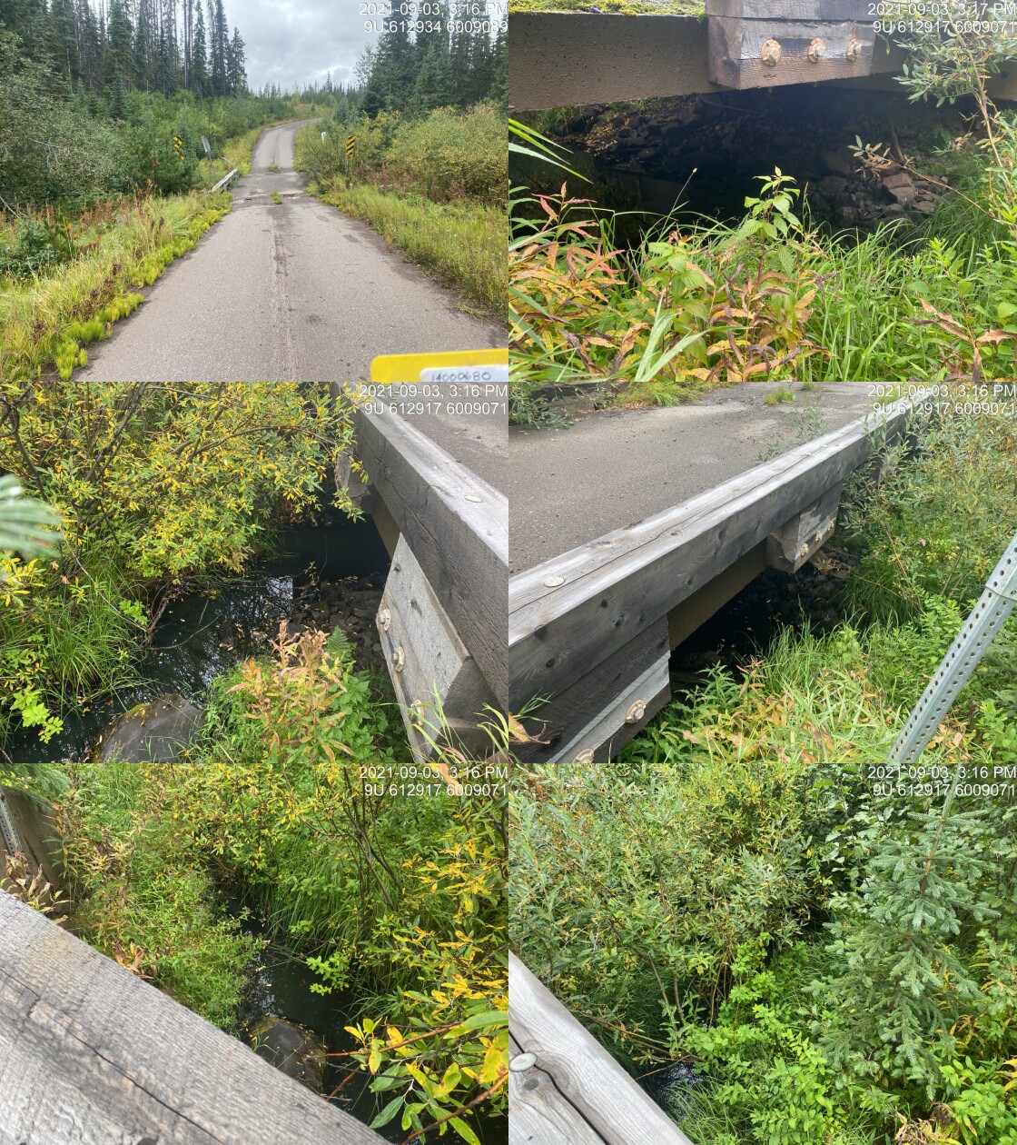
|
|||
| Comments: Bridge. 15:14 |
| Location and Stream Data |
|
Crossing Characteristics | – |
|---|---|---|---|
| Date | 2021-09-03 | Crossing Sub Type | Ford |
| PSCIS ID | 197948 | Diameter (m) | – |
| External ID | 14001323 | Length (m) | – |
| Crew | AI | Embedded | – |
| UTM Zone | 9 | Depth Embedded (m) | – |
| Easting | 612980.5 | Resemble Channel | – |
| Northing | 6011439 | Backwatered | – |
| Stream | Tributary to Tagit Creek | Percent Backwatered | – |
| Road | 15 Rd | Fill Depth (m) | – |
| Road Tenure | West Fraser R05232 | Outlet Drop (m) | – |
| Channel Width (m) | – | Outlet Pool Depth (m) | – |
| Stream Slope (%) | – | Inlet Drop | – |
| Beaver Activity | – | Slope (%) | – |
| Habitat Value | – | Valley Fill | – |
| Final score | 0 | Barrier Result | Unknown |
| Fix type | – | Fix Span / Diameter | – |
Photos: PSCIS ID 197948. From top left clockwise: Road/Site Card, Barrel, Outlet, Downstream, Upstream, Inlet.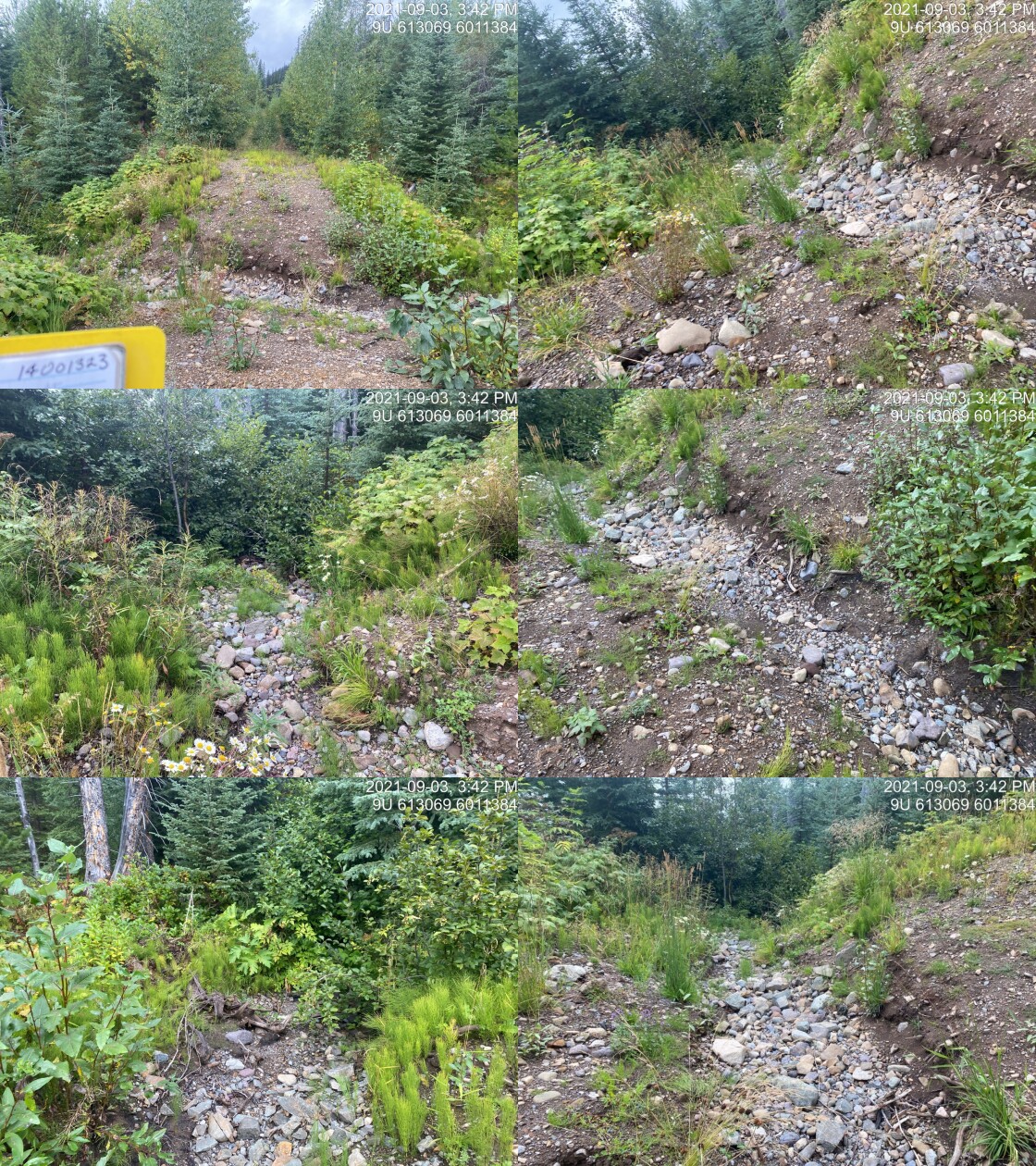
|
|||
| Comments: Deactivated road. ATV could get through. 15:40 |
| Location and Stream Data |
|
Crossing Characteristics | – |
|---|---|---|---|
| Date | 2021-09-03 | Crossing Sub Type | Round Culvert |
| PSCIS ID | 197949 | Diameter (m) | 1.2 |
| External ID | 2021090303 | Length (m) | 14 |
| Crew | AI | Embedded | No |
| UTM Zone | 9 | Depth Embedded (m) | – |
| Easting | 614402 | Resemble Channel | No |
| Northing | 6010350 | Backwatered | No |
| Stream | Tributary to Tagit Creek | Percent Backwatered | – |
| Road | 11 Rd | Fill Depth (m) | 1.5 |
| Road Tenure | Charles Priest R20078 | Outlet Drop (m) | 0.5 |
| Channel Width (m) | 2 | Outlet Pool Depth (m) | 0.6 |
| Stream Slope (%) | 2.5 | Inlet Drop | No |
| Beaver Activity | No | Slope (%) | 2.5 |
| Habitat Value | Medium | Valley Fill | Deep Fill |
| Final score | 31 | Barrier Result | Barrier |
| Fix type | Replace with New Open Bottom Structure | Fix Span / Diameter | 10 |
Photos: PSCIS ID 197949. From top left clockwise: Road/Site Card, Barrel, Outlet, Downstream, Upstream, Inlet.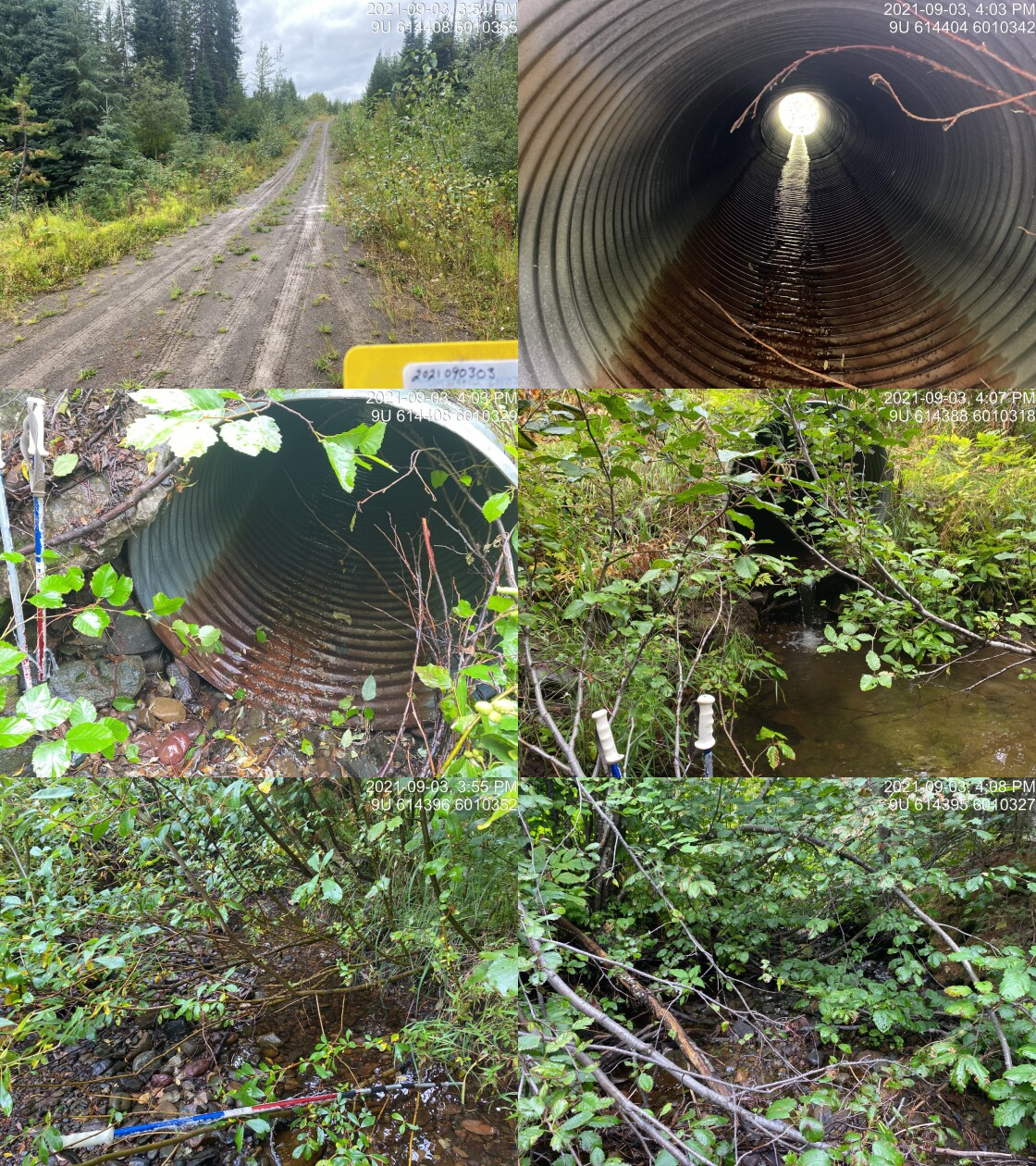
|
|||
| Comments: Good flow. Nice gravels. Deep undercut banks. CT upstream and downstream in FISS. ~40mm fish upstream. 15:52 |
| Location and Stream Data |
|
Crossing Characteristics | – |
|---|---|---|---|
| Date | 2021-09-03 | Crossing Sub Type | Bridge |
| PSCIS ID | 197950 | Diameter (m) | 19 |
| External ID | 2021090399 | Length (m) | 5 |
| Crew | AI | Embedded | – |
| UTM Zone | 9 | Depth Embedded (m) | – |
| Easting | 614676 | Resemble Channel | – |
| Northing | 6007859 | Backwatered | – |
| Stream | Tagit Creek | Percent Backwatered | – |
| Road | Chisholm FSR | Fill Depth (m) | – |
| Road Tenure | FLNR DND 9946 | Outlet Drop (m) | – |
| Channel Width (m) | – | Outlet Pool Depth (m) | – |
| Stream Slope (%) | – | Inlet Drop | – |
| Beaver Activity | – | Slope (%) | – |
| Habitat Value | – | Valley Fill | – |
| Final score | 0 | Barrier Result | Passable |
| Fix type | – | Fix Span / Diameter | – |
Photos: PSCIS ID 197950. From top left clockwise: Road/Site Card, Barrel, Outlet, Downstream, Upstream, Inlet.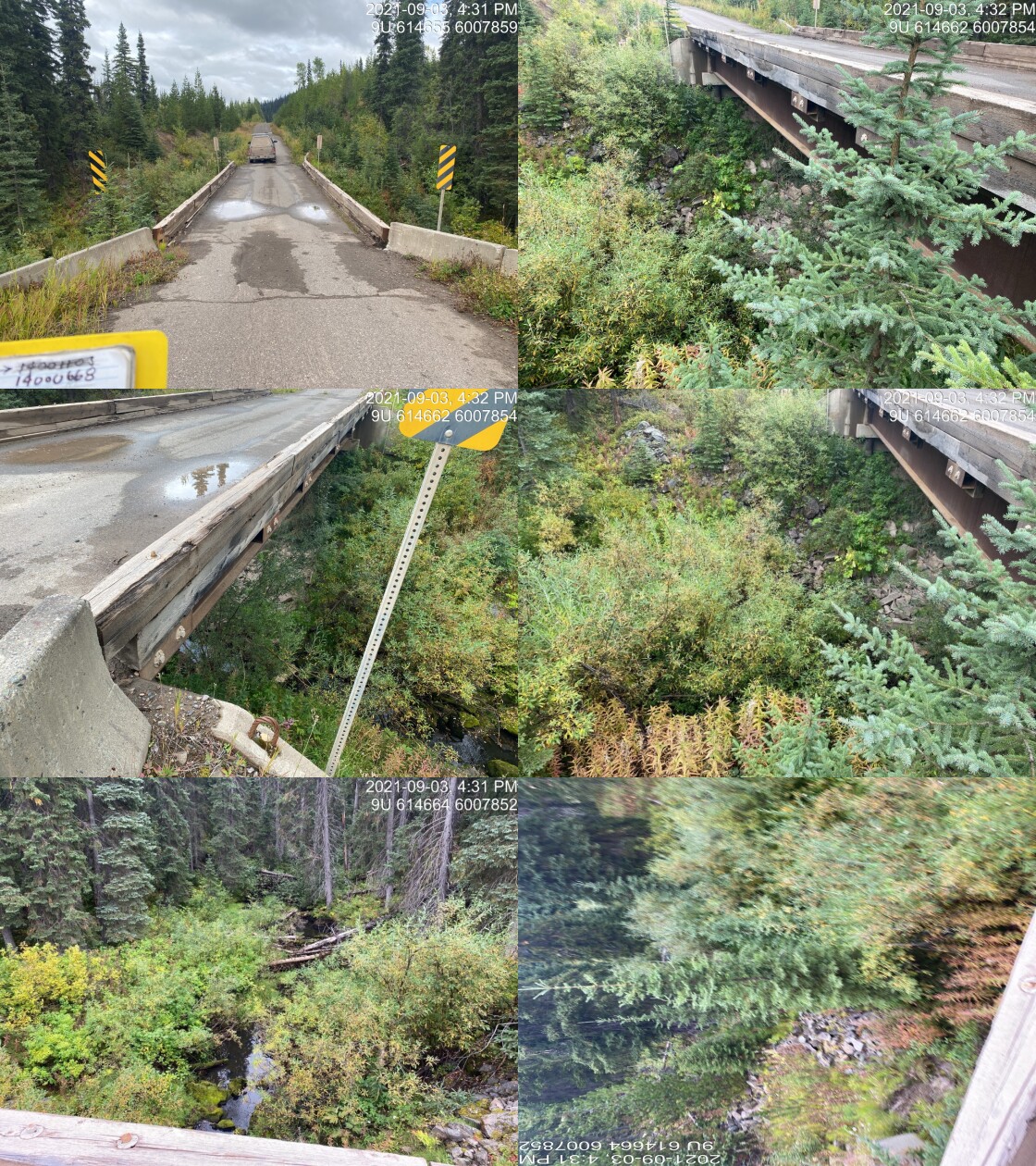
|
|||
| Comments: Bridge. 16:27 |
| Location and Stream Data |
|
Crossing Characteristics | – |
|---|---|---|---|
| Date | 2021-09-03 | Crossing Sub Type | Oval Culvert |
| PSCIS ID | 197951 | Diameter (m) | 1.6 |
| External ID | 14001177 | Length (m) | 22 |
| Crew | AI | Embedded | No |
| UTM Zone | 9 | Depth Embedded (m) | – |
| Easting | 620026.2 | Resemble Channel | No |
| Northing | 6010831 | Backwatered | No |
| Stream | Tributatry to Morice River | Percent Backwatered | – |
| Road | False Tagit FSR | Fill Depth (m) | 1.5 |
| Road Tenure | FLNR DND 9946 | Outlet Drop (m) | 1.1 |
| Channel Width (m) | 3 | Outlet Pool Depth (m) | 0.6 |
| Stream Slope (%) | 1 | Inlet Drop | No |
| Beaver Activity | No | Slope (%) | 4.5 |
| Habitat Value | Medium | Valley Fill | Deep Fill |
| Final score | 39 | Barrier Result | Barrier |
| Fix type | Replace with New Open Bottom Structure | Fix Span / Diameter | 10 |
Photos: PSCIS ID 197951. From top left clockwise: Road/Site Card, Barrel, Outlet, Downstream, Upstream, Inlet.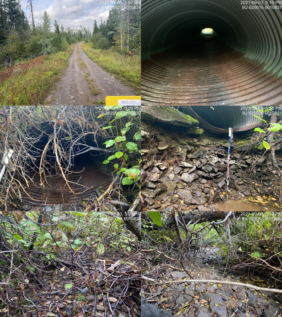
|
|||
| Comments: Dry upstream but sizable channel. Cobble substrate. ~20 fish 50-80mm in outlet pool. 17:05 |
| Location and Stream Data |
|
Crossing Characteristics | – |
|---|---|---|---|
| Date | 2021-09-03 | Crossing Sub Type | Round Culvert |
| PSCIS ID | 197952 | Diameter (m) | 1 |
| External ID | 14000690 | Length (m) | 24 |
| Crew | AI | Embedded | No |
| UTM Zone | 9 | Depth Embedded (m) | – |
| Easting | 625491.4 | Resemble Channel | No |
| Northing | 6008365 | Backwatered | No |
| Stream | Tributary to Morice River | Percent Backwatered | – |
| Road | Chisholm FSR | Fill Depth (m) | 1 |
| Road Tenure | FLNR DND 9946 | Outlet Drop (m) | 0.35 |
| Channel Width (m) | 2.1 | Outlet Pool Depth (m) | 0.5 |
| Stream Slope (%) | 6 | Inlet Drop | Yes |
| Beaver Activity | No | Slope (%) | 4.5 |
| Habitat Value | Low | Valley Fill | Deep Fill |
| Final score | 39 | Barrier Result | Barrier |
| Fix type | Replace with New Open Bottom Structure | Fix Span / Diameter | 10 |
Photos: PSCIS ID 197952. From top left clockwise: Road/Site Card, Barrel, Outlet, Downstream, Upstream, Inlet.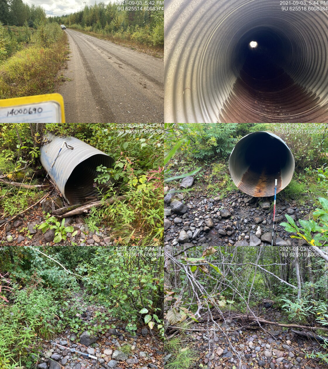
|
|||
| Comments: Dry except small outlet pool. Cobble substrate. Some gravels present. 17:41 |
| Location and Stream Data |
|
Crossing Characteristics | – |
|---|---|---|---|
| Date | 2021-09-03 | Crossing Sub Type | Ford |
| PSCIS ID | 197953 | Diameter (m) | – |
| External ID | 14001563 | Length (m) | – |
| Crew | AI | Embedded | – |
| UTM Zone | 9 | Depth Embedded (m) | – |
| Easting | 630001.2 | Resemble Channel | – |
| Northing | 6009752 | Backwatered | – |
| Stream | Tributary to Morice River | Percent Backwatered | – |
| Road | Spur | Fill Depth (m) | – |
| Road Tenure | Resource | Outlet Drop (m) | – |
| Channel Width (m) | – | Outlet Pool Depth (m) | – |
| Stream Slope (%) | – | Inlet Drop | – |
| Beaver Activity | – | Slope (%) | – |
| Habitat Value | – | Valley Fill | – |
| Final score | 0 | Barrier Result | Unknown |
| Fix type | – | Fix Span / Diameter | – |
Photos: PSCIS ID 197953. From top left clockwise: Road/Site Card, Barrel, Outlet, Downstream, Upstream, Inlet.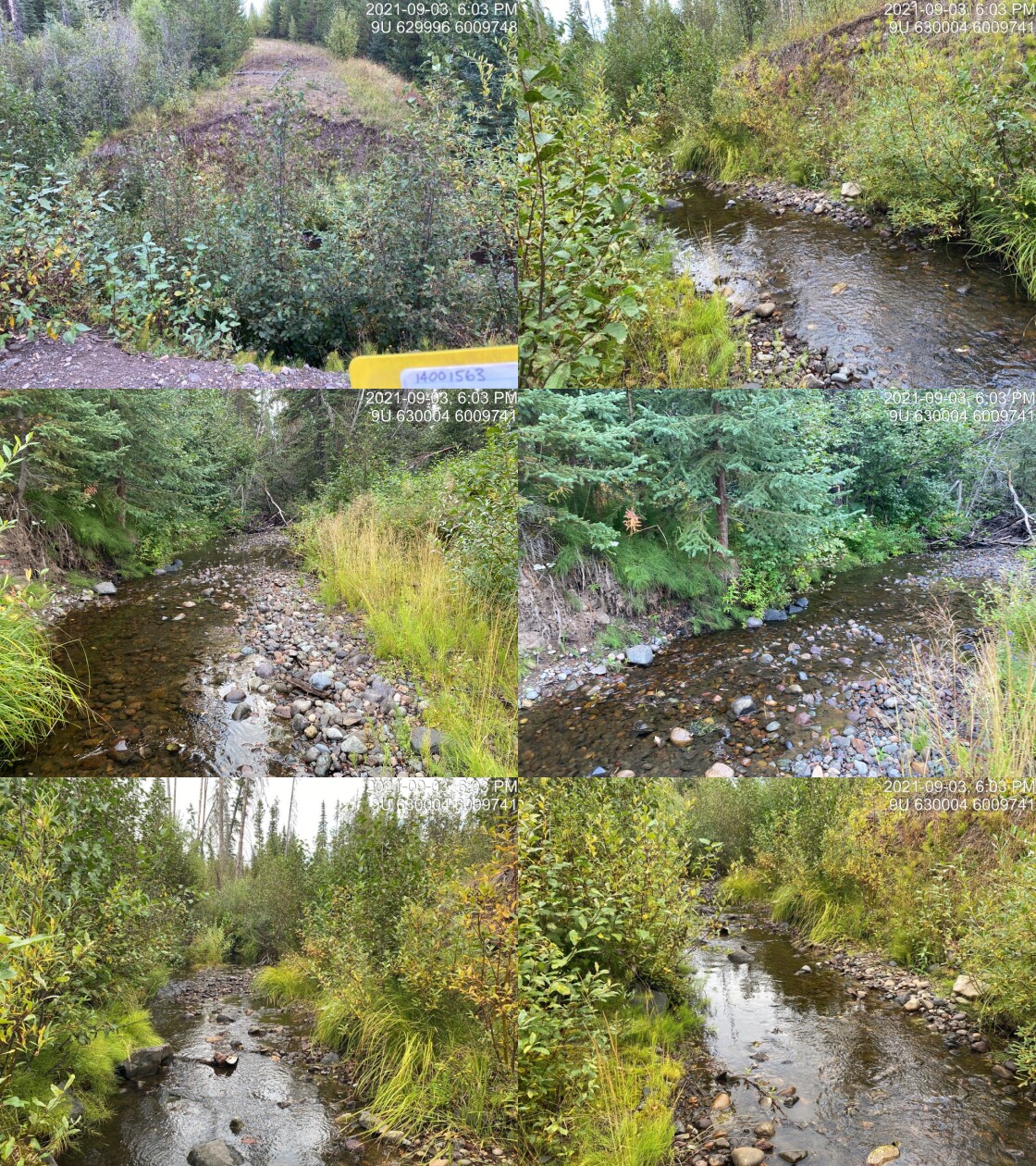
|
|||
| Comments: Full deactivation. No ATV passability. 18:01 |
| Location and Stream Data |
|
Crossing Characteristics | – |
|---|---|---|---|
| Date | 2021-09-03 | Crossing Sub Type | Round Culvert |
| PSCIS ID | 197954 | Diameter (m) | 1.25 |
| External ID | 14000696 | Length (m) | 30 |
| Crew | AI | Embedded | No |
| UTM Zone | 9 | Depth Embedded (m) | – |
| Easting | 630596.4 | Resemble Channel | No |
| Northing | 6010650 | Backwatered | Yes |
| Stream | Tributary to Morice River | Percent Backwatered | 25 |
| Road | Chisholm FSR | Fill Depth (m) | 3 |
| Road Tenure | FLNR DND 9946 | Outlet Drop (m) | 0 |
| Channel Width (m) | 1.7 | Outlet Pool Depth (m) | 0.6 |
| Stream Slope (%) | 3 | Inlet Drop | No |
| Beaver Activity | No | Slope (%) | 0.5 |
| Habitat Value | Medium | Valley Fill | Deep Fill |
| Final score | 22 | Barrier Result | Barrier |
| Fix type | Replace with New Open Bottom Structure | Fix Span / Diameter | 10 |
Photos: PSCIS ID 197954. From top left clockwise: Road/Site Card, Barrel, Outlet, Downstream, Upstream, Inlet.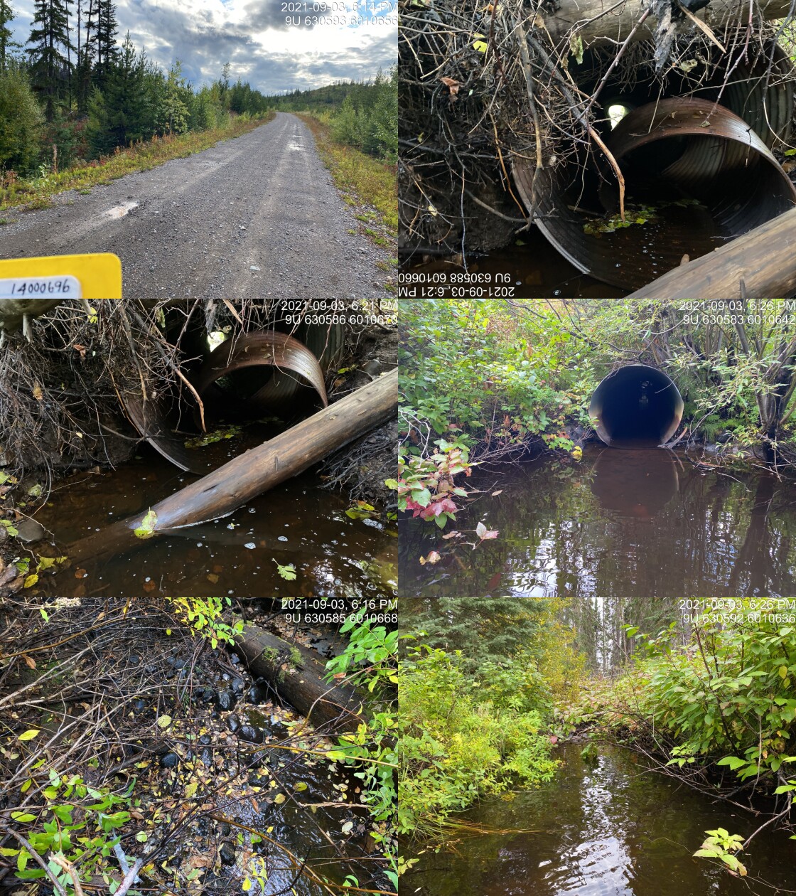
|
|||
| Comments: Nice stream downstream at deactivated crossing. Riparian shrub cover is extremely thick. Difficult to get width and gradient. Stream may be bigger. 18:13 |
| Location and Stream Data |
|
Crossing Characteristics | – |
|---|---|---|---|
| Date | 2021-09-04 | Crossing Sub Type | Ford |
| PSCIS ID | 197955 | Diameter (m) | – |
| External ID | 1800422 | Length (m) | – |
| Crew | AI | Embedded | – |
| UTM Zone | 9 | Depth Embedded (m) | – |
| Easting | 679525.4 | Resemble Channel | – |
| Northing | 6039649 | Backwatered | – |
| Stream | Ailport Creek | Percent Backwatered | – |
| Road | Powerline | Fill Depth (m) | – |
| Road Tenure | Unclassified | Outlet Drop (m) | – |
| Channel Width (m) | – | Outlet Pool Depth (m) | – |
| Stream Slope (%) | – | Inlet Drop | – |
| Beaver Activity | – | Slope (%) | – |
| Habitat Value | – | Valley Fill | – |
| Final score | 0 | Barrier Result | Unknown |
| Fix type | – | Fix Span / Diameter | – |
Photos: PSCIS ID 197955. From top left clockwise: Road/Site Card, Barrel, Outlet, Downstream, Upstream, Inlet.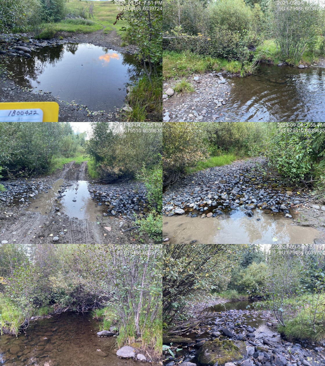
|
|||
| Comments: Ford. 19:49 |
| Location and Stream Data |
|
Crossing Characteristics | – |
|---|---|---|---|
| Date | 2021-09-05 | Crossing Sub Type | Ford |
| PSCIS ID | 197956 | Diameter (m) | – |
| External ID | 1801133 | Length (m) | – |
| Crew | AI | Embedded | – |
| UTM Zone | 9 | Depth Embedded (m) | – |
| Easting | 674339.1 | Resemble Channel | – |
| Northing | 6039595 | Backwatered | – |
| Stream | Tributary to Bulkley River | Percent Backwatered | – |
| Road | Spur | Fill Depth (m) | – |
| Road Tenure | Unclassified | Outlet Drop (m) | – |
| Channel Width (m) | – | Outlet Pool Depth (m) | – |
| Stream Slope (%) | – | Inlet Drop | – |
| Beaver Activity | – | Slope (%) | – |
| Habitat Value | – | Valley Fill | – |
| Final score | 0 | Barrier Result | Unknown |
| Fix type | – | Fix Span / Diameter | – |
Photos: PSCIS ID 197956. From top left clockwise: Road/Site Card, Barrel, Outlet, Downstream, Upstream, Inlet.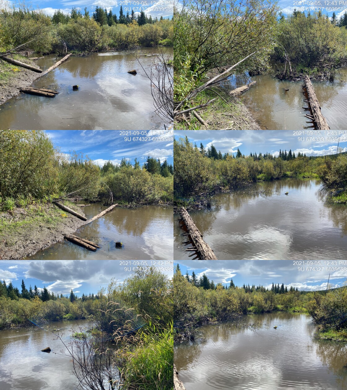
|
|||
| Comments: Beaver dam. 12:41 |
| Location and Stream Data |
|
Crossing Characteristics | – |
|---|---|---|---|
| Date | 2021-09-05 | Crossing Sub Type | Bridge |
| PSCIS ID | 197957 | Diameter (m) | 7 |
| External ID | 1801969 | Length (m) | 4 |
| Crew | AI | Embedded | – |
| UTM Zone | 9 | Depth Embedded (m) | – |
| Easting | 673797 | Resemble Channel | – |
| Northing | 6038906 | Backwatered | – |
| Stream | Tributary to Elwin Lake | Percent Backwatered | – |
| Road | Spur | Fill Depth (m) | – |
| Road Tenure | Unclassified | Outlet Drop (m) | – |
| Channel Width (m) | – | Outlet Pool Depth (m) | – |
| Stream Slope (%) | – | Inlet Drop | – |
| Beaver Activity | – | Slope (%) | – |
| Habitat Value | – | Valley Fill | – |
| Final score | 0 | Barrier Result | Passable |
| Fix type | – | Fix Span / Diameter | – |
Photos: PSCIS ID 197957. From top left clockwise: Road/Site Card, Barrel, Outlet, Downstream, Upstream, Inlet.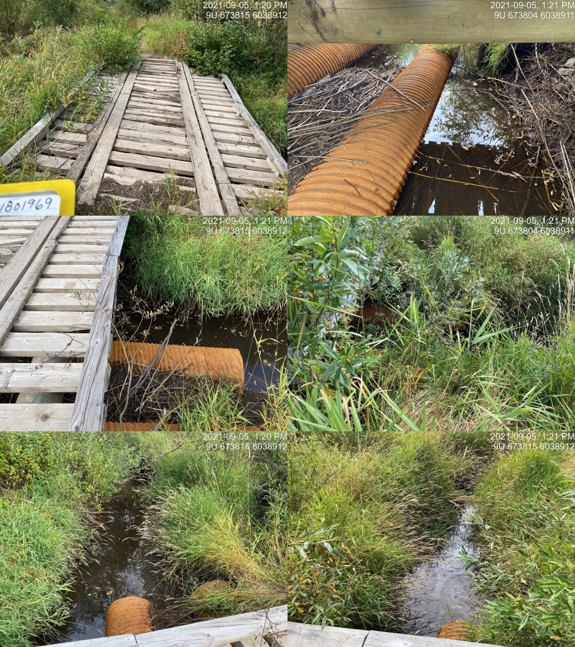
|
|||
| Comments: 2 washed out CV’s below. 13:20 |
| Location and Stream Data |
|
Crossing Characteristics | – |
|---|---|---|---|
| Date | 2021-09-05 | Crossing Sub Type | Bridge |
| PSCIS ID | 197958 | Diameter (m) | 15 |
| External ID | 1803828 | Length (m) | 5 |
| Crew | AI | Embedded | – |
| UTM Zone | 9 | Depth Embedded (m) | – |
| Easting | 674549 | Resemble Channel | – |
| Northing | 6038014 | Backwatered | – |
| Stream | Tributary to Bulkley River | Percent Backwatered | – |
| Road | Spur | Fill Depth (m) | – |
| Road Tenure | Solid Ground R12370 | Outlet Drop (m) | – |
| Channel Width (m) | – | Outlet Pool Depth (m) | – |
| Stream Slope (%) | – | Inlet Drop | – |
| Beaver Activity | – | Slope (%) | – |
| Habitat Value | – | Valley Fill | – |
| Final score | 0 | Barrier Result | Passable |
| Fix type | – | Fix Span / Diameter | – |
Photos: PSCIS ID 197958. From top left clockwise: Road/Site Card, Barrel, Outlet, Downstream, Upstream, Inlet.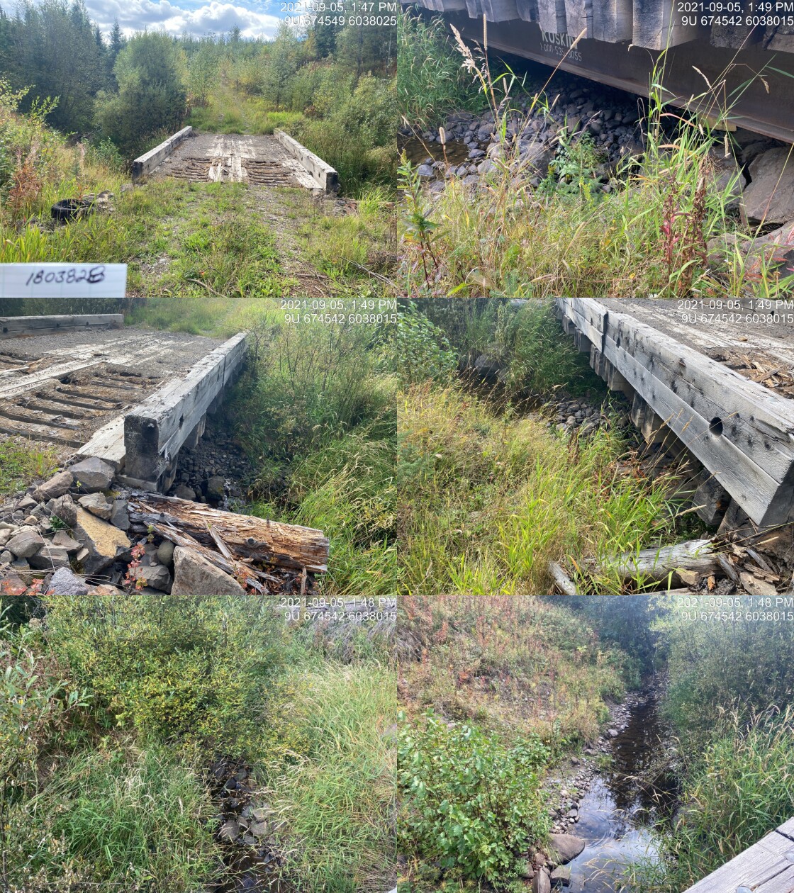
|
|||
| Comments: Bridge. 13:47 |
| Location and Stream Data |
|
Crossing Characteristics | – |
|---|---|---|---|
| Date | 2021-09-05 | Crossing Sub Type | Bridge |
| PSCIS ID | 197959 | Diameter (m) | 19 |
| External ID | 1804238 | Length (m) | 4 |
| Crew | AI | Embedded | – |
| UTM Zone | 9 | Depth Embedded (m) | – |
| Easting | 675156 | Resemble Channel | – |
| Northing | 6039878 | Backwatered | – |
| Stream | Tributary to Bulkley River | Percent Backwatered | – |
| Road | Spur | Fill Depth (m) | – |
| Road Tenure | Solid Ground R12370 | Outlet Drop (m) | – |
| Channel Width (m) | – | Outlet Pool Depth (m) | – |
| Stream Slope (%) | – | Inlet Drop | – |
| Beaver Activity | – | Slope (%) | – |
| Habitat Value | – | Valley Fill | – |
| Final score | 0 | Barrier Result | Passable |
| Fix type | – | Fix Span / Diameter | – |
Photos: PSCIS ID 197959. From top left clockwise: Road/Site Card, Barrel, Outlet, Downstream, Upstream, Inlet.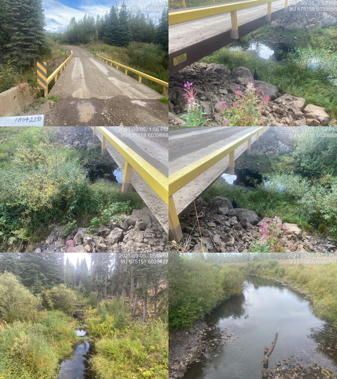
|
|||
| Comments: Newer. 13:55 |
| Location and Stream Data |
|
Crossing Characteristics | – |
|---|---|---|---|
| Date | 2021-09-13 | Crossing Sub Type | Round Culvert |
| PSCIS ID | 197960 | Diameter (m) | 3.4 |
| External ID | 24704566 | Length (m) | 24 |
| Crew | AI KP | Embedded | No |
| UTM Zone | 9 | Depth Embedded (m) | – |
| Easting | 605785.6 | Resemble Channel | No |
| Northing | 6099884 | Backwatered | No |
| Stream | Corya Creek | Percent Backwatered | – |
| Road | Railway | Fill Depth (m) | 1.5 |
| Road Tenure | Unknown | Outlet Drop (m) | 0.65 |
| Channel Width (m) | 18 | Outlet Pool Depth (m) | 3 |
| Stream Slope (%) | 2.8 | Inlet Drop | No |
| Beaver Activity | Yes | Slope (%) | 2.5 |
| Habitat Value | High | Valley Fill | Deep Fill |
| Final score | 34 | Barrier Result | Barrier |
| Fix type | Replace with New Open Bottom Structure | Fix Span / Diameter | 23 |
Photos: PSCIS ID 197960. From top left clockwise: Road/Site Card, Barrel, Outlet, Downstream, Upstream, Inlet.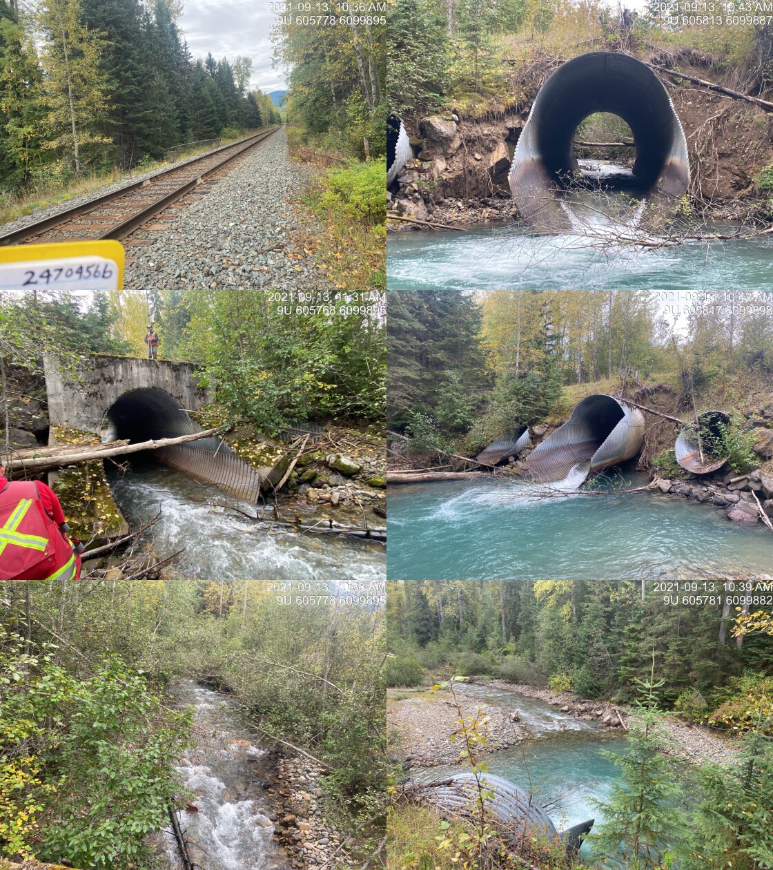
|
|||
| Comments: Outlet is cracked and drops. Inlet embedded to 2/3 way. 10:33 |
| Location and Stream Data |
|
Crossing Characteristics | – |
|---|---|---|---|
| Date | 2021-09-15 | Crossing Sub Type | Bridge |
| PSCIS ID | 197961 | Diameter (m) | 12 |
| External ID | 1805496 | Length (m) | 5 |
| Crew | AI DN | Embedded | – |
| UTM Zone | 9 | Depth Embedded (m) | – |
| Easting | 609393 | Resemble Channel | – |
| Northing | 6087111 | Backwatered | – |
| Stream | Owens Creek | Percent Backwatered | – |
| Road | CN Railway | Fill Depth (m) | – |
| Road Tenure | Canadian National | Outlet Drop (m) | – |
| Channel Width (m) | – | Outlet Pool Depth (m) | – |
| Stream Slope (%) | – | Inlet Drop | – |
| Beaver Activity | – | Slope (%) | – |
| Habitat Value | – | Valley Fill | – |
| Final score | 0 | Barrier Result | Passable |
| Fix type | – | Fix Span / Diameter | – |
Photos: PSCIS ID 197961. From top left clockwise: Road/Site Card, Barrel, Outlet, Downstream, Upstream, Inlet.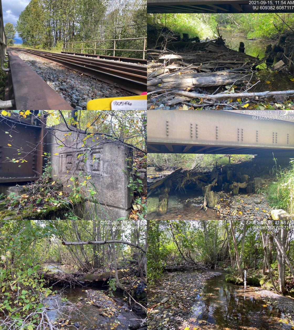
|
|||
| Comments: Bridge. 11:50 |
| Location and Stream Data |
|
Crossing Characteristics | – |
|---|---|---|---|
| Date | 2021-09-07 | Crossing Sub Type | Oval Culvert |
| PSCIS ID | 197962 | Diameter (m) | 3.6 |
| External ID | 14000798 | Length (m) | 15 |
| Crew | KP | Embedded | No |
| UTM Zone | 9 | Depth Embedded (m) | – |
| Easting | 643460.3 | Resemble Channel | No |
| Northing | 6025890 | Backwatered | No |
| Stream | Peacock Creek | Percent Backwatered | – |
| Road | Morice FSR | Fill Depth (m) | 3.5 |
| Road Tenure | FLNR DND 4656 | Outlet Drop (m) | 1.2 |
| Channel Width (m) | 9.3 | Outlet Pool Depth (m) | 0 |
| Stream Slope (%) | 4 | Inlet Drop | No |
| Beaver Activity | No | Slope (%) | 3.5 |
| Habitat Value | High | Valley Fill | Deep Fill |
| Final score | 39 | Barrier Result | Barrier |
| Fix type | Replace with New Open Bottom Structure | Fix Span / Diameter | 15.8 |
Photos: PSCIS ID 197962. From top left clockwise: Road/Site Card, Barrel, Outlet, Downstream, Upstream, Inlet.
|
|||
| Comments: Historic side channel for fish passage not functioning. 17:47 |
| Location and Stream Data |
|
Crossing Characteristics | – |
|---|---|---|---|
| Date | 2021-08-31 | Crossing Sub Type | Round Culvert |
| PSCIS ID | 197963 | Diameter (m) | 1.2 |
| External ID | 1805531 | Length (m) | 19 |
| Crew | KP AI | Embedded | No |
| UTM Zone | 9 | Depth Embedded (m) | – |
| Easting | 690763.8 | Resemble Channel | No |
| Northing | 6031192 | Backwatered | No |
| Stream | Tributary to Bulkley River | Percent Backwatered | – |
| Road | Railway | Fill Depth (m) | 1 |
| Road Tenure | Canadian National | Outlet Drop (m) | 0.4 |
| Channel Width (m) | 4 | Outlet Pool Depth (m) | 0.35 |
| Stream Slope (%) | 0 | Inlet Drop | Yes |
| Beaver Activity | Yes | Slope (%) | 2 |
| Habitat Value | Low | Valley Fill | Deep Fill |
| Final score | 34 | Barrier Result | Barrier |
| Fix type | Replace with New Open Bottom Structure | Fix Span / Diameter | 10 |
Photos: PSCIS ID 197963. From top left clockwise: Road/Site Card, Barrel, Outlet, Downstream, Upstream, Inlet.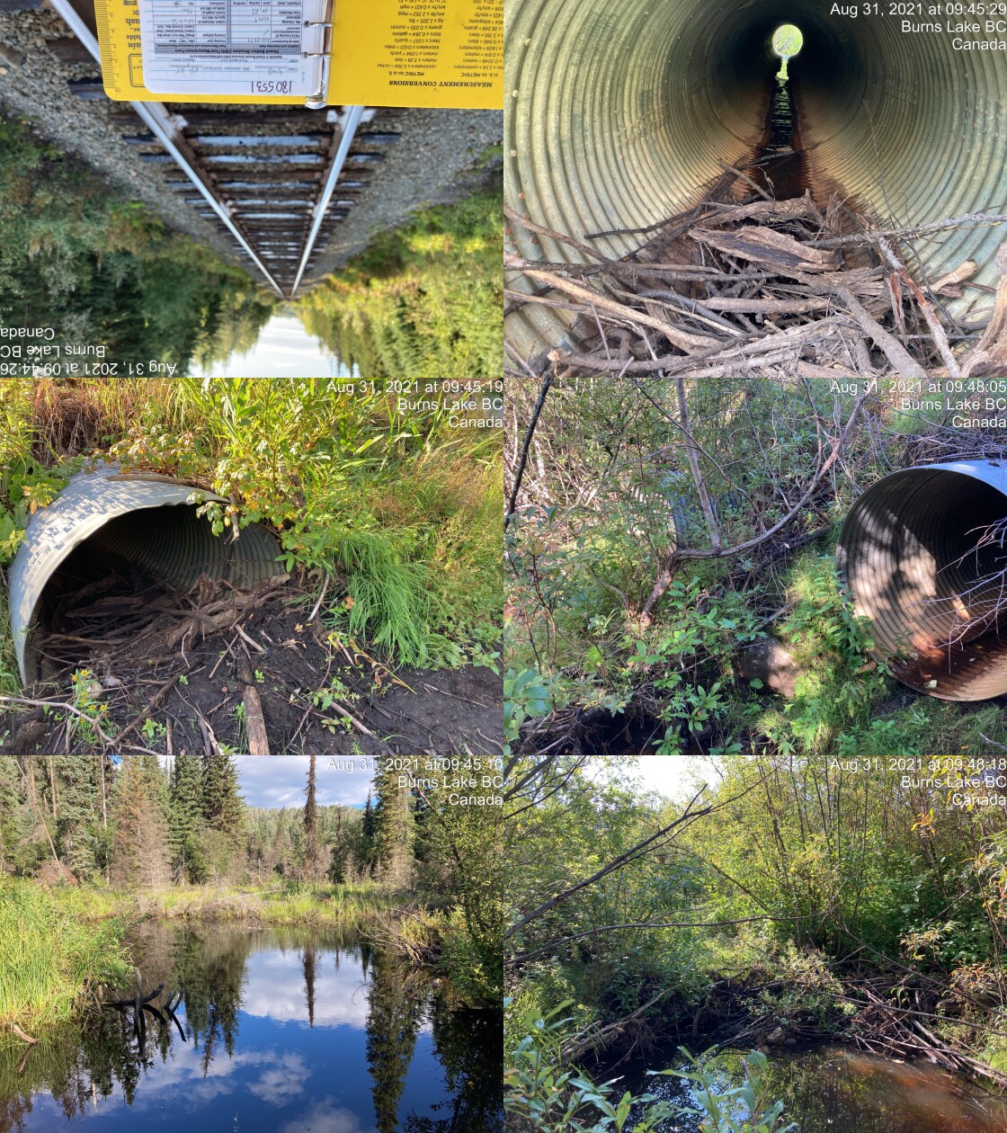
|
|||
| Comments: Beavers have clogged both inlets (double barrel). Significant sized marsh ~40m upstream with beaver dam 1.5 - 2m high on outlet of wetland. 9:40 |
| Location and Stream Data |
|
Crossing Characteristics | – |
|---|---|---|---|
| Date | 2021-08-31 | Crossing Sub Type | Round Culvert |
| PSCIS ID | 197964 | Diameter (m) | 1.5 |
| External ID | 1805529 | Length (m) | 21 |
| Crew | KP AI | Embedded | No |
| UTM Zone | 9 | Depth Embedded (m) | – |
| Easting | 691218.3 | Resemble Channel | No |
| Northing | 6031478 | Backwatered | Yes |
| Stream | Bulkley River | Percent Backwatered | 100 |
| Road | Railway | Fill Depth (m) | 3 |
| Road Tenure | Canadian National | Outlet Drop (m) | 0 |
| Channel Width (m) | 9 | Outlet Pool Depth (m) | 0.8 |
| Stream Slope (%) | 0 | Inlet Drop | No |
| Beaver Activity | No | Slope (%) | 0.7 |
| Habitat Value | High | Valley Fill | Deep Fill |
| Final score | 19 | Barrier Result | Potential |
| Fix type | Replace with New Open Bottom Structure | Fix Span / Diameter | 14 |
Photos: PSCIS ID 197964. From top left clockwise: Road/Site Card, Barrel, Outlet, Downstream, Upstream, Inlet.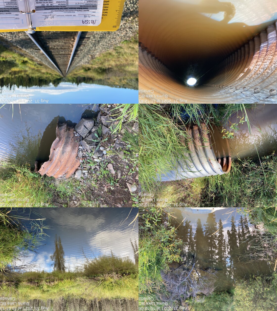
|
|||
| Comments: Backwatered fully, appears fully passable. Fish sighted at outlet. Distance from water surface to top of culvert is 70cm. 9:58 |
| Location and Stream Data |
|
Crossing Characteristics | – |
|---|---|---|---|
| Date | 2021-08-09 | Crossing Sub Type | Round Culvert |
| PSCIS ID | 197965 | Diameter (m) | 0.95 |
| External ID | 14000820 | Length (m) | 10 |
| Crew | LRH DM | Embedded | No |
| UTM Zone | 9 | Depth Embedded (m) | – |
| Easting | 617037 | Resemble Channel | No |
| Northing | 5997095 | Backwatered | No |
| Stream | Tributary to Collins Lake | Percent Backwatered | – |
| Road | Morice R FSR | Fill Depth (m) | 1.3 |
| Road Tenure | FLNR DND 4656 | Outlet Drop (m) | 0.4 |
| Channel Width (m) | 0.35 | Outlet Pool Depth (m) | 0.9 |
| Stream Slope (%) | 3 | Inlet Drop | No |
| Beaver Activity | No | Slope (%) | 2 |
| Habitat Value | Medium | Valley Fill | Deep Fill |
| Final score | 25 | Barrier Result | Barrier |
| Fix type | Replace Structure with Streambed Simulation CBS | Fix Span / Diameter | 3 |
Photos: PSCIS ID 197965. From top left clockwise: Road/Site Card, Barrel, Outlet, Downstream, Upstream, Inlet.
|
|||
| Comments: rock retaining wall (hand built), wood culvert, mainline, post code logging |
| Location and Stream Data |
|
Crossing Characteristics | – |
|---|---|---|---|
| Date | 2021-08-31 | Crossing Sub Type | Bridge |
| PSCIS ID | 197966 | Diameter (m) | 12 |
| External ID | 1800049 | Length (m) | 9 |
| Crew | KP AI | Embedded | – |
| UTM Zone | 9 | Depth Embedded (m) | – |
| Easting | 692281.2 | Resemble Channel | – |
| Northing | 6032072 | Backwatered | – |
| Stream | Bulkley River | Percent Backwatered | – |
| Road | Rose Lake Cuttoff Road | Fill Depth (m) | – |
| Road Tenure | MoTi Local | Outlet Drop (m) | – |
| Channel Width (m) | – | Outlet Pool Depth (m) | – |
| Stream Slope (%) | – | Inlet Drop | – |
| Beaver Activity | – | Slope (%) | – |
| Habitat Value | – | Valley Fill | – |
| Final score | 0 | Barrier Result | Passable |
| Fix type | – | Fix Span / Diameter | – |
Photos: PSCIS ID 197966. From top left clockwise: Road/Site Card, Barrel, Outlet, Downstream, Upstream, Inlet.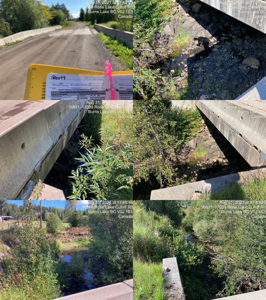
|
|||
| Comments: Rose Lake cut-off bridge. 11:38 |
| Location and Stream Data |
|
Crossing Characteristics | – |
|---|---|---|---|
| Date | 2021-08-31 | Crossing Sub Type | Round Culvert |
| PSCIS ID | 197967 | Diameter (m) | 3 |
| External ID | 1800050 | Length (m) | 30 |
| Crew | KP AI | Embedded | No |
| UTM Zone | 9 | Depth Embedded (m) | – |
| Easting | 692434.6 | Resemble Channel | No |
| Northing | 6032331 | Backwatered | No |
| Stream | Taman Creek | Percent Backwatered | – |
| Road | Highway 16 | Fill Depth (m) | 9.99 |
| Road Tenure | Highway | Outlet Drop (m) | 0 |
| Channel Width (m) | 5.3 | Outlet Pool Depth (m) | 0.4 |
| Stream Slope (%) | 1.7 | Inlet Drop | Yes |
| Beaver Activity | Yes | Slope (%) | 2.5 |
| Habitat Value | Medium | Valley Fill | Deep Fill |
| Final score | 27 | Barrier Result | Barrier |
| Fix type | Replace with New Open Bottom Structure | Fix Span / Diameter | 31 |
Photos: PSCIS ID 197967. From top left clockwise: Road/Site Card, Barrel, Outlet, Downstream, Upstream, Inlet.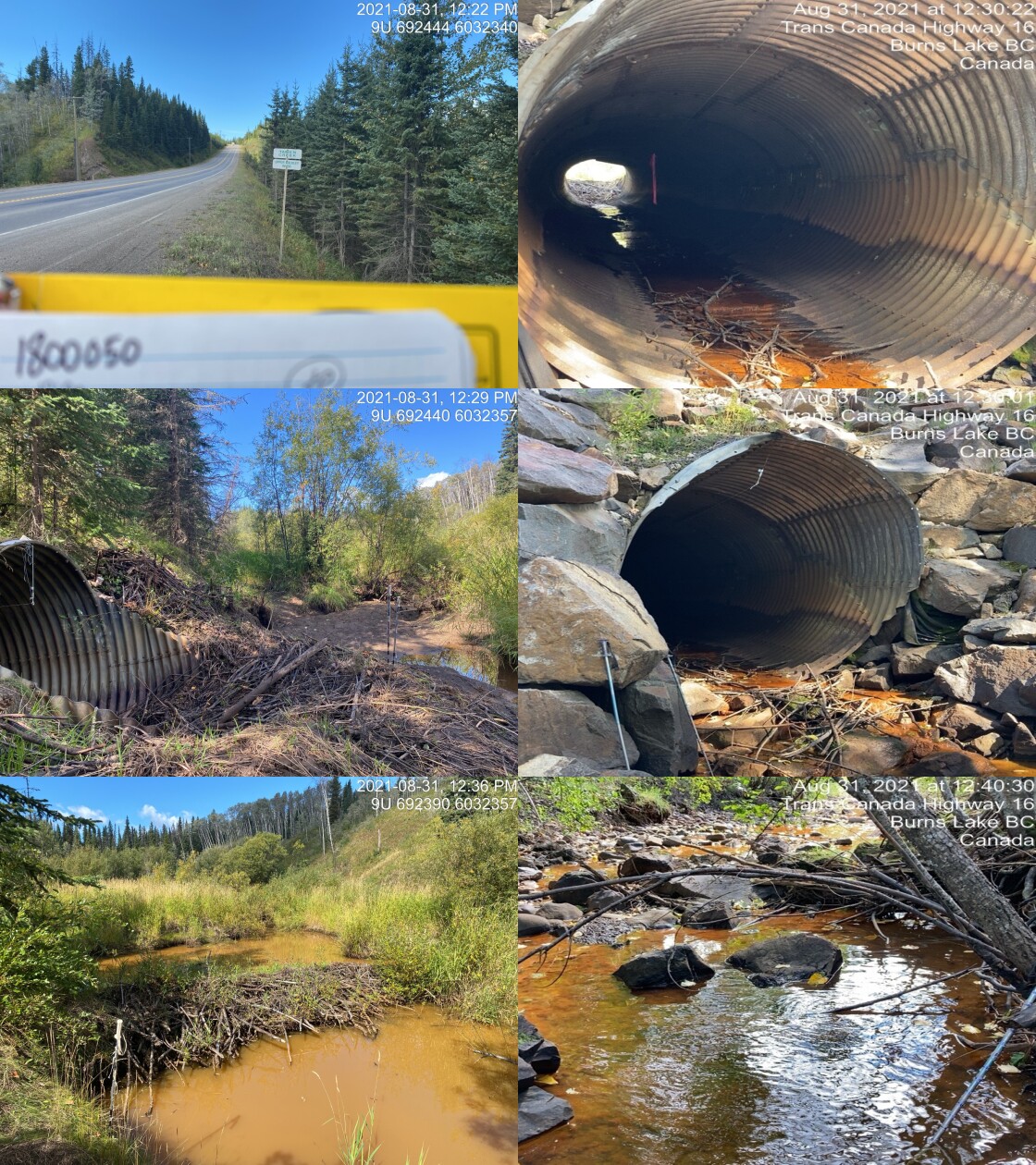
|
|||
| Comments: Beaver dam at inlet ~1.5m high. Rocks placed at outlet reducing drop to 0, rocks about long, and have stagged drop of 0.7m. 12:20 |
| Location and Stream Data |
|
Crossing Characteristics | – |
|---|---|---|---|
| Date | 2021-08-31 | Crossing Sub Type | Bridge |
| PSCIS ID | 197968 | Diameter (m) | 11 |
| External ID | 1801117 | Length (m) | 4 |
| Crew | KP | Embedded | – |
| UTM Zone | 9 | Depth Embedded (m) | – |
| Easting | 690733 | Resemble Channel | – |
| Northing | 6032353 | Backwatered | – |
| Stream | Bulkley River | Percent Backwatered | – |
| Road | Spur | Fill Depth (m) | – |
| Road Tenure | Unclassified | Outlet Drop (m) | – |
| Channel Width (m) | – | Outlet Pool Depth (m) | – |
| Stream Slope (%) | – | Inlet Drop | – |
| Beaver Activity | – | Slope (%) | – |
| Habitat Value | – | Valley Fill | – |
| Final score | 0 | Barrier Result | Passable |
| Fix type | – | Fix Span / Diameter | – |
Photos: PSCIS ID 197968. From top left clockwise: Road/Site Card, Barrel, Outlet, Downstream, Upstream, Inlet.
|
|||
| Comments: Observed water pump and intake hose below bridge (downstream). 13:42 |
| Location and Stream Data |
|
Crossing Characteristics | – |
|---|---|---|---|
| Date | 2021-08-31 | Crossing Sub Type | Bridge |
| PSCIS ID | 197969 | Diameter (m) | 10 |
| External ID | 1800583 | Length (m) | 4 |
| Crew | KP | Embedded | – |
| UTM Zone | 9 | Depth Embedded (m) | – |
| Easting | 689262 | Resemble Channel | – |
| Northing | 6033535 | Backwatered | – |
| Stream | Bulkley River | Percent Backwatered | – |
| Road | Raymond Road | Fill Depth (m) | – |
| Road Tenure | Unclassified | Outlet Drop (m) | – |
| Channel Width (m) | – | Outlet Pool Depth (m) | – |
| Stream Slope (%) | – | Inlet Drop | – |
| Beaver Activity | – | Slope (%) | – |
| Habitat Value | – | Valley Fill | – |
| Final score | 0 | Barrier Result | Passable |
| Fix type | – | Fix Span / Diameter | – |
Photos: PSCIS ID 197969. From top left clockwise: Road/Site Card, Barrel, Outlet, Downstream, Upstream, Inlet.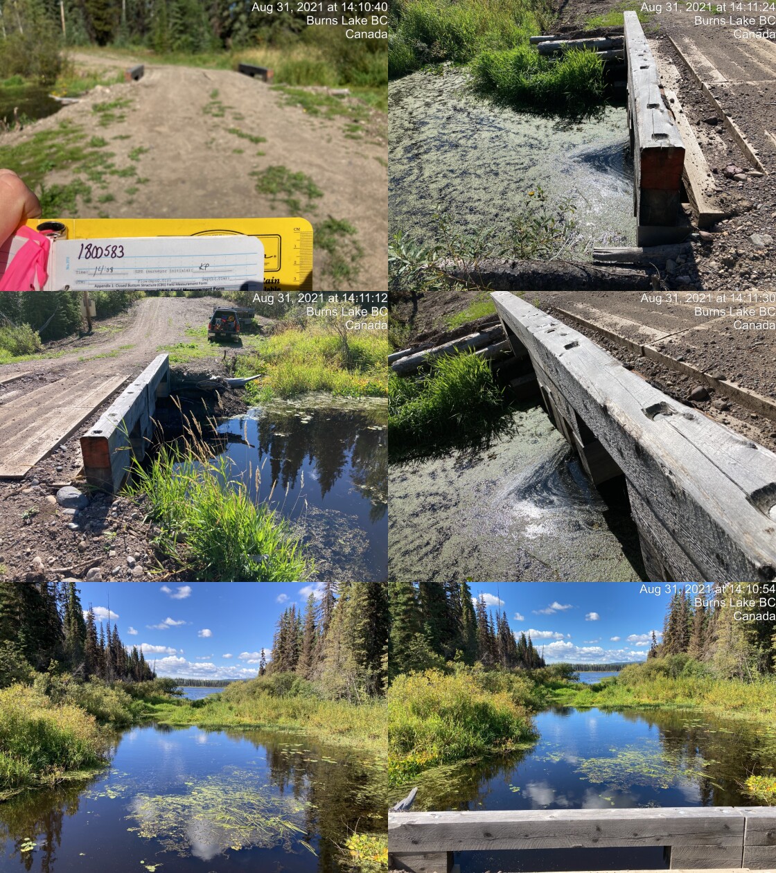
|
|||
| Comments: Bridge at outflow of Conrad Lake, on Bulkley River. Access via Mulligan road, then start of Raymond Road. 14:08 |
| Location and Stream Data |
|
Crossing Characteristics | – |
|---|---|---|---|
| Date | 2021-08-31 | Crossing Sub Type | Round Culvert |
| PSCIS ID | 197970 | Diameter (m) | 0.6 |
| External ID | 1803813 | Length (m) | 13 |
| Crew | KP | Embedded | No |
| UTM Zone | 9 | Depth Embedded (m) | – |
| Easting | 684415 | Resemble Channel | No |
| Northing | 6035809 | Backwatered | No |
| Stream | Tributary to Broman Lake | Percent Backwatered | – |
| Road | Broman Lake FSR | Fill Depth (m) | 0.5 |
| Road Tenure | Chinook Comfor R21201 | Outlet Drop (m) | 0.18 |
| Channel Width (m) | 0.7 | Outlet Pool Depth (m) | 0.5 |
| Stream Slope (%) | 5 | Inlet Drop | Yes |
| Beaver Activity | No | Slope (%) | 4 |
| Habitat Value | Low | Valley Fill | Deep Fill |
| Final score | 28 | Barrier Result | Barrier |
| Fix type | Replace Structure with Streambed Simulation CBS | Fix Span / Diameter | 3 |
Photos: PSCIS ID 197970. From top left clockwise: Road/Site Card, Barrel, Outlet, Downstream, Upstream, Inlet.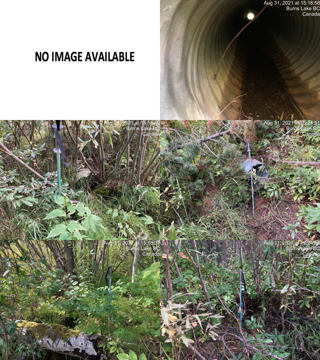
|
|||
| Comments: Just before km 3. Inlet embedded with vegetation ~0.2m. Channel dry, small amount of water in pool downstream. ~5cm. Hard to see channel downstream. 15:14 |
| Location and Stream Data |
|
Crossing Characteristics | – |
|---|---|---|---|
| Date | 2021-08-31 | Crossing Sub Type | Pipe Arch |
| PSCIS ID | 197971 | Diameter (m) | 1.8 |
| External ID | 1805000 | Length (m) | 30 |
| Crew | KP | Embedded | – |
| UTM Zone | 9 | Depth Embedded (m) | – |
| Easting | 685301 | Resemble Channel | – |
| Northing | 6036065 | Backwatered | – |
| Stream | Bulkley River | Percent Backwatered | – |
| Road | Broman Lake FSR | Fill Depth (m) | – |
| Road Tenure | Chinook Comfor R21201 | Outlet Drop (m) | – |
| Channel Width (m) | – | Outlet Pool Depth (m) | – |
| Stream Slope (%) | – | Inlet Drop | – |
| Beaver Activity | No | Slope (%) | – |
| Habitat Value | – | Valley Fill | – |
| Final score | 6 | Barrier Result | Passable |
| Fix type | – | Fix Span / Diameter | – |
Photos: PSCIS ID 197971. From top left clockwise: Road/Site Card, Barrel, Outlet, Downstream, Upstream, Inlet.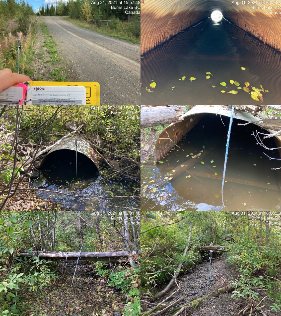
|
|||
| Comments: Channel mostly dry. Pool at inlet and another 30m upstream. Water depth 22cm at inlet. Pool at outlet and water throughout culvert. Open bottomed pipe arch. Looks very passable. Additional closed bottom structure higher and beside (river right), doesn’t appear to get use. 15:56 |
| Location and Stream Data |
|
Crossing Characteristics | – |
|---|---|---|---|
| Date | 2021-08-31 | Crossing Sub Type | Round Culvert |
| PSCIS ID | 197972 | Diameter (m) | 0.6 |
| External ID | 1802040 | Length (m) | 8 |
| Crew | KP | Embedded | No |
| UTM Zone | 9 | Depth Embedded (m) | – |
| Easting | 684950.1 | Resemble Channel | No |
| Northing | 6035440 | Backwatered | No |
| Stream | Tributary to Broman Lake | Percent Backwatered | – |
| Road | Powerline | Fill Depth (m) | 0.3 |
| Road Tenure | Unclassified | Outlet Drop (m) | 0 |
| Channel Width (m) | 0.8 | Outlet Pool Depth (m) | 0.6 |
| Stream Slope (%) | 2 | Inlet Drop | No |
| Beaver Activity | No | Slope (%) | 2 |
| Habitat Value | Low | Valley Fill | Deep Fill |
| Final score | 21 | Barrier Result | Barrier |
| Fix type | Replace Structure with Streambed Simulation CBS | Fix Span / Diameter | 3 |
Photos: PSCIS ID 197972. From top left clockwise: Road/Site Card, Barrel, Outlet, Downstream, Upstream, Inlet.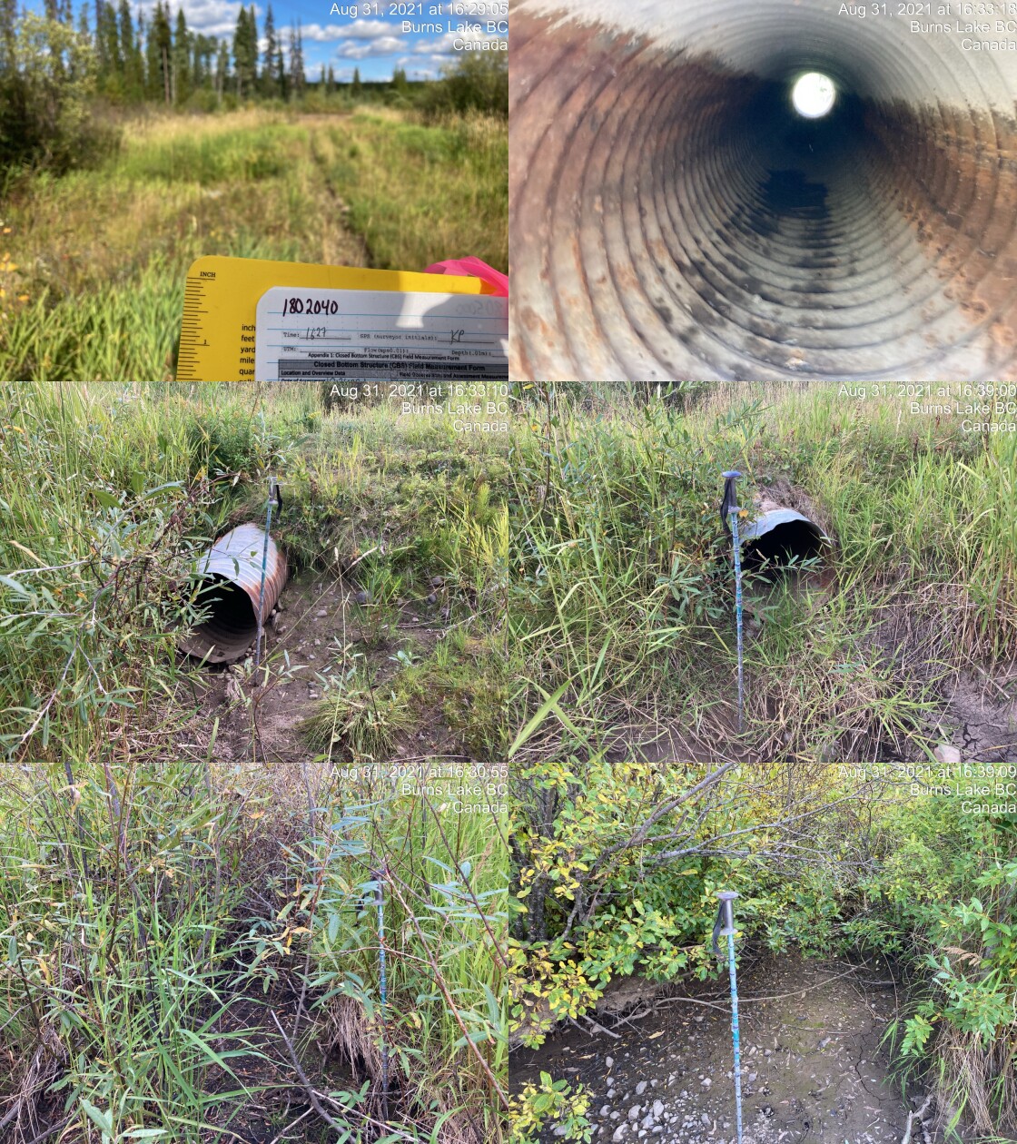
|
|||
| Comments: Powerline ascend via Broman Lake road, does not have outlet drop but does have gentle height change that could be a challenge for passage. Channel upstream dry, downstream dry except 5-10cm pool. Salamander young found in outlet pool. 16:27 |
| Location and Stream Data |
|
Crossing Characteristics | – |
|---|---|---|---|
| Date | 2021-08-31 | Crossing Sub Type | Bridge |
| PSCIS ID | 197973 | Diameter (m) | 11 |
| External ID | 1802039 | Length (m) | 5 |
| Crew | KP | Embedded | – |
| UTM Zone | 9 | Depth Embedded (m) | – |
| Easting | 685413.5 | Resemble Channel | – |
| Northing | 6035362 | Backwatered | – |
| Stream | Bulkley River | Percent Backwatered | – |
| Road | Powerline | Fill Depth (m) | – |
| Road Tenure | Unclassified | Outlet Drop (m) | – |
| Channel Width (m) | – | Outlet Pool Depth (m) | – |
| Stream Slope (%) | – | Inlet Drop | – |
| Beaver Activity | – | Slope (%) | – |
| Habitat Value | – | Valley Fill | – |
| Final score | 0 | Barrier Result | Passable |
| Fix type | – | Fix Span / Diameter | – |
Photos: PSCIS ID 197973. From top left clockwise: Road/Site Card, Barrel, Outlet, Downstream, Upstream, Inlet.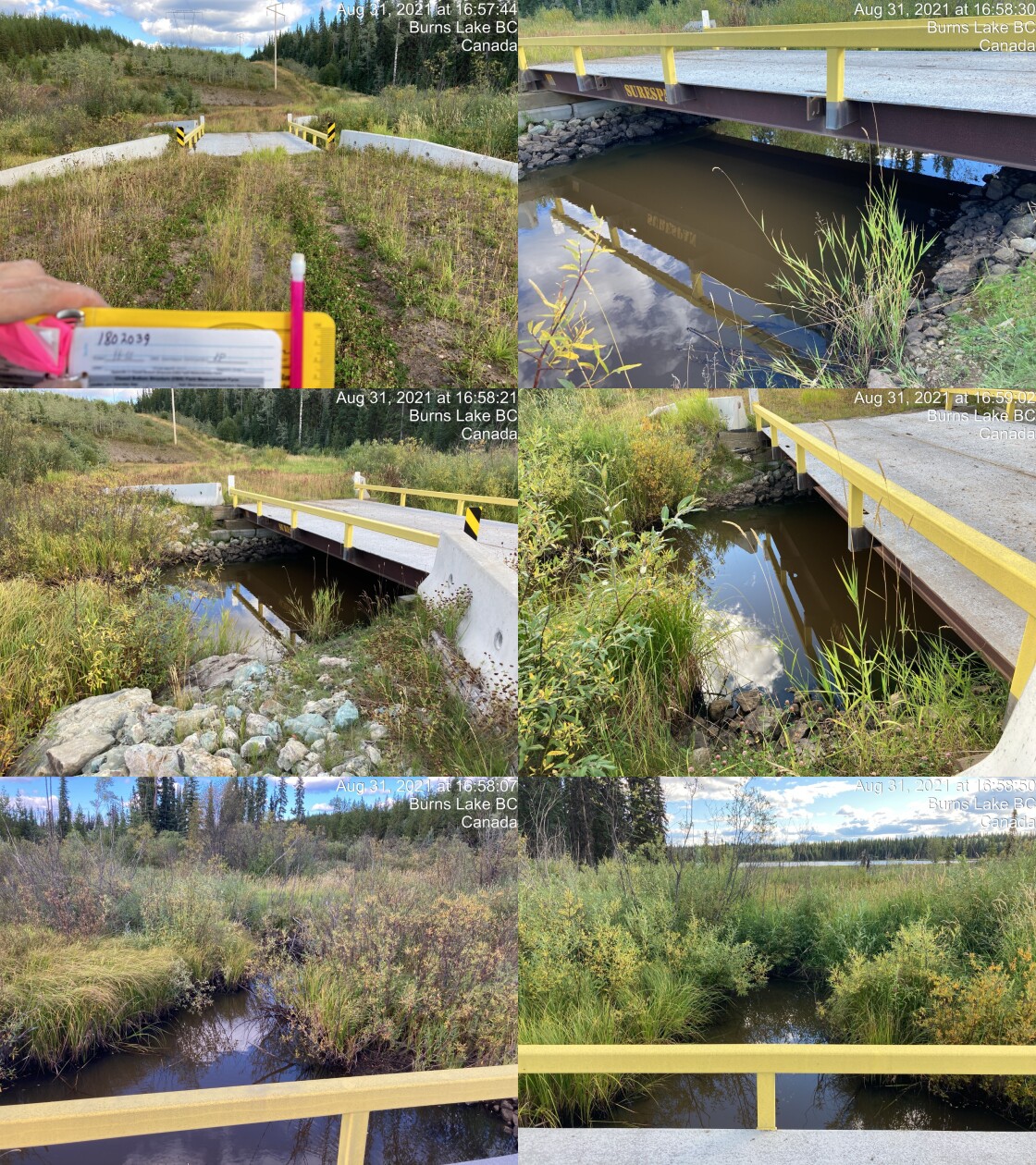
|
|||
| Comments: Powerline accessed via Broman Lake FSR bridge. 16:55 |
| Location and Stream Data |
|
Crossing Characteristics | – |
|---|---|---|---|
| Date | 2021-08-31 | Crossing Sub Type | Round Culvert |
| PSCIS ID | 197974 | Diameter (m) | 0.9 |
| External ID | 1800356 | Length (m) | 33 |
| Crew | KP | Embedded | No |
| UTM Zone | 9 | Depth Embedded (m) | – |
| Easting | 680383.2 | Resemble Channel | No |
| Northing | 6040056 | Backwatered | No |
| Stream | Watson Creek | Percent Backwatered | – |
| Road | Highway 16 | Fill Depth (m) | 3 |
| Road Tenure | Highway | Outlet Drop (m) | 0.93 |
| Channel Width (m) | 2.2 | Outlet Pool Depth (m) | 0.92 |
| Stream Slope (%) | 2 | Inlet Drop | No |
| Beaver Activity | No | Slope (%) | 3 |
| Habitat Value | Low | Valley Fill | Deep Fill |
| Final score | 42 | Barrier Result | Barrier |
| Fix type | Replace with New Open Bottom Structure | Fix Span / Diameter | 10 |
Photos: PSCIS ID 197974. From top left clockwise: Road/Site Card, Barrel, Outlet, Downstream, Upstream, Inlet.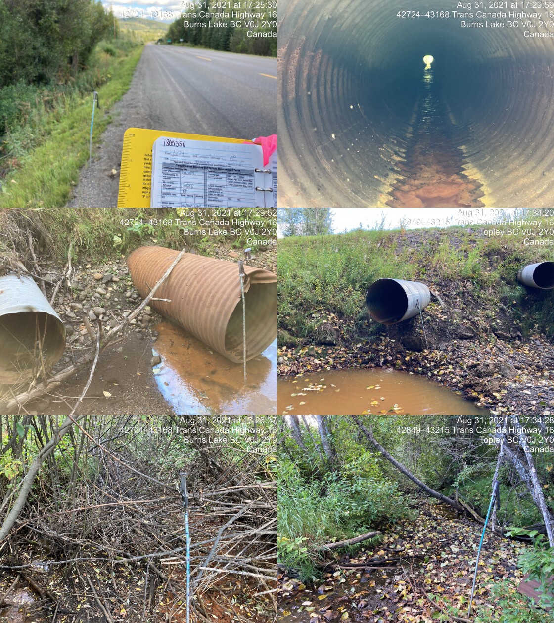
|
|||
| Comments: Channel dry. Small pool at inlet. Inlet perched above water 3cm and substrate 17cm. Channel upstream is not aligned with culvert at all. 17:24 |
| Location and Stream Data |
|
Crossing Characteristics | – |
|---|---|---|---|
| Date | 2021-08-31 | Crossing Sub Type | Round Culvert |
| PSCIS ID | 197975 | Diameter (m) | 3 |
| External ID | 1801122 | Length (m) | 10 |
| Crew | KP | Embedded | No |
| UTM Zone | 9 | Depth Embedded (m) | – |
| Easting | 680832 | Resemble Channel | No |
| Northing | 6040045 | Backwatered | No |
| Stream | Ailport Creek | Percent Backwatered | – |
| Road | Private Driveway | Fill Depth (m) | 0.5 |
| Road Tenure | Unclassified | Outlet Drop (m) | 0.3 |
| Channel Width (m) | 6.5 | Outlet Pool Depth (m) | 1.45 |
| Stream Slope (%) | 3 | Inlet Drop | No |
| Beaver Activity | No | Slope (%) | 4 |
| Habitat Value | Medium | Valley Fill | Deep Fill |
| Final score | 36 | Barrier Result | Barrier |
| Fix type | Replace with New Open Bottom Structure | Fix Span / Diameter | 11.5 |
Photos: PSCIS ID 197975. From top left clockwise: Road/Site Card, Barrel, Outlet, Downstream, Upstream, Inlet.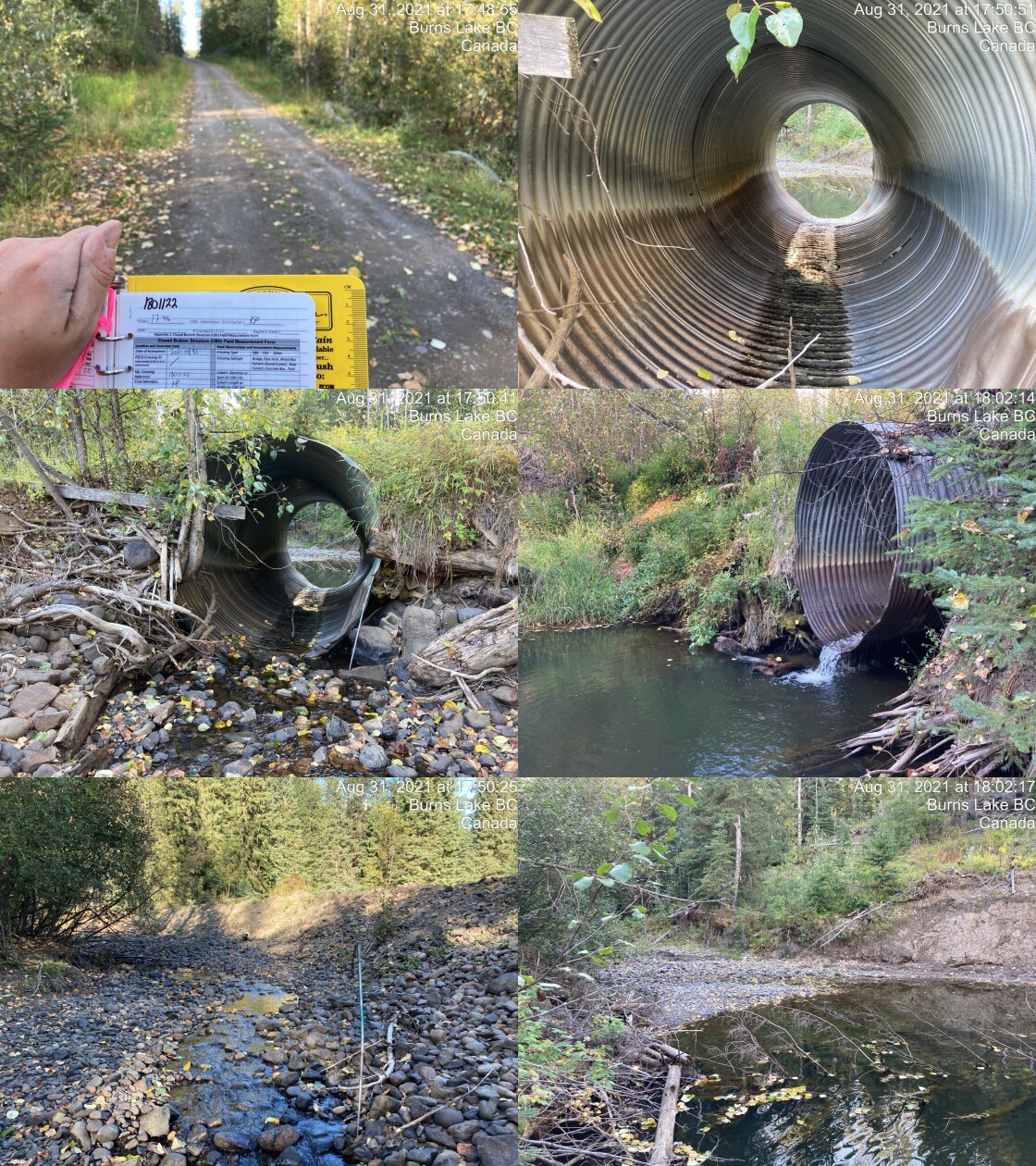
|
|||
| Comments: Dredging upstream, channel width not natural. Signs of major flooding including wear on upstream sides of culvert. No riparian zone on river left upstream. Culvert 4% but has bend at last 2m outlet drop and outlet pool depth are estimates. This stream could use some restoration. 17:46 |
| Location and Stream Data |
|
Crossing Characteristics | – |
|---|---|---|---|
| Date | 2021-08-31 | Crossing Sub Type | Oval Culvert |
| PSCIS ID | 197976 | Diameter (m) | 3.5 |
| External ID | 1800355 | Length (m) | 23 |
| Crew | KP | Embedded | No |
| UTM Zone | 9 | Depth Embedded (m) | – |
| Easting | 680644.8 | Resemble Channel | No |
| Northing | 6039756 | Backwatered | Yes |
| Stream | Ailport Creek | Percent Backwatered | 50 |
| Road | Highway 16 | Fill Depth (m) | 3 |
| Road Tenure | Highway | Outlet Drop (m) | 0 |
| Channel Width (m) | 7.5 | Outlet Pool Depth (m) | 0.55 |
| Stream Slope (%) | 4 | Inlet Drop | No |
| Beaver Activity | No | Slope (%) | 2 |
| Habitat Value | High | Valley Fill | Deep Fill |
| Final score | 24 | Barrier Result | Barrier |
| Fix type | Replace with New Open Bottom Structure | Fix Span / Diameter | 12.5 |
Photos: PSCIS ID 197976. From top left clockwise: Road/Site Card, Barrel, Outlet, Downstream, Upstream, Inlet.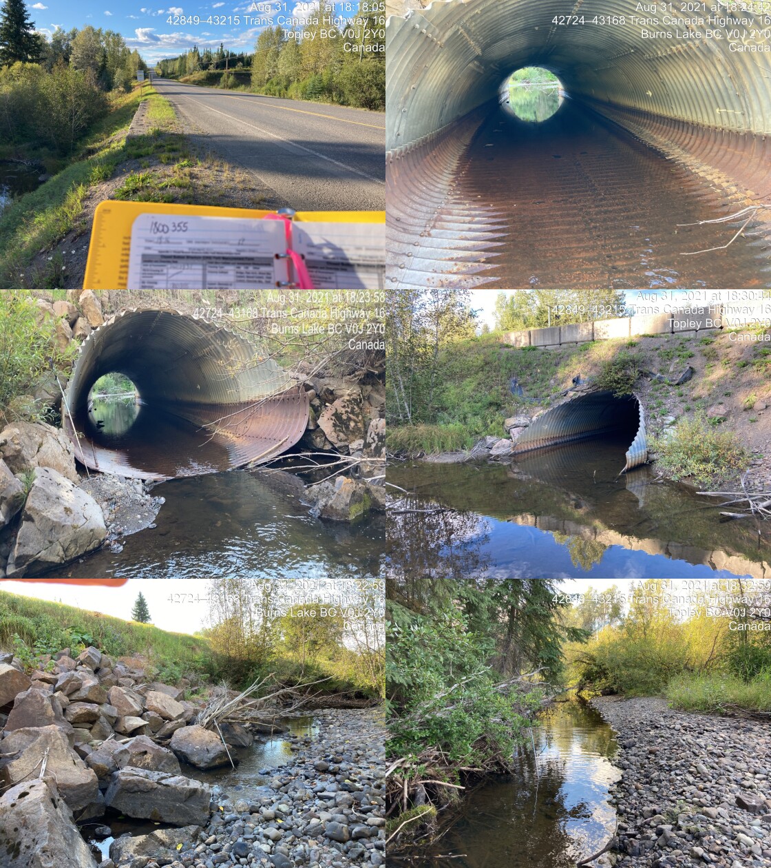
|
|||
| Comments: Fish sighted upstream, not aligned with stream, channel runs into rip rap berm of highway then over to closed bottom structure. Pool (40cn) on upstream inlet. Fish sighted in downstream pool. 18:16 |
| Location and Stream Data |
|
Crossing Characteristics | – |
|---|---|---|---|
| Date | 2021-09-01 | Crossing Sub Type | Bridge |
| PSCIS ID | 197977 | Diameter (m) | 11 |
| External ID | 2021090150 | Length (m) | 5 |
| Crew | KP | Embedded | – |
| UTM Zone | 9 | Depth Embedded (m) | – |
| Easting | 592509.8 | Resemble Channel | – |
| Northing | 6004823 | Backwatered | – |
| Stream | Tributary to Gosnell Creek | Percent Backwatered | – |
| Road | Crystal Creek FSR | Fill Depth (m) | – |
| Road Tenure | Unknown | Outlet Drop (m) | – |
| Channel Width (m) | – | Outlet Pool Depth (m) | – |
| Stream Slope (%) | – | Inlet Drop | – |
| Beaver Activity | – | Slope (%) | – |
| Habitat Value | – | Valley Fill | – |
| Final score | 0 | Barrier Result | Passable |
| Fix type | – | Fix Span / Diameter | – |
Photos: PSCIS ID 197977. From top left clockwise: Road/Site Card, Barrel, Outlet, Downstream, Upstream, Inlet.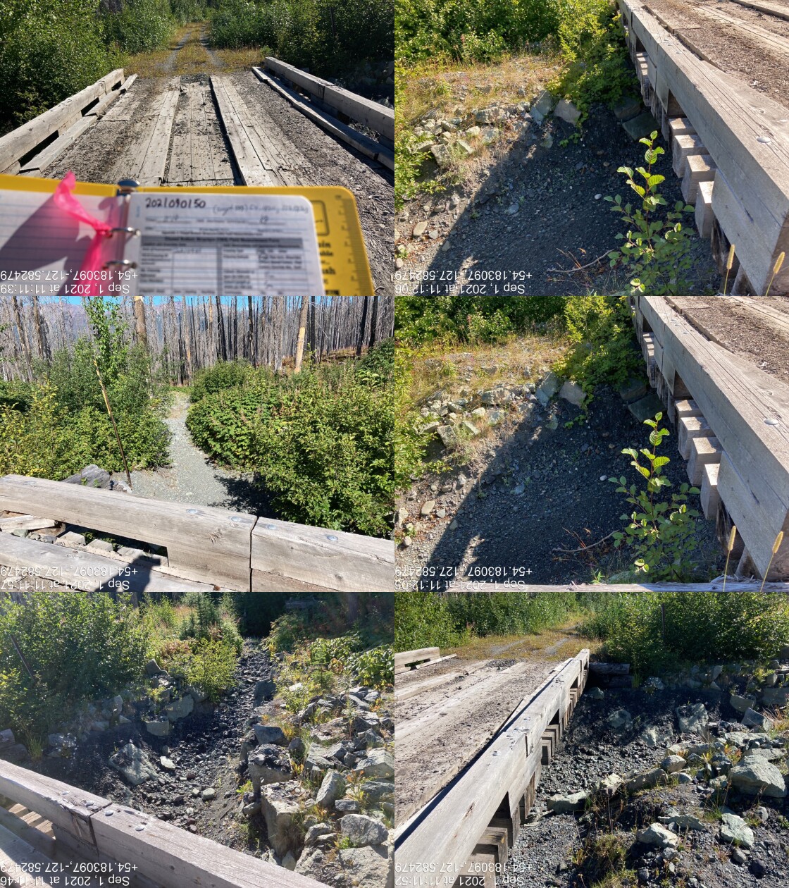
|
|||
| Comments: Bridge. 11:10 |
| Location and Stream Data |
|
Crossing Characteristics | – |
|---|---|---|---|
| Date | 2021-09-01 | Crossing Sub Type | Bridge |
| PSCIS ID | 197978 | Diameter (m) | 10 |
| External ID | 14000935 | Length (m) | 5 |
| Crew | KP | Embedded | – |
| UTM Zone | 9 | Depth Embedded (m) | – |
| Easting | 592921.9 | Resemble Channel | – |
| Northing | 6005009 | Backwatered | – |
| Stream | Tributary to Gosnell Creek | Percent Backwatered | – |
| Road | Crystal Creek FSR | Fill Depth (m) | – |
| Road Tenure | Unknown | Outlet Drop (m) | – |
| Channel Width (m) | – | Outlet Pool Depth (m) | – |
| Stream Slope (%) | – | Inlet Drop | – |
| Beaver Activity | – | Slope (%) | – |
| Habitat Value | – | Valley Fill | – |
| Final score | 0 | Barrier Result | Passable |
| Fix type | – | Fix Span / Diameter | – |
Photos: PSCIS ID 197978. From top left clockwise: Road/Site Card, Barrel, Outlet, Downstream, Upstream, Inlet.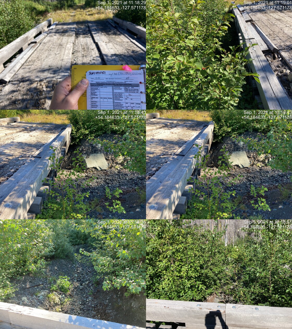
|
|||
| Comments: Bridge. 11:17 |
| Location and Stream Data |
|
Crossing Characteristics | – |
|---|---|---|---|
| Date | 2021-09-01 | Crossing Sub Type | Bridge |
| PSCIS ID | 197979 | Diameter (m) | 10 |
| External ID | 14000934 | Length (m) | 5 |
| Crew | KP | Embedded | – |
| UTM Zone | 9 | Depth Embedded (m) | – |
| Easting | 595765.3 | Resemble Channel | – |
| Northing | 6006122 | Backwatered | – |
| Stream | Tributary to Gosnell Creek | Percent Backwatered | – |
| Road | Crystal Creek FSR | Fill Depth (m) | – |
| Road Tenure | Unknown | Outlet Drop (m) | – |
| Channel Width (m) | – | Outlet Pool Depth (m) | – |
| Stream Slope (%) | – | Inlet Drop | – |
| Beaver Activity | – | Slope (%) | – |
| Habitat Value | – | Valley Fill | – |
| Final score | 0 | Barrier Result | Passable |
| Fix type | – | Fix Span / Diameter | – |
Photos: PSCIS ID 197979. From top left clockwise: Road/Site Card, Barrel, Outlet, Downstream, Upstream, Inlet.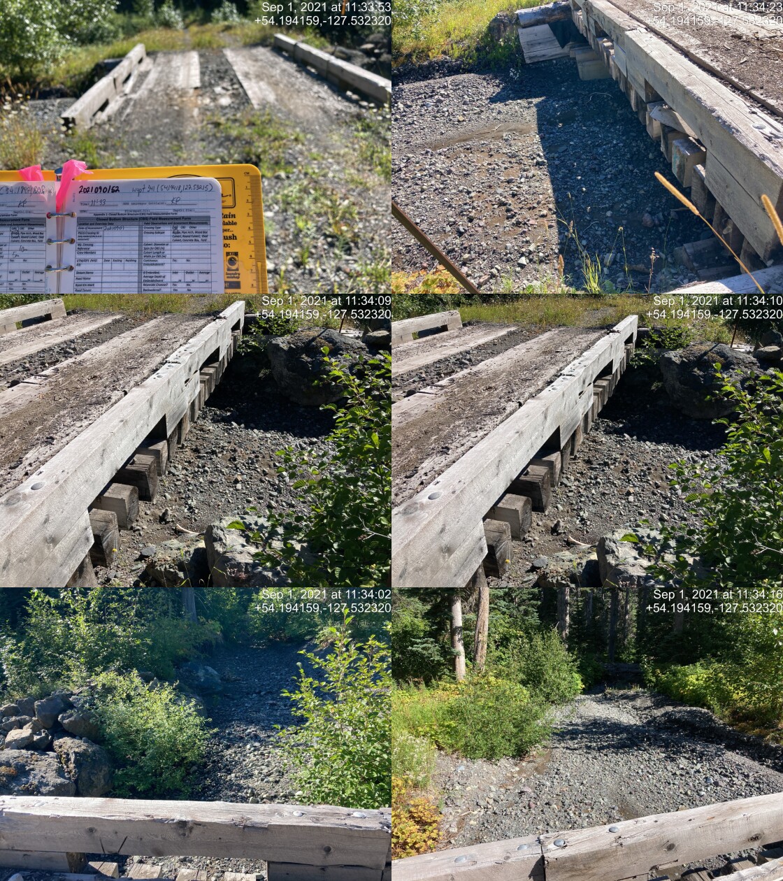
|
|||
| Comments: Bridge. 11:33 |
| Location and Stream Data |
|
Crossing Characteristics | – |
|---|---|---|---|
| Date | 2021-09-01 | Crossing Sub Type | Round Culvert |
| PSCIS ID | 197980 | Diameter (m) | 2 |
| External ID | 14000956 | Length (m) | 23 |
| Crew | KP | Embedded | Yes |
| UTM Zone | 9 | Depth Embedded (m) | 0.3 |
| Easting | 596610.5 | Resemble Channel | Yes |
| Northing | 6006123 | Backwatered | No |
| Stream | Tributary to Gosnell Creek | Percent Backwatered | – |
| Road | Crystal Creek FSR | Fill Depth (m) | 2.5 |
| Road Tenure | FLNR DND 9785 | Outlet Drop (m) | 0 |
| Channel Width (m) | 0.9 | Outlet Pool Depth (m) | 0.1 |
| Stream Slope (%) | 6 | Inlet Drop | No |
| Beaver Activity | No | Slope (%) | 2 |
| Habitat Value | Medium | Valley Fill | Deep Fill |
| Final score | 13 | Barrier Result | Passable |
| Fix type | – | Fix Span / Diameter | – |
Photos: PSCIS ID 197980. From top left clockwise: Road/Site Card, Barrel, Outlet, Downstream, Upstream, Inlet.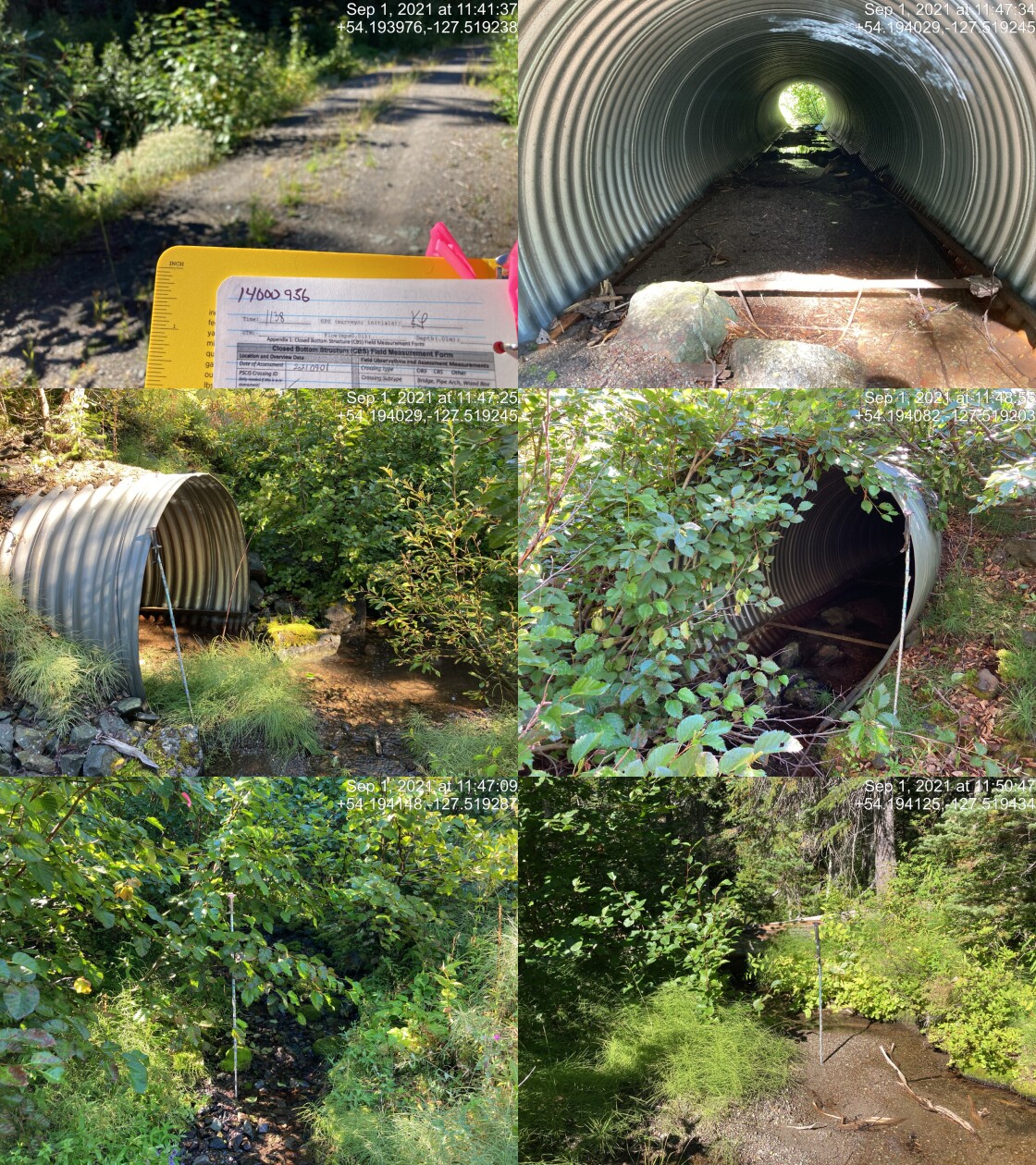
|
|||
| Comments: Appears passable. Nice little stream with plenty of gravel. 11:38 |
| Location and Stream Data |
|
Crossing Characteristics | – |
|---|---|---|---|
| Date | 2021-09-01 | Crossing Sub Type | Round Culvert |
| PSCIS ID | 197981 | Diameter (m) | 2 |
| External ID | 14000951 | Length (m) | 24 |
| Crew | KP | Embedded | Yes |
| UTM Zone | 9 | Depth Embedded (m) | 0.4 |
| Easting | 596698 | Resemble Channel | Yes |
| Northing | 6006213 | Backwatered | Yes |
| Stream | Tributary to Gosnell Creek | Percent Backwatered | 25 |
| Road | Crystal Creek FSR | Fill Depth (m) | 2 |
| Road Tenure | FLNR DND 9785 | Outlet Drop (m) | 0 |
| Channel Width (m) | 1.9 | Outlet Pool Depth (m) | 0.2 |
| Stream Slope (%) | 6 | Inlet Drop | No |
| Beaver Activity | No | Slope (%) | 1.5 |
| Habitat Value | Medium | Valley Fill | Deep Fill |
| Final score | 13 | Barrier Result | Passable |
| Fix type | – | Fix Span / Diameter | – |
Photos: PSCIS ID 197981. From top left clockwise: Road/Site Card, Barrel, Outlet, Downstream, Upstream, Inlet.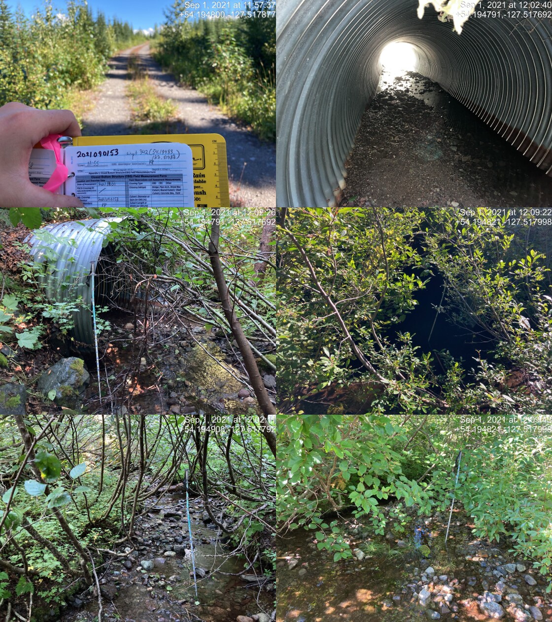
|
|||
| Comments: Appears passable. Similar to previous but bigger stream. Nice gravels on both sides. 11:55 |
| Location and Stream Data |
|
Crossing Characteristics | – |
|---|---|---|---|
| Date | 2021-09-01 | Crossing Sub Type | Round Culvert |
| PSCIS ID | 197982 | Diameter (m) | 1.8 |
| External ID | 14000941 | Length (m) | 24 |
| Crew | KP | Embedded | Yes |
| UTM Zone | 9 | Depth Embedded (m) | 0.3 |
| Easting | 598157.4 | Resemble Channel | Yes |
| Northing | 6006329 | Backwatered | Yes |
| Stream | Tributary to Gosnell Creek | Percent Backwatered | 25 |
| Road | Crystal Creek FSR | Fill Depth (m) | 1 |
| Road Tenure | FLNR DND 9785 | Outlet Drop (m) | 0 |
| Channel Width (m) | 2.2 | Outlet Pool Depth (m) | 0.2 |
| Stream Slope (%) | 4 | Inlet Drop | No |
| Beaver Activity | No | Slope (%) | 3.5 |
| Habitat Value | Medium | Valley Fill | Deep Fill |
| Final score | 21 | Barrier Result | Barrier |
| Fix type | Replace with New Open Bottom Structure | Fix Span / Diameter | 10 |
Photos: PSCIS ID 197982. From top left clockwise: Road/Site Card, Barrel, Outlet, Downstream, Upstream, Inlet.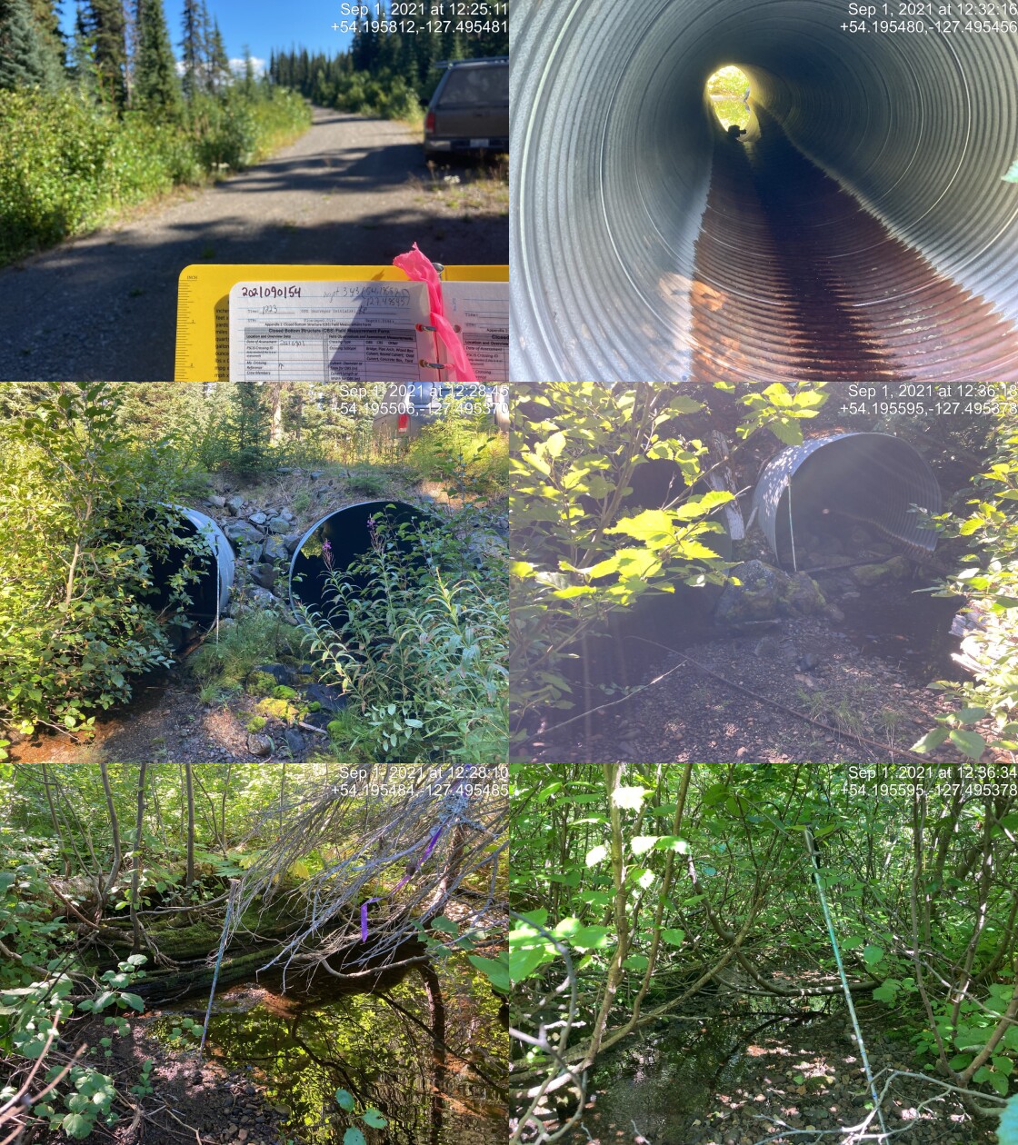
|
|||
| Comments: Only left (facing downstream) is embedded, right one backwatered 25%. Nice gravel on upstream and downstream side. 12:23 |
| Location and Stream Data |
|
Crossing Characteristics | – |
|---|---|---|---|
| Date | 2021-09-01 | Crossing Sub Type | Bridge |
| PSCIS ID | 197983 | Diameter (m) | 5 |
| External ID | 14000488 | Length (m) | 12 |
| Crew | KP | Embedded | – |
| UTM Zone | 9 | Depth Embedded (m) | – |
| Easting | 584581 | Resemble Channel | – |
| Northing | 6003388 | Backwatered | – |
| Stream | Tributary to Gosnell Creek | Percent Backwatered | – |
| Road | Crystal Creek FSR | Fill Depth (m) | – |
| Road Tenure | Canfor R07593 | Outlet Drop (m) | – |
| Channel Width (m) | – | Outlet Pool Depth (m) | – |
| Stream Slope (%) | – | Inlet Drop | – |
| Beaver Activity | – | Slope (%) | – |
| Habitat Value | – | Valley Fill | – |
| Final score | 0 | Barrier Result | Passable |
| Fix type | – | Fix Span / Diameter | – |
Photos: PSCIS ID 197983. From top left clockwise: Road/Site Card, Barrel, Outlet, Downstream, Upstream, Inlet.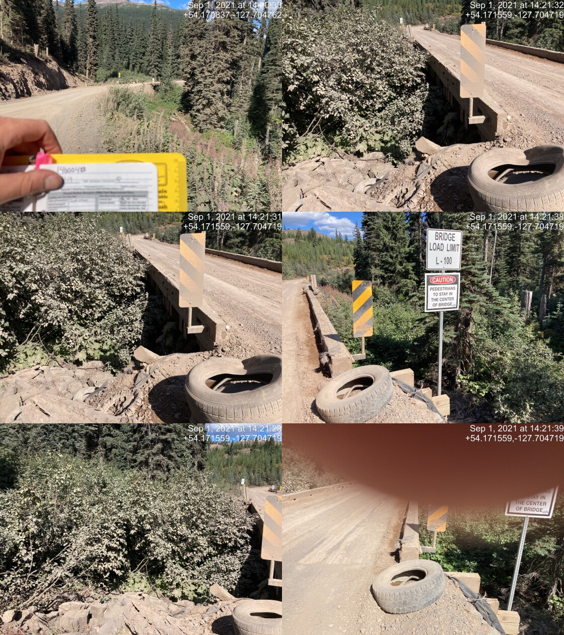
|
|||
| Comments: Bridge. 14:19 |
| Location and Stream Data |
|
Crossing Characteristics | – |
|---|---|---|---|
| Date | 2021-09-01 | Crossing Sub Type | Bridge |
| PSCIS ID | 197984 | Diameter (m) | 22 |
| External ID | 14000503 | Length (m) | 6 |
| Crew | KP | Embedded | – |
| UTM Zone | 9 | Depth Embedded (m) | – |
| Easting | 584043.6 | Resemble Channel | – |
| Northing | 6003655 | Backwatered | – |
| Stream | Tributary to Gosnell Creek | Percent Backwatered | – |
| Road | 6 Road | Fill Depth (m) | – |
| Road Tenure | Canfor R07593 | Outlet Drop (m) | – |
| Channel Width (m) | – | Outlet Pool Depth (m) | – |
| Stream Slope (%) | – | Inlet Drop | – |
| Beaver Activity | – | Slope (%) | – |
| Habitat Value | – | Valley Fill | – |
| Final score | 0 | Barrier Result | Passable |
| Fix type | – | Fix Span / Diameter | – |
Photos: PSCIS ID 197984. From top left clockwise: Road/Site Card, Barrel, Outlet, Downstream, Upstream, Inlet.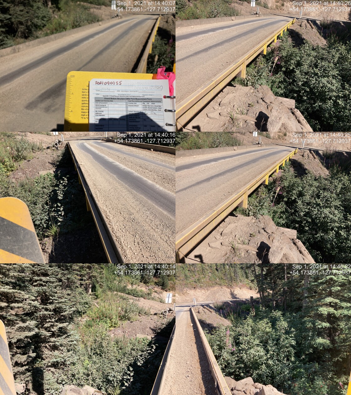
|
|||
| Comments: Bridge. 14:38 |
| Location and Stream Data |
|
Crossing Characteristics | – |
|---|---|---|---|
| Date | 2021-09-01 | Crossing Sub Type | Bridge |
| PSCIS ID | 197985 | Diameter (m) | 19 |
| External ID | 14000500 | Length (m) | 5 |
| Crew | KP | Embedded | – |
| UTM Zone | 9 | Depth Embedded (m) | – |
| Easting | 584889.5 | Resemble Channel | – |
| Northing | 6003492 | Backwatered | – |
| Stream | Tributary to Gosnell Creek | Percent Backwatered | – |
| Road | 6 Road | Fill Depth (m) | – |
| Road Tenure | Canfor R07593 | Outlet Drop (m) | – |
| Channel Width (m) | – | Outlet Pool Depth (m) | – |
| Stream Slope (%) | – | Inlet Drop | – |
| Beaver Activity | – | Slope (%) | – |
| Habitat Value | – | Valley Fill | – |
| Final score | 0 | Barrier Result | Passable |
| Fix type | – | Fix Span / Diameter | – |
Photos: PSCIS ID 197985. From top left clockwise: Road/Site Card, Barrel, Outlet, Downstream, Upstream, Inlet.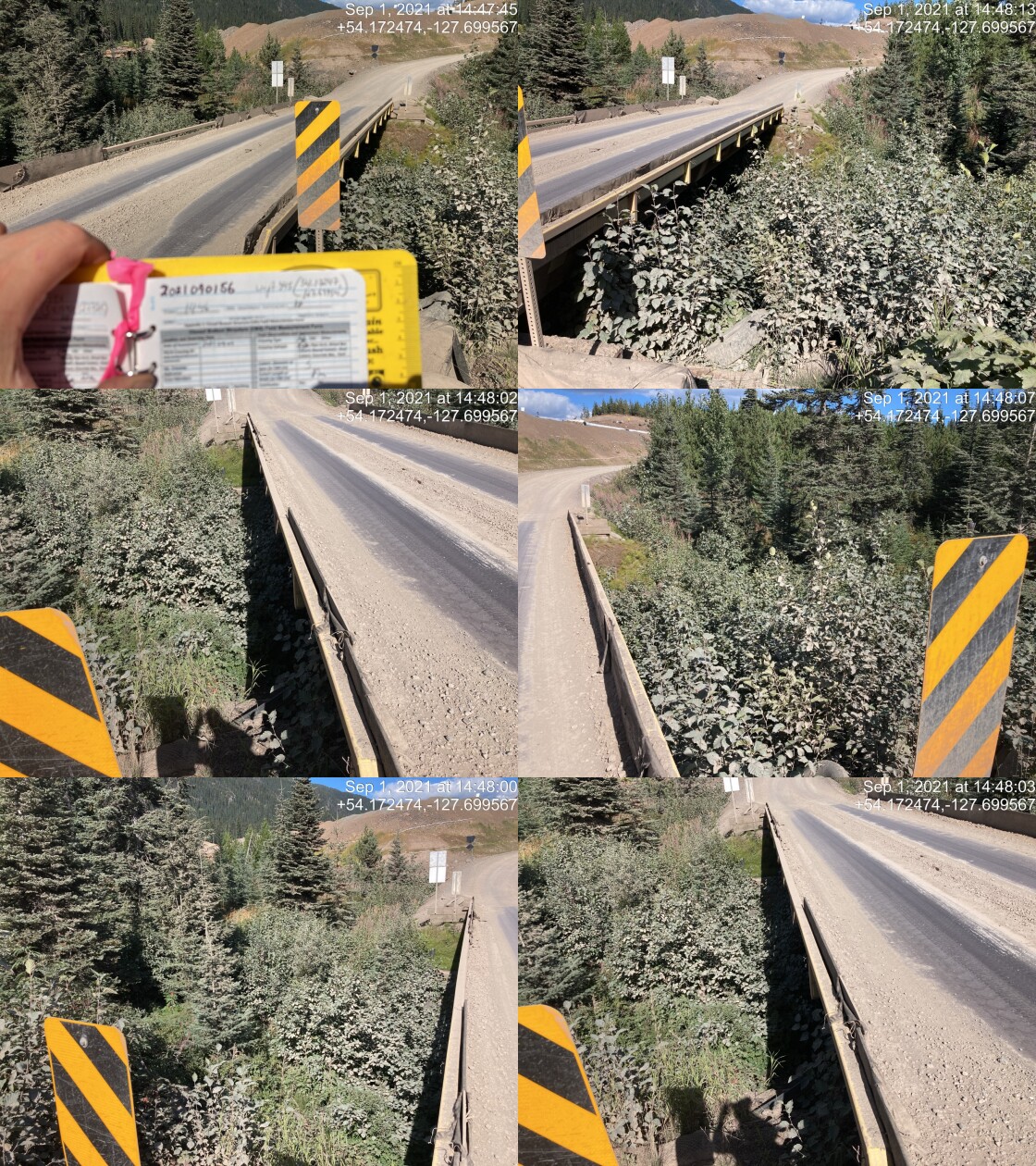
|
|||
| Comments: Bridge. 14:46 |
| Location and Stream Data |
|
Crossing Characteristics | – |
|---|---|---|---|
| Date | 2021-09-01 | Crossing Sub Type | Bridge |
| PSCIS ID | 197986 | Diameter (m) | 16 |
| External ID | 14000495 | Length (m) | 6 |
| Crew | KP | Embedded | – |
| UTM Zone | 9 | Depth Embedded (m) | – |
| Easting | 585701.7 | Resemble Channel | – |
| Northing | 6004480 | Backwatered | – |
| Stream | Tributary to Gosnell Creek | Percent Backwatered | – |
| Road | 6 Road | Fill Depth (m) | – |
| Road Tenure | Canfor R07593 | Outlet Drop (m) | – |
| Channel Width (m) | – | Outlet Pool Depth (m) | – |
| Stream Slope (%) | – | Inlet Drop | – |
| Beaver Activity | – | Slope (%) | – |
| Habitat Value | – | Valley Fill | – |
| Final score | 0 | Barrier Result | Passable |
| Fix type | – | Fix Span / Diameter | – |
Photos: PSCIS ID 197986. From top left clockwise: Road/Site Card, Barrel, Outlet, Downstream, Upstream, Inlet.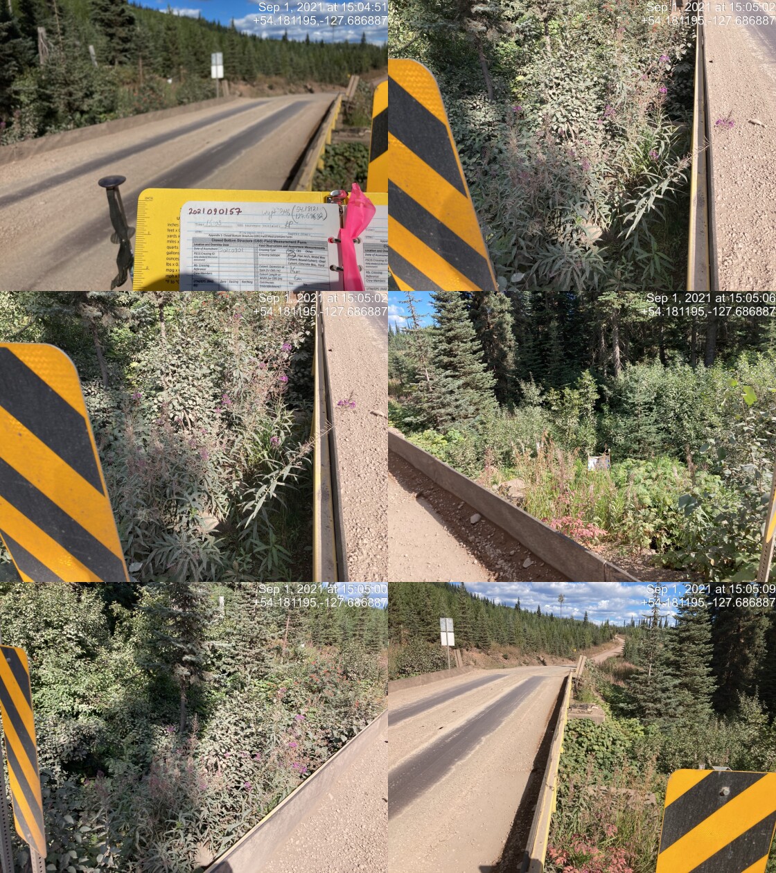
|
|||
| Comments: Bridge. 15:03 |
| Location and Stream Data |
|
Crossing Characteristics | – |
|---|---|---|---|
| Date | 2021-09-01 | Crossing Sub Type | Bridge |
| PSCIS ID | 197987 | Diameter (m) | 20 |
| External ID | 14000421 | Length (m) | 6 |
| Crew | KP | Embedded | – |
| UTM Zone | 9 | Depth Embedded (m) | – |
| Easting | 587108.4 | Resemble Channel | – |
| Northing | 6005346 | Backwatered | – |
| Stream | Tributary to Gosnell Creek | Percent Backwatered | – |
| Road | 11 Road | Fill Depth (m) | – |
| Road Tenure | Canfor R07593 | Outlet Drop (m) | – |
| Channel Width (m) | – | Outlet Pool Depth (m) | – |
| Stream Slope (%) | – | Inlet Drop | – |
| Beaver Activity | – | Slope (%) | – |
| Habitat Value | – | Valley Fill | – |
| Final score | 0 | Barrier Result | Passable |
| Fix type | – | Fix Span / Diameter | – |
Photos: PSCIS ID 197987. From top left clockwise: Road/Site Card, Barrel, Outlet, Downstream, Upstream, Inlet.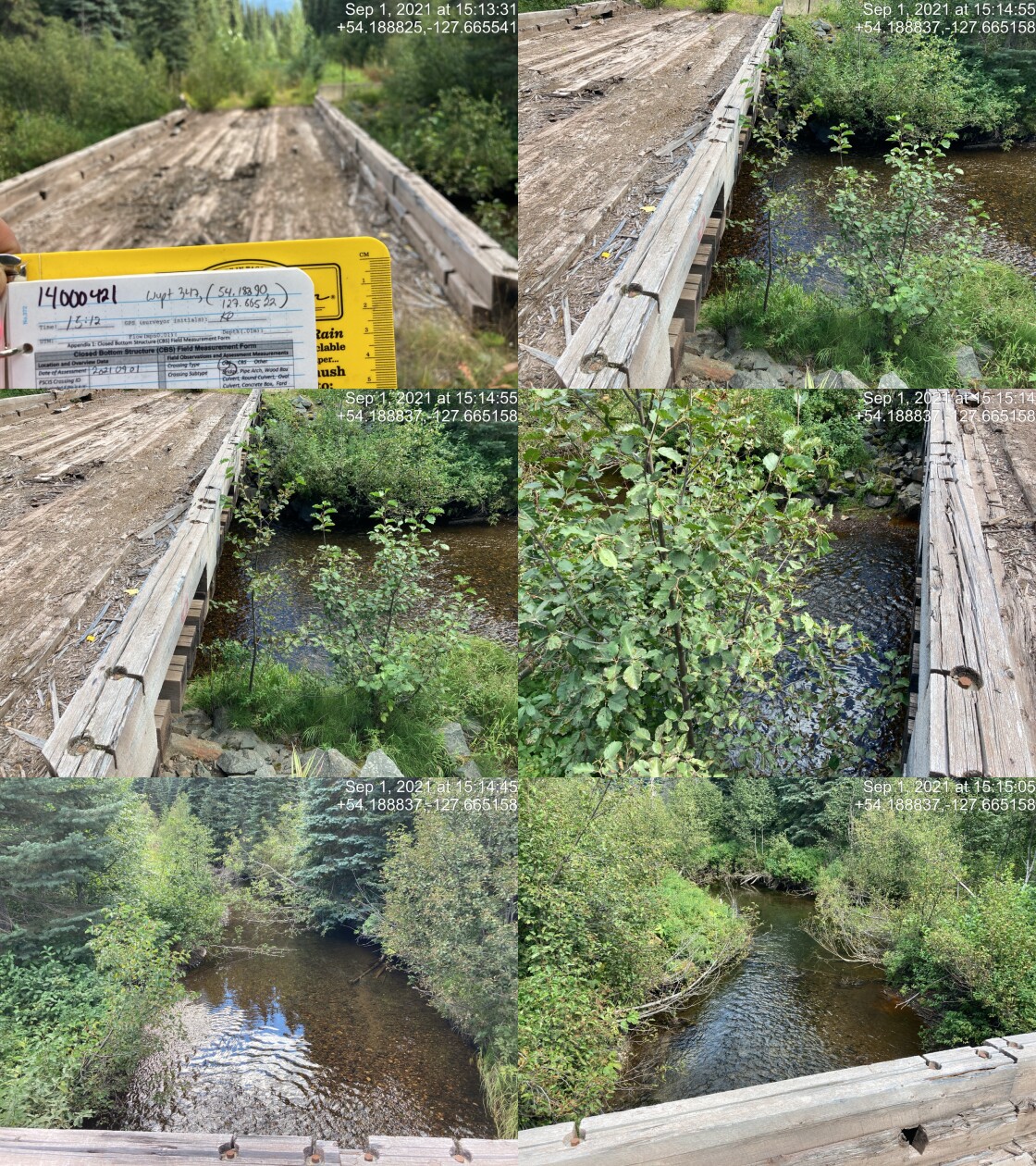
|
|||
| Comments: Hydrometric station 13m downstream assuming the modelling number is correct. There are 2 close by. 15:12 |
| Location and Stream Data |
|
Crossing Characteristics | – |
|---|---|---|---|
| Date | 2021-09-01 | Crossing Sub Type | Bridge |
| PSCIS ID | 197988 | Diameter (m) | 18 |
| External ID | 14000505 | Length (m) | 6 |
| Crew | KP | Embedded | – |
| UTM Zone | 9 | Depth Embedded (m) | – |
| Easting | 587095.2 | Resemble Channel | – |
| Northing | 6005362 | Backwatered | – |
| Stream | Tributary to Gosnell Creek | Percent Backwatered | – |
| Road | 6 Road | Fill Depth (m) | – |
| Road Tenure | Canfor R07593 | Outlet Drop (m) | – |
| Channel Width (m) | – | Outlet Pool Depth (m) | – |
| Stream Slope (%) | – | Inlet Drop | – |
| Beaver Activity | – | Slope (%) | – |
| Habitat Value | – | Valley Fill | – |
| Final score | 0 | Barrier Result | Passable |
| Fix type | – | Fix Span / Diameter | – |
Photos: PSCIS ID 197988. From top left clockwise: Road/Site Card, Barrel, Outlet, Downstream, Upstream, Inlet.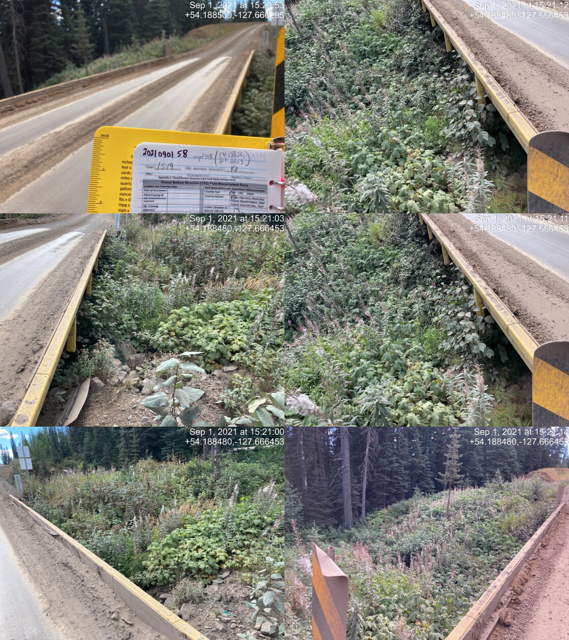
|
|||
| Comments: Bridge. 15:19 |
| Location and Stream Data |
|
Crossing Characteristics | – |
|---|---|---|---|
| Date | 2021-09-07 | Crossing Sub Type | Round Culvert |
| PSCIS ID | 197989 | Diameter (m) | 1.35 |
| External ID | 14000801 | Length (m) | 19 |
| Crew | AI | Embedded | No |
| UTM Zone | 9 | Depth Embedded (m) | – |
| Easting | 640778 | Resemble Channel | No |
| Northing | 6020795 | Backwatered | No |
| Stream | Tributary to Morice River | Percent Backwatered | – |
| Road | Morice FSR | Fill Depth (m) | 2 |
| Road Tenure | FLNR DND 4656 | Outlet Drop (m) | 0 |
| Channel Width (m) | 2.2 | Outlet Pool Depth (m) | 0 |
| Stream Slope (%) | 1.5 | Inlet Drop | Yes |
| Beaver Activity | No | Slope (%) | 3 |
| Habitat Value | Medium | Valley Fill | Deep Fill |
| Final score | 29 | Barrier Result | Barrier |
| Fix type | Replace with New Open Bottom Structure | Fix Span / Diameter | 10 |
Photos: PSCIS ID 197989. From top left clockwise: Road/Site Card, Barrel, Outlet, Downstream, Upstream, Inlet.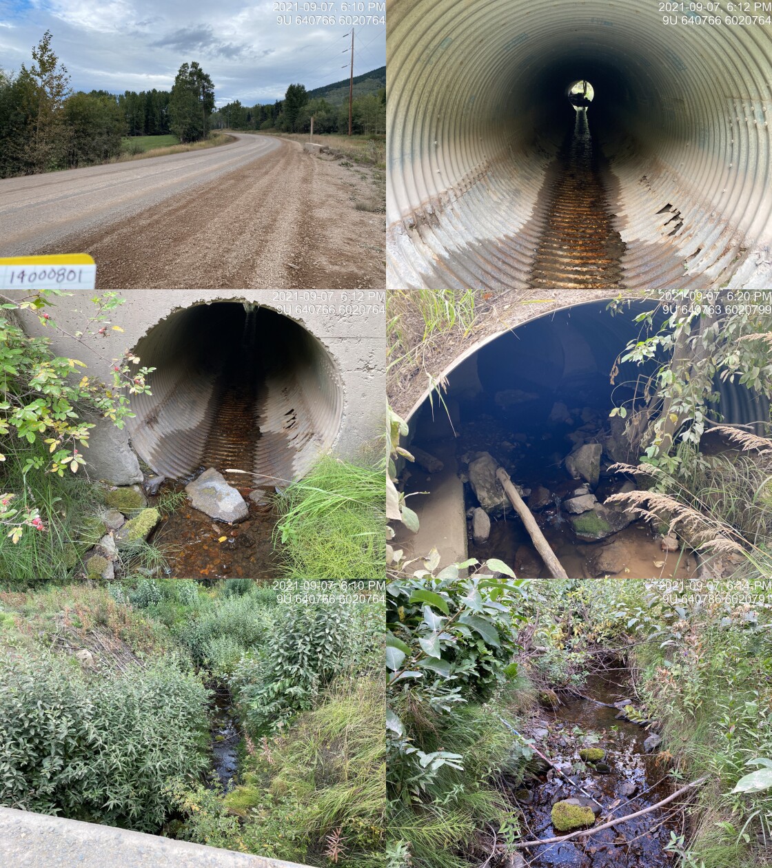
|
|||
| Comments: Concrete structure. Many 30-40mm fry. 2.5m open bottom structure end or pipe. 18:08 |
| Location and Stream Data |
|
Crossing Characteristics | – |
|---|---|---|---|
| Date | 2021-09-01 | Crossing Sub Type | Bridge |
| PSCIS ID | 197990 | Diameter (m) | 13 |
| External ID | 14000490 | Length (m) | 6 |
| Crew | KP | Embedded | – |
| UTM Zone | 9 | Depth Embedded (m) | – |
| Easting | 587080.7 | Resemble Channel | – |
| Northing | 6005468 | Backwatered | – |
| Stream | Tributary to Gosnell Creek | Percent Backwatered | – |
| Road | 6 Road | Fill Depth (m) | – |
| Road Tenure | Canfor R07593 | Outlet Drop (m) | – |
| Channel Width (m) | – | Outlet Pool Depth (m) | – |
| Stream Slope (%) | – | Inlet Drop | – |
| Beaver Activity | – | Slope (%) | – |
| Habitat Value | – | Valley Fill | – |
| Final score | 0 | Barrier Result | Passable |
| Fix type | – | Fix Span / Diameter | – |
Photos: PSCIS ID 197990. From top left clockwise: Road/Site Card, Barrel, Outlet, Downstream, Upstream, Inlet.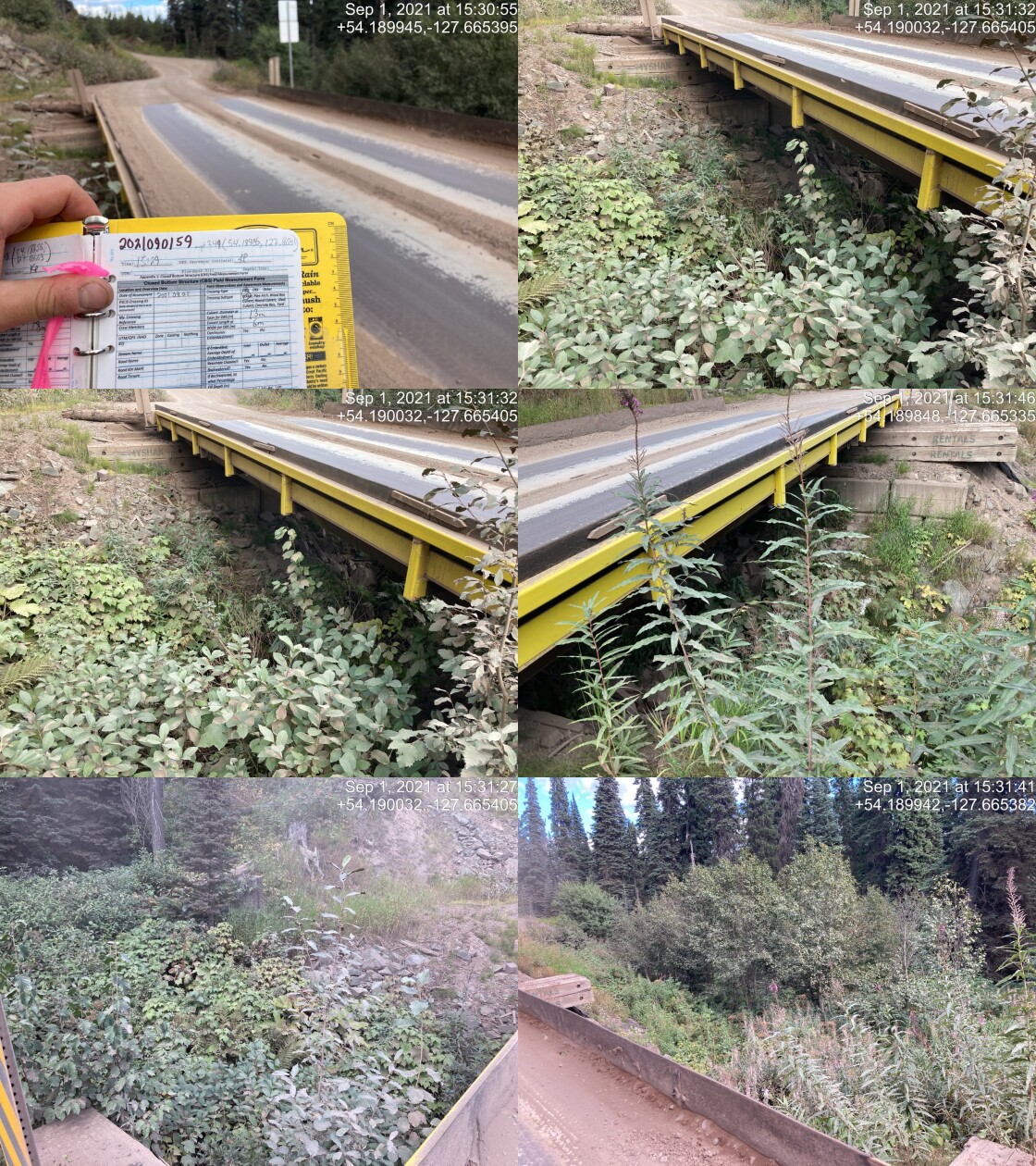
|
|||
| Comments: Bridge. 15:29 |
| Location and Stream Data |
|
Crossing Characteristics | – |
|---|---|---|---|
| Date | 2021-09-01 | Crossing Sub Type | Round Culvert |
| PSCIS ID | 197991 | Diameter (m) | 1.2 |
| External ID | 14000506 | Length (m) | 25 |
| Crew | KP | Embedded | No |
| UTM Zone | 9 | Depth Embedded (m) | – |
| Easting | 587368.2 | Resemble Channel | No |
| Northing | 6005869 | Backwatered | No |
| Stream | Tributary to Gosnell Creek | Percent Backwatered | – |
| Road | 6 Road | Fill Depth (m) | 7 |
| Road Tenure | Canfor R07593 | Outlet Drop (m) | 0 |
| Channel Width (m) | 0.8 | Outlet Pool Depth (m) | 0 |
| Stream Slope (%) | 6.5 | Inlet Drop | Yes |
| Beaver Activity | No | Slope (%) | 8 |
| Habitat Value | Medium | Valley Fill | Deep Fill |
| Final score | 23 | Barrier Result | Barrier |
| Fix type | Replace Structure with Streambed Simulation CBS | Fix Span / Diameter | 3 |
Photos: PSCIS ID 197991. From top left clockwise: Road/Site Card, Barrel, Outlet, Downstream, Upstream, Inlet.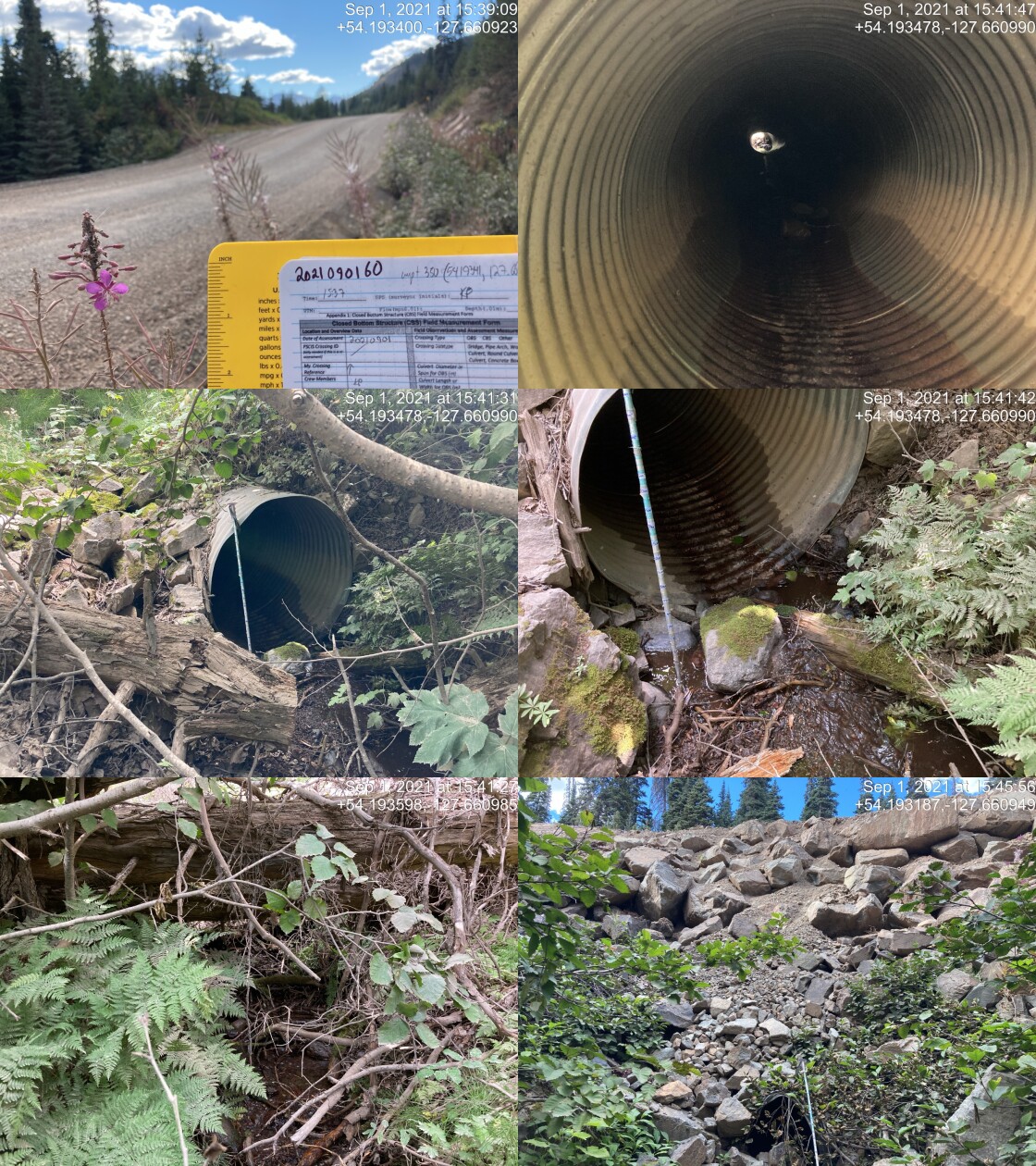
|
|||
| Comments: Outlet drop 0.3m. Outlet buried with rip rap fallen from road and surrounding armour. 15:37 |
| Location and Stream Data |
|
Crossing Characteristics | – |
|---|---|---|---|
| Date | 2021-09-01 | Crossing Sub Type | Round Culvert |
| PSCIS ID | 197992 | Diameter (m) | 0.9 |
| External ID | 2021090161 | Length (m) | 30 |
| Crew | KP | Embedded | No |
| UTM Zone | 9 | Depth Embedded (m) | – |
| Easting | 587307.6 | Resemble Channel | No |
| Northing | 6005830 | Backwatered | No |
| Stream | Tributary to Gosnell Creek | Percent Backwatered | – |
| Road | 6 Road | Fill Depth (m) | 2 |
| Road Tenure | Canfor R07593 | Outlet Drop (m) | 0 |
| Channel Width (m) | 0.5 | Outlet Pool Depth (m) | 0 |
| Stream Slope (%) | 6 | Inlet Drop | No |
| Beaver Activity | No | Slope (%) | 10 |
| Habitat Value | Low | Valley Fill | Deep Fill |
| Final score | 26 | Barrier Result | Barrier |
| Fix type | Replace Structure with Streambed Simulation CBS | Fix Span / Diameter | 3 |
Photos: PSCIS ID 197992. From top left clockwise: Road/Site Card, Barrel, Outlet, Downstream, Upstream, Inlet.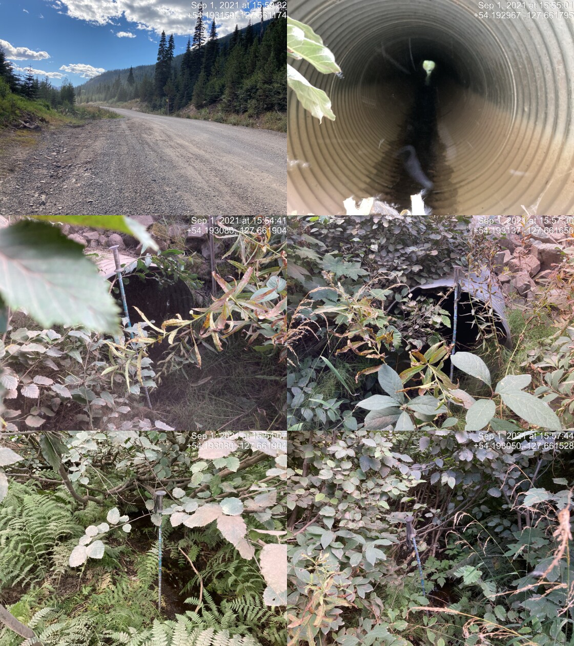
|
|||
| Comments: Very close to previous. Very small channelled stream, trickling. 15:51 |
| Location and Stream Data |
|
Crossing Characteristics | – |
|---|---|---|---|
| Date | 2021-09-01 | Crossing Sub Type | Bridge |
| PSCIS ID | 197993 | Diameter (m) | 28 |
| External ID | 14000494 | Length (m) | 7 |
| Crew | KP | Embedded | – |
| UTM Zone | 9 | Depth Embedded (m) | – |
| Easting | 588957.4 | Resemble Channel | – |
| Northing | 6007081 | Backwatered | – |
| Stream | Tributary to Gosnell Creek | Percent Backwatered | – |
| Road | 6 Road | Fill Depth (m) | – |
| Road Tenure | Canfor R07593 | Outlet Drop (m) | – |
| Channel Width (m) | – | Outlet Pool Depth (m) | – |
| Stream Slope (%) | – | Inlet Drop | – |
| Beaver Activity | – | Slope (%) | – |
| Habitat Value | – | Valley Fill | – |
| Final score | 0 | Barrier Result | Passable |
| Fix type | – | Fix Span / Diameter | – |
Photos: PSCIS ID 197993. From top left clockwise: Road/Site Card, Barrel, Outlet, Downstream, Upstream, Inlet.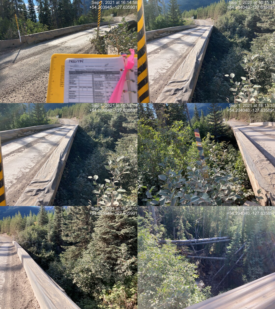
|
|||
| Comments: Bridge. 16:13 |
| Location and Stream Data |
|
Crossing Characteristics | – |
|---|---|---|---|
| Date | 2021-09-01 | Crossing Sub Type | Round Culvert |
| PSCIS ID | 197994 | Diameter (m) | 0.9 |
| External ID | 14000481 | Length (m) | 16 |
| Crew | KP | Embedded | No |
| UTM Zone | 9 | Depth Embedded (m) | – |
| Easting | 589783.6 | Resemble Channel | No |
| Northing | 6007798 | Backwatered | Yes |
| Stream | Tributary to Gosnell Creek | Percent Backwatered | 10 |
| Road | 6 Road | Fill Depth (m) | 1 |
| Road Tenure | Canfor R07593 | Outlet Drop (m) | 0 |
| Channel Width (m) | 1.1 | Outlet Pool Depth (m) | 0.15 |
| Stream Slope (%) | 6 | Inlet Drop | No |
| Beaver Activity | No | Slope (%) | 5 |
| Habitat Value | Medium | Valley Fill | Deep Fill |
| Final score | 26 | Barrier Result | Barrier |
| Fix type | Replace Structure with Streambed Simulation CBS | Fix Span / Diameter | 3 |
Photos: PSCIS ID 197994. From top left clockwise: Road/Site Card, Barrel, Outlet, Downstream, Upstream, Inlet.
|
|||
| Comments: Very recently logged upstream and downstream. 16:23 |
| Location and Stream Data |
|
Crossing Characteristics | – |
|---|---|---|---|
| Date | 2021-09-01 | Crossing Sub Type | Round Culvert |
| PSCIS ID | 197995 | Diameter (m) | 2.2 |
| External ID | 14000486 | Length (m) | 25 |
| Crew | KP | Embedded | Yes |
| UTM Zone | 9 | Depth Embedded (m) | 0.75 |
| Easting | 590552.1 | Resemble Channel | Yes |
| Northing | 6008295 | Backwatered | No |
| Stream | Tributary to Gosnell Creek | Percent Backwatered | – |
| Road | 6 Road | Fill Depth (m) | 1.5 |
| Road Tenure | Canfor R07593 | Outlet Drop (m) | 0 |
| Channel Width (m) | 0.8 | Outlet Pool Depth (m) | 0.2 |
| Stream Slope (%) | 6.5 | Inlet Drop | No |
| Beaver Activity | No | Slope (%) | 3 |
| Habitat Value | Medium | Valley Fill | Deep Fill |
| Final score | 13 | Barrier Result | Passable |
| Fix type | – | Fix Span / Diameter | – |
Photos: PSCIS ID 197995. From top left clockwise: Road/Site Card, Barrel, Outlet, Downstream, Upstream, Inlet.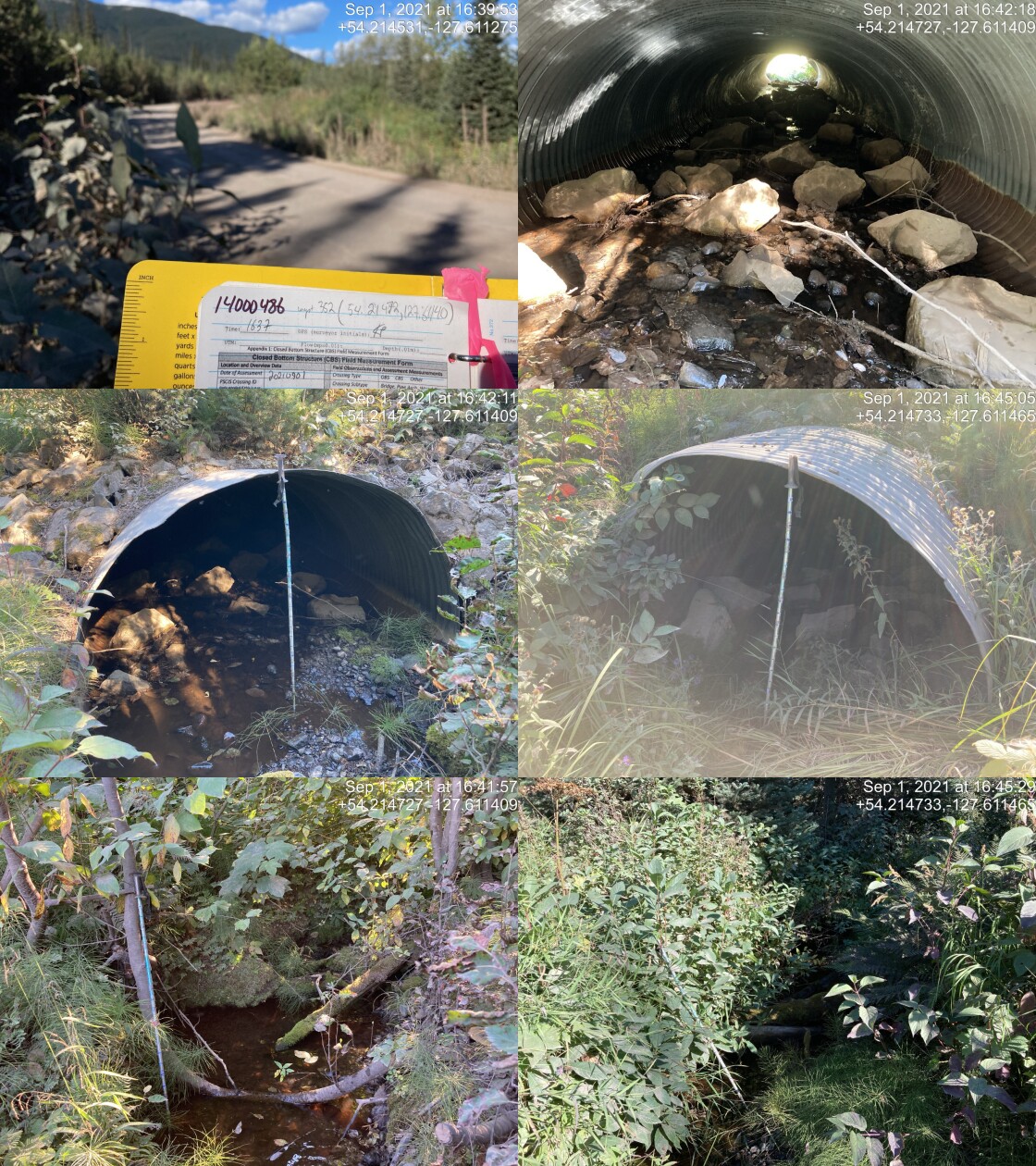
|
|||
| Comments: Estimated length, missed in field. All culverts on road were >20m due to size of road. 16:37 |
| Location and Stream Data |
|
Crossing Characteristics | – |
|---|---|---|---|
| Date | 2021-09-01 | Crossing Sub Type | Bridge |
| PSCIS ID | 197996 | Diameter (m) | 22 |
| External ID | 14000487 | Length (m) | 6 |
| Crew | KP | Embedded | – |
| UTM Zone | 9 | Depth Embedded (m) | – |
| Easting | 590985 | Resemble Channel | – |
| Northing | 6008508 | Backwatered | – |
| Stream | Tributary to Gosnell Creek | Percent Backwatered | – |
| Road | 6 Road | Fill Depth (m) | – |
| Road Tenure | Canfor R07593 | Outlet Drop (m) | – |
| Channel Width (m) | – | Outlet Pool Depth (m) | – |
| Stream Slope (%) | – | Inlet Drop | – |
| Beaver Activity | – | Slope (%) | – |
| Habitat Value | – | Valley Fill | – |
| Final score | 0 | Barrier Result | Passable |
| Fix type | – | Fix Span / Diameter | – |
Photos: PSCIS ID 197996. From top left clockwise: Road/Site Card, Barrel, Outlet, Downstream, Upstream, Inlet.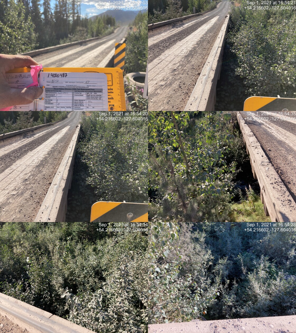
|
|||
| Comments: Check utm. 16:52 |
| Location and Stream Data |
|
Crossing Characteristics | – |
|---|---|---|---|
| Date | 2021-09-01 | Crossing Sub Type | Bridge |
| PSCIS ID | 197997 | Diameter (m) | 11 |
| External ID | 14000492 | Length (m) | 6 |
| Crew | KP | Embedded | – |
| UTM Zone | 9 | Depth Embedded (m) | – |
| Easting | 591945.7 | Resemble Channel | – |
| Northing | 6008758 | Backwatered | – |
| Stream | Tributary to Gosnell Creek | Percent Backwatered | – |
| Road | 6 Road | Fill Depth (m) | – |
| Road Tenure | Canfor R07593 | Outlet Drop (m) | – |
| Channel Width (m) | – | Outlet Pool Depth (m) | – |
| Stream Slope (%) | – | Inlet Drop | – |
| Beaver Activity | – | Slope (%) | – |
| Habitat Value | – | Valley Fill | – |
| Final score | 0 | Barrier Result | Passable |
| Fix type | – | Fix Span / Diameter | – |
Photos: PSCIS ID 197997. From top left clockwise: Road/Site Card, Barrel, Outlet, Downstream, Upstream, Inlet.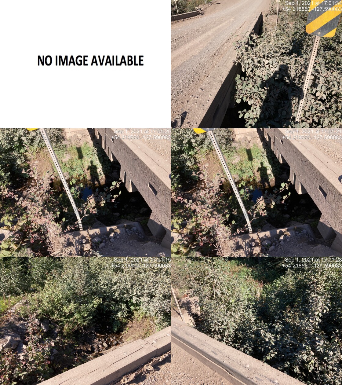
|
|||
| Comments: Bridge. 17:00 |
| Location and Stream Data |
|
Crossing Characteristics | – |
|---|---|---|---|
| Date | 2021-09-01 | Crossing Sub Type | Round Culvert |
| PSCIS ID | 197998 | Diameter (m) | 1.5 |
| External ID | 14000507 | Length (m) | 24 |
| Crew | KP | Embedded | No |
| UTM Zone | 9 | Depth Embedded (m) | – |
| Easting | 593237.3 | Resemble Channel | No |
| Northing | 6009679 | Backwatered | No |
| Stream | Tributary to Gosnell Creek | Percent Backwatered | – |
| Road | 6 Road | Fill Depth (m) | 1 |
| Road Tenure | Canfor R07593 | Outlet Drop (m) | 0 |
| Channel Width (m) | 1.8 | Outlet Pool Depth (m) | 0.15 |
| Stream Slope (%) | 7 | Inlet Drop | No |
| Beaver Activity | No | Slope (%) | 5 |
| Habitat Value | Medium | Valley Fill | Deep Fill |
| Final score | 26 | Barrier Result | Barrier |
| Fix type | Replace Structure with Streambed Simulation CBS | Fix Span / Diameter | 3 |
Photos: PSCIS ID 197998. From top left clockwise: Road/Site Card, Barrel, Outlet, Downstream, Upstream, Inlet.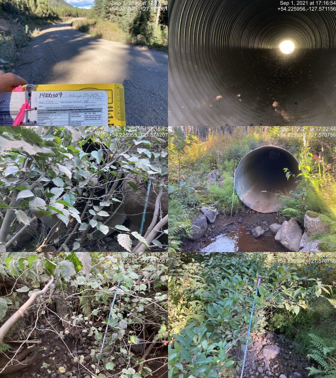
|
|||
| Comments: Channel dry upstream. 3 toads in outlet pool. 17:12 |
| Location and Stream Data |
|
Crossing Characteristics | – |
|---|---|---|---|
| Date | 2021-09-01 | Crossing Sub Type | Bridge |
| PSCIS ID | 197999 | Diameter (m) | 35 |
| External ID | 14001125 | Length (m) | 6 |
| Crew | KP | Embedded | – |
| UTM Zone | 9 | Depth Embedded (m) | – |
| Easting | 598080.8 | Resemble Channel | – |
| Northing | 6016791 | Backwatered | – |
| Stream | Tributary to Gosnell Creek | Percent Backwatered | – |
| Road | 6 Road | Fill Depth (m) | – |
| Road Tenure | Canfor R10645 | Outlet Drop (m) | – |
| Channel Width (m) | – | Outlet Pool Depth (m) | – |
| Stream Slope (%) | – | Inlet Drop | – |
| Beaver Activity | – | Slope (%) | – |
| Habitat Value | – | Valley Fill | – |
| Final score | 0 | Barrier Result | Passable |
| Fix type | – | Fix Span / Diameter | – |
Photos: PSCIS ID 197999. From top left clockwise: Road/Site Card, Barrel, Outlet, Downstream, Upstream, Inlet.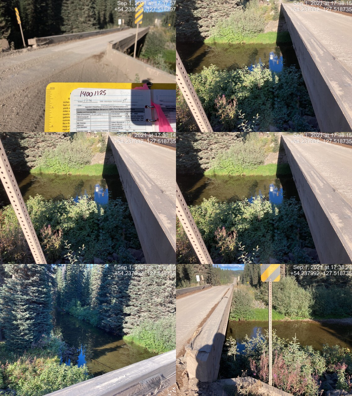
|
|||
| Comments: Bridge. 17:36 |
| Location and Stream Data |
|
Crossing Characteristics | – |
|---|---|---|---|
| Date | 2021-09-02 | Crossing Sub Type | Oval Culvert |
| PSCIS ID | 198000 | Diameter (m) | 3.9 |
| External ID | 14001161 | Length (m) | 16 |
| Crew | KP AI | Embedded | No |
| UTM Zone | 9 | Depth Embedded (m) | – |
| Easting | 605511 | Resemble Channel | No |
| Northing | 5992667 | Backwatered | No |
| Stream | McBride Creek | Percent Backwatered | – |
| Road | Nanika FSR | Fill Depth (m) | 0.8 |
| Road Tenure | FLNR DND 4656 | Outlet Drop (m) | 0.05 |
| Channel Width (m) | 9 | Outlet Pool Depth (m) | 0.8 |
| Stream Slope (%) | 2 | Inlet Drop | No |
| Beaver Activity | No | Slope (%) | 0.5 |
| Habitat Value | High | Valley Fill | Deep Fill |
| Final score | 19 | Barrier Result | Potential |
| Fix type | Replace with New Open Bottom Structure | Fix Span / Diameter | 14 |
Photos: PSCIS ID 198000. From top left clockwise: Road/Site Card, Barrel, Outlet, Downstream, Upstream, Inlet.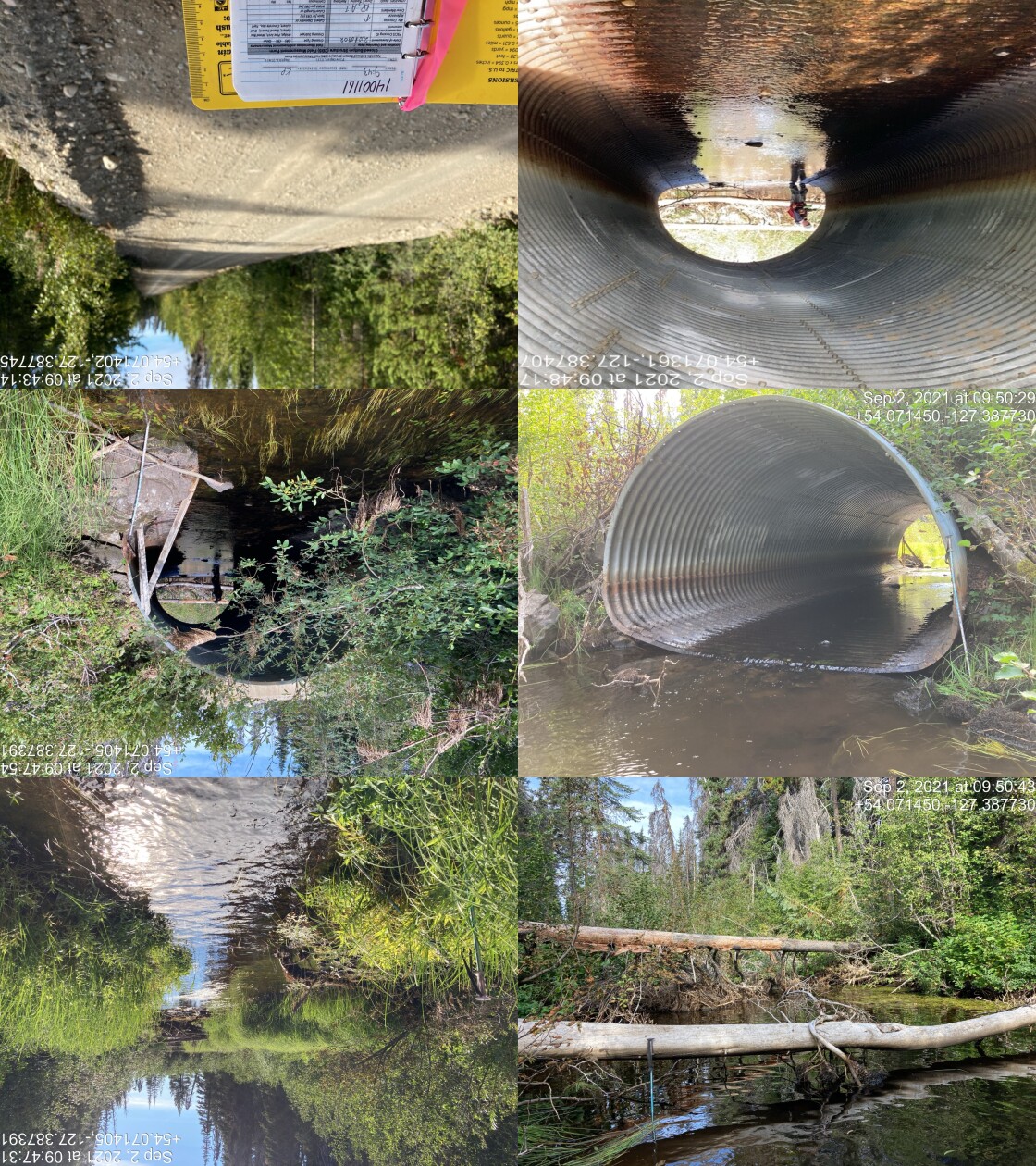
|
|||
| Comments: Laser level for slope. Channel width difficult to measure due to vegetation. 9:43 |
| Location and Stream Data |
|
Crossing Characteristics | – |
|---|---|---|---|
| Date | 2021-09-02 | Crossing Sub Type | Bridge |
| PSCIS ID | 198001 | Diameter (m) | 11 |
| External ID | 14000576 | Length (m) | 5 |
| Crew | KP | Embedded | – |
| UTM Zone | 9 | Depth Embedded (m) | – |
| Easting | 602436.9 | Resemble Channel | – |
| Northing | 5984669 | Backwatered | – |
| Stream | Tributary to Nanika River | Percent Backwatered | – |
| Road | Spur | Fill Depth (m) | – |
| Road Tenure | Canfor R06951 | Outlet Drop (m) | – |
| Channel Width (m) | – | Outlet Pool Depth (m) | – |
| Stream Slope (%) | – | Inlet Drop | – |
| Beaver Activity | – | Slope (%) | – |
| Habitat Value | – | Valley Fill | – |
| Final score | 0 | Barrier Result | Passable |
| Fix type | – | Fix Span / Diameter | – |
Photos: PSCIS ID 198001. From top left clockwise: Road/Site Card, Barrel, Outlet, Downstream, Upstream, Inlet.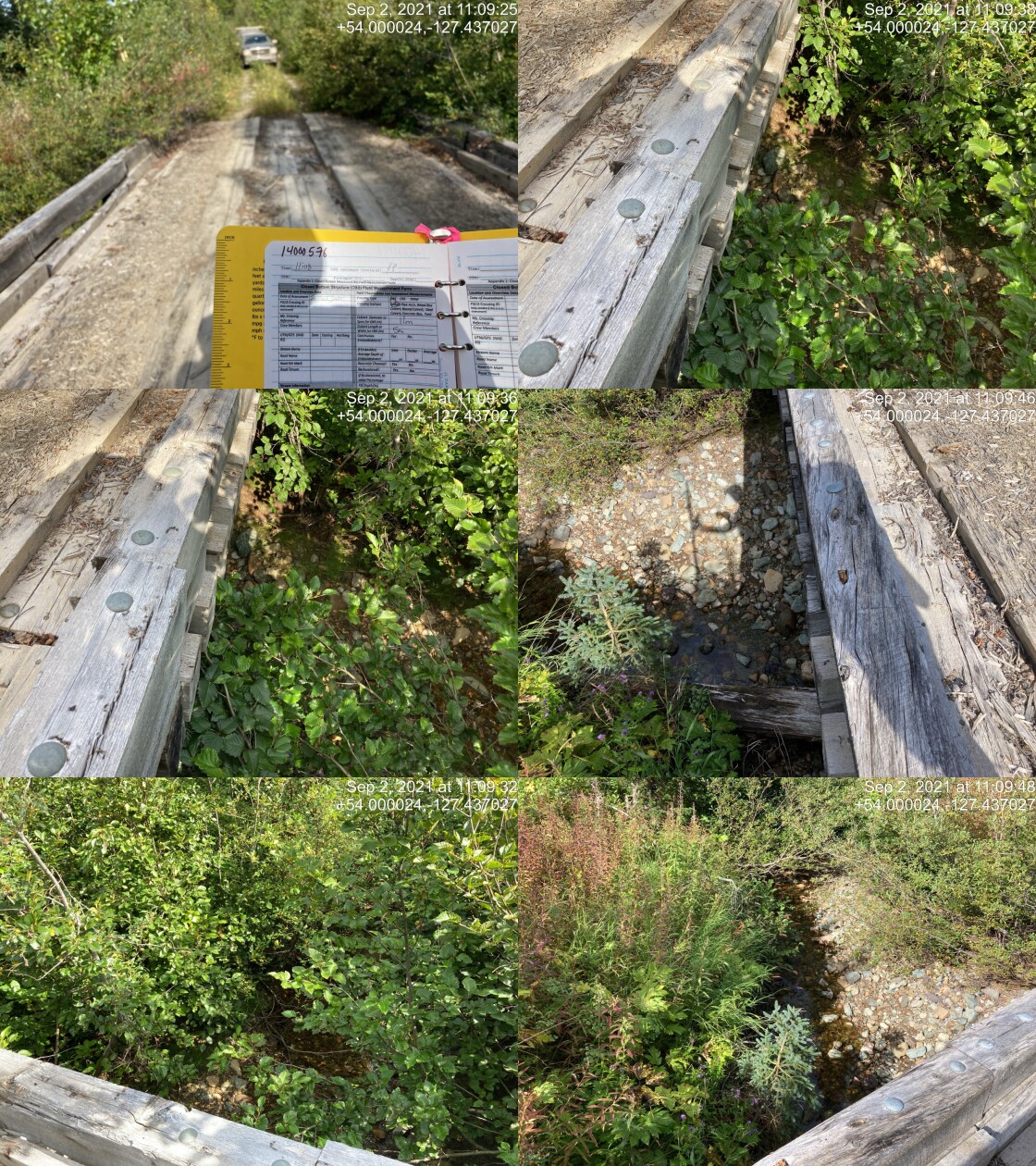
|
|||
| Comments: Bridge. 11:08 |
| Location and Stream Data |
|
Crossing Characteristics | – |
|---|---|---|---|
| Date | 2021-09-02 | Crossing Sub Type | Round Culvert |
| PSCIS ID | 198002 | Diameter (m) | 1 |
| External ID | 14001009 | Length (m) | 16 |
| Crew | KP | Embedded | No |
| UTM Zone | 9 | Depth Embedded (m) | – |
| Easting | 602775.8 | Resemble Channel | No |
| Northing | 5984983 | Backwatered | No |
| Stream | Tributary to Nanika River | Percent Backwatered | – |
| Road | 9 Road | Fill Depth (m) | 1 |
| Road Tenure | Canfor R06951 | Outlet Drop (m) | 0 |
| Channel Width (m) | 0.5 | Outlet Pool Depth (m) | 0.22 |
| Stream Slope (%) | 8 | Inlet Drop | Yes |
| Beaver Activity | No | Slope (%) | 5 |
| Habitat Value | Low | Valley Fill | Deep Fill |
| Final score | 23 | Barrier Result | Barrier |
| Fix type | Replace Structure with Streambed Simulation CBS | Fix Span / Diameter | 3 |
Photos: PSCIS ID 198002. From top left clockwise: Road/Site Card, Barrel, Outlet, Downstream, Upstream, Inlet.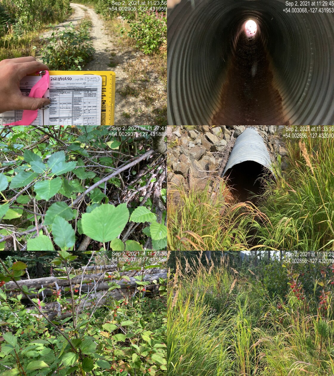
|
|||
| Comments: Dry channel, difficult to locate channel upstream. Inlet drop 0.3m. Appears it could be backwatered when there is flow. Outlet partially embedded on <3m in. 11:22 |
| Location and Stream Data |
|
Crossing Characteristics | – |
|---|---|---|---|
| Date | 2021-09-02 | Crossing Sub Type | Round Culvert |
| PSCIS ID | 198003 | Diameter (m) | 0.6 |
| External ID | 14000582 | Length (m) | 20 |
| Crew | KP | Embedded | No |
| UTM Zone | 9 | Depth Embedded (m) | – |
| Easting | 601366.6 | Resemble Channel | No |
| Northing | 5986580 | Backwatered | No |
| Stream | Tributary to Nanika River | Percent Backwatered | – |
| Road | Nanika FSR | Fill Depth (m) | 1 |
| Road Tenure | Canfor R06951 | Outlet Drop (m) | 0.1 |
| Channel Width (m) | 0.5 | Outlet Pool Depth (m) | 0.2 |
| Stream Slope (%) | 5 | Inlet Drop | No |
| Beaver Activity | No | Slope (%) | 5 |
| Habitat Value | Low | Valley Fill | Deep Fill |
| Final score | 23 | Barrier Result | Barrier |
| Fix type | Replace Structure with Streambed Simulation CBS | Fix Span / Diameter | 3 |
Photos: PSCIS ID 198003. From top left clockwise: Road/Site Card, Barrel, Outlet, Downstream, Upstream, Inlet.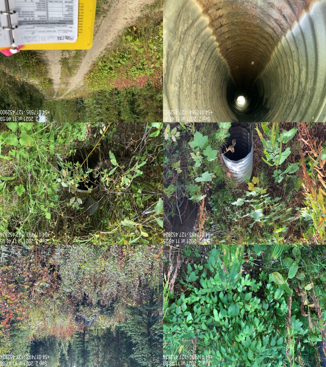
|
|||
| Comments: Poorly defined channel unlikely fish habitat. Dry. 11:45 |
| Location and Stream Data |
|
Crossing Characteristics | – |
|---|---|---|---|
| Date | 2021-09-02 | Crossing Sub Type | Bridge |
| PSCIS ID | 198004 | Diameter (m) | 17 |
| External ID | 14001163 | Length (m) | 6 |
| Crew | KP | Embedded | – |
| UTM Zone | 9 | Depth Embedded (m) | – |
| Easting | 603640 | Resemble Channel | – |
| Northing | 5988349 | Backwatered | – |
| Stream | Tributary to Nanika River | Percent Backwatered | – |
| Road | Nanika FSR | Fill Depth (m) | – |
| Road Tenure | FLNR DND 4656 | Outlet Drop (m) | – |
| Channel Width (m) | – | Outlet Pool Depth (m) | – |
| Stream Slope (%) | – | Inlet Drop | – |
| Beaver Activity | – | Slope (%) | – |
| Habitat Value | – | Valley Fill | – |
| Final score | 0 | Barrier Result | Passable |
| Fix type | – | Fix Span / Diameter | – |
Photos: PSCIS ID 198004. From top left clockwise: Road/Site Card, Barrel, Outlet, Downstream, Upstream, Inlet.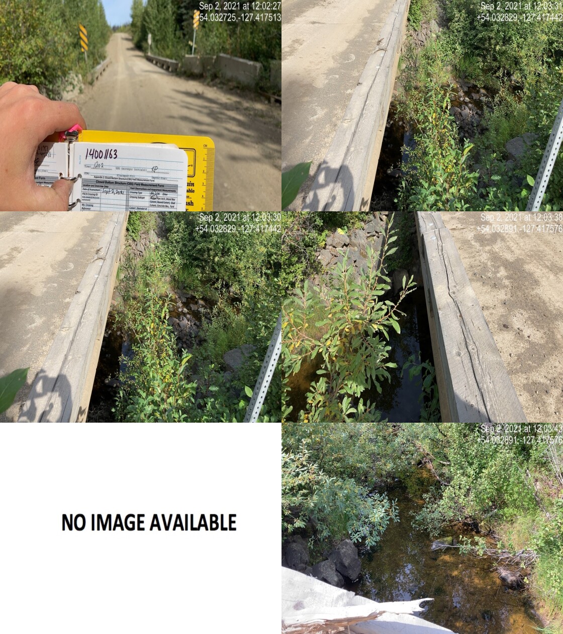
|
|||
| Comments: Bridge. 12:02 |
| Location and Stream Data |
|
Crossing Characteristics | – |
|---|---|---|---|
| Date | 2021-09-02 | Crossing Sub Type | Round Culvert |
| PSCIS ID | 198005 | Diameter (m) | 1.2 |
| External ID | 14001078 | Length (m) | 10 |
| Crew | KP | Embedded | No |
| UTM Zone | 9 | Depth Embedded (m) | – |
| Easting | 605308 | Resemble Channel | No |
| Northing | 5987254 | Backwatered | No |
| Stream | Tributary to Nanika River | Percent Backwatered | – |
| Road | Spur | Fill Depth (m) | 0.5 |
| Road Tenure | Canfor R06951 | Outlet Drop (m) | 0 |
| Channel Width (m) | 0.8 | Outlet Pool Depth (m) | 0 |
| Stream Slope (%) | 4 | Inlet Drop | Yes |
| Beaver Activity | No | Slope (%) | 3 |
| Habitat Value | Low | Valley Fill | Deep Fill |
| Final score | 20 | Barrier Result | Barrier |
| Fix type | Replace Structure with Streambed Simulation CBS | Fix Span / Diameter | 3 |
Photos: PSCIS ID 198005. From top left clockwise: Road/Site Card, Barrel, Outlet, Downstream, Upstream, Inlet.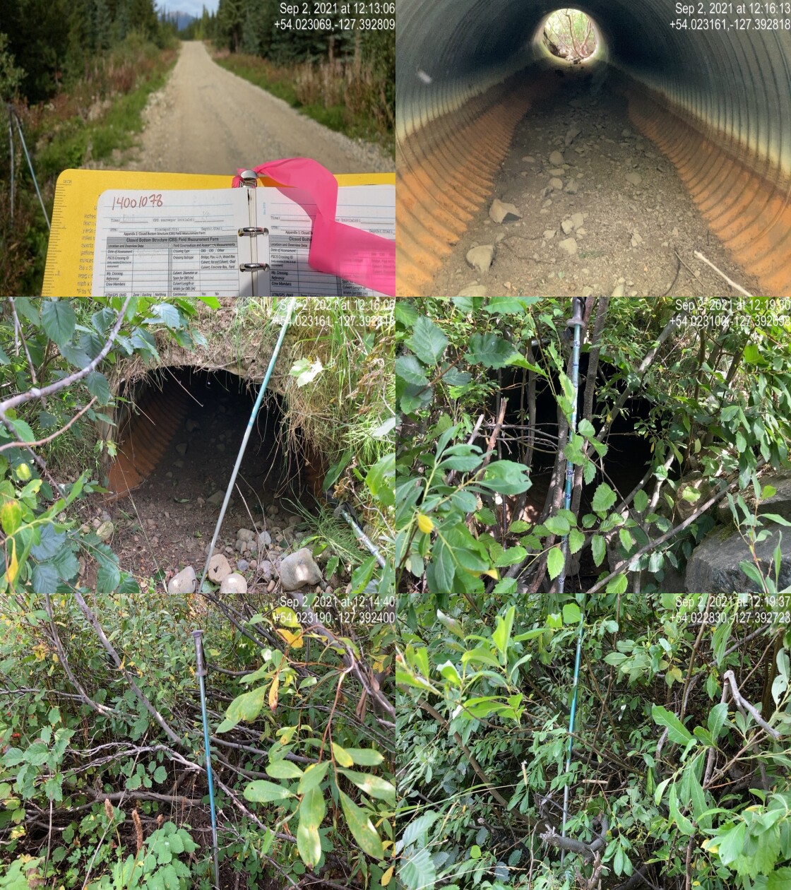
|
|||
| Comments: Dry channel, stream slope estimated. Outlet drop .15m. 12:12 |
| Location and Stream Data |
|
Crossing Characteristics | – |
|---|---|---|---|
| Date | 2021-09-02 | Crossing Sub Type | Bridge |
| PSCIS ID | 198006 | Diameter (m) | 10 |
| External ID | 14001080 | Length (m) | 5 |
| Crew | KP | Embedded | – |
| UTM Zone | 9 | Depth Embedded (m) | – |
| Easting | 605496.7 | Resemble Channel | – |
| Northing | 5986870 | Backwatered | – |
| Stream | Tributary to Nanika River | Percent Backwatered | – |
| Road | Spur | Fill Depth (m) | – |
| Road Tenure | Unknown | Outlet Drop (m) | – |
| Channel Width (m) | – | Outlet Pool Depth (m) | – |
| Stream Slope (%) | – | Inlet Drop | – |
| Beaver Activity | – | Slope (%) | – |
| Habitat Value | – | Valley Fill | – |
| Final score | 0 | Barrier Result | Passable |
| Fix type | – | Fix Span / Diameter | – |
Photos: PSCIS ID 198006. From top left clockwise: Road/Site Card, Barrel, Outlet, Downstream, Upstream, Inlet.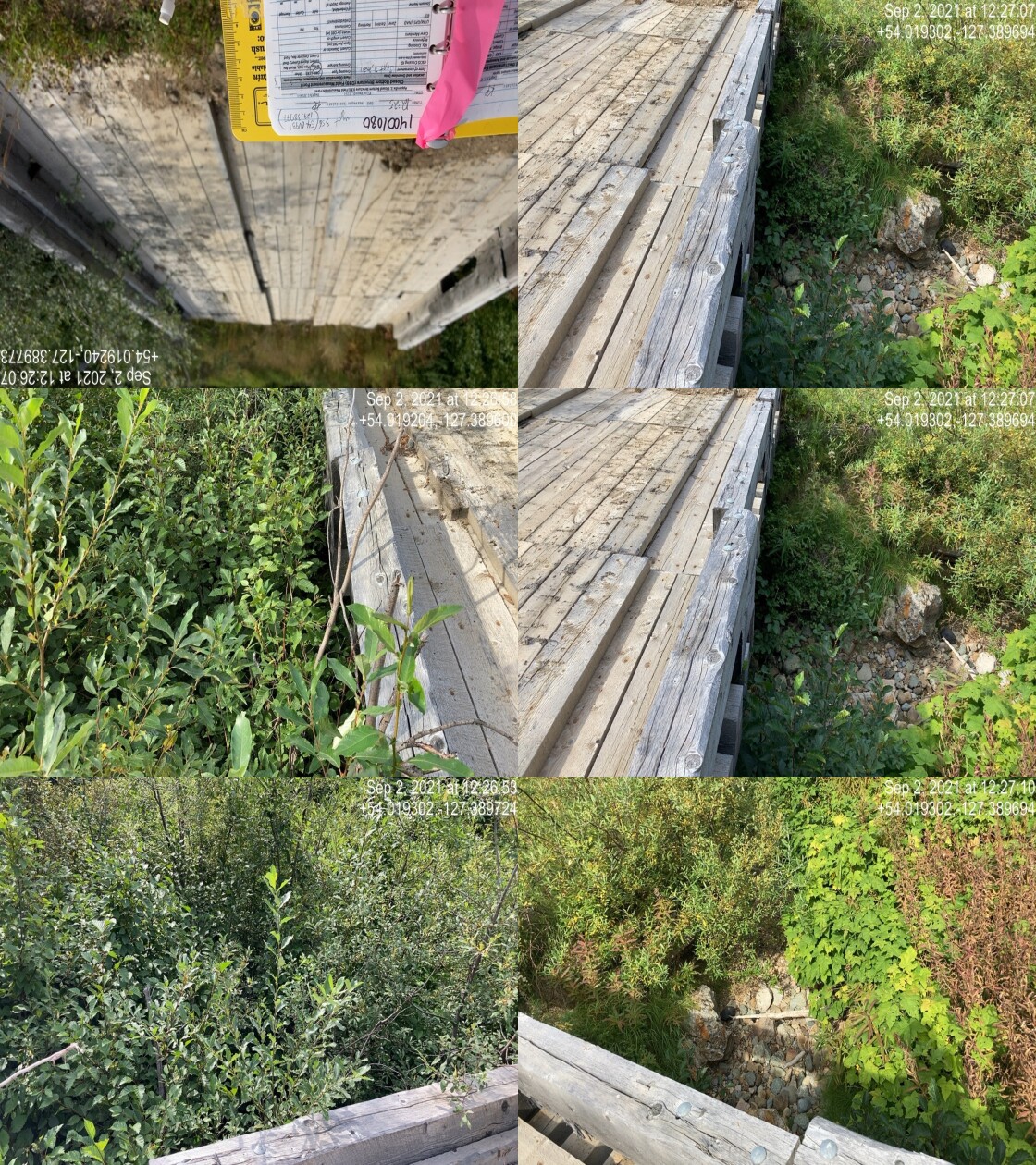
|
|||
| Comments: Location much different than map. 12:25 |
| Location and Stream Data |
|
Crossing Characteristics | – |
|---|---|---|---|
| Date | 2021-09-02 | Crossing Sub Type | Round Culvert |
| PSCIS ID | 198007 | Diameter (m) | 0.6 |
| External ID | 14001077 | Length (m) | 10 |
| Crew | KP | Embedded | Yes |
| UTM Zone | 9 | Depth Embedded (m) | 0.2 |
| Easting | 605389 | Resemble Channel | No |
| Northing | 5986595 | Backwatered | No |
| Stream | Tributary to Nanika River | Percent Backwatered | – |
| Road | Spur | Fill Depth (m) | 0.5 |
| Road Tenure | Canfor R06951 | Outlet Drop (m) | 0.1 |
| Channel Width (m) | 1 | Outlet Pool Depth (m) | 0.15 |
| Stream Slope (%) | 7 | Inlet Drop | No |
| Beaver Activity | No | Slope (%) | 4 |
| Habitat Value | Low | Valley Fill | Deep Fill |
| Final score | 21 | Barrier Result | Barrier |
| Fix type | Replace Structure with Streambed Simulation CBS | Fix Span / Diameter | 3 |
Photos: PSCIS ID 198007. From top left clockwise: Road/Site Card, Barrel, Outlet, Downstream, Upstream, Inlet.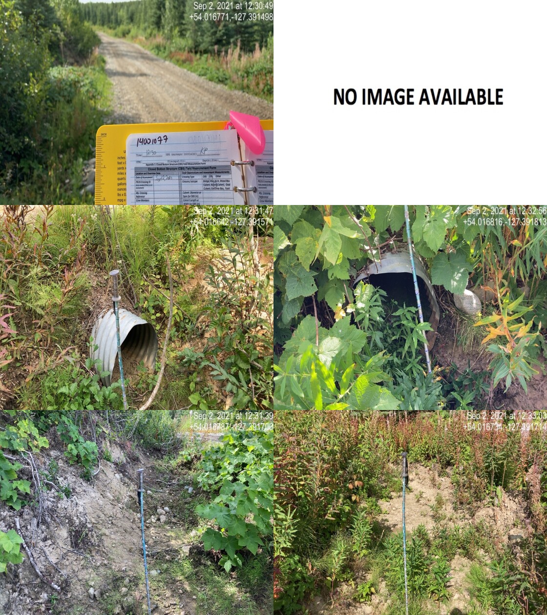
|
|||
| Comments: Dry, hard to see channel. More of a maintenance culvert, completed due to fish data upstream. No real channel. Embedment is fines more erosional deposit. 12:30 |
| Location and Stream Data |
|
Crossing Characteristics | – |
|---|---|---|---|
| Date | 2021-09-02 | Crossing Sub Type | Round Culvert |
| PSCIS ID | 198008 | Diameter (m) | 0.9 |
| External ID | 14000865 | Length (m) | 11 |
| Crew | KP | Embedded | No |
| UTM Zone | 9 | Depth Embedded (m) | – |
| Easting | 606426.2 | Resemble Channel | No |
| Northing | 5986782 | Backwatered | No |
| Stream | Tributary to Nanika River | Percent Backwatered | – |
| Road | Spur | Fill Depth (m) | 0.2 |
| Road Tenure | Canfor R10644 | Outlet Drop (m) | 0.18 |
| Channel Width (m) | 1.8 | Outlet Pool Depth (m) | 0.6 |
| Stream Slope (%) | 7 | Inlet Drop | Yes |
| Beaver Activity | No | Slope (%) | 6 |
| Habitat Value | Medium | Valley Fill | Deep Fill |
| Final score | 31 | Barrier Result | Barrier |
| Fix type | Replace Structure with Streambed Simulation CBS | Fix Span / Diameter | 3 |
Photos: PSCIS ID 198008. From top left clockwise: Road/Site Card, Barrel, Outlet, Downstream, Upstream, Inlet.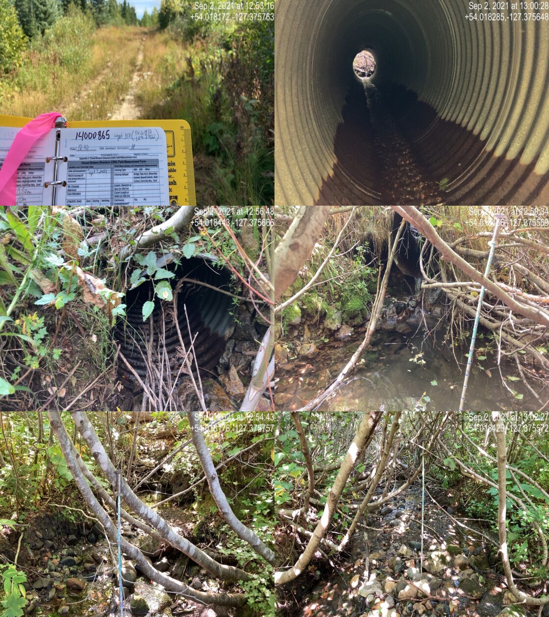
|
|||
| Comments: Stream has good flow, well developed channel. 12:50 |
| Location and Stream Data |
|
Crossing Characteristics | – |
|---|---|---|---|
| Date | 2021-09-02 | Crossing Sub Type | Round Culvert |
| PSCIS ID | 198009 | Diameter (m) | 0.9 |
| External ID | 14000535 | Length (m) | 14 |
| Crew | KP | Embedded | No |
| UTM Zone | 9 | Depth Embedded (m) | – |
| Easting | 599263.7 | Resemble Channel | No |
| Northing | 5984699 | Backwatered | No |
| Stream | Tributary to Nanika River | Percent Backwatered | – |
| Road | 1 Road | Fill Depth (m) | 0.75 |
| Road Tenure | Canfor R08817 | Outlet Drop (m) | 0.8 |
| Channel Width (m) | 1 | Outlet Pool Depth (m) | 0.15 |
| Stream Slope (%) | 8 | Inlet Drop | No |
| Beaver Activity | No | Slope (%) | 5 |
| Habitat Value | Low | Valley Fill | Deep Fill |
| Final score | 33 | Barrier Result | Barrier |
| Fix type | Replace Structure with Streambed Simulation CBS | Fix Span / Diameter | 3 |
Photos: PSCIS ID 198009. From top left clockwise: Road/Site Card, Barrel, Outlet, Downstream, Upstream, Inlet.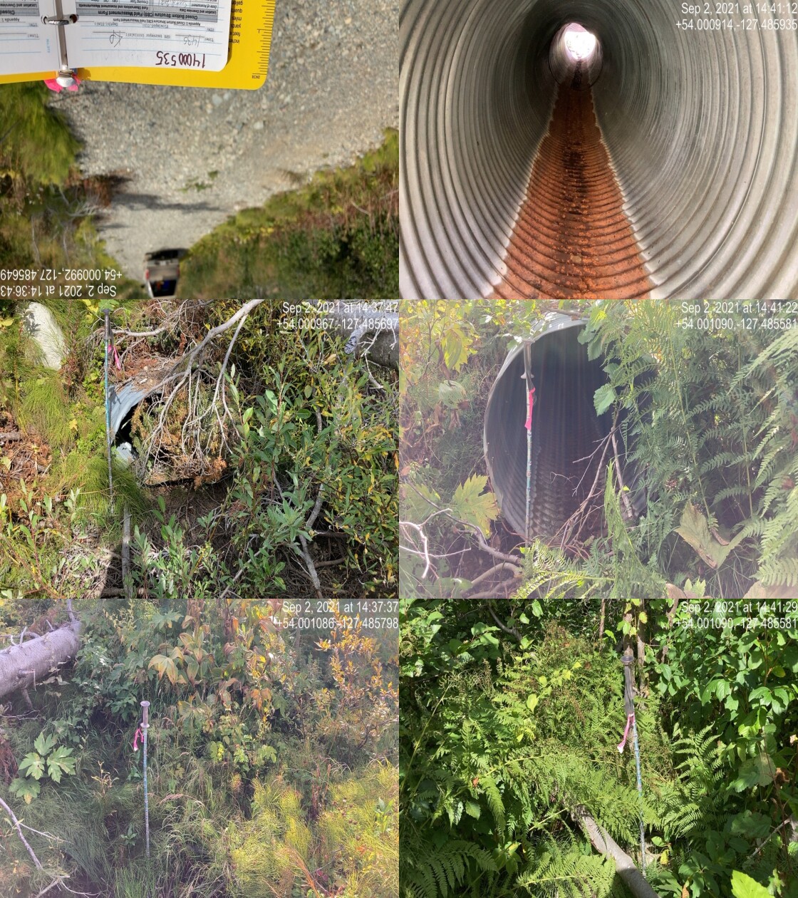
|
|||
| Comments: Channel dry , hard to find. Unlikely fish habitat. Culvert deformed. 14:35 |
| Location and Stream Data |
|
Crossing Characteristics | – |
|---|---|---|---|
| Date | 2021-09-02 | Crossing Sub Type | Bridge |
| PSCIS ID | 198010 | Diameter (m) | 26 |
| External ID | 14000450 | Length (m) | 5 |
| Crew | KP | Embedded | – |
| UTM Zone | 9 | Depth Embedded (m) | – |
| Easting | 599516.3 | Resemble Channel | – |
| Northing | 5985582 | Backwatered | – |
| Stream | Tributary to Nanika River | Percent Backwatered | – |
| Road | 4 Road | Fill Depth (m) | – |
| Road Tenure | FLNR DND 4656 | Outlet Drop (m) | – |
| Channel Width (m) | – | Outlet Pool Depth (m) | – |
| Stream Slope (%) | – | Inlet Drop | – |
| Beaver Activity | – | Slope (%) | – |
| Habitat Value | – | Valley Fill | – |
| Final score | 0 | Barrier Result | Passable |
| Fix type | – | Fix Span / Diameter | – |
Photos: PSCIS ID 198010. From top left clockwise: Road/Site Card, Barrel, Outlet, Downstream, Upstream, Inlet.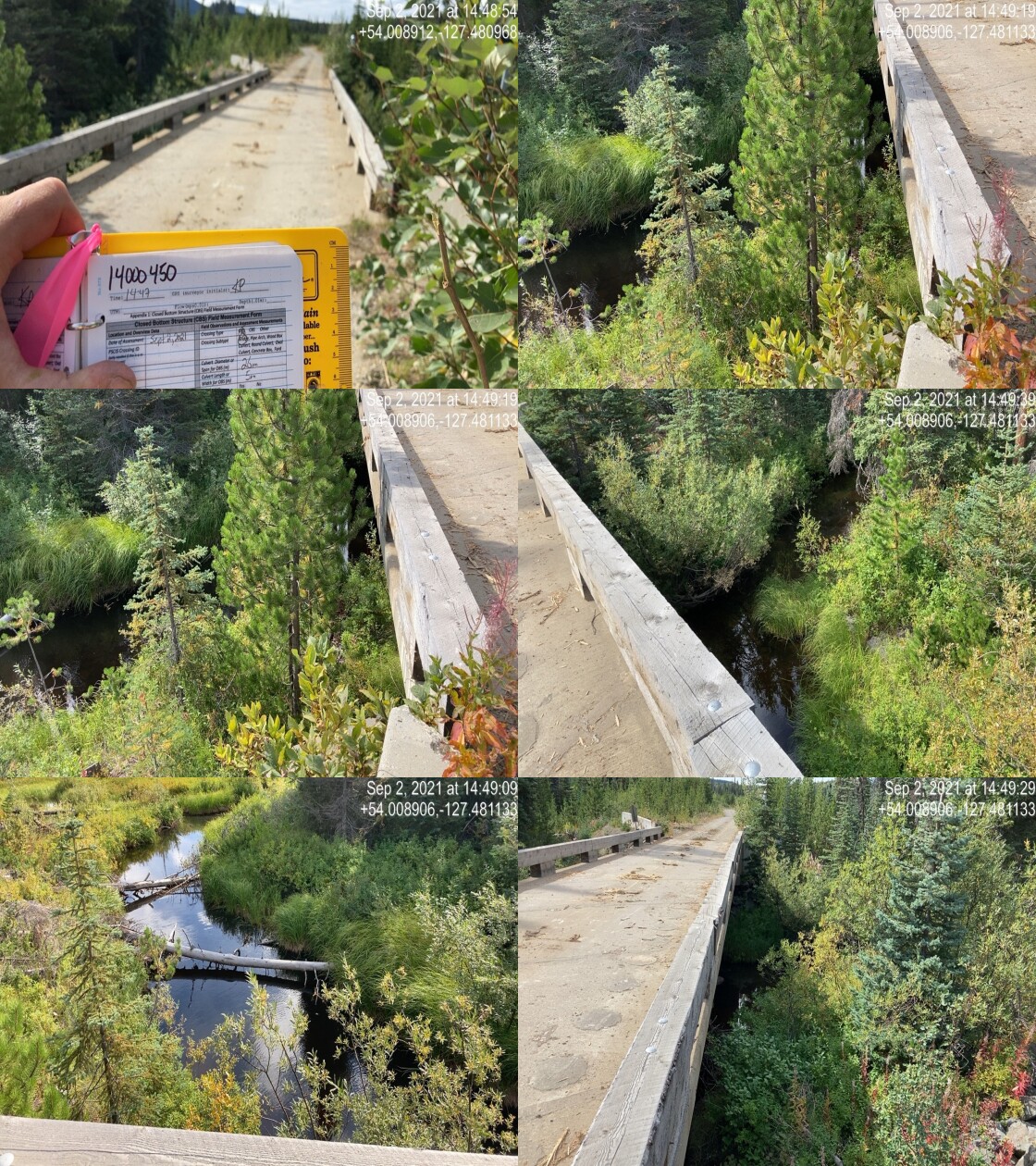
|
|||
| Comments: Bridge. 14:47 |
| Location and Stream Data |
|
Crossing Characteristics | – |
|---|---|---|---|
| Date | 2021-09-02 | Crossing Sub Type | Round Culvert |
| PSCIS ID | 198011 | Diameter (m) | 1.6 |
| External ID | 14000443 | Length (m) | 22 |
| Crew | KP | Embedded | No |
| UTM Zone | 9 | Depth Embedded (m) | – |
| Easting | 599738.2 | Resemble Channel | No |
| Northing | 5986409 | Backwatered | No |
| Stream | Tributary to Nanika River | Percent Backwatered | – |
| Road | 4 Road | Fill Depth (m) | 2.5 |
| Road Tenure | FLNR DND 4656 | Outlet Drop (m) | 0.4 |
| Channel Width (m) | 2.2 | Outlet Pool Depth (m) | 0.7 |
| Stream Slope (%) | 7 | Inlet Drop | No |
| Beaver Activity | No | Slope (%) | 6 |
| Habitat Value | Low | Valley Fill | Deep Fill |
| Final score | 39 | Barrier Result | Barrier |
| Fix type | Replace with New Open Bottom Structure | Fix Span / Diameter | 10 |
Photos: PSCIS ID 198011. From top left clockwise: Road/Site Card, Barrel, Outlet, Downstream, Upstream, Inlet.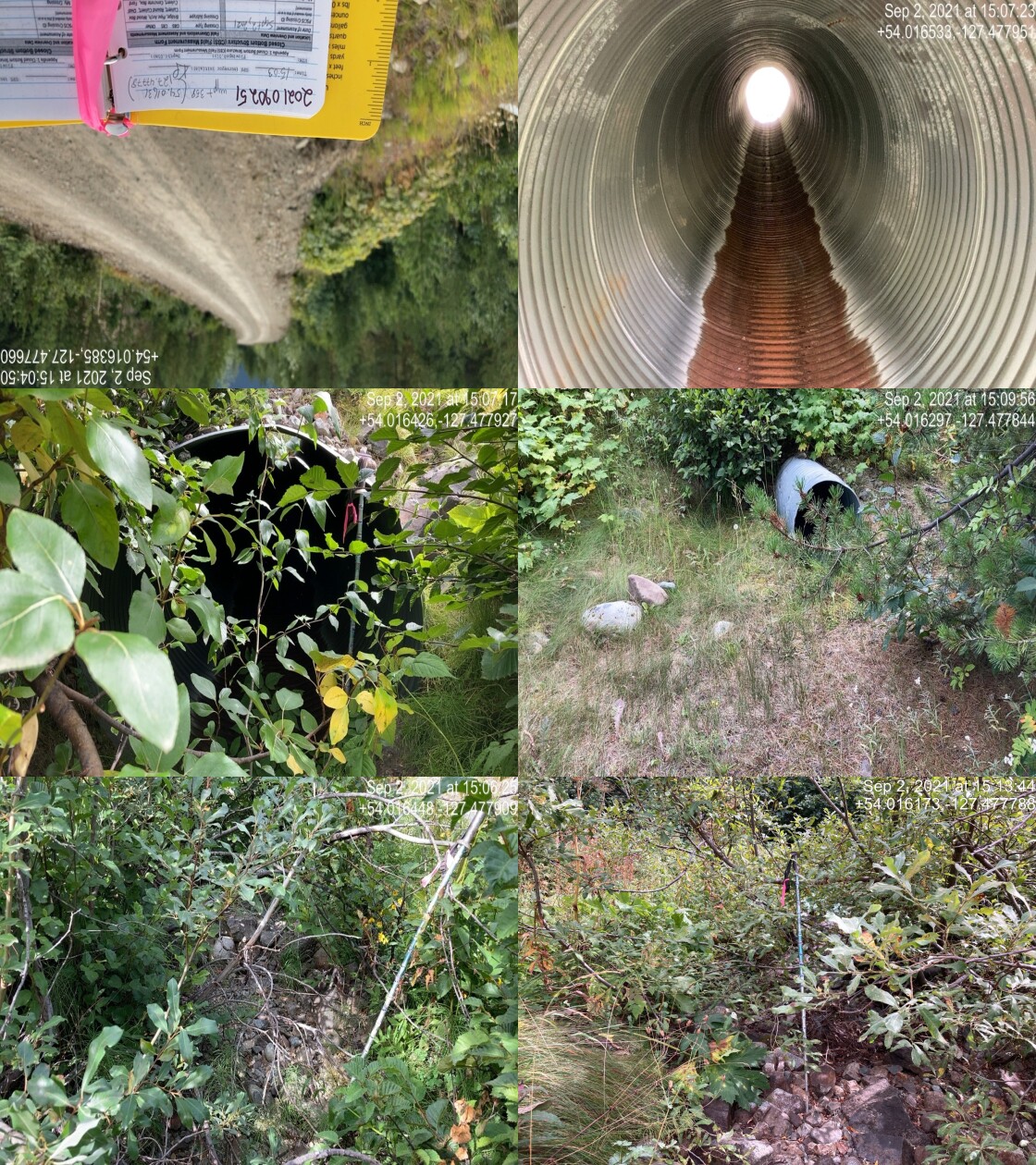
|
|||
| Comments: Dry channel. Another culvert ~5m away, higher and smaller for flood or overflow. Outlet pool big, stream experiences high seasonal variation. 15:03 |
| Location and Stream Data |
|
Crossing Characteristics | – |
|---|---|---|---|
| Date | 2021-09-02 | Crossing Sub Type | Round Culvert |
| PSCIS ID | 198012 | Diameter (m) | 1.2 |
| External ID | 14001052 | Length (m) | 14 |
| Crew | KP | Embedded | No |
| UTM Zone | 9 | Depth Embedded (m) | – |
| Easting | 604443.1 | Resemble Channel | No |
| Northing | 5995222 | Backwatered | No |
| Stream | Tributary to McBride River | Percent Backwatered | – |
| Road | Morice FSR | Fill Depth (m) | 0.2 |
| Road Tenure | Canfor R10640 | Outlet Drop (m) | 0 |
| Channel Width (m) | 1.2 | Outlet Pool Depth (m) | 0 |
| Stream Slope (%) | 0.5 | Inlet Drop | Yes |
| Beaver Activity | Yes | Slope (%) | 0.5 |
| Habitat Value | Medium | Valley Fill | Deep Fill |
| Final score | 13 | Barrier Result | Passable |
| Fix type | – | Fix Span / Diameter | – |
Photos: PSCIS ID 198012. From top left clockwise: Road/Site Card, Barrel, Outlet, Downstream, Upstream, Inlet.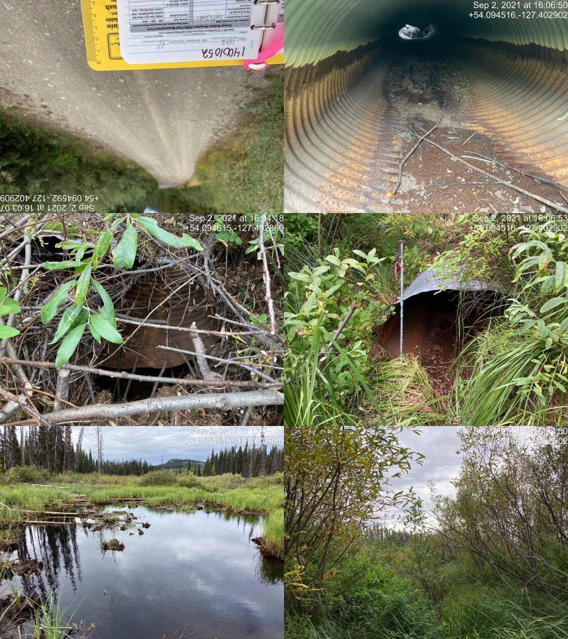
|
|||
| Comments: Beaver clogged inlet, with potentially a beaver lodge built on it. No water flowing through. Culvert broken in several places. Looks like old beaver fence on inlet, not effective. Large wetland upstream and downstream. 16:02 |
| Location and Stream Data |
|
Crossing Characteristics | – |
|---|---|---|---|
| Date | 2021-09-02 | Crossing Sub Type | Round Culvert |
| PSCIS ID | 198013 | Diameter (m) | 0.7 |
| External ID | 14000777 | Length (m) | 13 |
| Crew | KP | Embedded | No |
| UTM Zone | 9 | Depth Embedded (m) | – |
| Easting | 605157 | Resemble Channel | Yes |
| Northing | 5994783 | Backwatered | Yes |
| Stream | Tributary to McBride River | Percent Backwatered | 100 |
| Road | Morice FSR | Fill Depth (m) | 0.5 |
| Road Tenure | FLNR DND 4656 | Outlet Drop (m) | 0 |
| Channel Width (m) | 0.7 | Outlet Pool Depth (m) | 0 |
| Stream Slope (%) | 0.5 | Inlet Drop | No |
| Beaver Activity | No | Slope (%) | 0.5 |
| Habitat Value | Medium | Valley Fill | Deep Fill |
| Final score | 13 | Barrier Result | Passable |
| Fix type | – | Fix Span / Diameter | – |
Photos: PSCIS ID 198013. From top left clockwise: Road/Site Card, Barrel, Outlet, Downstream, Upstream, Inlet.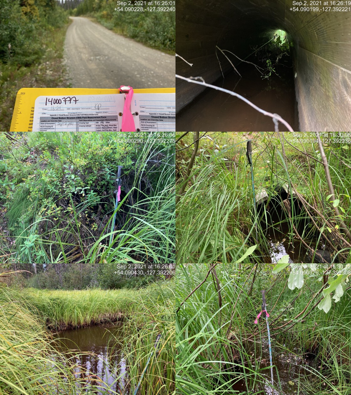
|
|||
| Comments: Wetland like habitat above and below, culvert is made of wood but intact. Damage on top of culvert on outlet (missing plank). 16:24 |
| Location and Stream Data |
|
Crossing Characteristics | – |
|---|---|---|---|
| Date | 2021-09-02 | Crossing Sub Type | Round Culvert |
| PSCIS ID | 198014 | Diameter (m) | 0.9 |
| External ID | 14000779 | Length (m) | 10 |
| Crew | KP | Embedded | No |
| UTM Zone | 9 | Depth Embedded (m) | – |
| Easting | 605675 | Resemble Channel | Yes |
| Northing | 5993744 | Backwatered | No |
| Stream | Tributary to McBride River | Percent Backwatered | – |
| Road | Morice FSR | Fill Depth (m) | 0.3 |
| Road Tenure | FLNR DND 4656 | Outlet Drop (m) | 0 |
| Channel Width (m) | 0.9 | Outlet Pool Depth (m) | 0 |
| Stream Slope (%) | 0.5 | Inlet Drop | No |
| Beaver Activity | No | Slope (%) | 0.5 |
| Habitat Value | Medium | Valley Fill | Deep Fill |
| Final score | 13 | Barrier Result | Passable |
| Fix type | – | Fix Span / Diameter | – |
Photos: PSCIS ID 198014. From top left clockwise: Road/Site Card, Barrel, Outlet, Downstream, Upstream, Inlet.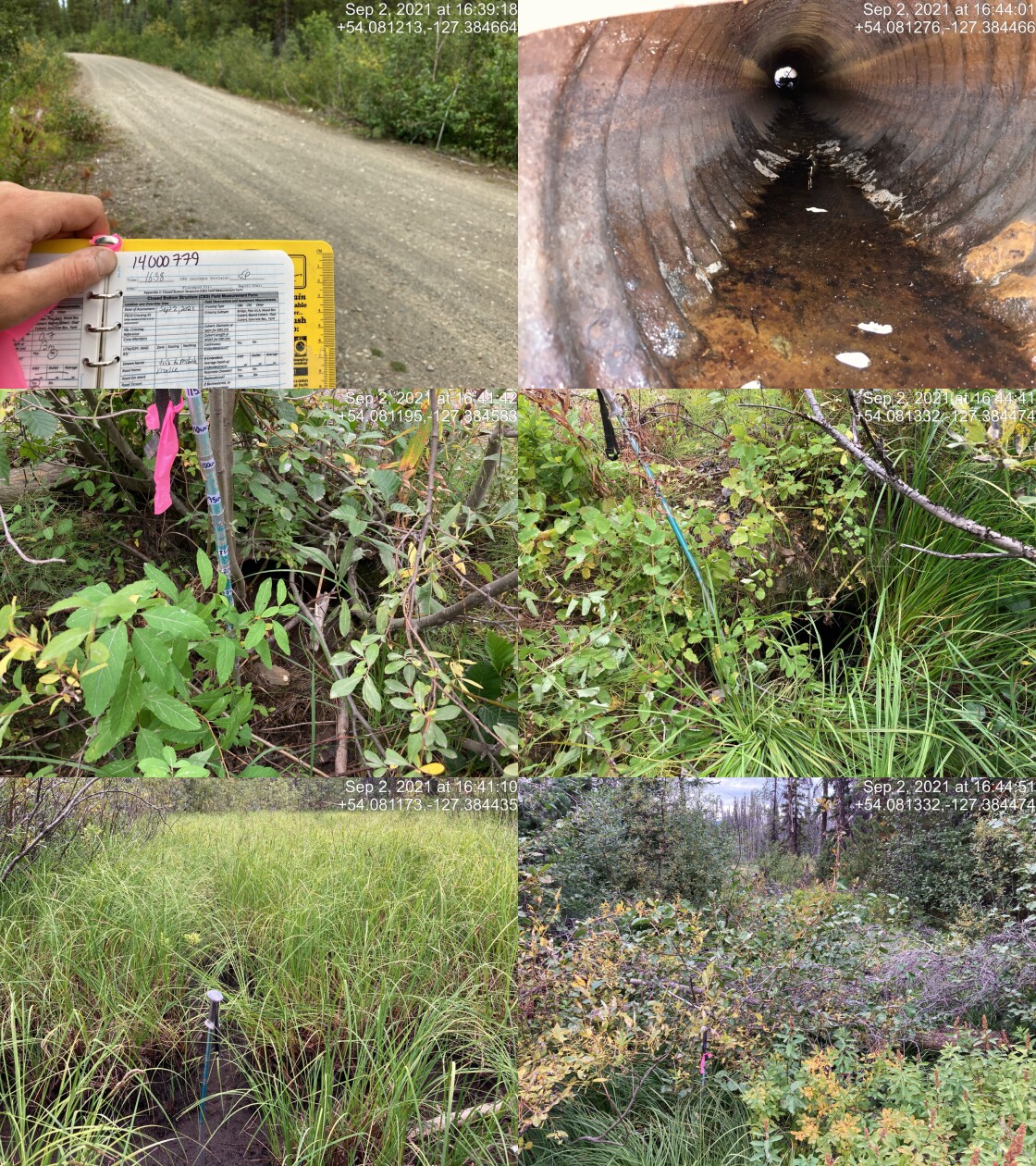
|
|||
| Comments: Wetland habitat on both sides of crossing. Inlet hard to find, has major vegetation growth coming out of it and is ~1m higher than upstream substrate. Channel dry, likely backwatered for spring flow. 16:38 |
| Location and Stream Data |
|
Crossing Characteristics | – |
|---|---|---|---|
| Date | 2021-09-03 | Crossing Sub Type | Bridge |
| PSCIS ID | 198015 | Diameter (m) | 13 |
| External ID | 14000565 | Length (m) | 4 |
| Crew | KP | Embedded | – |
| UTM Zone | 9 | Depth Embedded (m) | – |
| Easting | 608574.3 | Resemble Channel | – |
| Northing | 6022389 | Backwatered | – |
| Stream | Tributary to Thautil River | Percent Backwatered | – |
| Road | Chisholm FSR | Fill Depth (m) | – |
| Road Tenure | West Fraser R05232 | Outlet Drop (m) | – |
| Channel Width (m) | – | Outlet Pool Depth (m) | – |
| Stream Slope (%) | – | Inlet Drop | – |
| Beaver Activity | – | Slope (%) | – |
| Habitat Value | – | Valley Fill | – |
| Final score | 0 | Barrier Result | Passable |
| Fix type | – | Fix Span / Diameter | – |
Photos: PSCIS ID 198015. From top left clockwise: Road/Site Card, Barrel, Outlet, Downstream, Upstream, Inlet.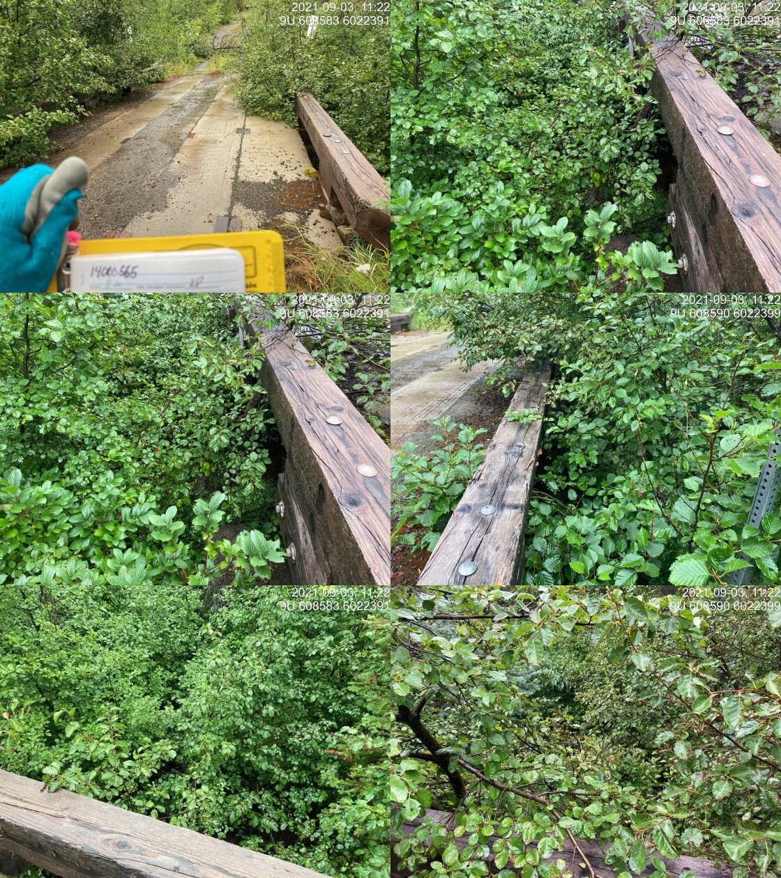
|
|||
| Comments: Bridge. 11:20 |
| Location and Stream Data |
|
Crossing Characteristics | – |
|---|---|---|---|
| Date | 2021-09-03 | Crossing Sub Type | Round Culvert |
| PSCIS ID | 198016 | Diameter (m) | 1.2 |
| External ID | 14000562 | Length (m) | 25 |
| Crew | KP | Embedded | No |
| UTM Zone | 9 | Depth Embedded (m) | – |
| Easting | 608138.1 | Resemble Channel | No |
| Northing | 6020911 | Backwatered | No |
| Stream | Tributary to Thautil River | Percent Backwatered | – |
| Road | Chisholm FSR | Fill Depth (m) | 4.5 |
| Road Tenure | West Fraser R05232 | Outlet Drop (m) | 0.19 |
| Channel Width (m) | 1.3 | Outlet Pool Depth (m) | 0 |
| Stream Slope (%) | 10 | Inlet Drop | Yes |
| Beaver Activity | No | Slope (%) | 5 |
| Habitat Value | Medium | Valley Fill | Deep Fill |
| Final score | 31 | Barrier Result | Barrier |
| Fix type | Replace Structure with Streambed Simulation CBS | Fix Span / Diameter | 3 |
Photos: PSCIS ID 198016. From top left clockwise: Road/Site Card, Barrel, Outlet, Downstream, Upstream, Inlet.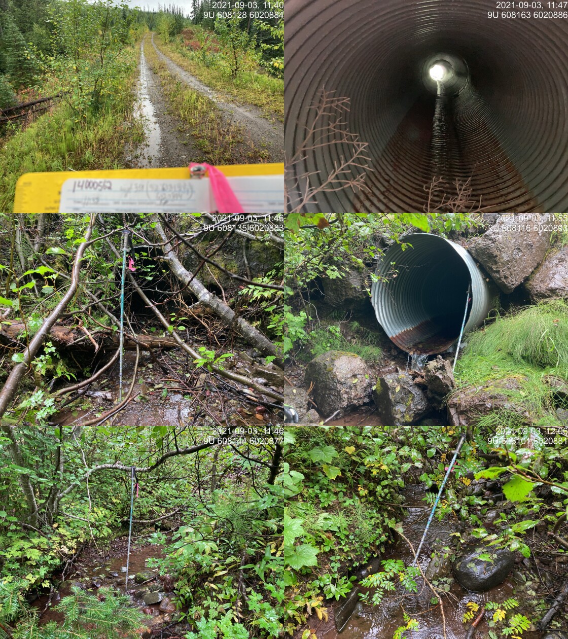
|
|||
| Comments: Inlet drop 0.07m. Nice flowing stream. Lots of fill. Rocks at outlet increase challenge for upstream movement. 11:38 |
| Location and Stream Data |
|
Crossing Characteristics | – |
|---|---|---|---|
| Date | 2021-09-03 | Crossing Sub Type | Bridge |
| PSCIS ID | 198017 | Diameter (m) | 25 |
| External ID | 14000702 | Length (m) | 5 |
| Crew | KP | Embedded | – |
| UTM Zone | 9 | Depth Embedded (m) | – |
| Easting | 607585 | Resemble Channel | – |
| Northing | 6016381 | Backwatered | – |
| Stream | Tributary to Thautil River | Percent Backwatered | – |
| Road | Chisholm FSR | Fill Depth (m) | – |
| Road Tenure | FLNR DND 9946 | Outlet Drop (m) | – |
| Channel Width (m) | – | Outlet Pool Depth (m) | – |
| Stream Slope (%) | – | Inlet Drop | – |
| Beaver Activity | – | Slope (%) | – |
| Habitat Value | – | Valley Fill | – |
| Final score | 0 | Barrier Result | Passable |
| Fix type | – | Fix Span / Diameter | – |
Photos: PSCIS ID 198017. From top left clockwise: Road/Site Card, Barrel, Outlet, Downstream, Upstream, Inlet.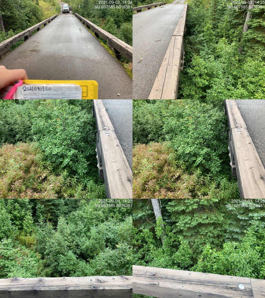
|
|||
| Comments: Bridge. 14:22 |
| Location and Stream Data |
|
Crossing Characteristics | – |
|---|---|---|---|
| Date | 2021-09-03 | Crossing Sub Type | Bridge |
| PSCIS ID | 198018 | Diameter (m) | 11 |
| External ID | 14000685 | Length (m) | 4 |
| Crew | KP | Embedded | – |
| UTM Zone | 9 | Depth Embedded (m) | – |
| Easting | 607509 | Resemble Channel | – |
| Northing | 6013247 | Backwatered | – |
| Stream | Tributary to Thautil River | Percent Backwatered | – |
| Road | Chisholm FSR | Fill Depth (m) | – |
| Road Tenure | FLNR DND 9946 | Outlet Drop (m) | – |
| Channel Width (m) | – | Outlet Pool Depth (m) | – |
| Stream Slope (%) | – | Inlet Drop | – |
| Beaver Activity | – | Slope (%) | – |
| Habitat Value | – | Valley Fill | – |
| Final score | 0 | Barrier Result | Passable |
| Fix type | – | Fix Span / Diameter | – |
Photos: PSCIS ID 198018. From top left clockwise: Road/Site Card, Barrel, Outlet, Downstream, Upstream, Inlet.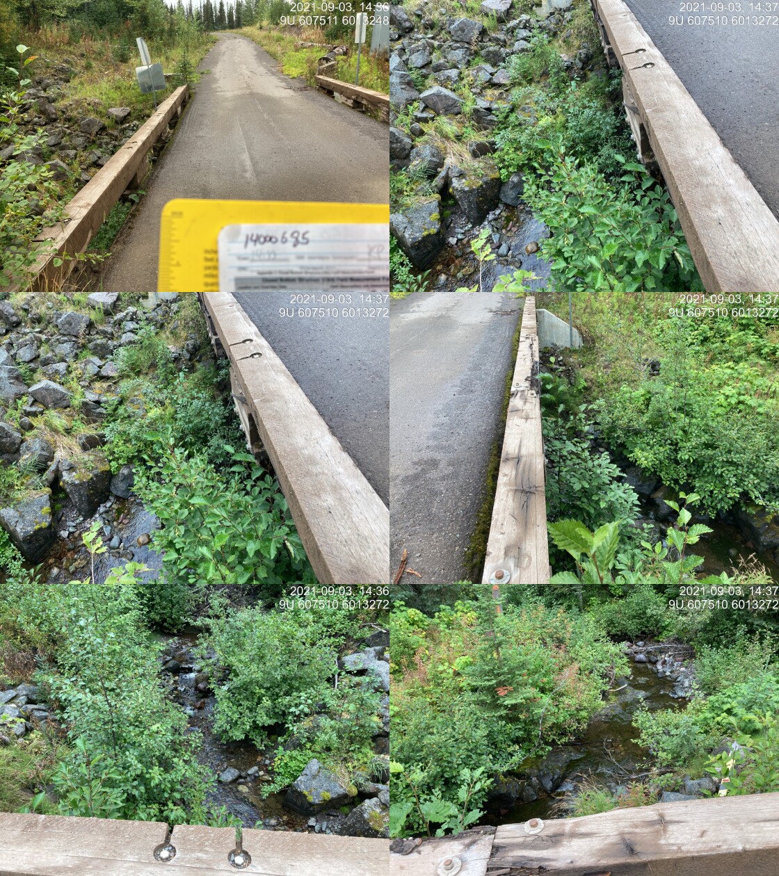
|
|||
| Comments: Bridge. 14:33 |
| Location and Stream Data |
|
Crossing Characteristics | – |
|---|---|---|---|
| Date | 2021-09-03 | Crossing Sub Type | Round Culvert |
| PSCIS ID | 198019 | Diameter (m) | 1 |
| External ID | 14000669 | Length (m) | 12 |
| Crew | KP | Embedded | No |
| UTM Zone | 9 | Depth Embedded (m) | – |
| Easting | 607690.2 | Resemble Channel | No |
| Northing | 6012189 | Backwatered | No |
| Stream | Tributary to Thautil River | Percent Backwatered | – |
| Road | Chisholm FSR | Fill Depth (m) | 2.5 |
| Road Tenure | FLNR DND 9946 | Outlet Drop (m) | 0.12 |
| Channel Width (m) | 1.6 | Outlet Pool Depth (m) | 0.5 |
| Stream Slope (%) | 5 | Inlet Drop | Yes |
| Beaver Activity | No | Slope (%) | 4.5 |
| Habitat Value | Medium | Valley Fill | Deep Fill |
| Final score | 26 | Barrier Result | Barrier |
| Fix type | Replace Structure with Streambed Simulation CBS | Fix Span / Diameter | 3 |
Photos: PSCIS ID 198019. From top left clockwise: Road/Site Card, Barrel, Outlet, Downstream, Upstream, Inlet.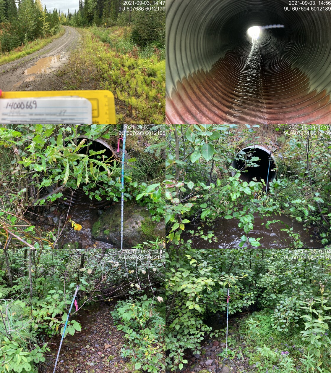
|
|||
| Comments: Initially ~1.6m channel, then ~40m upstream goes underground and channel down to 1.1 or 0.9m. Inlet drop ~0.25m in front of inlet. Culvert slope challenging due to angle and deformed middle of culvert. 14:46 |
| Location and Stream Data |
|
Crossing Characteristics | – |
|---|---|---|---|
| Date | 2021-09-03 | Crossing Sub Type | Round Culvert |
| PSCIS ID | 198020 | Diameter (m) | 0.6 |
| External ID | 14000688 | Length (m) | 16 |
| Crew | KP | Embedded | No |
| UTM Zone | 9 | Depth Embedded (m) | – |
| Easting | 614148.2 | Resemble Channel | No |
| Northing | 6008425 | Backwatered | No |
| Stream | Tributary to Thautil River | Percent Backwatered | – |
| Road | Chisholm FSR | Fill Depth (m) | 2.5 |
| Road Tenure | FLNR DND 9946 | Outlet Drop (m) | 0 |
| Channel Width (m) | 0 | Outlet Pool Depth (m) | 0 |
| Stream Slope (%) | 4 | Inlet Drop | No |
| Beaver Activity | No | Slope (%) | 5 |
| Habitat Value | Low | Valley Fill | Deep Fill |
| Final score | 23 | Barrier Result | Barrier |
| Fix type | Replace Structure with Streambed Simulation CBS | Fix Span / Diameter | 3 |
Photos: PSCIS ID 198020. From top left clockwise: Road/Site Card, Barrel, Outlet, Downstream, Upstream, Inlet.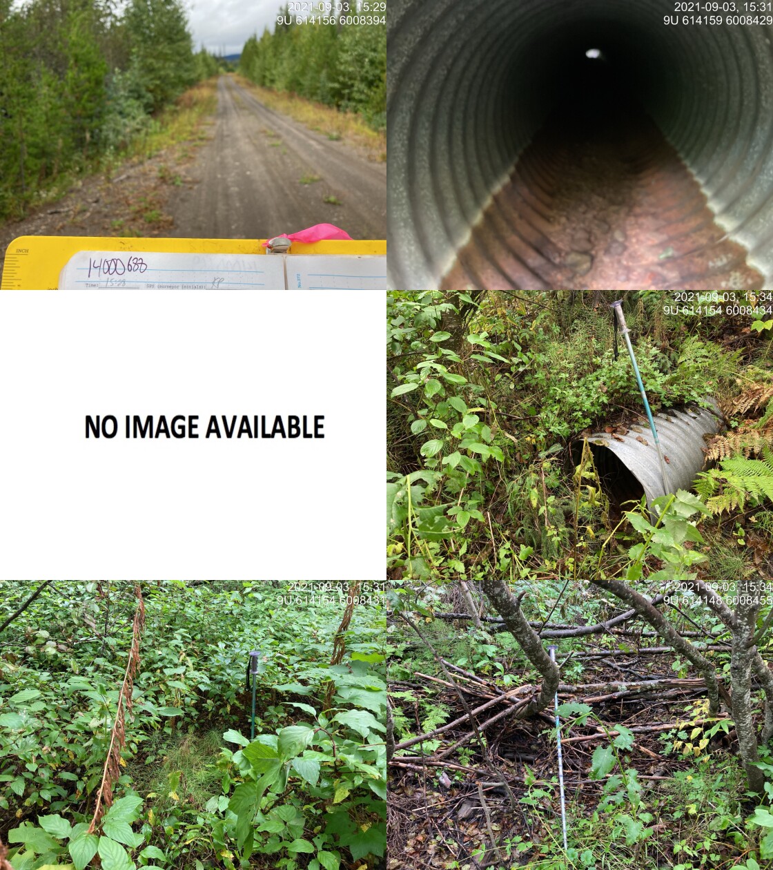
|
|||
| Comments: No channel found downstream. Not fish habitat. No channel upstream either. 15:28 |
| Location and Stream Data |
|
Crossing Characteristics | – |
|---|---|---|---|
| Date | 2021-09-03 | Crossing Sub Type | Bridge |
| PSCIS ID | 198021 | Diameter (m) | 17 |
| External ID | 14000546 | Length (m) | 4 |
| Crew | KP | Embedded | – |
| UTM Zone | 9 | Depth Embedded (m) | – |
| Easting | 614944.7 | Resemble Channel | – |
| Northing | 6010129 | Backwatered | – |
| Stream | Tagit Creek | Percent Backwatered | – |
| Road | Spur | Fill Depth (m) | – |
| Road Tenure | FLNR DND 9946 | Outlet Drop (m) | – |
| Channel Width (m) | – | Outlet Pool Depth (m) | – |
| Stream Slope (%) | – | Inlet Drop | – |
| Beaver Activity | – | Slope (%) | – |
| Habitat Value | – | Valley Fill | – |
| Final score | 0 | Barrier Result | Passable |
| Fix type | – | Fix Span / Diameter | – |
Photos: PSCIS ID 198021. From top left clockwise: Road/Site Card, Barrel, Outlet, Downstream, Upstream, Inlet.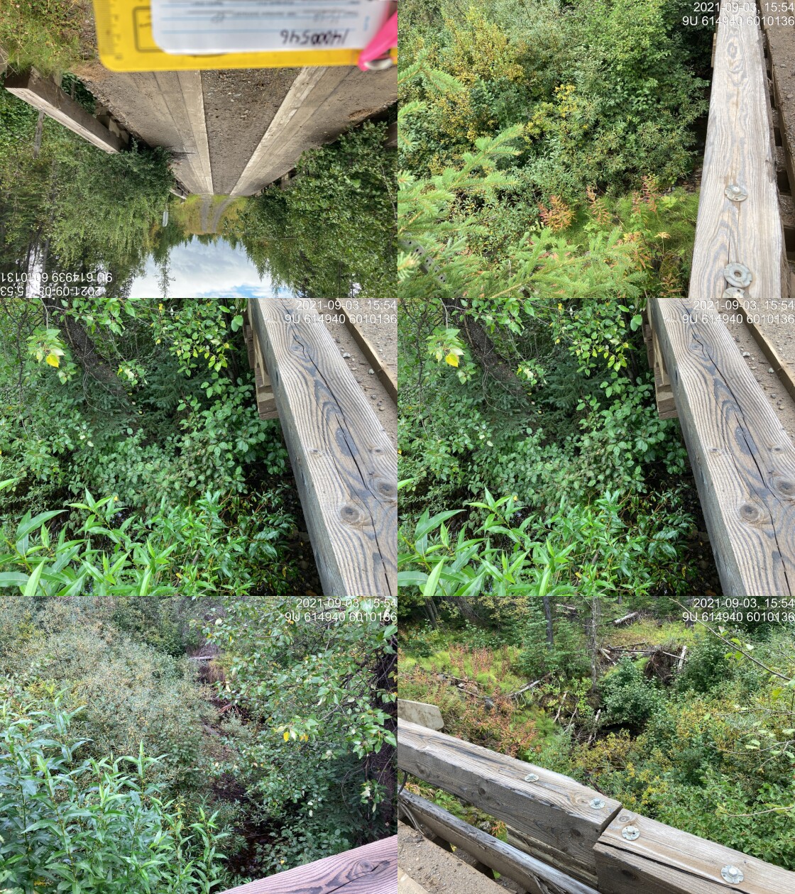
|
|||
| Comments: Bridge. 15:52 |
| Location and Stream Data |
|
Crossing Characteristics | – |
|---|---|---|---|
| Date | 2021-09-03 | Crossing Sub Type | Round Culvert |
| PSCIS ID | 198022 | Diameter (m) | 1 |
| External ID | 14001769 | Length (m) | 11 |
| Crew | KP | Embedded | No |
| UTM Zone | 9 | Depth Embedded (m) | – |
| Easting | 614711.5 | Resemble Channel | No |
| Northing | 6009971 | Backwatered | Yes |
| Stream | Tributary to Tagit Creek | Percent Backwatered | 10 |
| Road | 5 Road | Fill Depth (m) | 2 |
| Road Tenure | Resource | Outlet Drop (m) | 0 |
| Channel Width (m) | 1.4 | Outlet Pool Depth (m) | 0.3 |
| Stream Slope (%) | 4.5 | Inlet Drop | Yes |
| Beaver Activity | No | Slope (%) | 3.5 |
| Habitat Value | Medium | Valley Fill | Deep Fill |
| Final score | 26 | Barrier Result | Barrier |
| Fix type | Replace Structure with Streambed Simulation CBS | Fix Span / Diameter | 3 |
Photos: PSCIS ID 198022. From top left clockwise: Road/Site Card, Barrel, Outlet, Downstream, Upstream, Inlet.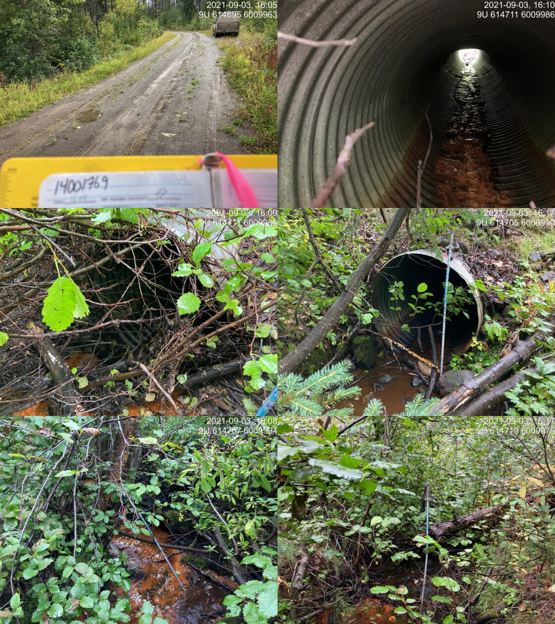
|
|||
| Comments: No beaver activity observed but suspected beaver dam upstream due to slow/low flow, and reddish brown algae observed at other beaver site. Inlet drop 0.27. Backwatered a little with pool downstream. Slope tough due to big bend in middle of culvert. 16:04 |
| Location and Stream Data |
|
Crossing Characteristics | – |
|---|---|---|---|
| Date | 2021-09-03 | Crossing Sub Type | Bridge |
| PSCIS ID | 198023 | Diameter (m) | 12 |
| External ID | 14001103 | Length (m) | 4 |
| Crew | KP | Embedded | – |
| UTM Zone | 9 | Depth Embedded (m) | – |
| Easting | 614567.8 | Resemble Channel | – |
| Northing | 6008396 | Backwatered | – |
| Stream | Tributary to Tagit Creek | Percent Backwatered | – |
| Road | 5 Road | Fill Depth (m) | – |
| Road Tenure | FLNR DND 9946 | Outlet Drop (m) | – |
| Channel Width (m) | – | Outlet Pool Depth (m) | – |
| Stream Slope (%) | – | Inlet Drop | – |
| Beaver Activity | – | Slope (%) | – |
| Habitat Value | – | Valley Fill | – |
| Final score | 0 | Barrier Result | Passable |
| Fix type | – | Fix Span / Diameter | – |
Photos: PSCIS ID 198023. From top left clockwise: Road/Site Card, Barrel, Outlet, Downstream, Upstream, Inlet.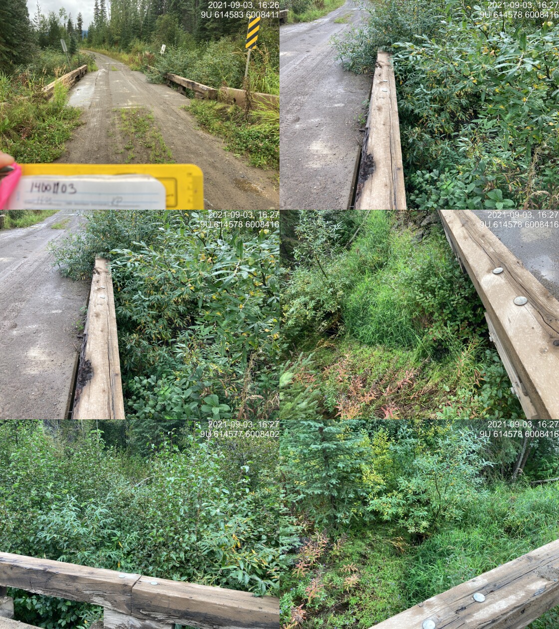
|
|||
| Comments: Bridge. 16:25 |
| Location and Stream Data |
|
Crossing Characteristics | – |
|---|---|---|---|
| Date | 2021-09-03 | Crossing Sub Type | Bridge |
| PSCIS ID | 198024 | Diameter (m) | 10 |
| External ID | 14001175 | Length (m) | 4 |
| Crew | KP | Embedded | – |
| UTM Zone | 9 | Depth Embedded (m) | – |
| Easting | 620580.2 | Resemble Channel | – |
| Northing | 6010857 | Backwatered | – |
| Stream | Tributary to Tagit Creek | Percent Backwatered | – |
| Road | False Tagit FSR | Fill Depth (m) | – |
| Road Tenure | FLNR DND 9946 | Outlet Drop (m) | – |
| Channel Width (m) | – | Outlet Pool Depth (m) | – |
| Stream Slope (%) | – | Inlet Drop | – |
| Beaver Activity | – | Slope (%) | – |
| Habitat Value | – | Valley Fill | – |
| Final score | 0 | Barrier Result | Passable |
| Fix type | – | Fix Span / Diameter | – |
Photos: PSCIS ID 198024. From top left clockwise: Road/Site Card, Barrel, Outlet, Downstream, Upstream, Inlet.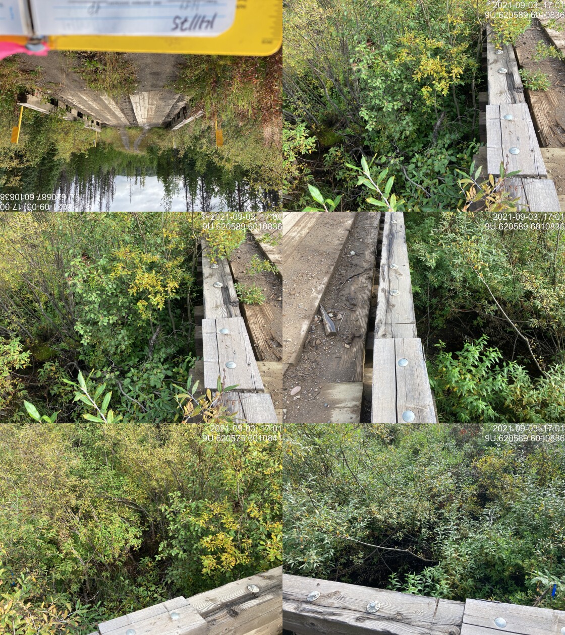
|
|||
| Comments: Bridge. 16:59 |
| Location and Stream Data |
|
Crossing Characteristics | – |
|---|---|---|---|
| Date | 2021-09-03 | Crossing Sub Type | Bridge |
| PSCIS ID | 198025 | Diameter (m) | 12 |
| External ID | 14000677 | Length (m) | 4 |
| Crew | KP | Embedded | – |
| UTM Zone | 9 | Depth Embedded (m) | – |
| Easting | 619787.9 | Resemble Channel | – |
| Northing | 6008369 | Backwatered | – |
| Stream | Tributary to Thautil River | Percent Backwatered | – |
| Road | Chisholm FSR | Fill Depth (m) | – |
| Road Tenure | FLNR DND 9946 | Outlet Drop (m) | – |
| Channel Width (m) | – | Outlet Pool Depth (m) | – |
| Stream Slope (%) | – | Inlet Drop | – |
| Beaver Activity | – | Slope (%) | – |
| Habitat Value | – | Valley Fill | – |
| Final score | 0 | Barrier Result | Passable |
| Fix type | – | Fix Span / Diameter | – |
Photos: PSCIS ID 198025. From top left clockwise: Road/Site Card, Barrel, Outlet, Downstream, Upstream, Inlet.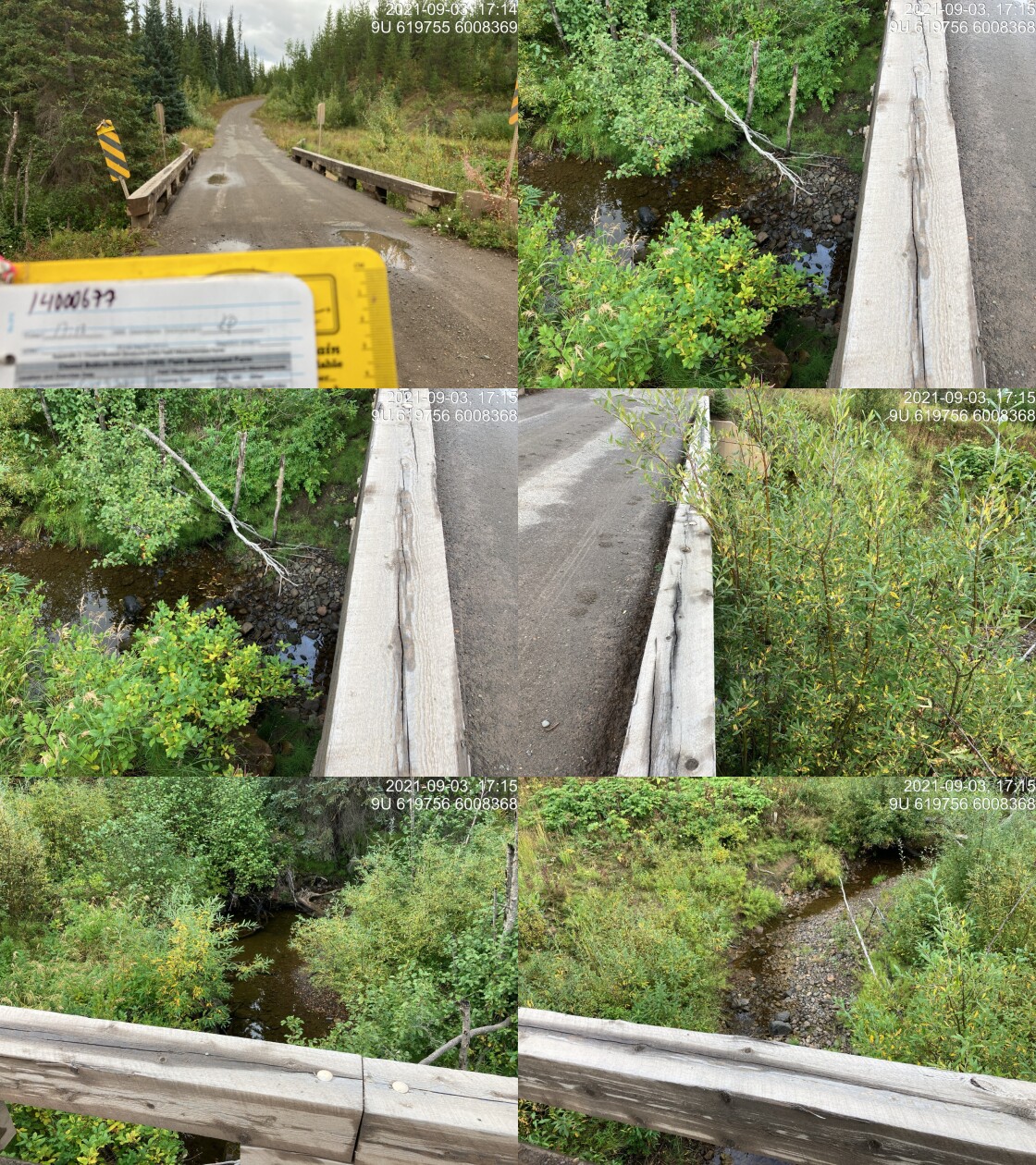
|
|||
| Comments: Bridge. 17:13 |
| Location and Stream Data |
|
Crossing Characteristics | – |
|---|---|---|---|
| Date | 2021-09-03 | Crossing Sub Type | Round Culvert |
| PSCIS ID | 198026 | Diameter (m) | 0.5 |
| External ID | 14000697 | Length (m) | 13 |
| Crew | KP | Embedded | No |
| UTM Zone | 9 | Depth Embedded (m) | – |
| Easting | 620771.3 | Resemble Channel | No |
| Northing | 6007645 | Backwatered | No |
| Stream | Tributary to Thautil River | Percent Backwatered | – |
| Road | Chisholm FSR | Fill Depth (m) | 1 |
| Road Tenure | FLNR DND 9946 | Outlet Drop (m) | 0.05 |
| Channel Width (m) | 0.7 | Outlet Pool Depth (m) | 0.12 |
| Stream Slope (%) | 7 | Inlet Drop | No |
| Beaver Activity | No | Slope (%) | 3 |
| Habitat Value | Low | Valley Fill | Deep Fill |
| Final score | 26 | Barrier Result | Barrier |
| Fix type | Replace Structure with Streambed Simulation CBS | Fix Span / Diameter | 3 |
Photos: PSCIS ID 198026. From top left clockwise: Road/Site Card, Barrel, Outlet, Downstream, Upstream, Inlet.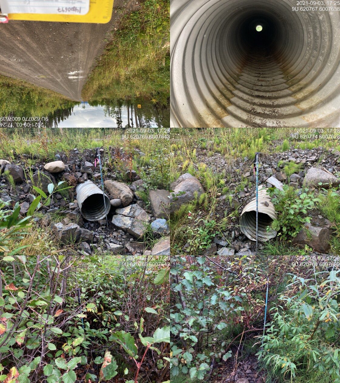
|
|||
| Comments: Dry channel. Upstream channel not well defined. Slope of stream estimated. Unlikely fish bearing. 17:20 |
| Location and Stream Data |
|
Crossing Characteristics | – |
|---|---|---|---|
| Date | 2021-09-03 | Crossing Sub Type | Bridge |
| PSCIS ID | 198027 | Diameter (m) | 10 |
| External ID | 14000692 | Length (m) | 4 |
| Crew | KP | Embedded | – |
| UTM Zone | 9 | Depth Embedded (m) | – |
| Easting | 625143.8 | Resemble Channel | – |
| Northing | 6007956 | Backwatered | – |
| Stream | Tributary to Thautil River | Percent Backwatered | – |
| Road | Chisholm FSR | Fill Depth (m) | – |
| Road Tenure | FLNR DND 9946 | Outlet Drop (m) | – |
| Channel Width (m) | – | Outlet Pool Depth (m) | – |
| Stream Slope (%) | – | Inlet Drop | – |
| Beaver Activity | – | Slope (%) | – |
| Habitat Value | – | Valley Fill | – |
| Final score | 0 | Barrier Result | Passable |
| Fix type | – | Fix Span / Diameter | – |
Photos: PSCIS ID 198027. From top left clockwise: Road/Site Card, Barrel, Outlet, Downstream, Upstream, Inlet.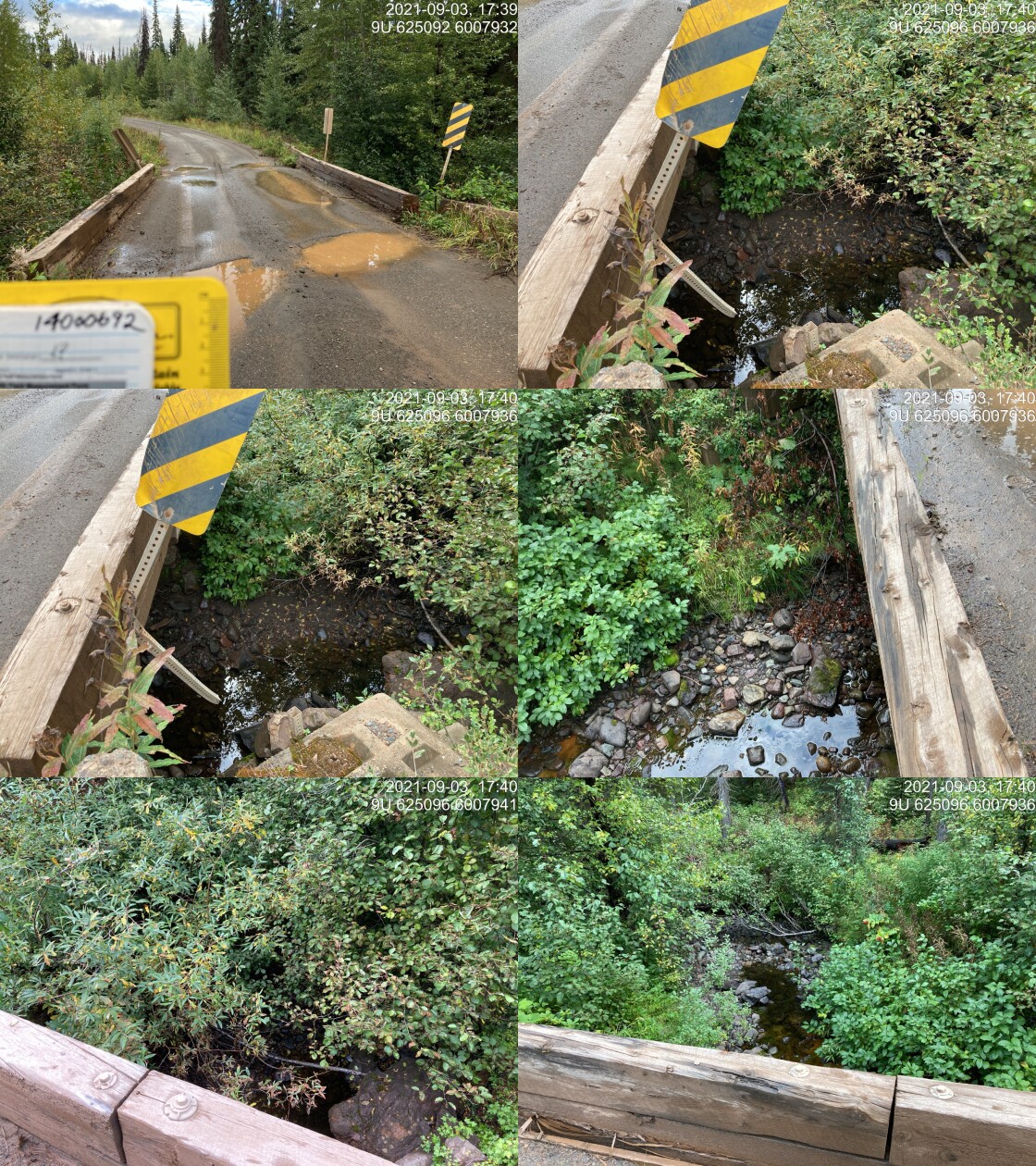
|
|||
| Comments: Bridge. 17:38 |
| Location and Stream Data |
|
Crossing Characteristics | – |
|---|---|---|---|
| Date | 2021-09-03 | Crossing Sub Type | Round Culvert |
| PSCIS ID | 198028 | Diameter (m) | 1.2 |
| External ID | 14000683 | Length (m) | 17 |
| Crew | KP | Embedded | No |
| UTM Zone | 9 | Depth Embedded (m) | – |
| Easting | 627065 | Resemble Channel | No |
| Northing | 6008380 | Backwatered | No |
| Stream | Tributary to Thautil River | Percent Backwatered | – |
| Road | Chisholm FSR | Fill Depth (m) | 2 |
| Road Tenure | FLNR DND 9946 | Outlet Drop (m) | 0.12 |
| Channel Width (m) | 1.1 | Outlet Pool Depth (m) | 0.17 |
| Stream Slope (%) | 5 | Inlet Drop | No |
| Beaver Activity | No | Slope (%) | 3.5 |
| Habitat Value | Low | Valley Fill | Deep Fill |
| Final score | 23 | Barrier Result | Barrier |
| Fix type | Replace Structure with Streambed Simulation CBS | Fix Span / Diameter | 3 |
Photos: PSCIS ID 198028. From top left clockwise: Road/Site Card, Barrel, Outlet, Downstream, Upstream, Inlet.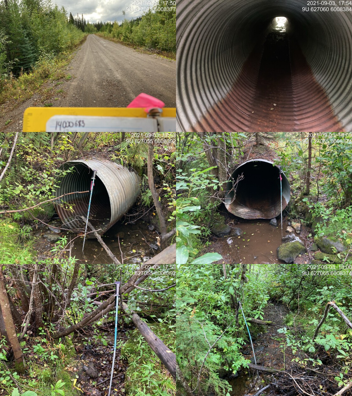
|
|||
| Comments: No water flowing however pools of stagnant water throughout. Culvert bent in the middle and appears to have some substrate and stagnant water in the middle. 17:49 |
| Location and Stream Data |
|
Crossing Characteristics | – |
|---|---|---|---|
| Date | 2021-09-03 | Crossing Sub Type | Round Culvert |
| PSCIS ID | 198029 | Diameter (m) | 1 |
| External ID | 14000694 | Length (m) | 21 |
| Crew | KP | Embedded | No |
| UTM Zone | 9 | Depth Embedded (m) | – |
| Easting | 628708 | Resemble Channel | No |
| Northing | 6009766 | Backwatered | No |
| Stream | Tributary to Thautil River | Percent Backwatered | – |
| Road | Chisholm FSR | Fill Depth (m) | 1 |
| Road Tenure | FLNR DND 9946 | Outlet Drop (m) | 0 |
| Channel Width (m) | 0.9 | Outlet Pool Depth (m) | 0 |
| Stream Slope (%) | 7 | Inlet Drop | Yes |
| Beaver Activity | No | Slope (%) | 5 |
| Habitat Value | Low | Valley Fill | Deep Fill |
| Final score | 23 | Barrier Result | Barrier |
| Fix type | Replace Structure with Streambed Simulation CBS | Fix Span / Diameter | 3 |
Photos: PSCIS ID 198029. From top left clockwise: Road/Site Card, Barrel, Outlet, Downstream, Upstream, Inlet.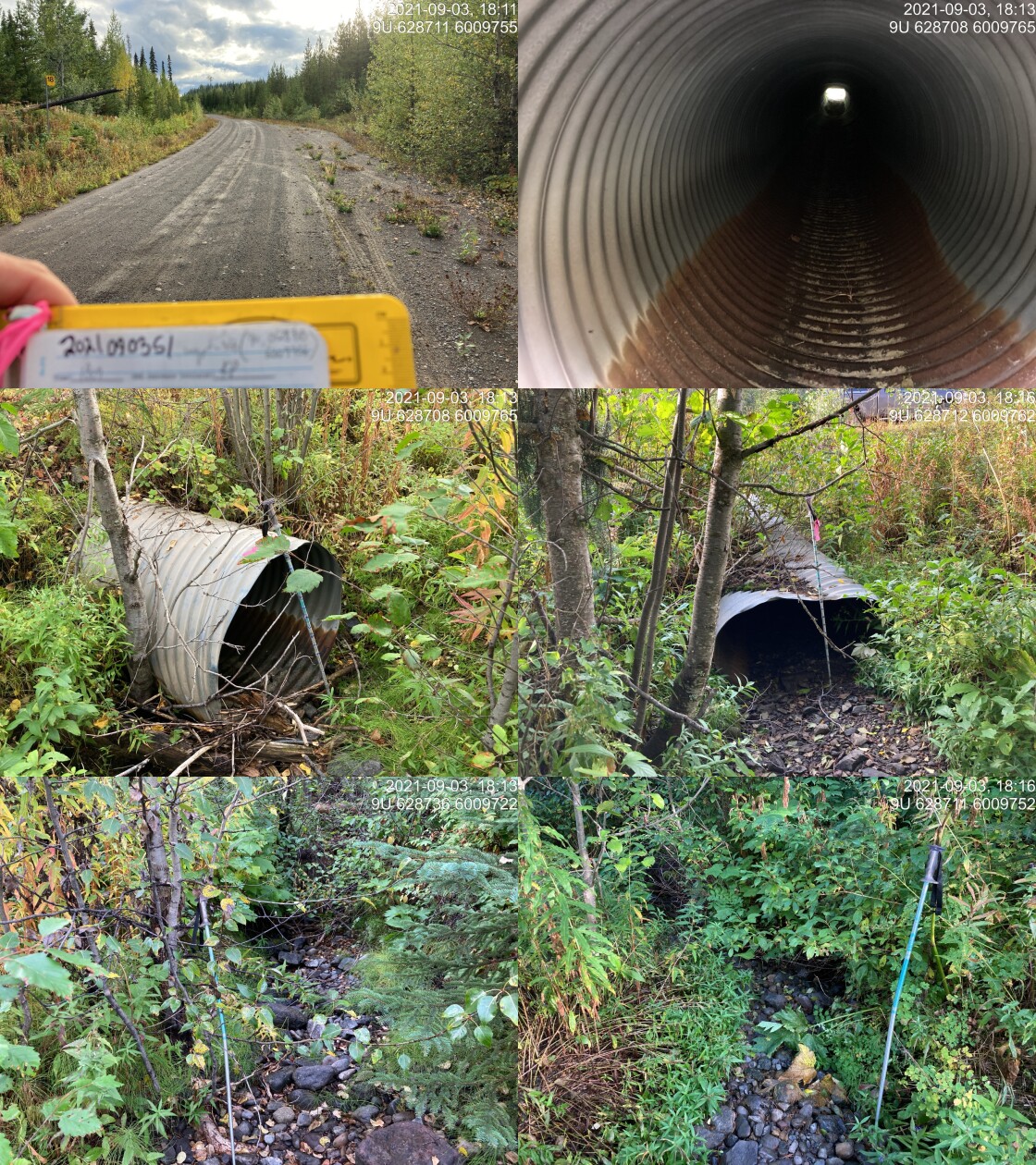
|
|||
| Comments: Dry channel, upstream slope estimated. Inlet drop 0.2m. Culvert slope difficult to get due to misshapen structure. Outlet embedded a little bit. 18:09 |
| Location and Stream Data |
|
Crossing Characteristics | – |
|---|---|---|---|
| Date | 2021-08-11 | Crossing Sub Type | Round Culvert |
| PSCIS ID | 198030 | Diameter (m) | 0.7 |
| External ID | 14000823 | Length (m) | 12 |
| Crew | LRH DM | Embedded | No |
| UTM Zone | 9 | Depth Embedded (m) | – |
| Easting | 623571 | Resemble Channel | No |
| Northing | 6001711 | Backwatered | No |
| Stream | Tributary to Lamprey Creek | Percent Backwatered | – |
| Road | Morice FSR | Fill Depth (m) | 1.5 |
| Road Tenure | FLNR DND 4656 | Outlet Drop (m) | 0.05 |
| Channel Width (m) | 1 | Outlet Pool Depth (m) | 0.45 |
| Stream Slope (%) | 15 | Inlet Drop | Yes |
| Beaver Activity | No | Slope (%) | 2 |
| Habitat Value | Low | Valley Fill | Deep Fill |
| Final score | 21 | Barrier Result | Barrier |
| Fix type | Replace Structure with Streambed Simulation CBS | Fix Span / Diameter | 3 |
Photos: PSCIS ID 198030. From top left clockwise: Road/Site Card, Barrel, Outlet, Downstream, Upstream, Inlet.
|
|||
| Comments: Water flowing in channel up and down stream. |
| Location and Stream Data |
|
Crossing Characteristics | – |
|---|---|---|---|
| Date | 2021-09-05 | Crossing Sub Type | Ford |
| PSCIS ID | 198031 | Diameter (m) | – |
| External ID | 1801166 | Length (m) | – |
| Crew | KP | Embedded | – |
| UTM Zone | 9 | Depth Embedded (m) | – |
| Easting | 675438.9 | Resemble Channel | – |
| Northing | 6044630 | Backwatered | – |
| Stream | Cesford Creek | Percent Backwatered | – |
| Road | Spur | Fill Depth (m) | – |
| Road Tenure | Unclassified | Outlet Drop (m) | – |
| Channel Width (m) | – | Outlet Pool Depth (m) | – |
| Stream Slope (%) | – | Inlet Drop | – |
| Beaver Activity | – | Slope (%) | – |
| Habitat Value | – | Valley Fill | – |
| Final score | 0 | Barrier Result | Unknown |
| Fix type | – | Fix Span / Diameter | – |
Photos: PSCIS ID 198031. From top left clockwise: Road/Site Card, Barrel, Outlet, Downstream, Upstream, Inlet.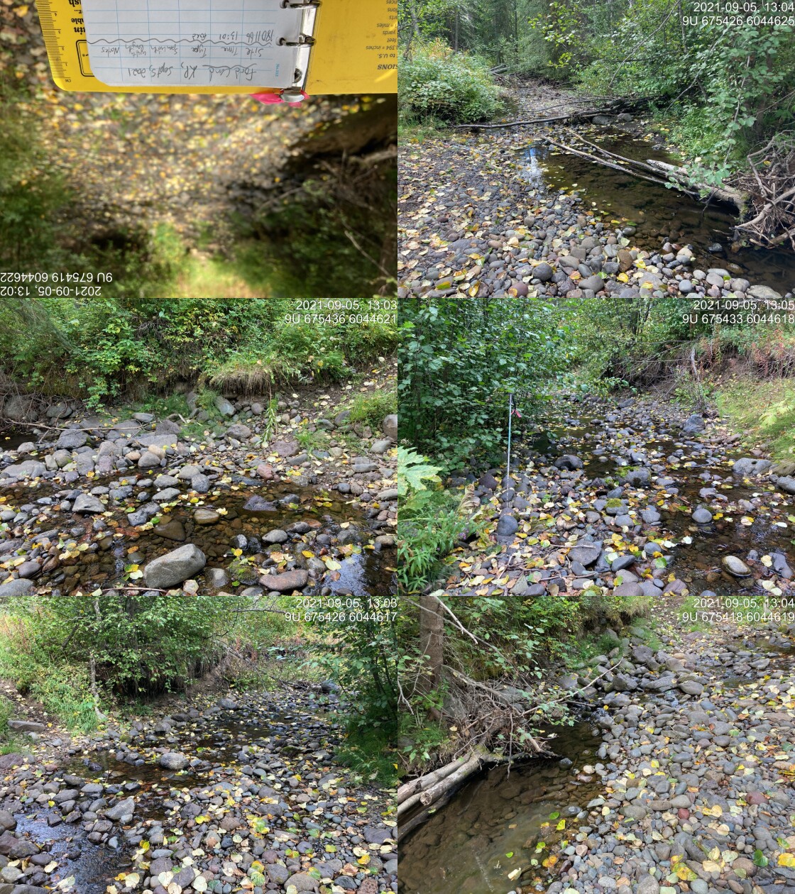
|
|||
| Comments: Ford. 13:01 |
| Location and Stream Data |
|
Crossing Characteristics | – |
|---|---|---|---|
| Date | 2021-09-05 | Crossing Sub Type | Ford |
| PSCIS ID | 198032 | Diameter (m) | – |
| External ID | 1801165 | Length (m) | – |
| Crew | KP | Embedded | – |
| UTM Zone | 9 | Depth Embedded (m) | – |
| Easting | 675402 | Resemble Channel | – |
| Northing | 6044909 | Backwatered | – |
| Stream | McRea Creek | Percent Backwatered | – |
| Road | Spur | Fill Depth (m) | – |
| Road Tenure | Unclassified | Outlet Drop (m) | – |
| Channel Width (m) | – | Outlet Pool Depth (m) | – |
| Stream Slope (%) | – | Inlet Drop | – |
| Beaver Activity | – | Slope (%) | – |
| Habitat Value | – | Valley Fill | – |
| Final score | 0 | Barrier Result | Unknown |
| Fix type | – | Fix Span / Diameter | – |
Photos: PSCIS ID 198032. From top left clockwise: Road/Site Card, Barrel, Outlet, Downstream, Upstream, Inlet.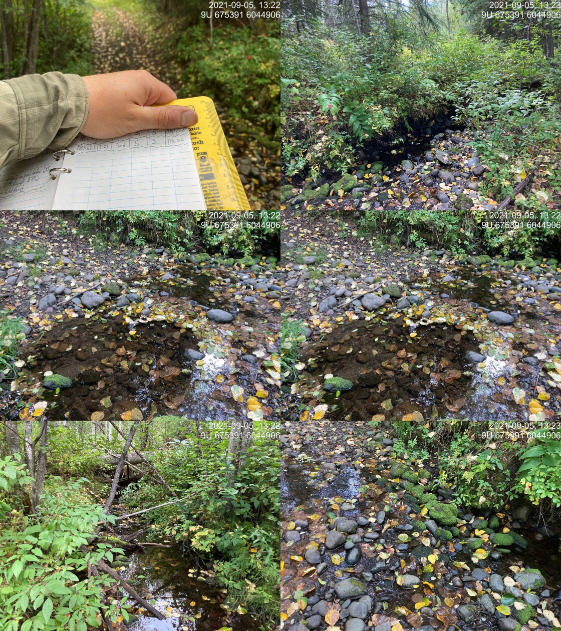
|
|||
| Comments: Ford. 13:21 |
| Location and Stream Data |
|
Crossing Characteristics | – |
|---|---|---|---|
| Date | 2021-09-06 | Crossing Sub Type | Round Culvert |
| PSCIS ID | 198033 | Diameter (m) | 0.4 |
| External ID | 14000395 | Length (m) | 11 |
| Crew | KP AI VJ TP | Embedded | No |
| UTM Zone | 9 | Depth Embedded (m) | – |
| Easting | 605863.8 | Resemble Channel | No |
| Northing | 6023574 | Backwatered | Yes |
| Stream | Tributary to Gabriel Creek | Percent Backwatered | 50 |
| Road | Thautil FSR | Fill Depth (m) | 1.5 |
| Road Tenure | West Fraser R03753 | Outlet Drop (m) | 0 |
| Channel Width (m) | 0.67 | Outlet Pool Depth (m) | 0 |
| Stream Slope (%) | 4 | Inlet Drop | No |
| Beaver Activity | No | Slope (%) | 1.5 |
| Habitat Value | Low | Valley Fill | Deep Fill |
| Final score | 21 | Barrier Result | Barrier |
| Fix type | Replace Structure with Streambed Simulation CBS | Fix Span / Diameter | 3 |
Photos: PSCIS ID 198033. From top left clockwise: Road/Site Card, Barrel, Outlet, Downstream, Upstream, Inlet.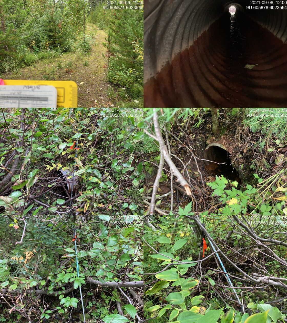
|
|||
| Comments: Small stream, trickling at current water level. 11:44 |
| Location and Stream Data |
|
Crossing Characteristics | – |
|---|---|---|---|
| Date | 2021-09-06 | Crossing Sub Type | Round Culvert |
| PSCIS ID | 198034 | Diameter (m) | 0.9 |
| External ID | 14000994 | Length (m) | 17 |
| Crew | KP AI VJ TP | Embedded | No |
| UTM Zone | 9 | Depth Embedded (m) | – |
| Easting | 603815 | Resemble Channel | No |
| Northing | 6009562 | Backwatered | No |
| Stream | Tributary to Thautil River | Percent Backwatered | – |
| Road | Thautil FSR | Fill Depth (m) | 4 |
| Road Tenure | FLNR DND 9785 | Outlet Drop (m) | 0.34 |
| Channel Width (m) | 0.6 | Outlet Pool Depth (m) | 0.31 |
| Stream Slope (%) | 1 | Inlet Drop | No |
| Beaver Activity | No | Slope (%) | 2 |
| Habitat Value | Medium | Valley Fill | Deep Fill |
| Final score | 28 | Barrier Result | Barrier |
| Fix type | Replace Structure with Streambed Simulation CBS | Fix Span / Diameter | 3 |
Photos: PSCIS ID 198034. From top left clockwise: Road/Site Card, Barrel, Outlet, Downstream, Upstream, Inlet.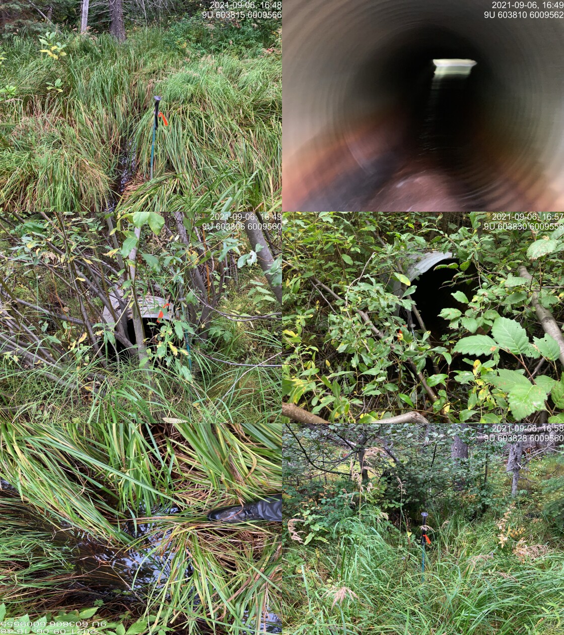
|
|||
| Comments: Upstream sedge wetland looking habitat with distinct narrow channel. Outlet drop, and small pool. Small vegetation embedment. Stream trickling. Similar sedge / wetland habitat downstream. 16:46 |
| Location and Stream Data |
|
Crossing Characteristics | – |
|---|---|---|---|
| Date | 2021-09-06 | Crossing Sub Type | Round Culvert |
| PSCIS ID | 198035 | Diameter (m) | 1 |
| External ID | 14000398 | Length (m) | 13 |
| Crew | KP | Embedded | No |
| UTM Zone | 9 | Depth Embedded (m) | – |
| Easting | 605437 | Resemble Channel | No |
| Northing | 6021867 | Backwatered | No |
| Stream | Tributary to Gabriel Creek | Percent Backwatered | – |
| Road | Thautil FSR | Fill Depth (m) | 2 |
| Road Tenure | West Fraser R03753 | Outlet Drop (m) | 0.18 |
| Channel Width (m) | 1.17 | Outlet Pool Depth (m) | 0.26 |
| Stream Slope (%) | 6 | Inlet Drop | Yes |
| Beaver Activity | No | Slope (%) | 5 |
| Habitat Value | Low | Valley Fill | Deep Fill |
| Final score | 28 | Barrier Result | Barrier |
| Fix type | Replace Structure with Streambed Simulation CBS | Fix Span / Diameter | 3 |
Photos: PSCIS ID 198035. From top left clockwise: Road/Site Card, Barrel, Outlet, Downstream, Upstream, Inlet.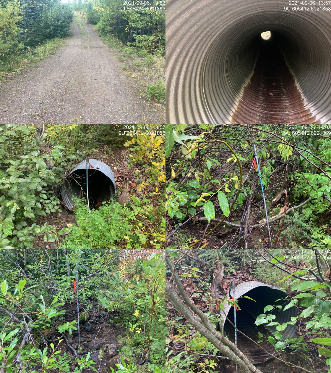
|
|||
| Comments: Dry channel. 13:53 |
| Location and Stream Data |
|
Crossing Characteristics | – |
|---|---|---|---|
| Date | 2021-09-06 | Crossing Sub Type | Round Culvert |
| PSCIS ID | 198036 | Diameter (m) | 0.9 |
| External ID | 14000377 | Length (m) | 24 |
| Crew | KP | Embedded | No |
| UTM Zone | 9 | Depth Embedded (m) | – |
| Easting | 606924.1 | Resemble Channel | No |
| Northing | 6020704 | Backwatered | No |
| Stream | Tributary to Thaultil River | Percent Backwatered | – |
| Road | Thautil FSR | Fill Depth (m) | 4.5 |
| Road Tenure | West Fraser R03753 | Outlet Drop (m) | 1.1 |
| Channel Width (m) | 1.9 | Outlet Pool Depth (m) | 0.55 |
| Stream Slope (%) | 8 | Inlet Drop | Yes |
| Beaver Activity | No | Slope (%) | 6 |
| Habitat Value | Medium | Valley Fill | Deep Fill |
| Final score | 39 | Barrier Result | Barrier |
| Fix type | Replace Structure with Streambed Simulation CBS | Fix Span / Diameter | 3 |
Photos: PSCIS ID 198036. From top left clockwise: Road/Site Card, Barrel, Outlet, Downstream, Upstream, Inlet.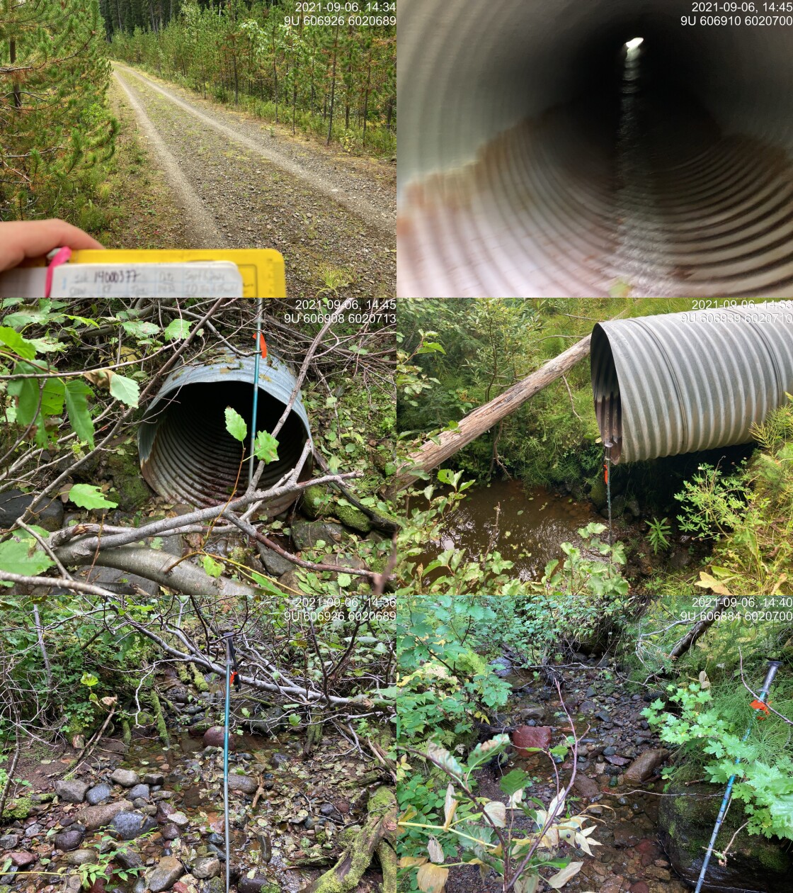
|
|||
| Comments: Fish sighted in outlet pool. Nice little stream, some habitat value. Water flowing below culvert a little. 14:32 |
| Location and Stream Data |
|
Crossing Characteristics | – |
|---|---|---|---|
| Date | 2021-09-06 | Crossing Sub Type | Round Culvert |
| PSCIS ID | 198037 | Diameter (m) | 0.6 |
| External ID | 14000375 | Length (m) | 12 |
| Crew | KP | Embedded | No |
| UTM Zone | 9 | Depth Embedded (m) | – |
| Easting | 605796.6 | Resemble Channel | No |
| Northing | 6016997 | Backwatered | No |
| Stream | Tributary to Thautil River | Percent Backwatered | – |
| Road | Thautil FSR | Fill Depth (m) | 0.3 |
| Road Tenure | West Fraser R03753 | Outlet Drop (m) | 0 |
| Channel Width (m) | 0.65 | Outlet Pool Depth (m) | 0 |
| Stream Slope (%) | 4.5 | Inlet Drop | No |
| Beaver Activity | No | Slope (%) | 2 |
| Habitat Value | Low | Valley Fill | Deep Fill |
| Final score | 18 | Barrier Result | Potential |
| Fix type | Replace Structure with Streambed Simulation CBS | Fix Span / Diameter | 3 |
Photos: PSCIS ID 198037. From top left clockwise: Road/Site Card, Barrel, Outlet, Downstream, Upstream, Inlet.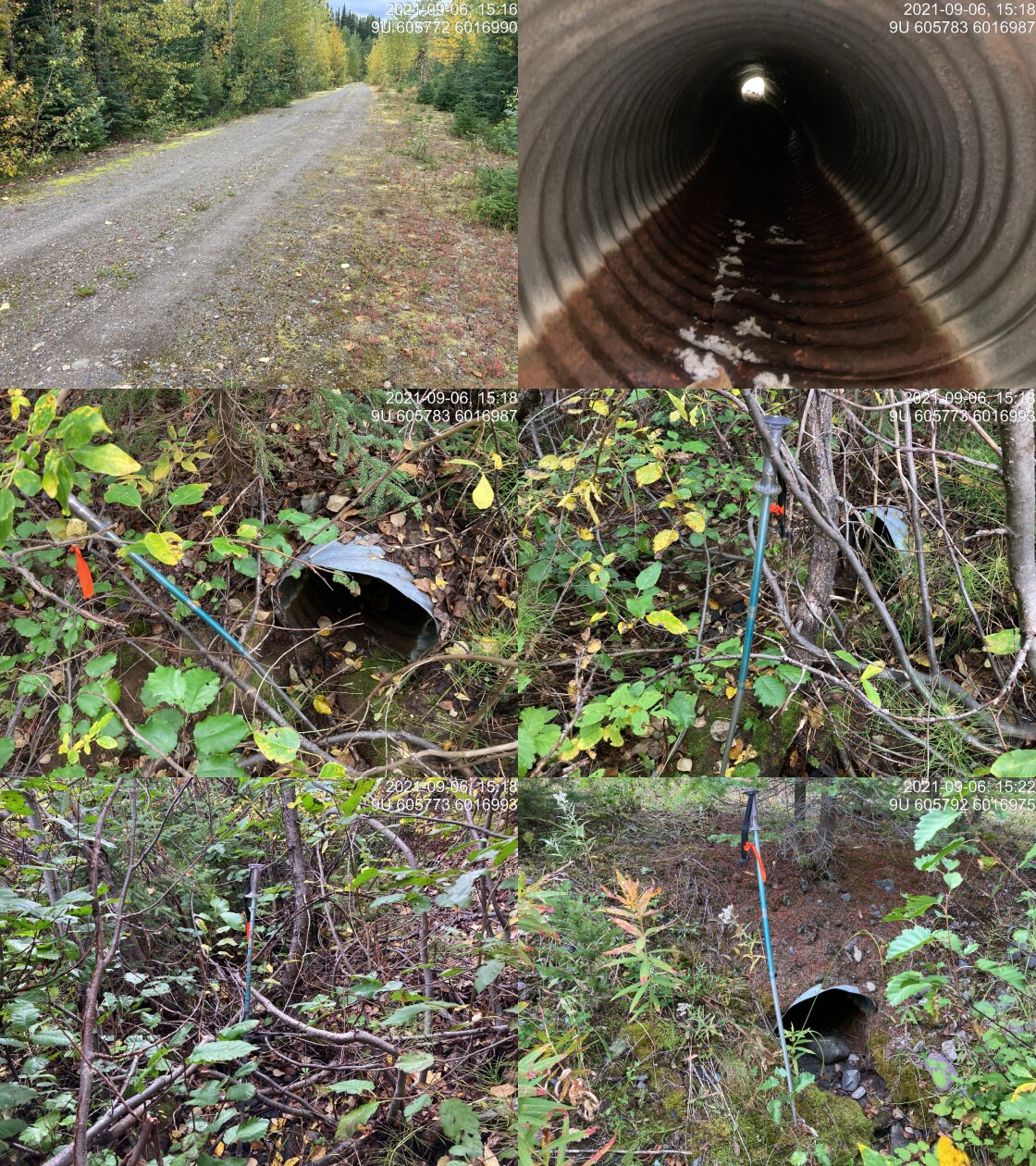
|
|||
| Comments: Dry channel. Upstream channel runs parallel to road, not well defined channel, appears very ephemeral. Downstream channel much more defined. Outlet partially embedded. 15:16 |
| Location and Stream Data |
|
Crossing Characteristics | – |
|---|---|---|---|
| Date | 2021-09-06 | Crossing Sub Type | Round Culvert |
| PSCIS ID | 198038 | Diameter (m) | 0.6 |
| External ID | 14000382 | Length (m) | 11 |
| Crew | KP | Embedded | No |
| UTM Zone | 9 | Depth Embedded (m) | – |
| Easting | 604924 | Resemble Channel | No |
| Northing | 6014325 | Backwatered | No |
| Stream | Tributary to Thautil River | Percent Backwatered | – |
| Road | Thautil FSR | Fill Depth (m) | 1 |
| Road Tenure | West Fraser R03753 | Outlet Drop (m) | 0.17 |
| Channel Width (m) | 0.7 | Outlet Pool Depth (m) | 0.48 |
| Stream Slope (%) | 4 | Inlet Drop | No |
| Beaver Activity | No | Slope (%) | 3 |
| Habitat Value | Low | Valley Fill | Deep Fill |
| Final score | 28 | Barrier Result | Barrier |
| Fix type | Replace Structure with Streambed Simulation CBS | Fix Span / Diameter | 3 |
Photos: PSCIS ID 198038. From top left clockwise: Road/Site Card, Barrel, Outlet, Downstream, Upstream, Inlet.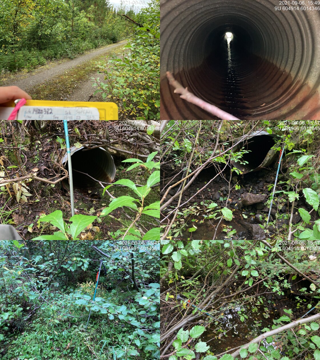
|
|||
| Comments: Dry channel. Upstream channel heavily vegetated and goes below mossy structure 5m towards inlet. Outlet damaged and slightly misshapen. Large outlet pool but still minimal channel downstream that is partially vegetated, and goes under moss. Culvert slope estimated afterwards as not recorded in field. 15:45 |
| Location and Stream Data |
|
Crossing Characteristics | – |
|---|---|---|---|
| Date | 2021-09-06 | Crossing Sub Type | Round Culvert |
| PSCIS ID | 198039 | Diameter (m) | 0.9 |
| External ID | 14000379 | Length (m) | 28 |
| Crew | KP | Embedded | No |
| UTM Zone | 9 | Depth Embedded (m) | – |
| Easting | 604834.9 | Resemble Channel | No |
| Northing | 6012766 | Backwatered | No |
| Stream | Tributary to Thautil River | Percent Backwatered | – |
| Road | Thautil FSR | Fill Depth (m) | 5 |
| Road Tenure | Canfor R07593 | Outlet Drop (m) | 1.6 |
| Channel Width (m) | 1.1 | Outlet Pool Depth (m) | 0.4 |
| Stream Slope (%) | 5 | Inlet Drop | No |
| Beaver Activity | No | Slope (%) | 5 |
| Habitat Value | Low | Valley Fill | Deep Fill |
| Final score | 36 | Barrier Result | Barrier |
| Fix type | Replace Structure with Streambed Simulation CBS | Fix Span / Diameter | 3 |
Photos: PSCIS ID 198039. From top left clockwise: Road/Site Card, Barrel, Outlet, Downstream, Upstream, Inlet.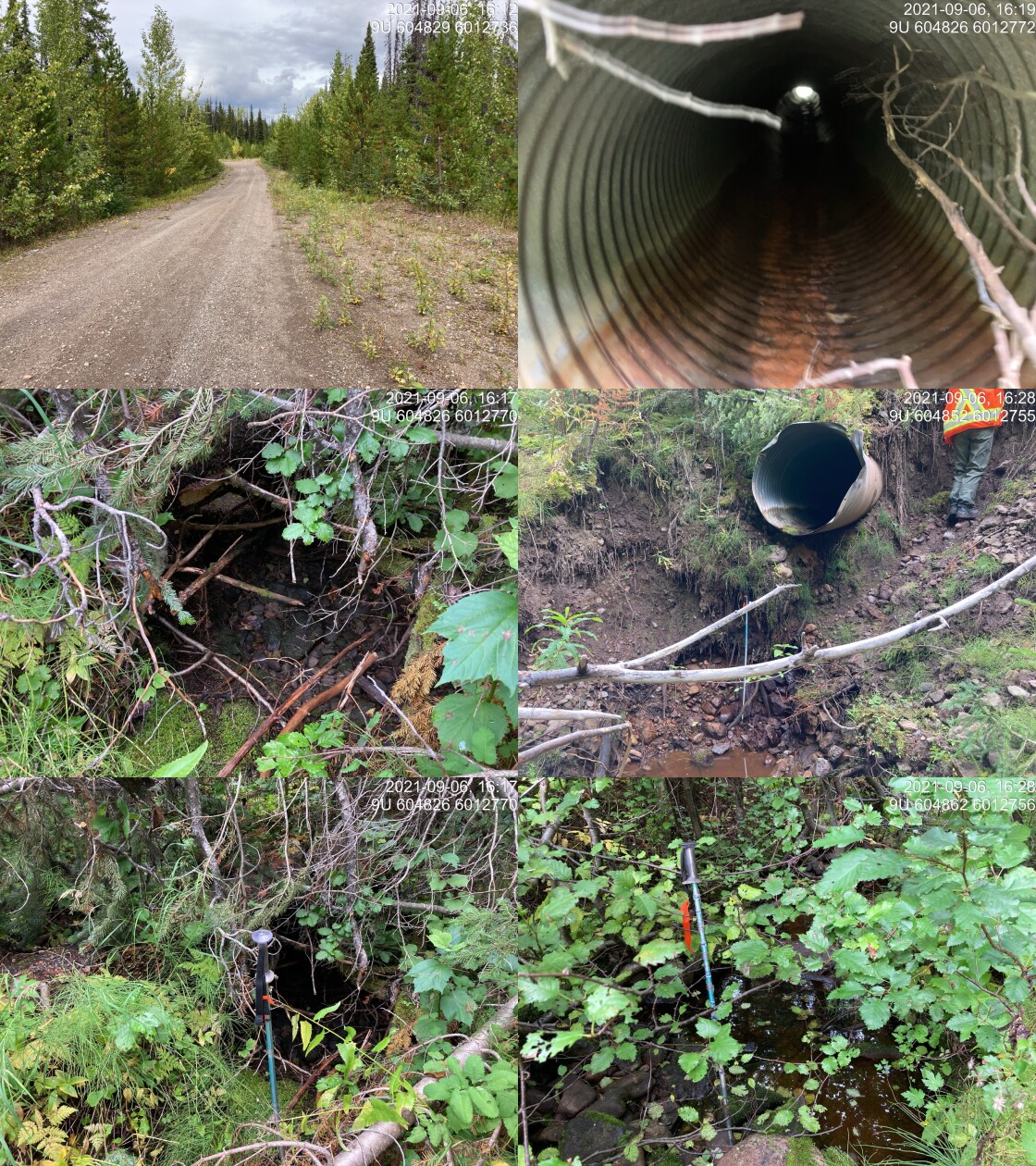
|
|||
| Comments: Upstream channel is partially subsurface below mossy vegetation. Mostly dry with powder pools, huge OD. Downstream channel a bit bigger with larger pools. Creek not flowing. 16:11 |
| Location and Stream Data |
|
Crossing Characteristics | – |
|---|---|---|---|
| Date | 2021-09-08 | Crossing Sub Type | Round Culvert |
| PSCIS ID | 198040 | Diameter (m) | 0.9 |
| External ID | 14000882 | Length (m) | 14 |
| Crew | KP | Embedded | No |
| UTM Zone | 9 | Depth Embedded (m) | – |
| Easting | 607215.9 | Resemble Channel | No |
| Northing | 5997194 | Backwatered | Yes |
| Stream | Tributary to Morice River | Percent Backwatered | 100 |
| Road | Spur | Fill Depth (m) | 0.5 |
| Road Tenure | Canfor R08826 | Outlet Drop (m) | 0 |
| Channel Width (m) | 0.9 | Outlet Pool Depth (m) | 0 |
| Stream Slope (%) | 0.5 | Inlet Drop | No |
| Beaver Activity | Yes | Slope (%) | 1 |
| Habitat Value | Medium | Valley Fill | Deep Fill |
| Final score | 18 | Barrier Result | Potential |
| Fix type | Replace Structure with Streambed Simulation CBS | Fix Span / Diameter | 3 |
Photos: PSCIS ID 198040. From top left clockwise: Road/Site Card, Barrel, Outlet, Downstream, Upstream, Inlet.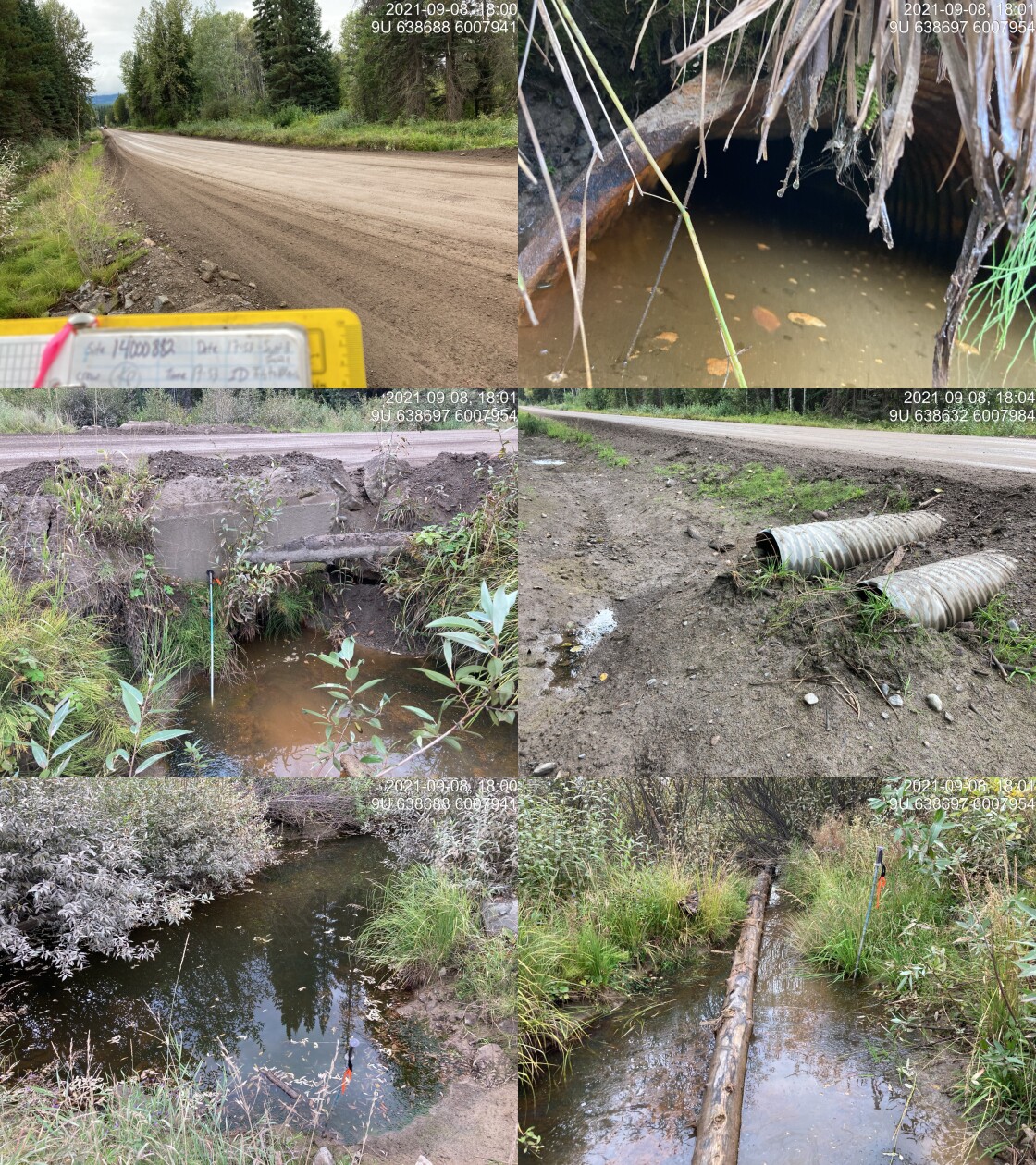
|
|||
| Comments: Culvert 100% covered by mud from beaver activity, otherwise would be flowing through backwatered. Outlet 100% backwatered almost covering culvert in water. Large wetland complex upstream. Infrastructure looks old and in poor shape, retaining wall / cement block tipping over on outlet. Slop estimated based on backwatered status. Additional culvert ~75m down the road to deal with flooding. 17:53 |
| Location and Stream Data |
|
Crossing Characteristics | – |
|---|---|---|---|
| Date | 2021-09-12 | Crossing Sub Type | Bridge |
| PSCIS ID | 198041 | Diameter (m) | 11 |
| External ID | 1802760 | Length (m) | 3 |
| Crew | KP | Embedded | – |
| UTM Zone | 9 | Depth Embedded (m) | – |
| Easting | 640551.2 | Resemble Channel | – |
| Northing | 6053250 | Backwatered | – |
| Stream | Deep Creek | Percent Backwatered | – |
| Road | Spur | Fill Depth (m) | – |
| Road Tenure | Unclassified | Outlet Drop (m) | – |
| Channel Width (m) | – | Outlet Pool Depth (m) | – |
| Stream Slope (%) | – | Inlet Drop | – |
| Beaver Activity | – | Slope (%) | – |
| Habitat Value | – | Valley Fill | – |
| Final score | 0 | Barrier Result | Passable |
| Fix type | – | Fix Span / Diameter | – |
Photos: PSCIS ID 198041. From top left clockwise: Road/Site Card, Barrel, Outlet, Downstream, Upstream, Inlet.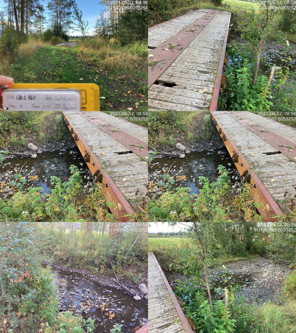
|
|||
| Comments: Old rail can deck, now bridge. Owner says nothing else downstream. 8:55 |
| Location and Stream Data |
|
Crossing Characteristics | – |
|---|---|---|---|
| Date | 2021-09-12 | Crossing Sub Type | Concrete Box |
| PSCIS ID | 198042 | Diameter (m) | 2.8 |
| External ID | 1805553 | Length (m) | 14 |
| Crew | KP | Embedded | Yes |
| UTM Zone | 9 | Depth Embedded (m) | 0.1 |
| Easting | 611695.8 | Resemble Channel | Yes |
| Northing | 6082109 | Backwatered | No |
| Stream | Toboggan Creek | Percent Backwatered | – |
| Road | CN Railway | Fill Depth (m) | 0.5 |
| Road Tenure | Canadian National | Outlet Drop (m) | 0 |
| Channel Width (m) | 11.5 | Outlet Pool Depth (m) | 0 |
| Stream Slope (%) | 0.25 | Inlet Drop | No |
| Beaver Activity | Yes | Slope (%) | 0.2 |
| Habitat Value | High | Valley Fill | Deep Fill |
| Final score | 11 | Barrier Result | Passable |
| Fix type | – | Fix Span / Diameter | – |
Photos: PSCIS ID 198042. From top left clockwise: Road/Site Card, Barrel, Outlet, Downstream, Upstream, Inlet.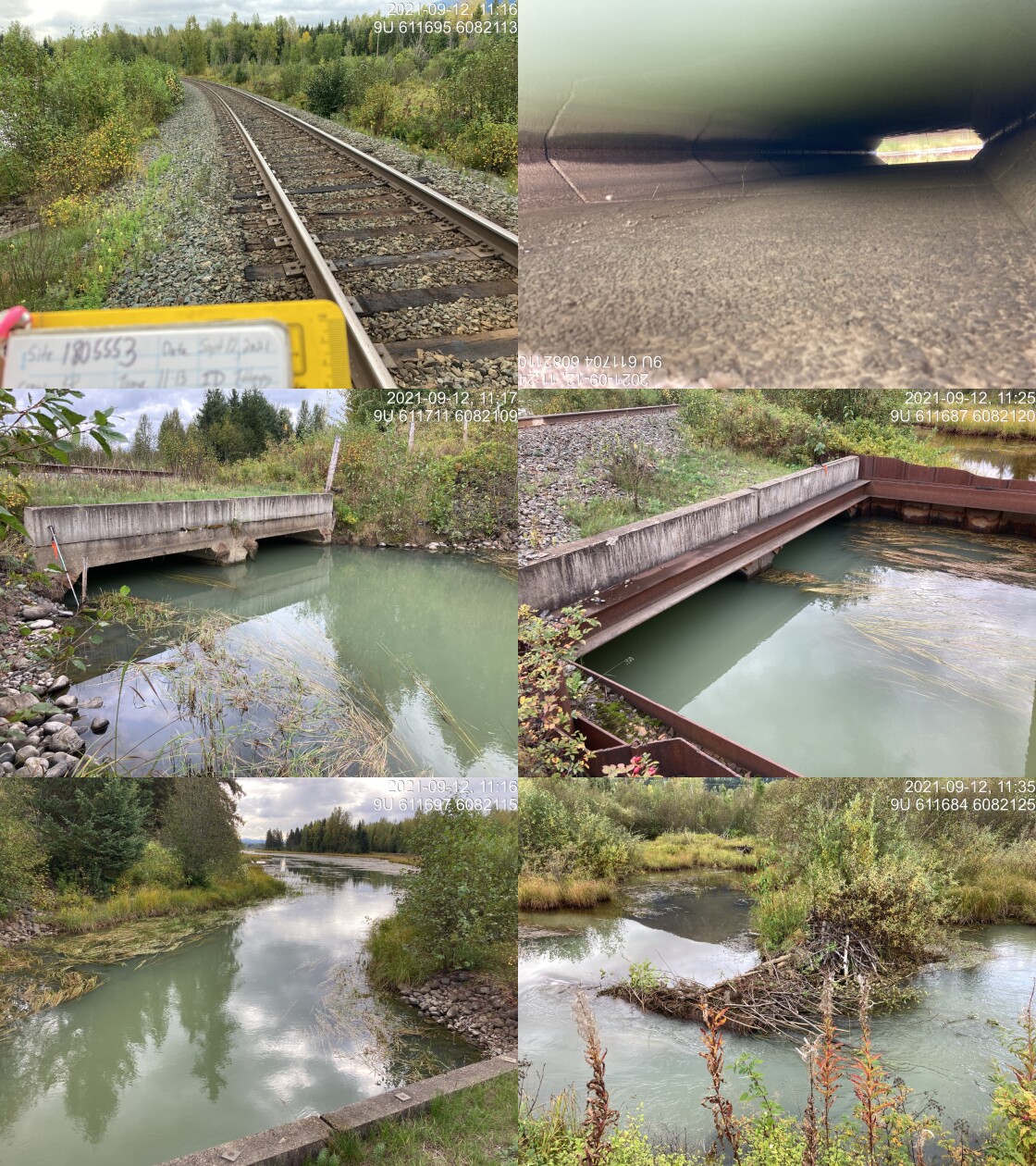
|
|||
| Comments: 2 concrete box. Not backwatered but fully wetted due to slow flowing water. Stream slope estimated. Lake/wetland habitat upstream, flowing very slowly through, assuming the crossing is embedded or an open bottom. Appears to be fish friendly. Length was taken with rangefinder. 11:13 |
| Location and Stream Data |
|
Crossing Characteristics | – |
|---|---|---|---|
| Date | 2021-09-14 | Crossing Sub Type | Ford |
| PSCIS ID | 198043 | Diameter (m) | – |
| External ID | 24704568 | Length (m) | – |
| Crew | KP | Embedded | – |
| UTM Zone | 9 | Depth Embedded (m) | – |
| Easting | 605738.7 | Resemble Channel | – |
| Northing | 6096763 | Backwatered | – |
| Stream | John Brown | Percent Backwatered | – |
| Road | Powerline | Fill Depth (m) | – |
| Road Tenure | Unknown | Outlet Drop (m) | – |
| Channel Width (m) | – | Outlet Pool Depth (m) | – |
| Stream Slope (%) | – | Inlet Drop | – |
| Beaver Activity | – | Slope (%) | – |
| Habitat Value | – | Valley Fill | – |
| Final score | 0 | Barrier Result | Unknown |
| Fix type | – | Fix Span / Diameter | – |
Photos: PSCIS ID 198043. From top left clockwise: Road/Site Card, Barrel, Outlet, Downstream, Upstream, Inlet.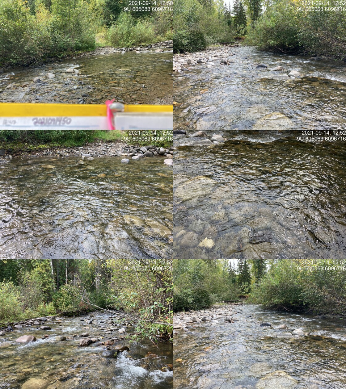
|
|||
| Comments: Ford. 12:47 |
| Location and Stream Data |
|
Crossing Characteristics | – |
|---|---|---|---|
| Date | 2021-09-15 | Crossing Sub Type | Round Culvert |
| PSCIS ID | 198044 | Diameter (m) | 0.1 |
| External ID | 1805573 | Length (m) | 15 |
| Crew | KP | Embedded | No |
| UTM Zone | 9 | Depth Embedded (m) | – |
| Easting | 610392.9 | Resemble Channel | No |
| Northing | 6084973 | Backwatered | No |
| Stream | Tributary to Toboggan Creek | Percent Backwatered | – |
| Road | Railway | Fill Depth (m) | 2 |
| Road Tenure | Canadian National | Outlet Drop (m) | 0 |
| Channel Width (m) | 2 | Outlet Pool Depth (m) | 0 |
| Stream Slope (%) | 1 | Inlet Drop | No |
| Beaver Activity | No | Slope (%) | 3 |
| Habitat Value | Low | Valley Fill | Deep Fill |
| Final score | 29 | Barrier Result | Barrier |
| Fix type | Replace Structure with Streambed Simulation CBS | Fix Span / Diameter | 3 |
Photos: PSCIS ID 198044. From top left clockwise: Road/Site Card, Barrel, Outlet, Downstream, Upstream, Inlet.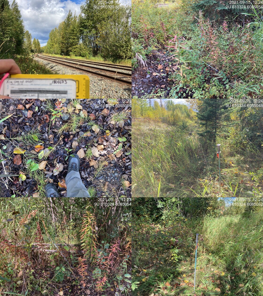
|
|||
| Comments: Crossing does not exist on railway. Site entered as a placeholder because there should be connection. Surveyed above and below modelled crossing. There is ephemeral channel upstream of the railway that is directed to go along the railway in ditch and quickly dissipates into shrubs and grasses. 12:19 |
| Location and Stream Data |
|
Crossing Characteristics | – |
|---|---|---|---|
| Date | 2021-09-15 | Crossing Sub Type | Bridge |
| PSCIS ID | 198045 | Diameter (m) | 13 |
| External ID | 1805549 | Length (m) | 6 |
| Crew | KP AI | Embedded | – |
| UTM Zone | 9 | Depth Embedded (m) | – |
| Easting | 611345.1 | Resemble Channel | – |
| Northing | 6083669 | Backwatered | – |
| Stream | Elliot Creek | Percent Backwatered | – |
| Road | CN Railway | Fill Depth (m) | – |
| Road Tenure | Canadian National | Outlet Drop (m) | – |
| Channel Width (m) | – | Outlet Pool Depth (m) | – |
| Stream Slope (%) | – | Inlet Drop | – |
| Beaver Activity | – | Slope (%) | – |
| Habitat Value | – | Valley Fill | – |
| Final score | 0 | Barrier Result | Passable |
| Fix type | – | Fix Span / Diameter | – |
Photos: PSCIS ID 198045. From top left clockwise: Road/Site Card, Barrel, Outlet, Downstream, Upstream, Inlet.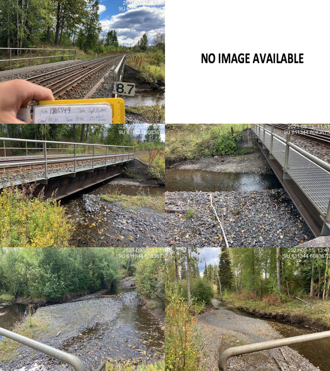
|
|||
| Comments: Bridge. 13:40 |
| Location and Stream Data |
|
Crossing Characteristics | – |
|---|---|---|---|
| Date | 2021-09-16 | Crossing Sub Type | Bridge |
| PSCIS ID | 198046 | Diameter (m) | 6 |
| External ID | 2021091650 | Length (m) | 4 |
| Crew | KP AI | Embedded | – |
| UTM Zone | 9 | Depth Embedded (m) | – |
| Easting | 589659 | Resemble Channel | – |
| Northing | 6123249 | Backwatered | – |
| Stream | Tributary to Waterfall Creek | Percent Backwatered | – |
| Road | – | Fill Depth (m) | – |
| Road Tenure | Unknown | Outlet Drop (m) | – |
| Channel Width (m) | – | Outlet Pool Depth (m) | – |
| Stream Slope (%) | – | Inlet Drop | – |
| Beaver Activity | – | Slope (%) | – |
| Habitat Value | – | Valley Fill | – |
| Final score | 0 | Barrier Result | Passable |
| Fix type | – | Fix Span / Diameter | – |
Photos: PSCIS ID 198046. From top left clockwise: Road/Site Card, Barrel, Outlet, Downstream, Upstream, Inlet.
|
|||
| Comments: Bridge. 14:27 |
| Location and Stream Data |
|
Crossing Characteristics | – |
|---|---|---|---|
| Date | 2021-09-16 | Crossing Sub Type | Ford |
| PSCIS ID | 198047 | Diameter (m) | – |
| External ID | 1801773 | Length (m) | – |
| Crew | DN | Embedded | – |
| UTM Zone | 9 | Depth Embedded (m) | – |
| Easting | 603432.1 | Resemble Channel | – |
| Northing | 6107844 | Backwatered | – |
| Stream | Boulder Creek | Percent Backwatered | – |
| Road | Unnamed | Fill Depth (m) | – |
| Road Tenure | Unclassified | Outlet Drop (m) | – |
| Channel Width (m) | – | Outlet Pool Depth (m) | – |
| Stream Slope (%) | – | Inlet Drop | – |
| Beaver Activity | – | Slope (%) | – |
| Habitat Value | – | Valley Fill | – |
| Final score | 0 | Barrier Result | Unknown |
| Fix type | – | Fix Span / Diameter | – |
Photos: PSCIS ID 198047. From top left clockwise: Road/Site Card, Barrel, Outlet, Downstream, Upstream, Inlet.
|
|||
| Comments: No structure present. |
| Location and Stream Data |
|
Crossing Characteristics | – |
|---|---|---|---|
| Date | 2021-09-05 | Crossing Sub Type | Round Culvert |
| PSCIS ID | 198048 | Diameter (m) | 2.5 |
| External ID | 1800048 | Length (m) | 25 |
| Crew | KP AI | Embedded | No |
| UTM Zone | 9 | Depth Embedded (m) | – |
| Easting | 674397.1 | Resemble Channel | No |
| Northing | 6043433 | Backwatered | Yes |
| Stream | Cesford Creek | Percent Backwatered | 30 |
| Road | Highway 16 | Fill Depth (m) | 1 |
| Road Tenure | MoTi Arterial | Outlet Drop (m) | 0 |
| Channel Width (m) | 5.48 | Outlet Pool Depth (m) | 0.09 |
| Stream Slope (%) | 3.5 | Inlet Drop | Yes |
| Beaver Activity | No | Slope (%) | 1.5 |
| Habitat Value | High | Valley Fill | Deep Fill |
| Final score | 24 | Barrier Result | Barrier |
| Fix type | Replace with New Open Bottom Structure | Fix Span / Diameter | 10 |
Photos: PSCIS ID 198048. From top left clockwise: Road/Site Card, Barrel, Outlet, Downstream, Upstream, Inlet.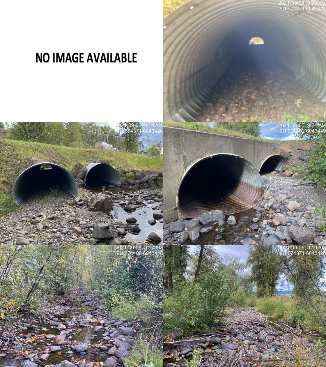
|
|||
| Comments: Habitat confirmation conducted. Two pipes (2.5m x 2.5m). Culvert slope measured with lazel level. Fish observed. Could not locate downstream crossing on railway. Garmin backroads mapbook shows stream connecting with side channel of the Bulkley. 9:17 |
| Location and Stream Data |
|
Crossing Characteristics | – |
|---|---|---|---|
| Date | 2021-09-05 | Crossing Sub Type | Round Culvert |
| PSCIS ID | 198049 | Diameter (m) | 3.7 |
| External ID | 1800193 | Length (m) | 21 |
| Crew | AI KP | Embedded | No |
| UTM Zone | 9 | Depth Embedded (m) | – |
| Easting | 674875.4 | Resemble Channel | No |
| Northing | 6043782 | Backwatered | No |
| Stream | Cesford Creek | Percent Backwatered | – |
| Road | Highway 118 | Fill Depth (m) | 1 |
| Road Tenure | MoTi Arterial | Outlet Drop (m) | 0.5 |
| Channel Width (m) | 4.9 | Outlet Pool Depth (m) | 0.25 |
| Stream Slope (%) | 2.83 | Inlet Drop | No |
| Beaver Activity | No | Slope (%) | 1.5 |
| Habitat Value | High | Valley Fill | Deep Fill |
| Final score | 34 | Barrier Result | Barrier |
| Fix type | Replace with New Open Bottom Structure | Fix Span / Diameter | 10 |
Photos: PSCIS ID 198049. From top left clockwise: Road/Site Card, Barrel, Outlet, Downstream, Upstream, Inlet.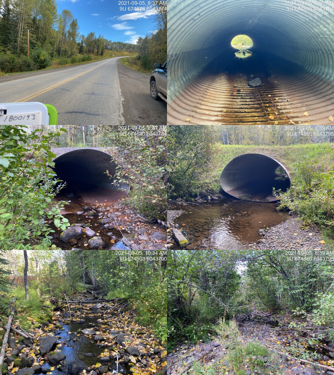
|
|||
| Comments: Habitat confirmation conducted. ~110mm fish observed in outlet pool. Culvert slope surveyed with lazer level. 8:37 |
| Location and Stream Data |
|
Crossing Characteristics | – |
|---|---|---|---|
| Date | 2021-09-06 | Crossing Sub Type | Round Culvert |
| PSCIS ID | 198050 | Diameter (m) | 0.9 |
| External ID | 14000394 | Length (m) | 20 |
| Crew | AI | Embedded | No |
| UTM Zone | 9 | Depth Embedded (m) | – |
| Easting | 604924.2 | Resemble Channel | No |
| Northing | 6012912 | Backwatered | No |
| Stream | Tributary to Thautil River | Percent Backwatered | – |
| Road | Thautil FSR | Fill Depth (m) | 2 |
| Road Tenure | West Fraser R03753 | Outlet Drop (m) | 0.4 |
| Channel Width (m) | 0.9 | Outlet Pool Depth (m) | 0.3 |
| Stream Slope (%) | 6 | Inlet Drop | No |
| Beaver Activity | No | Slope (%) | 4 |
| Habitat Value | Low | Valley Fill | Deep Fill |
| Final score | 36 | Barrier Result | Barrier |
| Fix type | Replace Structure with Streambed Simulation CBS | Fix Span / Diameter | 3 |
Photos: PSCIS ID 198050. From top left clockwise: Road/Site Card, Barrel, Outlet, Downstream, Upstream, Inlet.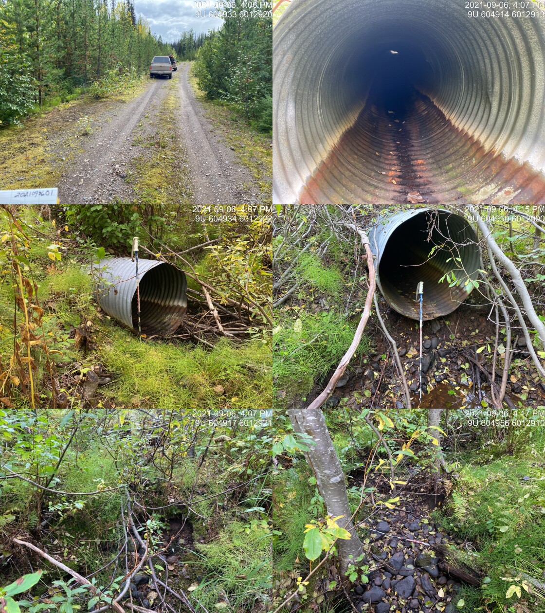
|
|||
| Comments: ID is 2021090601 in the photos. 16:03 |
| Location and Stream Data |
|
Crossing Characteristics | – |
|---|---|---|---|
| Date | 2021-09-06 | Crossing Sub Type | Round Culvert |
| PSCIS ID | 198051 | Diameter (m) | 0.6 |
| External ID | 14001409 | Length (m) | 11 |
| Crew | AI | Embedded | No |
| UTM Zone | 9 | Depth Embedded (m) | – |
| Easting | 604621.6 | Resemble Channel | No |
| Northing | 6012796 | Backwatered | No |
| Stream | Tributary to Thautil River | Percent Backwatered | – |
| Road | Spur | Fill Depth (m) | 1 |
| Road Tenure | Canfor R04078 | Outlet Drop (m) | 0 |
| Channel Width (m) | 1.3 | Outlet Pool Depth (m) | 0 |
| Stream Slope (%) | 1 | Inlet Drop | No |
| Beaver Activity | No | Slope (%) | 4 |
| Habitat Value | Low | Valley Fill | Deep Fill |
| Final score | 26 | Barrier Result | Barrier |
| Fix type | Replace Structure with Streambed Simulation CBS | Fix Span / Diameter | 3 |
Photos: PSCIS ID 198051. From top left clockwise: Road/Site Card, Barrel, Outlet, Downstream, Upstream, Inlet.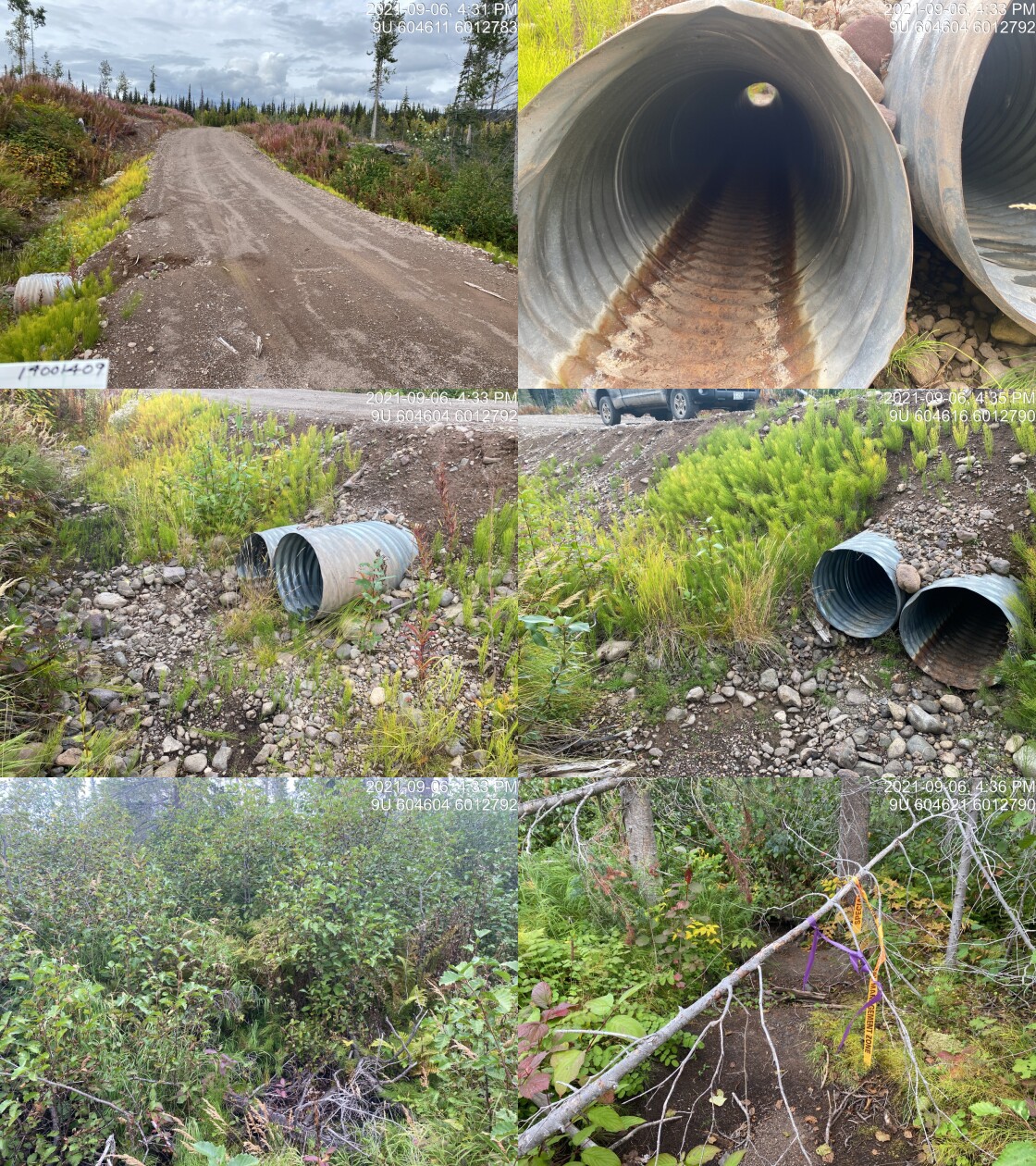
|
|||
| Comments: Dry, difficult to find the channel upstream. 16:30 |
| Location and Stream Data |
|
Crossing Characteristics | – |
|---|---|---|---|
| Date | 2021-09-06 | Crossing Sub Type | Round Culvert |
| PSCIS ID | 198052 | Diameter (m) | 0.4 |
| External ID | 14001468 | Length (m) | 12 |
| Crew | AI | Embedded | No |
| UTM Zone | 9 | Depth Embedded (m) | – |
| Easting | 604616.4 | Resemble Channel | No |
| Northing | 6010547 | Backwatered | No |
| Stream | Tributary to Thautil River | Percent Backwatered | – |
| Road | Spur | Fill Depth (m) | 1 |
| Road Tenure | Unclassified | Outlet Drop (m) | 0 |
| Channel Width (m) | 0.5 | Outlet Pool Depth (m) | 0 |
| Stream Slope (%) | 0 | Inlet Drop | No |
| Beaver Activity | No | Slope (%) | 4 |
| Habitat Value | Low | Valley Fill | Deep Fill |
| Final score | 23 | Barrier Result | Barrier |
| Fix type | Replace Structure with Streambed Simulation CBS | Fix Span / Diameter | 3 |
Photos: PSCIS ID 198052. From top left clockwise: Road/Site Card, Barrel, Outlet, Downstream, Upstream, Inlet.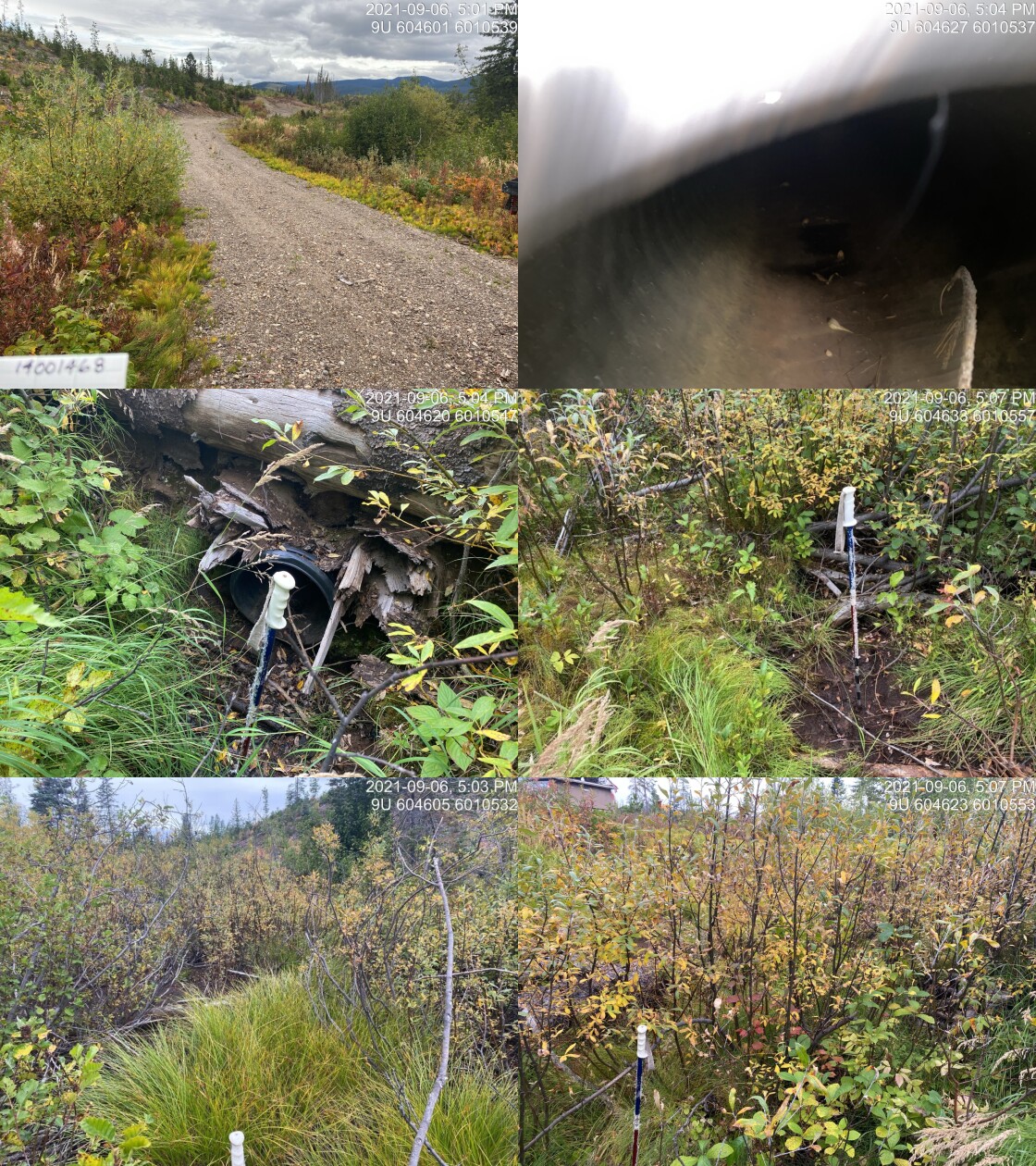
|
|||
| Comments: Cannot locate outlet. Not likely fish habitat. Seasonal wetland. 17:00 |
| Location and Stream Data |
|
Crossing Characteristics | – |
|---|---|---|---|
| Date | 2021-09-06 | Crossing Sub Type | Bridge |
| PSCIS ID | 198053 | Diameter (m) | 8 |
| External ID | 14000399 | Length (m) | 5 |
| Crew | AI | Embedded | – |
| UTM Zone | 9 | Depth Embedded (m) | – |
| Easting | 604826 | Resemble Channel | – |
| Northing | 6022653 | Backwatered | – |
| Stream | Tributary to Gabriel Creek | Percent Backwatered | – |
| Road | Thautil FSR | Fill Depth (m) | – |
| Road Tenure | West Fraser R03753 | Outlet Drop (m) | – |
| Channel Width (m) | – | Outlet Pool Depth (m) | – |
| Stream Slope (%) | – | Inlet Drop | – |
| Beaver Activity | – | Slope (%) | – |
| Habitat Value | – | Valley Fill | – |
| Final score | 0 | Barrier Result | Passable |
| Fix type | – | Fix Span / Diameter | – |
Photos: PSCIS ID 198053. From top left clockwise: Road/Site Card, Barrel, Outlet, Downstream, Upstream, Inlet.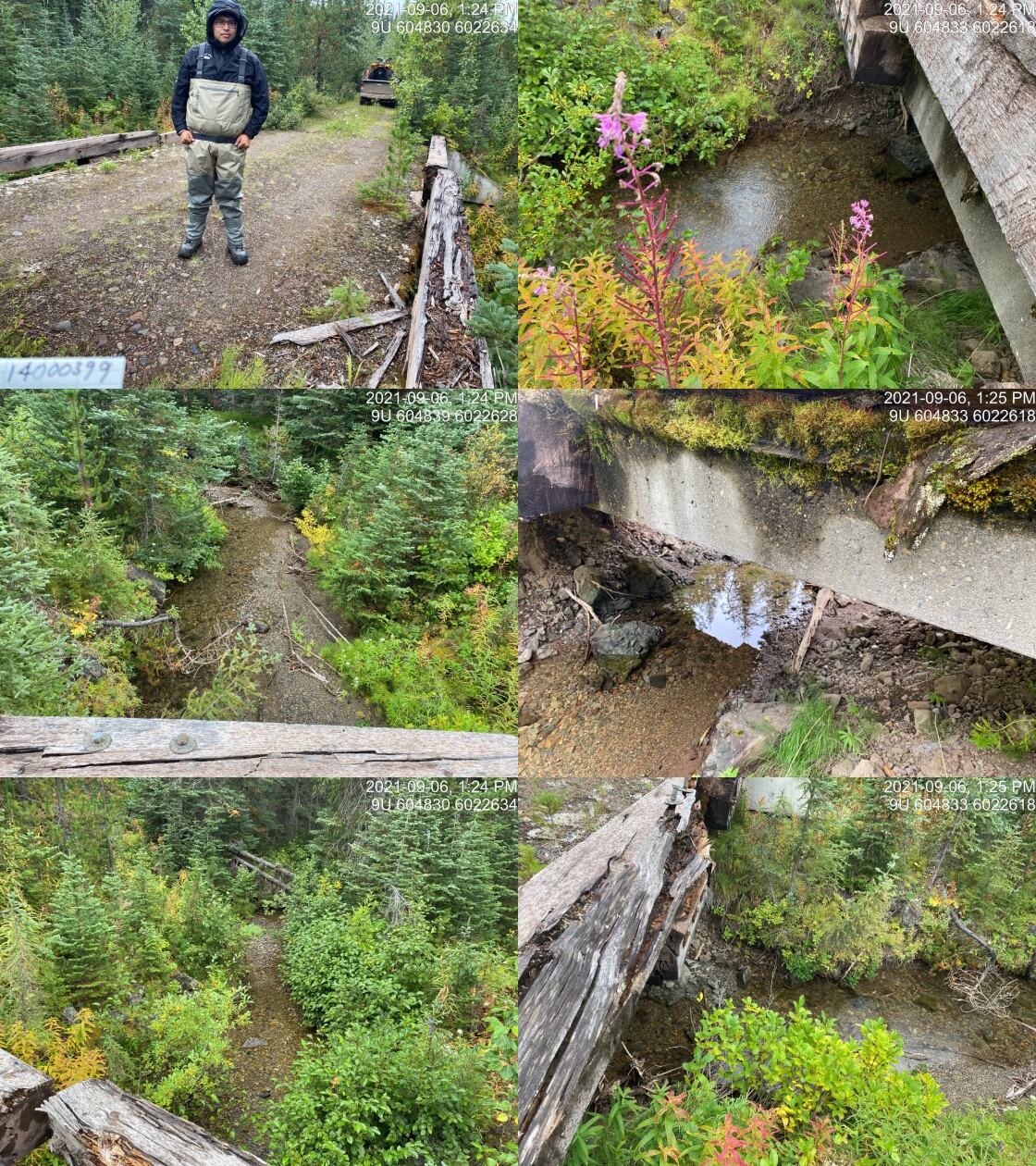
|
|||
| Comments: Bridge. 13:22 |
| Location and Stream Data |
|
Crossing Characteristics | – |
|---|---|---|---|
| Date | 2021-09-06 | Crossing Sub Type | Bridge |
| PSCIS ID | 198054 | Diameter (m) | 7 |
| External ID | 14001432 | Length (m) | 2 |
| Crew | AI | Embedded | – |
| UTM Zone | 9 | Depth Embedded (m) | – |
| Easting | 604342.5 | Resemble Channel | – |
| Northing | 6022072 | Backwatered | – |
| Stream | Gabriel Creek | Percent Backwatered | – |
| Road | Thautil FSR | Fill Depth (m) | – |
| Road Tenure | Canfor R07593 | Outlet Drop (m) | – |
| Channel Width (m) | – | Outlet Pool Depth (m) | – |
| Stream Slope (%) | – | Inlet Drop | – |
| Beaver Activity | – | Slope (%) | – |
| Habitat Value | – | Valley Fill | – |
| Final score | 0 | Barrier Result | Passable |
| Fix type | – | Fix Span / Diameter | – |
Photos: PSCIS ID 198054. From top left clockwise: Road/Site Card, Barrel, Outlet, Downstream, Upstream, Inlet.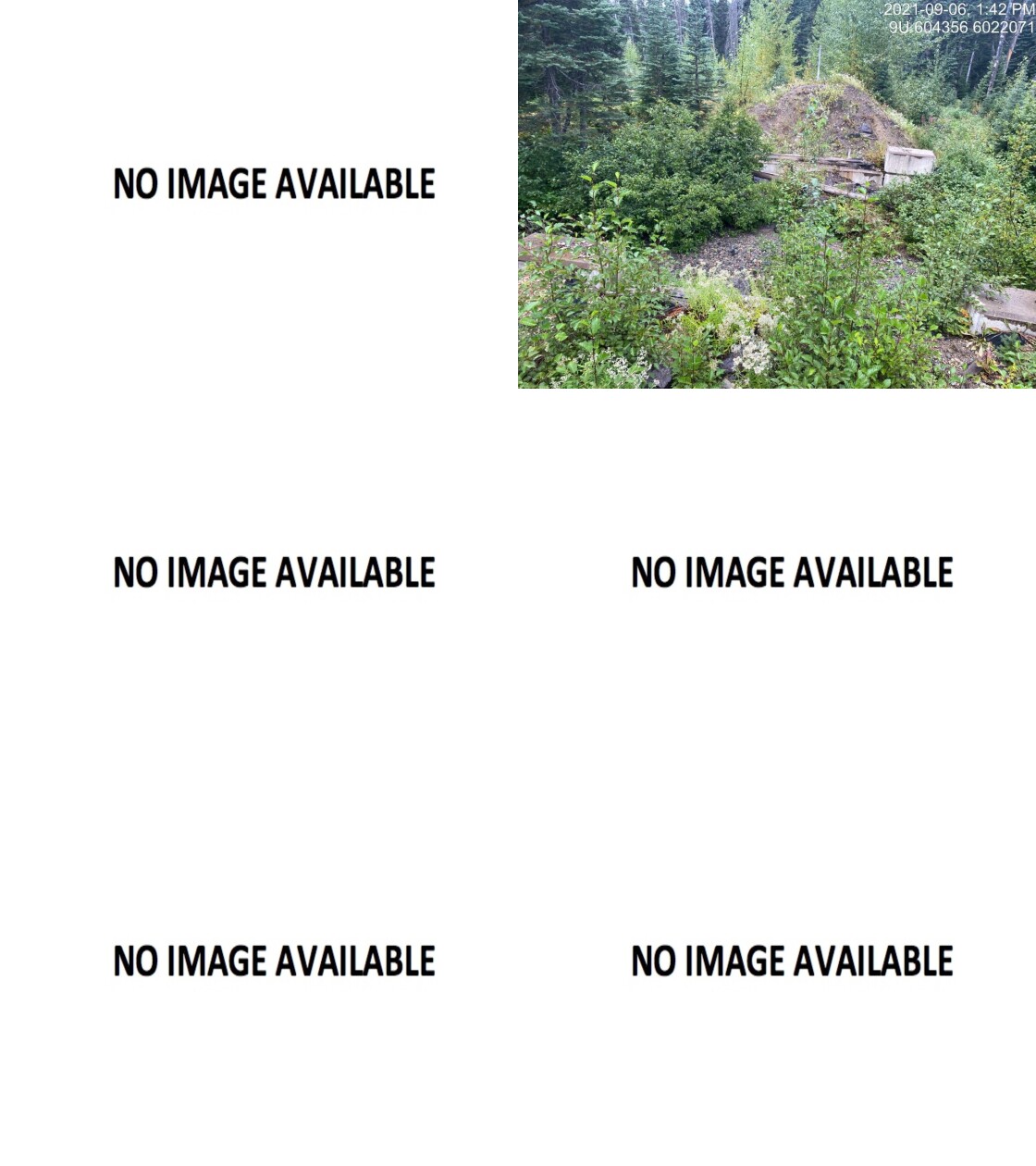
|
|||
| Comments: Bridge. 13:24 |
| Location and Stream Data |
|
Crossing Characteristics | – |
|---|---|---|---|
| Date | 2021-09-06 | Crossing Sub Type | Oval Culvert |
| PSCIS ID | 198055 | Diameter (m) | 0.9 |
| External ID | 14000381 | Length (m) | 15 |
| Crew | AI VJ TP | Embedded | No |
| UTM Zone | 9 | Depth Embedded (m) | – |
| Easting | 606100.2 | Resemble Channel | No |
| Northing | 6017301 | Backwatered | No |
| Stream | Tributary to Thautil River | Percent Backwatered | – |
| Road | Thautil FSR | Fill Depth (m) | 1.5 |
| Road Tenure | West Fraser R03753 | Outlet Drop (m) | 0.25 |
| Channel Width (m) | 1.1 | Outlet Pool Depth (m) | 0 |
| Stream Slope (%) | 3 | Inlet Drop | No |
| Beaver Activity | Yes | Slope (%) | 1 |
| Habitat Value | Low | Valley Fill | Deep Fill |
| Final score | 26 | Barrier Result | Barrier |
| Fix type | Replace Structure with Streambed Simulation CBS | Fix Span / Diameter | 3 |
Photos: PSCIS ID 198055. From top left clockwise: Road/Site Card, Barrel, Outlet, Downstream, Upstream, Inlet.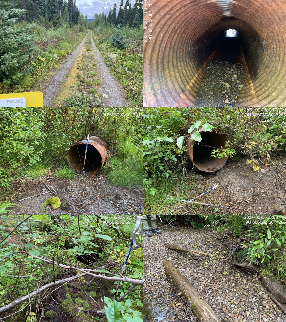
|
|||
| Comments: Unlikely fish habitat. Culvert pool does not drain into obvious channel most likely wetlands. 14:45 |
| Location and Stream Data |
|
Crossing Characteristics | – |
|---|---|---|---|
| Date | 2021-09-06 | Crossing Sub Type | Oval Culvert |
| PSCIS ID | 198056 | Diameter (m) | 0.6 |
| External ID | 14000389 | Length (m) | 25 |
| Crew | AI VJ TP | Embedded | No |
| UTM Zone | 9 | Depth Embedded (m) | – |
| Easting | 604962.1 | Resemble Channel | No |
| Northing | 6015050 | Backwatered | No |
| Stream | Tributary to Thautil River | Percent Backwatered | – |
| Road | Thautil FSR | Fill Depth (m) | 4.5 |
| Road Tenure | West Fraser R03753 | Outlet Drop (m) | 1.2 |
| Channel Width (m) | 1.8 | Outlet Pool Depth (m) | 0.45 |
| Stream Slope (%) | 9 | Inlet Drop | No |
| Beaver Activity | No | Slope (%) | 4 |
| Habitat Value | Low | Valley Fill | Deep Fill |
| Final score | 39 | Barrier Result | Barrier |
| Fix type | Replace Structure with Streambed Simulation CBS | Fix Span / Diameter | 3 |
Photos: PSCIS ID 198056. From top left clockwise: Road/Site Card, Barrel, Outlet, Downstream, Upstream, Inlet.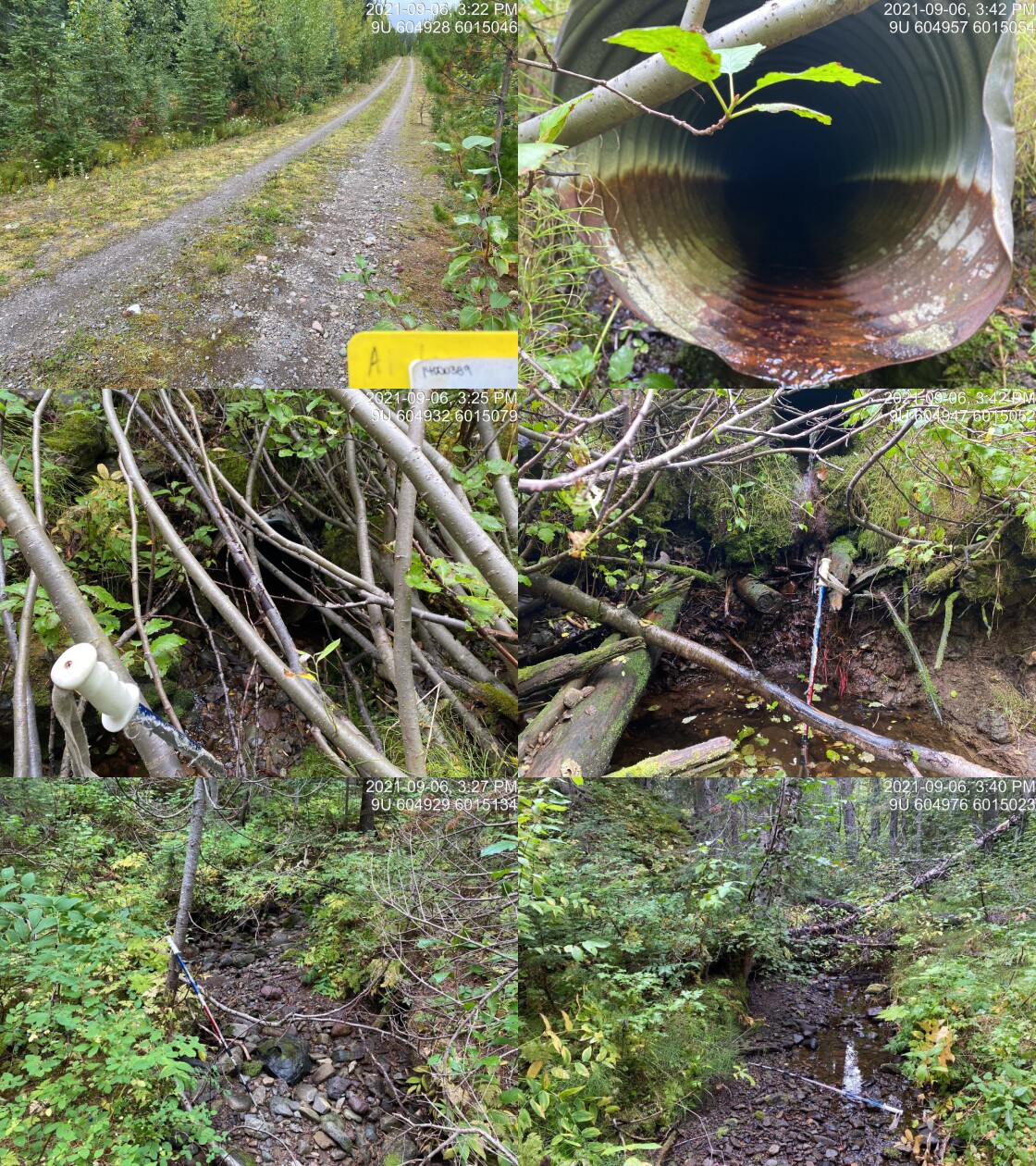
|
|||
| Comments: Small stream. Minimal flow - not dry. Steep downstream of culvert. 80cm steps, good gravels. 15:22 |
| Location and Stream Data |
|
Crossing Characteristics | – |
|---|---|---|---|
| Date | 2021-09-06 | Crossing Sub Type | Round Culvert |
| PSCIS ID | 198057 | Diameter (m) | 1.4 |
| External ID | 14000383 | Length (m) | 18 |
| Crew | AI KP VJ TP | Embedded | No |
| UTM Zone | 9 | Depth Embedded (m) | – |
| Easting | 605307.1 | Resemble Channel | No |
| Northing | 6023040 | Backwatered | No |
| Stream | Tributary to Gabriel Creek | Percent Backwatered | – |
| Road | Thautil FSR | Fill Depth (m) | 3 |
| Road Tenure | West Fraser R03753 | Outlet Drop (m) | 0 |
| Channel Width (m) | 3 | Outlet Pool Depth (m) | 0.75 |
| Stream Slope (%) | 3.5 | Inlet Drop | No |
| Beaver Activity | No | Slope (%) | 3 |
| Habitat Value | Medium | Valley Fill | Deep Fill |
| Final score | 29 | Barrier Result | Barrier |
| Fix type | Replace with New Open Bottom Structure | Fix Span / Diameter | 10 |
Photos: PSCIS ID 198057. From top left clockwise: Road/Site Card, Barrel, Outlet, Downstream, Upstream, Inlet.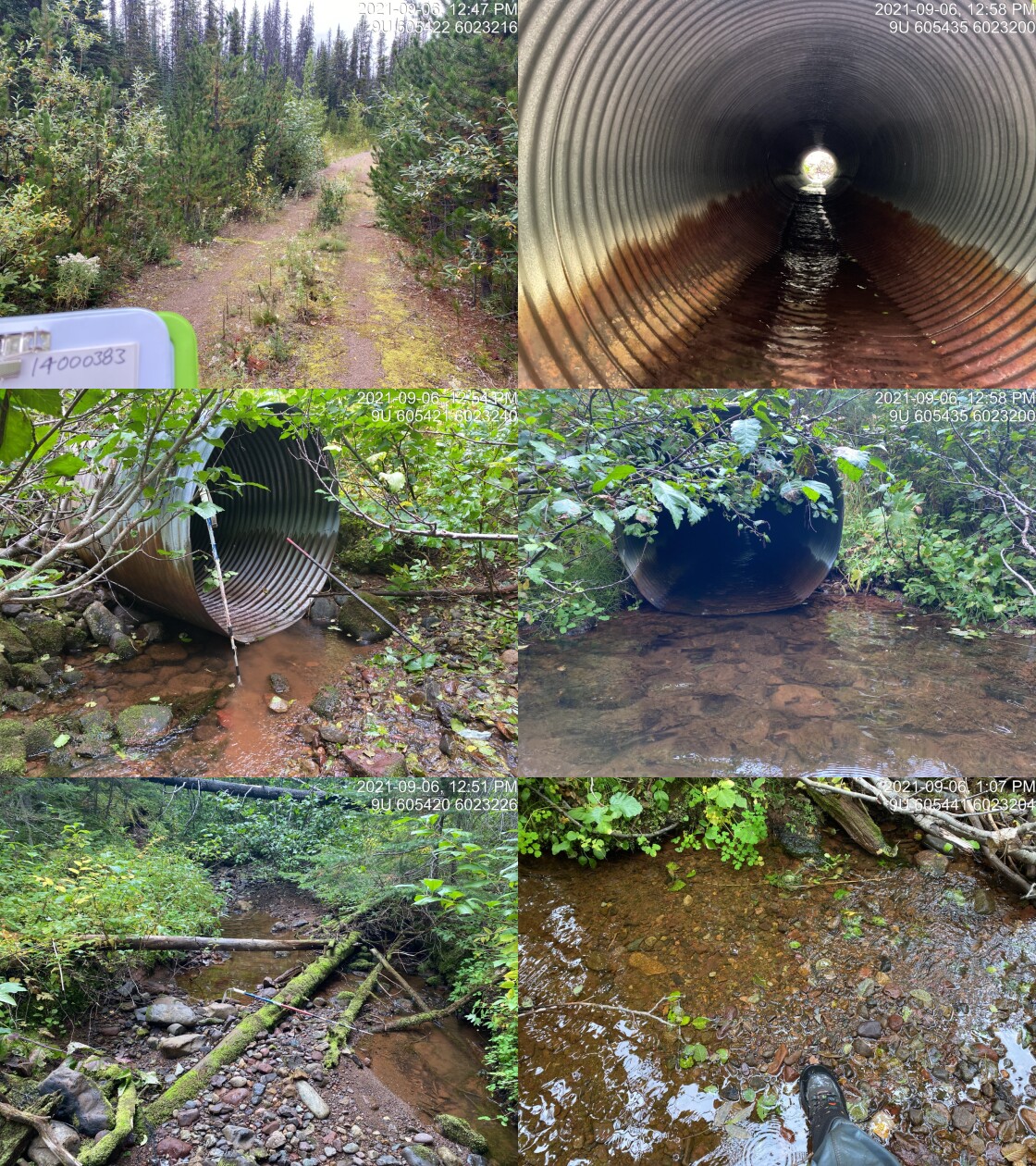
|
|||
| Comments: Waypoint WP381. 12:47 |
| Location and Stream Data |
|
Crossing Characteristics | – |
|---|---|---|---|
| Date | 2021-09-06 | Crossing Sub Type | Round Culvert |
| PSCIS ID | 198058 | Diameter (m) | 1 |
| External ID | 14000390 | Length (m) | 14 |
| Crew | AI VJ TP | Embedded | No |
| UTM Zone | 9 | Depth Embedded (m) | – |
| Easting | 605778.6 | Resemble Channel | No |
| Northing | 6021673 | Backwatered | No |
| Stream | Tributary to Gabriel Creek | Percent Backwatered | – |
| Road | Thautil FSR | Fill Depth (m) | 1 |
| Road Tenure | West Fraser R03753 | Outlet Drop (m) | 0.3 |
| Channel Width (m) | 1.5 | Outlet Pool Depth (m) | 0.2 |
| Stream Slope (%) | 7 | Inlet Drop | No |
| Beaver Activity | No | Slope (%) | 5 |
| Habitat Value | Low | Valley Fill | Deep Fill |
| Final score | 36 | Barrier Result | Barrier |
| Fix type | Replace Structure with Streambed Simulation CBS | Fix Span / Diameter | 3 |
Photos: PSCIS ID 198058. From top left clockwise: Road/Site Card, Barrel, Outlet, Downstream, Upstream, Inlet.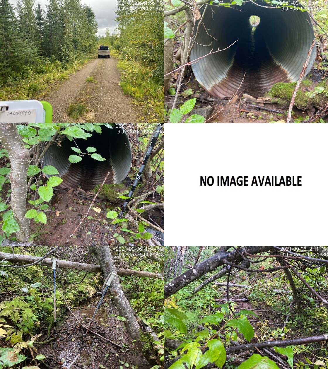
|
|||
| Comments: Very small amount of flow. Some good gravels. Multiple FISS sites downstream with velocity barrier noted. Non-fish? 13:54 |
| Location and Stream Data |
|
Crossing Characteristics | – |
|---|---|---|---|
| Date | 2021-09-06 | Crossing Sub Type | Round Culvert |
| PSCIS ID | 198059 | Diameter (m) | 0.6 |
| External ID | 14000392 | Length (m) | 12 |
| Crew | AI KP | Embedded | No |
| UTM Zone | 9 | Depth Embedded (m) | – |
| Easting | 605753.6 | Resemble Channel | No |
| Northing | 6023618 | Backwatered | No |
| Stream | Tributary to Gabriel Creek | Percent Backwatered | – |
| Road | Thautil FSR | Fill Depth (m) | 1.5 |
| Road Tenure | West Fraser R03753 | Outlet Drop (m) | 0.62 |
| Channel Width (m) | 1.5 | Outlet Pool Depth (m) | 0.82 |
| Stream Slope (%) | 4 | Inlet Drop | No |
| Beaver Activity | No | Slope (%) | 2 |
| Habitat Value | Medium | Valley Fill | Deep Fill |
| Final score | 31 | Barrier Result | Barrier |
| Fix type | Replace Structure with Streambed Simulation CBS | Fix Span / Diameter | 3 |
Photos: PSCIS ID 198059. From top left clockwise: Road/Site Card, Barrel, Outlet, Downstream, Upstream, Inlet.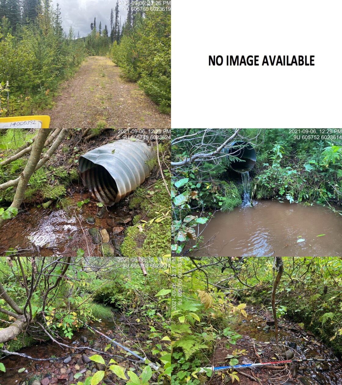
|
|||
| Comments: Nice gravels. Some flow at this dry time of year. Small system with Dolly Varden noted downstream. 12:26 |
| Location and Stream Data |
|
Crossing Characteristics | – |
|---|---|---|---|
| Date | 2021-09-07 | Crossing Sub Type | Round Culvert |
| PSCIS ID | 198060 | Diameter (m) | 0.6 |
| External ID | 14000718 | Length (m) | 16 |
| Crew | AI | Embedded | No |
| UTM Zone | 9 | Depth Embedded (m) | – |
| Easting | 643962 | Resemble Channel | No |
| Northing | 6001978 | Backwatered | Yes |
| Stream | Tributary to Owen Creek | Percent Backwatered | 100 |
| Road | Morice-Owen FSR | Fill Depth (m) | 0.7 |
| Road Tenure | Unknown | Outlet Drop (m) | 0 |
| Channel Width (m) | 2 | Outlet Pool Depth (m) | 0.36 |
| Stream Slope (%) | 3 | Inlet Drop | No |
| Beaver Activity | No | Slope (%) | 0.5 |
| Habitat Value | Medium | Valley Fill | Deep Fill |
| Final score | 19 | Barrier Result | Potential |
| Fix type | Replace with New Open Bottom Structure | Fix Span / Diameter | 10 |
Photos: PSCIS ID 198060. From top left clockwise: Road/Site Card, Barrel, Outlet, Downstream, Upstream, Inlet.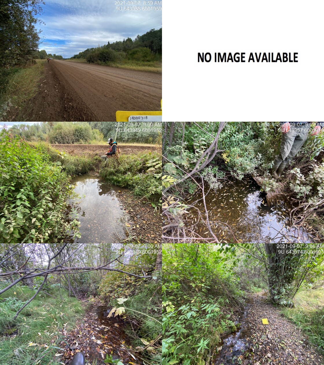
|
|||
| Comments: Very nice gravels. Some flow. Passable currently but may by higher velocity at higher flows. 8:59 |
| Location and Stream Data |
|
Crossing Characteristics | – |
|---|---|---|---|
| Date | 2021-09-07 | Crossing Sub Type | Pipe Arch |
| PSCIS ID | 198061 | Diameter (m) | 50 |
| External ID | 14000796 | Length (m) | 5 |
| Crew | AI | Embedded | – |
| UTM Zone | 9 | Depth Embedded (m) | – |
| Easting | 637564.1 | Resemble Channel | – |
| Northing | 6007909 | Backwatered | – |
| Stream | Fenton Creek | Percent Backwatered | – |
| Road | Morice-West FSR | Fill Depth (m) | – |
| Road Tenure | Resource | Outlet Drop (m) | – |
| Channel Width (m) | – | Outlet Pool Depth (m) | – |
| Stream Slope (%) | – | Inlet Drop | – |
| Beaver Activity | – | Slope (%) | – |
| Habitat Value | – | Valley Fill | – |
| Final score | 0 | Barrier Result | Passable |
| Fix type | – | Fix Span / Diameter | – |
Photos: PSCIS ID 198061. From top left clockwise: Road/Site Card, Barrel, Outlet, Downstream, Upstream, Inlet.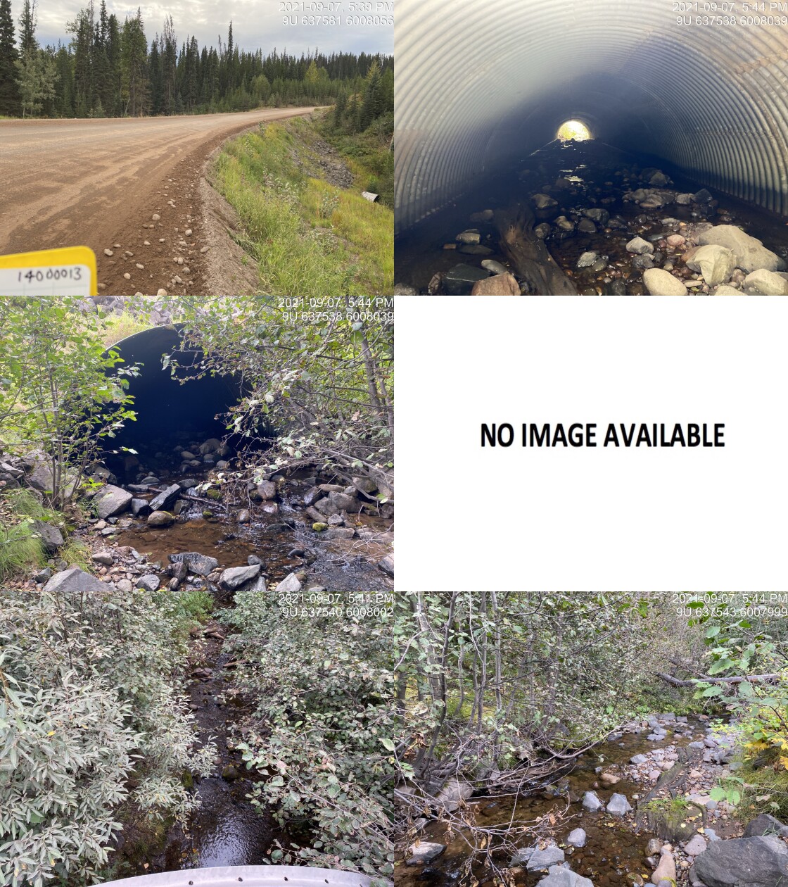
|
|||
| Comments: Pipe arch. Mis-labelled as 14000013 (upstream modelled crossing) which has been removed. 17:39 |
| Location and Stream Data |
|
Crossing Characteristics | – |
|---|---|---|---|
| Date | 2021-09-08 | Crossing Sub Type | Round Culvert |
| PSCIS ID | 198062 | Diameter (m) | 0.95 |
| External ID | 14000991 | Length (m) | 19 |
| Crew | AI | Embedded | No |
| UTM Zone | 9 | Depth Embedded (m) | – |
| Easting | 623923 | Resemble Channel | No |
| Northing | 6005104 | Backwatered | No |
| Stream | Tributary to Morice River | Percent Backwatered | – |
| Road | Morice-West FSR | Fill Depth (m) | 2.3 |
| Road Tenure | FLNR DND 9785 | Outlet Drop (m) | 0.3 |
| Channel Width (m) | 10 | Outlet Pool Depth (m) | 0.1 |
| Stream Slope (%) | 0 | Inlet Drop | No |
| Beaver Activity | Yes | Slope (%) | 4 |
| Habitat Value | Medium | Valley Fill | Deep Fill |
| Final score | 39 | Barrier Result | Barrier |
| Fix type | Replace with New Open Bottom Structure | Fix Span / Diameter | 15 |
Photos: PSCIS ID 198062. From top left clockwise: Road/Site Card, Barrel, Outlet, Downstream, Upstream, Inlet.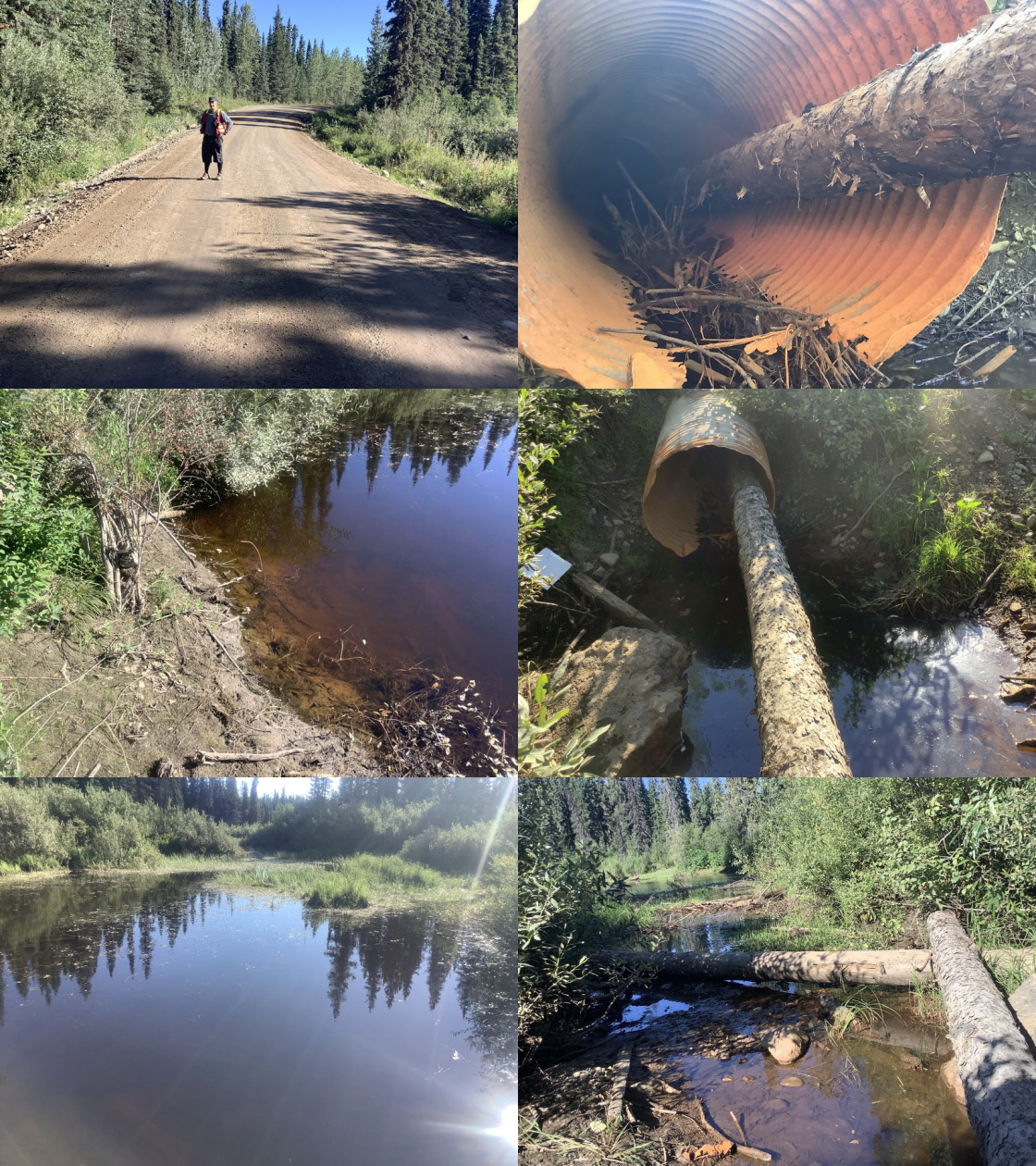
|
|||
| Comments: Upstream wetland appears shallow. Flown with drone. Could not locate inlet. Culvert damaged with 24cm tree lodged in it. Slope estimated as black barrel. 17:30 |
| Location and Stream Data |
|
Crossing Characteristics | – |
|---|---|---|---|
| Date | 2021-09-08 | Crossing Sub Type | Pipe Arch |
| PSCIS ID | 198063 | Diameter (m) | 17 |
| External ID | 14000764 | Length (m) | 4 |
| Crew | AI | Embedded | – |
| UTM Zone | 9 | Depth Embedded (m) | – |
| Easting | 609753 | Resemble Channel | – |
| Northing | 5992972 | Backwatered | – |
| Stream | Tsiyuh Creek | Percent Backwatered | – |
| Road | Morice River FSR | Fill Depth (m) | – |
| Road Tenure | FLNR DND 4656 | Outlet Drop (m) | – |
| Channel Width (m) | – | Outlet Pool Depth (m) | – |
| Stream Slope (%) | – | Inlet Drop | – |
| Beaver Activity | – | Slope (%) | – |
| Habitat Value | – | Valley Fill | – |
| Final score | 0 | Barrier Result | Passable |
| Fix type | – | Fix Span / Diameter | – |
Photos: PSCIS ID 198063. From top left clockwise: Road/Site Card, Barrel, Outlet, Downstream, Upstream, Inlet.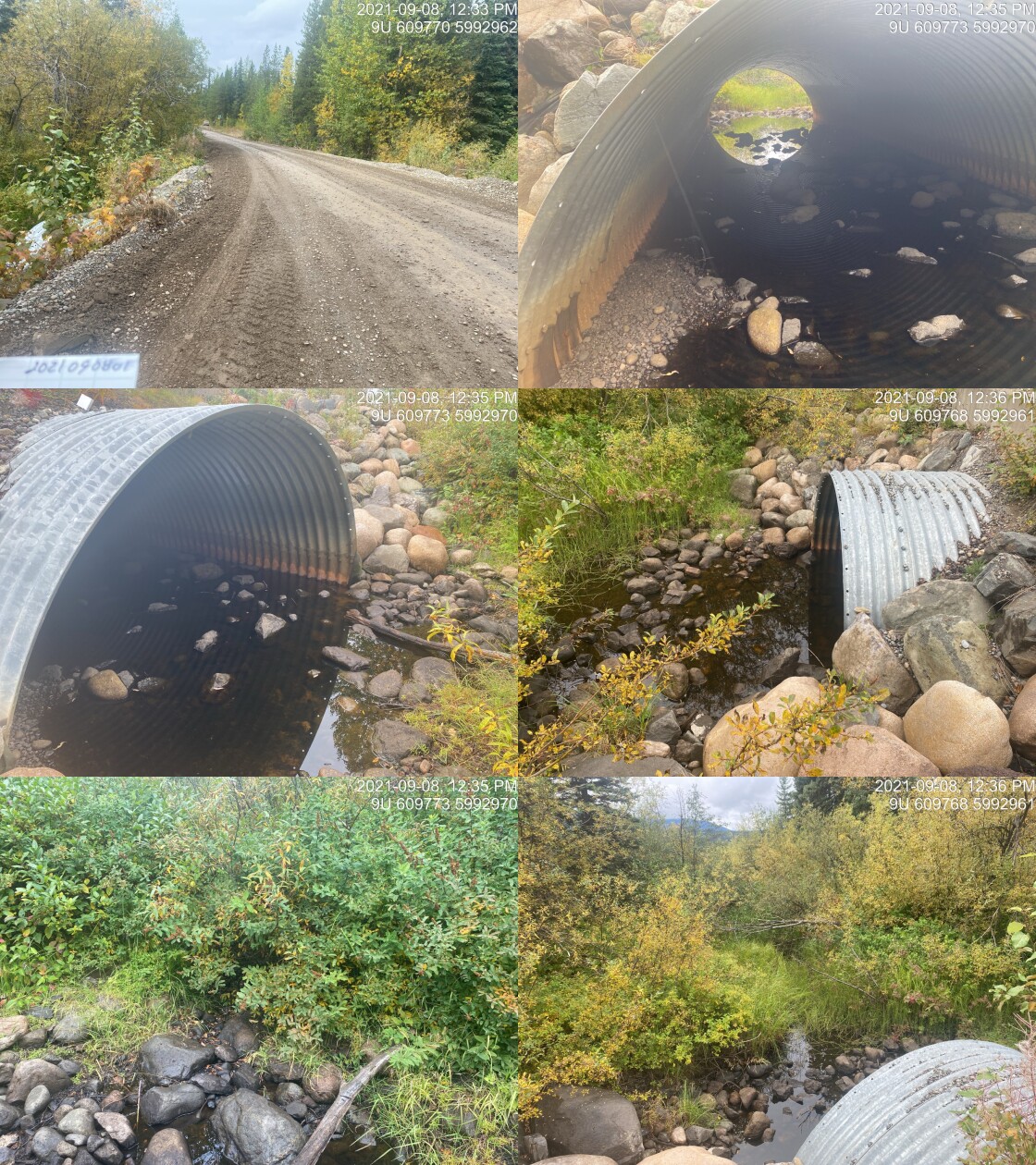
|
|||
| Comments: Pipe arch. 12:33 |
| Location and Stream Data |
|
Crossing Characteristics | – |
|---|---|---|---|
| Date | 2021-09-08 | Crossing Sub Type | Round Culvert |
| PSCIS ID | 198064 | Diameter (m) | 1.6 |
| External ID | 14001094 | Length (m) | 14 |
| Crew | KP AI TP VJ | Embedded | No |
| UTM Zone | 9 | Depth Embedded (m) | – |
| Easting | 623369 | Resemble Channel | No |
| Northing | 6000283 | Backwatered | No |
| Stream | Tributary to Lamprey Creek | Percent Backwatered | – |
| Road | Spur | Fill Depth (m) | 1 |
| Road Tenure | Canfor R05233 | Outlet Drop (m) | 0.54 |
| Channel Width (m) | 2.56 | Outlet Pool Depth (m) | 0.6 |
| Stream Slope (%) | 4.5 | Inlet Drop | No |
| Beaver Activity | No | Slope (%) | 5 |
| Habitat Value | Medium | Valley Fill | Deep Fill |
| Final score | 36 | Barrier Result | Barrier |
| Fix type | Replace with New Open Bottom Structure | Fix Span / Diameter | 10 |
Photos: PSCIS ID 198064. From top left clockwise: Road/Site Card, Barrel, Outlet, Downstream, Upstream, Inlet.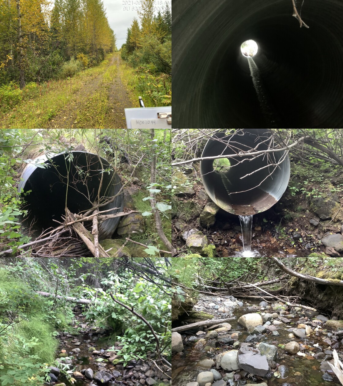
|
|||
| Comments: Habitat confirmation conducted. Fish observed (150mm). Good flows when compared to many other streams. 9:25 |
| Location and Stream Data |
|
Crossing Characteristics | – |
|---|---|---|---|
| Date | 2021-09-11 | Crossing Sub Type | Round Culvert |
| PSCIS ID | 198065 | Diameter (m) | 1.2 |
| External ID | 1800191 | Length (m) | 10 |
| Crew | AI | Embedded | No |
| UTM Zone | 9 | Depth Embedded (m) | – |
| Easting | 680197 | Resemble Channel | No |
| Northing | 6041647 | Backwatered | No |
| Stream | Watson Creek | Percent Backwatered | – |
| Road | Montgomery Road | Fill Depth (m) | 0.7 |
| Road Tenure | MoTi Local | Outlet Drop (m) | 0.13 |
| Channel Width (m) | 3 | Outlet Pool Depth (m) | 0.1 |
| Stream Slope (%) | 1 | Inlet Drop | No |
| Beaver Activity | No | Slope (%) | 1 |
| Habitat Value | Medium | Valley Fill | Deep Fill |
| Final score | 21 | Barrier Result | Barrier |
| Fix type | Replace with New Open Bottom Structure | Fix Span / Diameter | 10 |
Photos: PSCIS ID 198065. From top left clockwise: Road/Site Card, Barrel, Outlet, Downstream, Upstream, Inlet.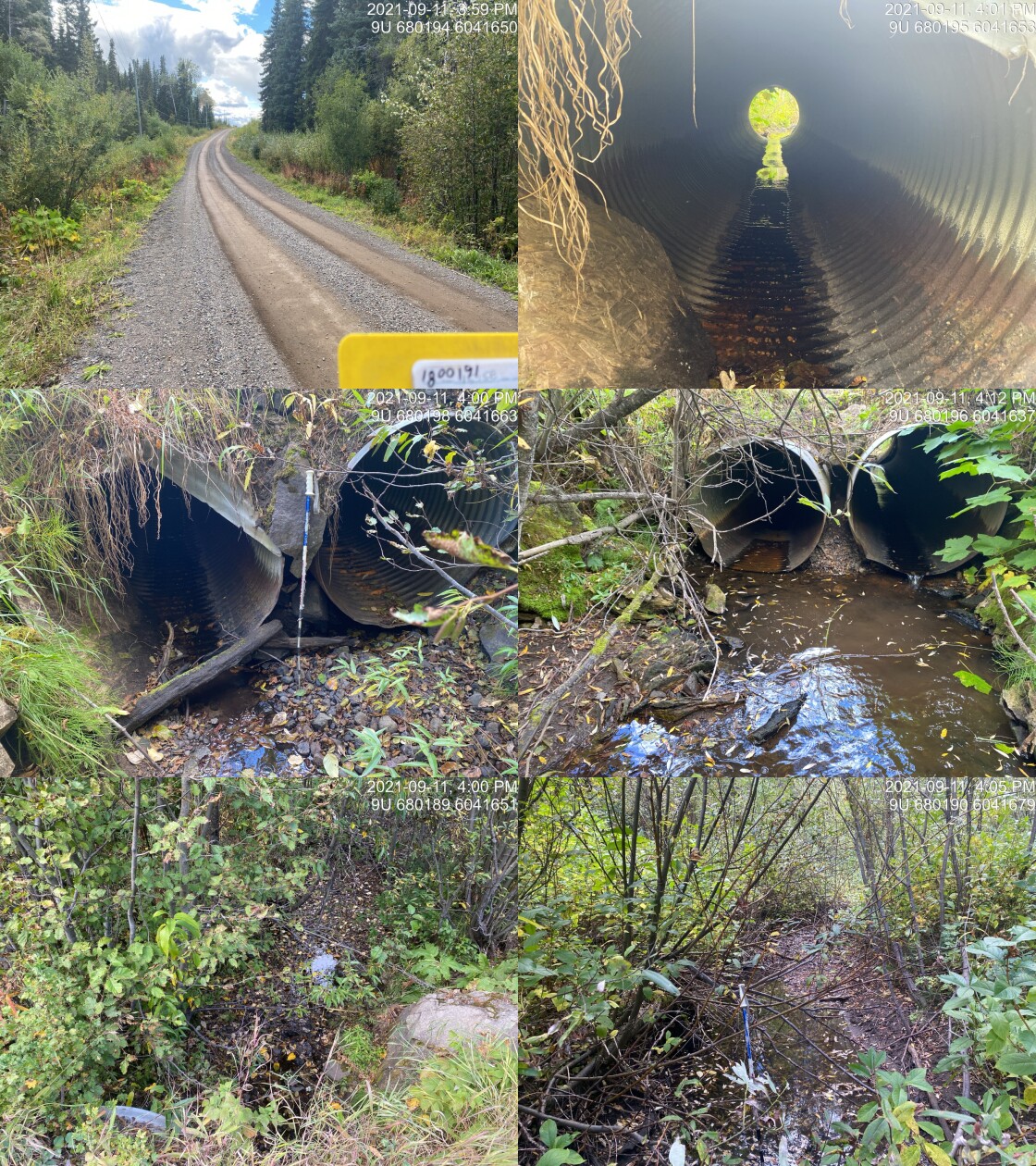
|
|||
| Comments: Very low flow but channel is mostly watered. Abundant gravels and excellent vegetation cover. 15:58 |
| Location and Stream Data |
|
Crossing Characteristics | – |
|---|---|---|---|
| Date | 2021-09-12 | Crossing Sub Type | Round Culvert |
| PSCIS ID | 198066 | Diameter (m) | 1.3 |
| External ID | 1802488 | Length (m) | 6 |
| Crew | AI | Embedded | No |
| UTM Zone | 9 | Depth Embedded (m) | – |
| Easting | 640243.9 | Resemble Channel | No |
| Northing | 6048061 | Backwatered | Yes |
| Stream | Thompson Creek | Percent Backwatered | 95 |
| Road | Private Road | Fill Depth (m) | 0.2 |
| Road Tenure | Unclassified | Outlet Drop (m) | 0 |
| Channel Width (m) | 2.77 | Outlet Pool Depth (m) | 0.1 |
| Stream Slope (%) | 0.5 | Inlet Drop | No |
| Beaver Activity | No | Slope (%) | 0.4 |
| Habitat Value | High | Valley Fill | Deep Fill |
| Final score | 16 | Barrier Result | Potential |
| Fix type | Replace with New Open Bottom Structure | Fix Span / Diameter | 10 |
Photos: PSCIS ID 198066. From top left clockwise: Road/Site Card, Barrel, Outlet, Downstream, Upstream, Inlet.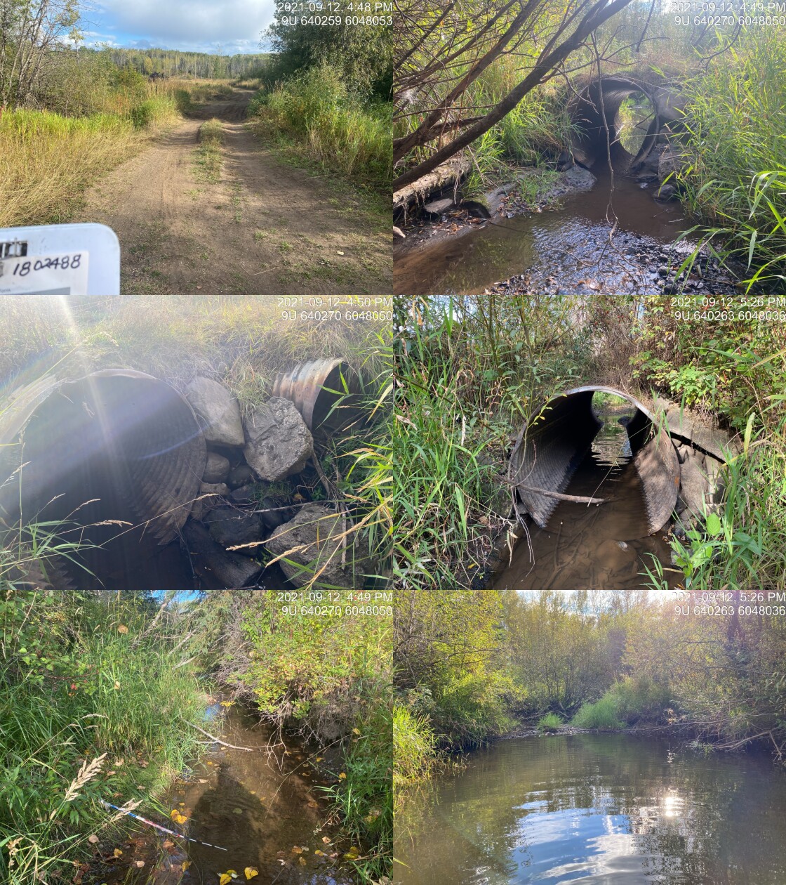
|
|||
| Comments: Udder View Farm. Currently appears passable for all life stages and species but may present slight barrier at time of year when flow are high. Large outlet pool indicates that culvert is undersized. Landowners adjacent to the stream report that the channel was historically relocated through the fields near the river and they would like to work together to relocate. 16:48 |
| Location and Stream Data |
|
Crossing Characteristics | – |
|---|---|---|---|
| Date | 2021-08-09 | Crossing Sub Type | Round Culvert |
| PSCIS ID | 198067 | Diameter (m) | 0.95 |
| External ID | 14000804 | Length (m) | 13 |
| Crew | LRH DM | Embedded | No |
| UTM Zone | 9 | Depth Embedded (m) | – |
| Easting | 620202 | Resemble Channel | No |
| Northing | 5998472 | Backwatered | No |
| Stream | Tributary to Lamprey Creek | Percent Backwatered | – |
| Road | Morice R FSR | Fill Depth (m) | 0.5 |
| Road Tenure | FLNR DND 4656 | Outlet Drop (m) | 0.2 |
| Channel Width (m) | 2.2 | Outlet Pool Depth (m) | 0.25 |
| Stream Slope (%) | 6 | Inlet Drop | Yes |
| Beaver Activity | No | Slope (%) | 2 |
| Habitat Value | Low | Valley Fill | Deep Fill |
| Final score | 26 | Barrier Result | Barrier |
| Fix type | Replace with New Open Bottom Structure | Fix Span / Diameter | 10 |
Photos: PSCIS ID 198067. From top left clockwise: Road/Site Card, Barrel, Outlet, Downstream, Upstream, Inlet.
|
|||
| Comments: Channel dry, Mainline - post code. |
| Location and Stream Data |
|
Crossing Characteristics | – |
|---|---|---|---|
| Date | 2021-08-09 | Crossing Sub Type | Round Culvert |
| PSCIS ID | 198068 | Diameter (m) | 0.5 |
| External ID | 14000815 | Length (m) | 13 |
| Crew | LRH DM | Embedded | No |
| UTM Zone | 9 | Depth Embedded (m) | – |
| Easting | 619989 | Resemble Channel | No |
| Northing | 5998259 | Backwatered | No |
| Stream | Tributary to Lamprey Creek | Percent Backwatered | – |
| Road | Morice R FSR | Fill Depth (m) | 0.3 |
| Road Tenure | FLNR DND 4656 | Outlet Drop (m) | 0.4 |
| Channel Width (m) | 0.8 | Outlet Pool Depth (m) | 0.5 |
| Stream Slope (%) | 2 | Inlet Drop | Yes |
| Beaver Activity | No | Slope (%) | 2 |
| Habitat Value | Low | Valley Fill | Deep Fill |
| Final score | 31 | Barrier Result | Barrier |
| Fix type | Replace Structure with Streambed Simulation CBS | Fix Span / Diameter | 3 |
Photos: PSCIS ID 198068. From top left clockwise: Road/Site Card, Barrel, Outlet, Downstream, Upstream, Inlet.
|
|||
| Comments: down stream channel follows ditch line, dry channel. |
| Location and Stream Data |
|
Crossing Characteristics | – |
|---|---|---|---|
| Date | 2021-08-09 | Crossing Sub Type | Round Culvert |
| PSCIS ID | 198069 | Diameter (m) | 0.8 |
| External ID | 14000256 | Length (m) | 9 |
| Crew | LRH DM | Embedded | No |
| UTM Zone | 9 | Depth Embedded (m) | – |
| Easting | 616234.1 | Resemble Channel | No |
| Northing | 5998376 | Backwatered | No |
| Stream | Tributary to Collins Lake | Percent Backwatered | – |
| Road | Morice Nado | Fill Depth (m) | 0.3 |
| Road Tenure | Unclassified | Outlet Drop (m) | 0.05 |
| Channel Width (m) | 2.5 | Outlet Pool Depth (m) | 0.5 |
| Stream Slope (%) | 2 | Inlet Drop | No |
| Beaver Activity | No | Slope (%) | 1 |
| Habitat Value | Medium | Valley Fill | Deep Fill |
| Final score | 21 | Barrier Result | Barrier |
| Fix type | Replace with New Open Bottom Structure | Fix Span / Diameter | 10 |
Photos: PSCIS ID 198069. From top left clockwise: Road/Site Card, Barrel, Outlet, Downstream, Upstream, Inlet.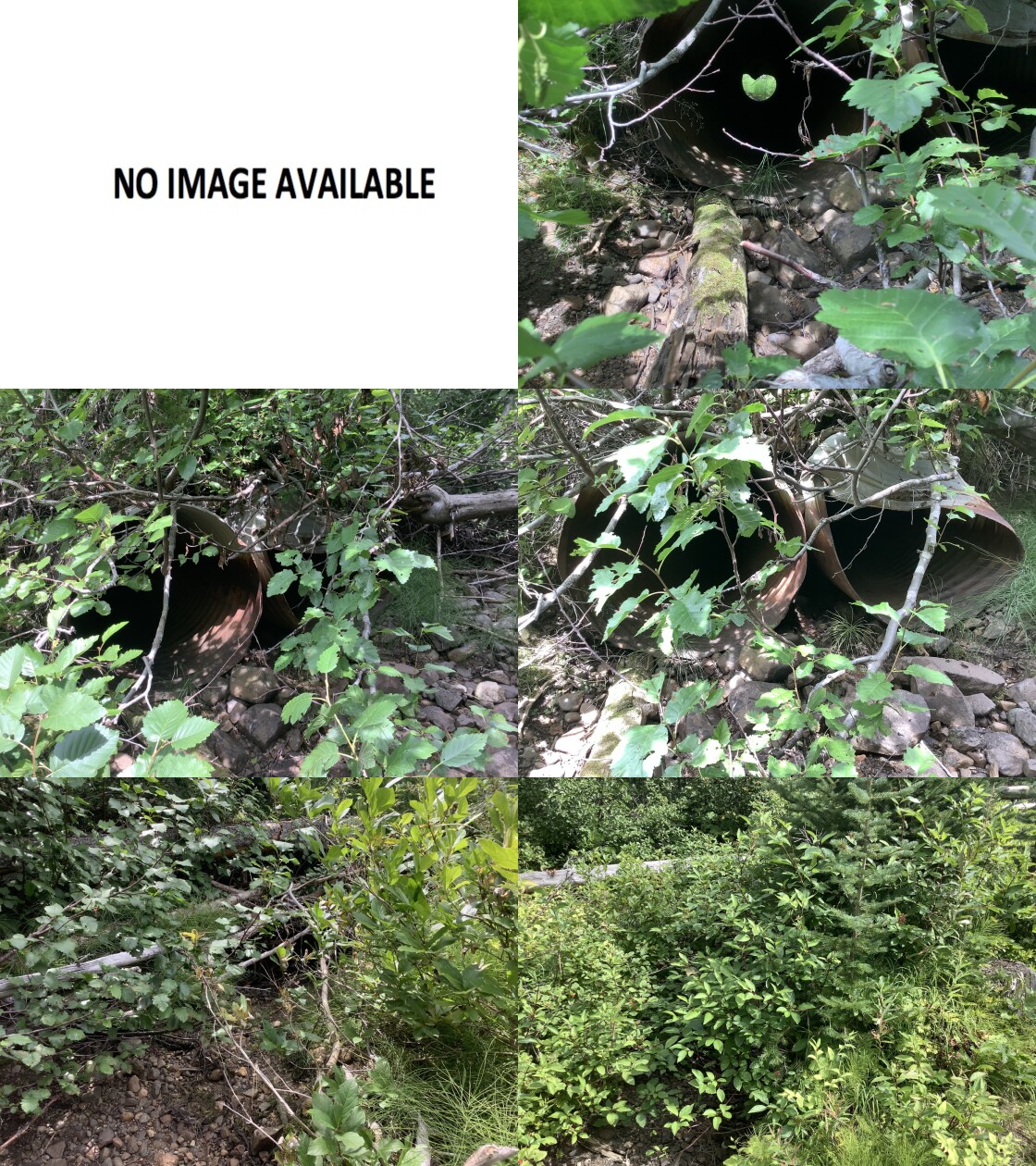
|
|||
| Comments: channel dry, old overgrown road, pooled after observed upslope of culvert |
| Location and Stream Data |
|
Crossing Characteristics | – |
|---|---|---|---|
| Date | 2021-08-11 | Crossing Sub Type | Bridge |
| PSCIS ID | 198070 | Diameter (m) | 13 |
| External ID | 14001029 | Length (m) | 6 |
| Crew | LRH DM | Embedded | – |
| UTM Zone | 9 | Depth Embedded (m) | – |
| Easting | 626238.6 | Resemble Channel | – |
| Northing | 6005131 | Backwatered | – |
| Stream | Tributary to Lamprey Creek | Percent Backwatered | – |
| Road | 7 Road | Fill Depth (m) | – |
| Road Tenure | Canfor R06460 | Outlet Drop (m) | – |
| Channel Width (m) | – | Outlet Pool Depth (m) | – |
| Stream Slope (%) | – | Inlet Drop | – |
| Beaver Activity | – | Slope (%) | – |
| Habitat Value | – | Valley Fill | – |
| Final score | 0 | Barrier Result | Passable |
| Fix type | – | Fix Span / Diameter | – |
Photos: PSCIS ID 198070. From top left clockwise: Road/Site Card, Barrel, Outlet, Downstream, Upstream, Inlet.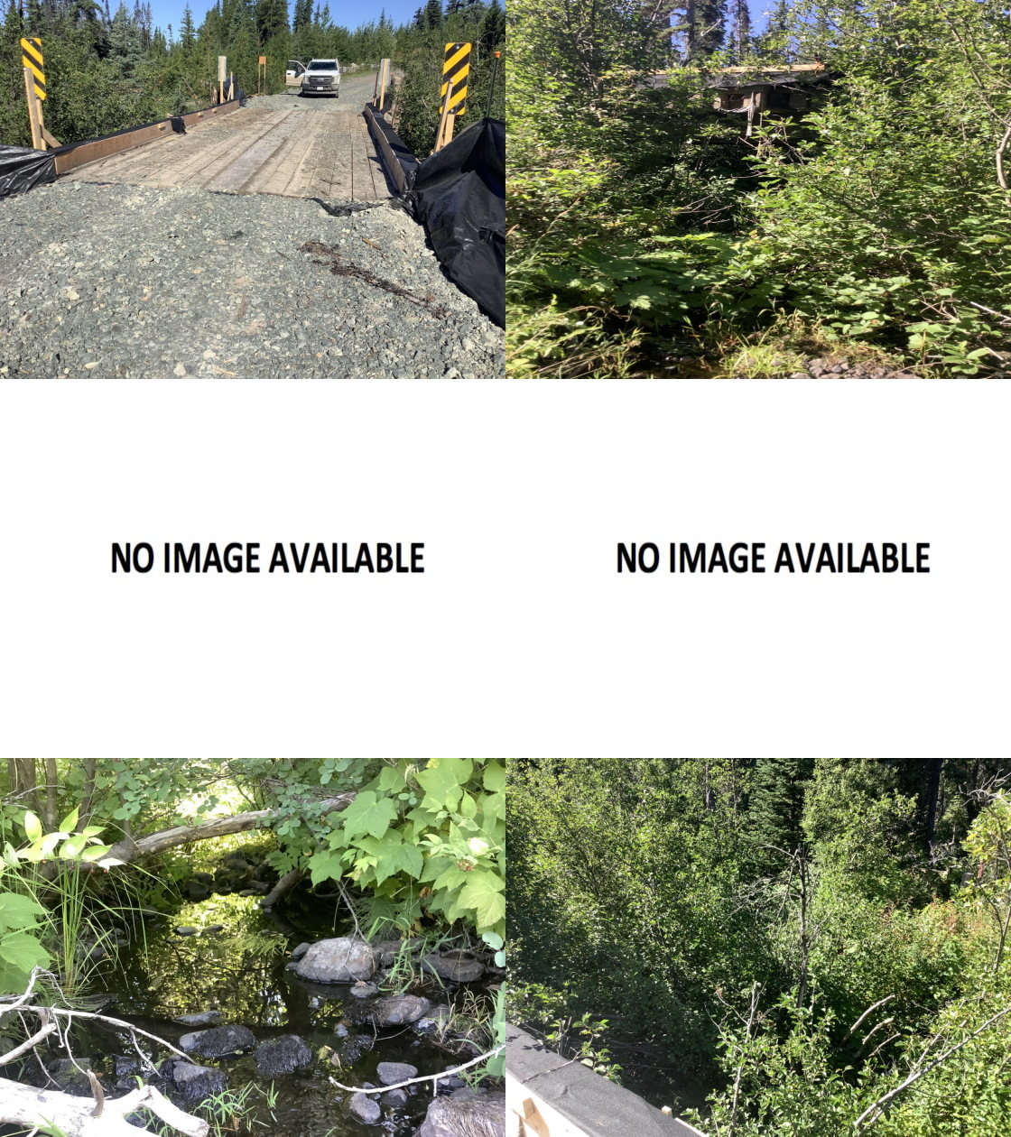
|
|||
| Comments: Bridge, 2 layers of sediment/erosion control cloth on and adjacent to bridge - installation by pipeline company |
| Location and Stream Data |
|
Crossing Characteristics | – |
|---|---|---|---|
| Date | 2021-08-09 | Crossing Sub Type | Round Culvert |
| PSCIS ID | 198071 | Diameter (m) | 0.8 |
| External ID | 14000022 | Length (m) | 6 |
| Crew | LRH DM | Embedded | No |
| UTM Zone | 9 | Depth Embedded (m) | – |
| Easting | 616801 | Resemble Channel | No |
| Northing | 5998662 | Backwatered | No |
| Stream | Tributary to Collins Lake | Percent Backwatered | – |
| Road | spur Morice Nado | Fill Depth (m) | 1 |
| Road Tenure | Unclassified | Outlet Drop (m) | 0 |
| Channel Width (m) | 2 | Outlet Pool Depth (m) | 0 |
| Stream Slope (%) | 1 | Inlet Drop | No |
| Beaver Activity | No | Slope (%) | 1 |
| Habitat Value | Medium | Valley Fill | Deep Fill |
| Final score | 21 | Barrier Result | Barrier |
| Fix type | Replace Structure with Streambed Simulation CBS | Fix Span / Diameter | 3 |
Photos: PSCIS ID 198071. From top left clockwise: Road/Site Card, Barrel, Outlet, Downstream, Upstream, Inlet.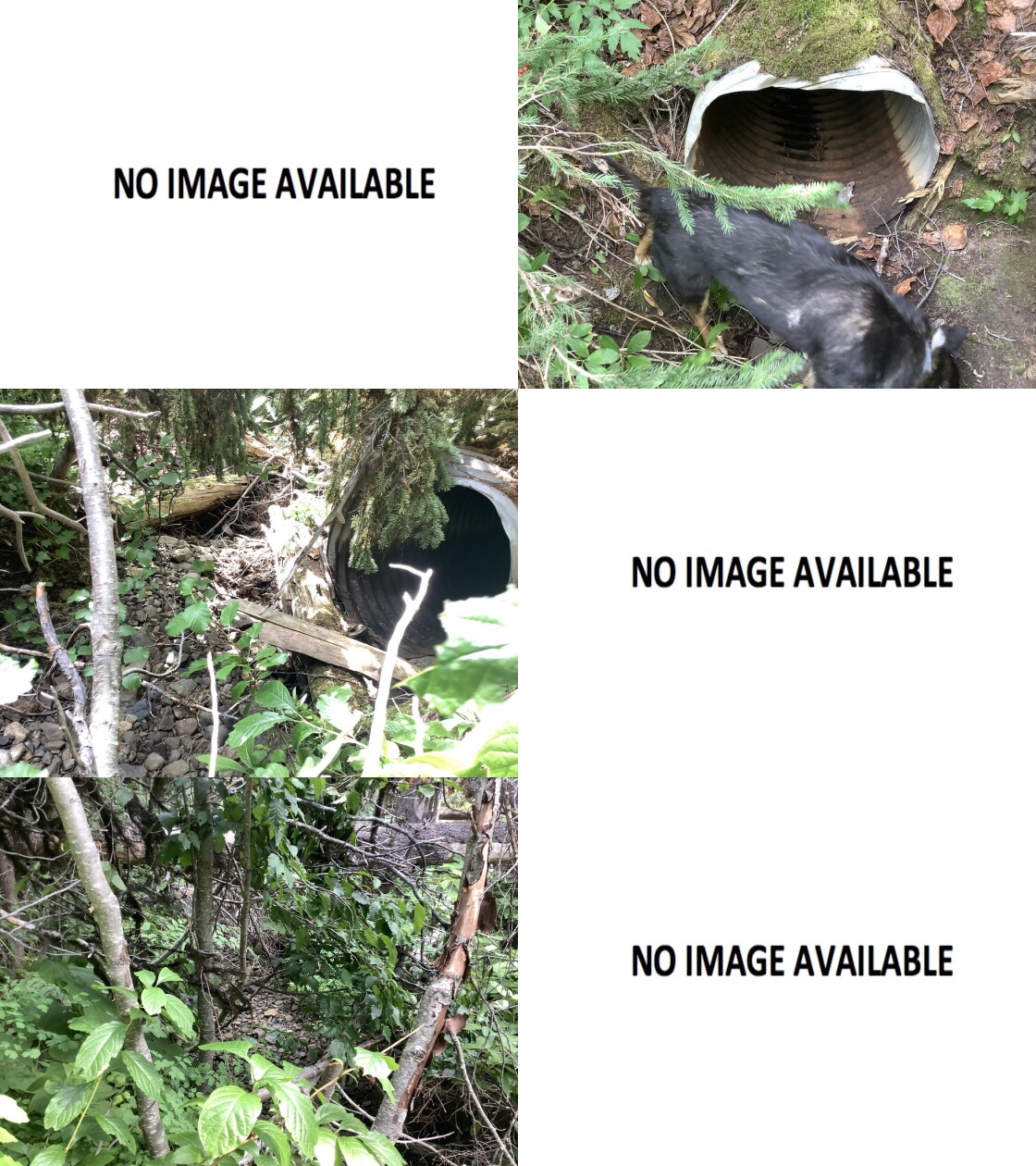
|
|||
| Comments: stream diverted onto road for approximately 500m - between ‘modelled crossing Ids’ 1014000022 and 1014000256, remove structure and restore to original channel, old pre-code logging |
| Location and Stream Data |
|
Crossing Characteristics | – |
|---|---|---|---|
| Date | 2021-08-10 | Crossing Sub Type | Round Culvert |
| PSCIS ID | 198072 | Diameter (m) | 0.9 |
| External ID | 14000892 | Length (m) | 16 |
| Crew | LRH DM | Embedded | No |
| UTM Zone | 9 | Depth Embedded (m) | – |
| Easting | 620392.1 | Resemble Channel | No |
| Northing | 5991273 | Backwatered | No |
| Stream | Tributary to Lamprey Creek | Percent Backwatered | – |
| Road | Spur | Fill Depth (m) | 2 |
| Road Tenure | Canfor R10987 | Outlet Drop (m) | 0 |
| Channel Width (m) | 1 | Outlet Pool Depth (m) | 0 |
| Stream Slope (%) | 4 | Inlet Drop | No |
| Beaver Activity | No | Slope (%) | 0 |
| Habitat Value | Low | Valley Fill | Deep Fill |
| Final score | 16 | Barrier Result | Potential |
| Fix type | Replace Structure with Streambed Simulation CBS | Fix Span / Diameter | 3 |
Photos: PSCIS ID 198072. From top left clockwise: Road/Site Card, Barrel, Outlet, Downstream, Upstream, Inlet.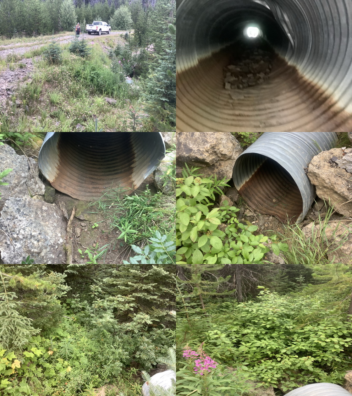
|
|||
| Comments: Dry channel, Post Code |
| Location and Stream Data |
|
Crossing Characteristics | – |
|---|---|---|---|
| Date | 2021-08-09 | Crossing Sub Type | Ford |
| PSCIS ID | 198073 | Diameter (m) | – |
| External ID | 14000322 | Length (m) | – |
| Crew | LRH DM | Embedded | – |
| UTM Zone | 9 | Depth Embedded (m) | – |
| Easting | 616899.2 | Resemble Channel | – |
| Northing | 5998674 | Backwatered | – |
| Stream | Tributary to Collins Lake | Percent Backwatered | – |
| Road | spur Morice Nado | Fill Depth (m) | – |
| Road Tenure | Resource | Outlet Drop (m) | – |
| Channel Width (m) | – | Outlet Pool Depth (m) | – |
| Stream Slope (%) | – | Inlet Drop | – |
| Beaver Activity | – | Slope (%) | – |
| Habitat Value | – | Valley Fill | – |
| Final score | 0 | Barrier Result | Unknown |
| Fix type | – | Fix Span / Diameter | – |
Photos: PSCIS ID 198073. From top left clockwise: Road/Site Card, Barrel, Outlet, Downstream, Upstream, Inlet.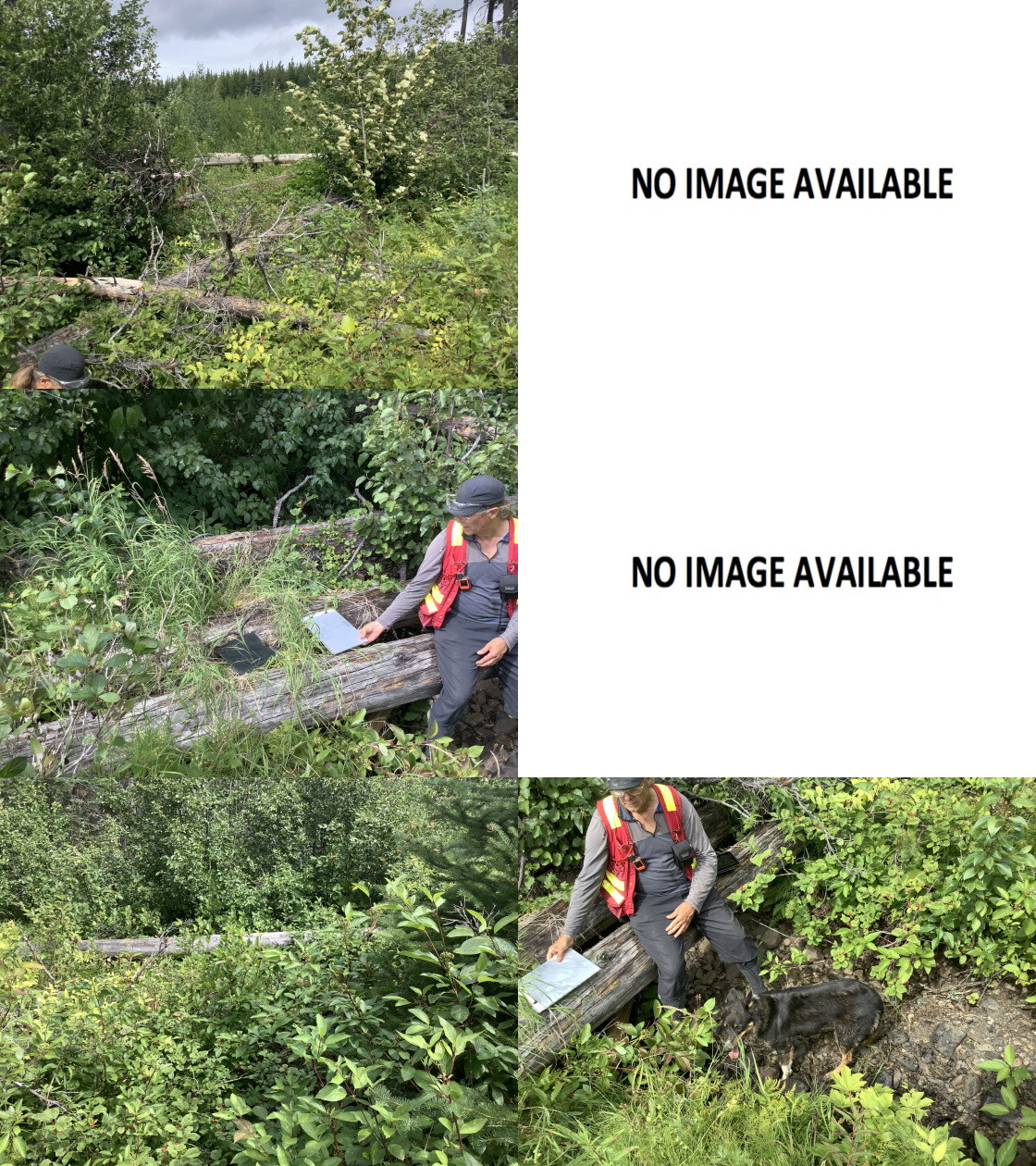
|
|||
| Comments: Deactivated road - no structure. |
| Location and Stream Data |
|
Crossing Characteristics | – |
|---|---|---|---|
| Date | 2021-08-10 | Crossing Sub Type | Bridge |
| PSCIS ID | 198074 | Diameter (m) | 9 |
| External ID | 14000967 | Length (m) | 5 |
| Crew | LRH DM | Embedded | – |
| UTM Zone | 9 | Depth Embedded (m) | – |
| Easting | 624444.3 | Resemble Channel | – |
| Northing | 6002416 | Backwatered | – |
| Stream | Tributary to Lamprey Creek | Percent Backwatered | – |
| Road | 08 Road | Fill Depth (m) | – |
| Road Tenure | Unclassified | Outlet Drop (m) | – |
| Channel Width (m) | – | Outlet Pool Depth (m) | – |
| Stream Slope (%) | – | Inlet Drop | – |
| Beaver Activity | – | Slope (%) | – |
| Habitat Value | – | Valley Fill | – |
| Final score | 0 | Barrier Result | Passable |
| Fix type | – | Fix Span / Diameter | – |
Photos: PSCIS ID 198074. From top left clockwise: Road/Site Card, Barrel, Outlet, Downstream, Upstream, Inlet.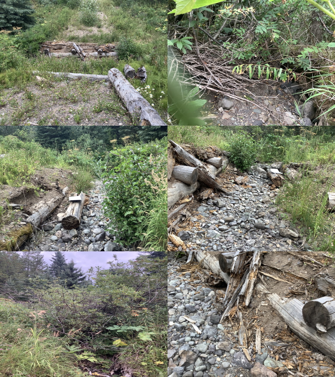
|
|||
| Comments: dry channel, post code. Width estimated. |
| Location and Stream Data |
|
Crossing Characteristics | – |
|---|---|---|---|
| Date | 2021-08-09 | Crossing Sub Type | Round Culvert |
| PSCIS ID | 198075 | Diameter (m) | 0.6 |
| External ID | 14001624 | Length (m) | 9 |
| Crew | LRH DM | Embedded | No |
| UTM Zone | 9 | Depth Embedded (m) | 0.05 |
| Easting | 618396.2 | Resemble Channel | Yes |
| Northing | 5996675 | Backwatered | Yes |
| Stream | Tributary to Collins Lake | Percent Backwatered | 50 |
| Road | Spur | Fill Depth (m) | 1 |
| Road Tenure | Resource | Outlet Drop (m) | 0 |
| Channel Width (m) | 0.65 | Outlet Pool Depth (m) | 0 |
| Stream Slope (%) | 10 | Inlet Drop | Yes |
| Beaver Activity | No | Slope (%) | 2 |
| Habitat Value | Low | Valley Fill | Deep Fill |
| Final score | 18 | Barrier Result | Potential |
| Fix type | Replace Structure with Streambed Simulation CBS | Fix Span / Diameter | 3 |
Photos: PSCIS ID 198075. From top left clockwise: Road/Site Card, Barrel, Outlet, Downstream, Upstream, Inlet.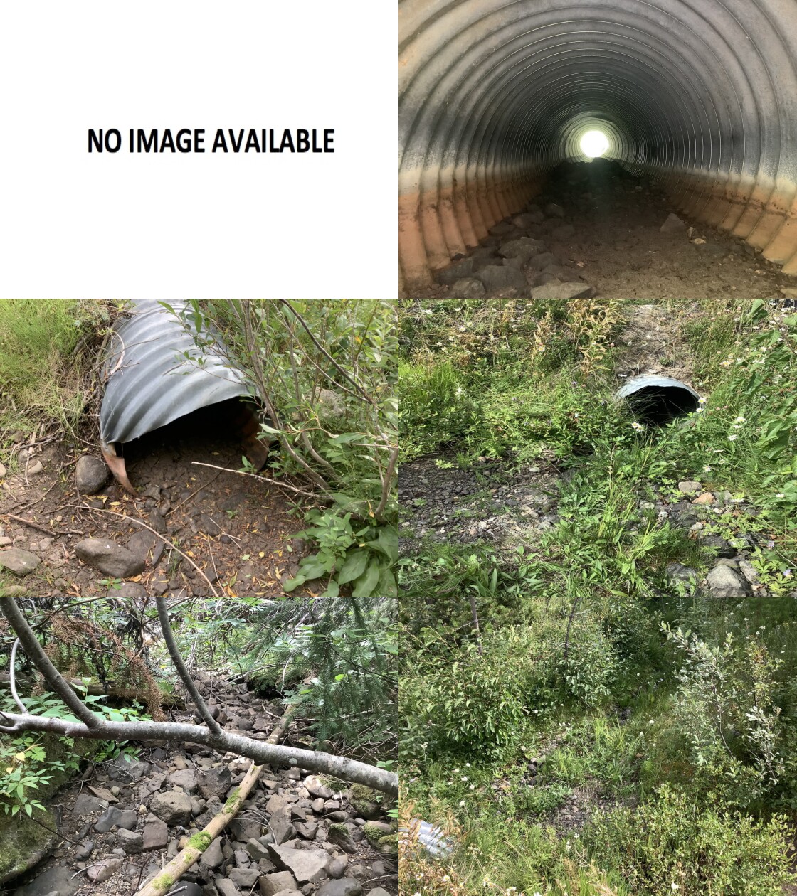
|
|||
| Comments: dry channel, crossing takes the ditch line flow as well resulting in downstream channel being larger than up stream, post-code logging |
| Location and Stream Data |
|
Crossing Characteristics | – |
|---|---|---|---|
| Date | 2021-08-10 | Crossing Sub Type | Wood Box Culvert |
| PSCIS ID | 198076 | Diameter (m) | 3 |
| External ID | 14000593 | Length (m) | 6 |
| Crew | LRH DM | Embedded | – |
| UTM Zone | 9 | Depth Embedded (m) | – |
| Easting | 621807 | Resemble Channel | – |
| Northing | 5996215 | Backwatered | – |
| Stream | Tributary to Lamprey Creek | Percent Backwatered | – |
| Road | Spur | Fill Depth (m) | – |
| Road Tenure | Canfor R05233 | Outlet Drop (m) | – |
| Channel Width (m) | – | Outlet Pool Depth (m) | – |
| Stream Slope (%) | – | Inlet Drop | – |
| Beaver Activity | – | Slope (%) | – |
| Habitat Value | – | Valley Fill | – |
| Final score | 0 | Barrier Result | Passable |
| Fix type | – | Fix Span / Diameter | – |
Photos: PSCIS ID 198076. From top left clockwise: Road/Site Card, Barrel, Outlet, Downstream, Upstream, Inlet.
|
|||
| Comments: Upstream channel contains some pooled water, up stream the stream is diverted down ditch line and over tops road 30m from old crossing. Pre Code logging. Span estimated. |
| Location and Stream Data |
|
Crossing Characteristics | – |
|---|---|---|---|
| Date | 2021-08-10 | Crossing Sub Type | Bridge |
| PSCIS ID | 198077 | Diameter (m) | 13 |
| External ID | 24740003 | Length (m) | 5 |
| Crew | LRH DM | Embedded | – |
| UTM Zone | 9 | Depth Embedded (m) | – |
| Easting | 622870.2 | Resemble Channel | – |
| Northing | 5988875 | Backwatered | – |
| Stream | Tributary to Lamprey Creek | Percent Backwatered | – |
| Road | Bill Nye spur | Fill Depth (m) | – |
| Road Tenure | Unclassified | Outlet Drop (m) | – |
| Channel Width (m) | – | Outlet Pool Depth (m) | – |
| Stream Slope (%) | – | Inlet Drop | – |
| Beaver Activity | – | Slope (%) | – |
| Habitat Value | – | Valley Fill | – |
| Final score | 0 | Barrier Result | Passable |
| Fix type | – | Fix Span / Diameter | – |
Photos: PSCIS ID 198077. From top left clockwise: Road/Site Card, Barrel, Outlet, Downstream, Upstream, Inlet.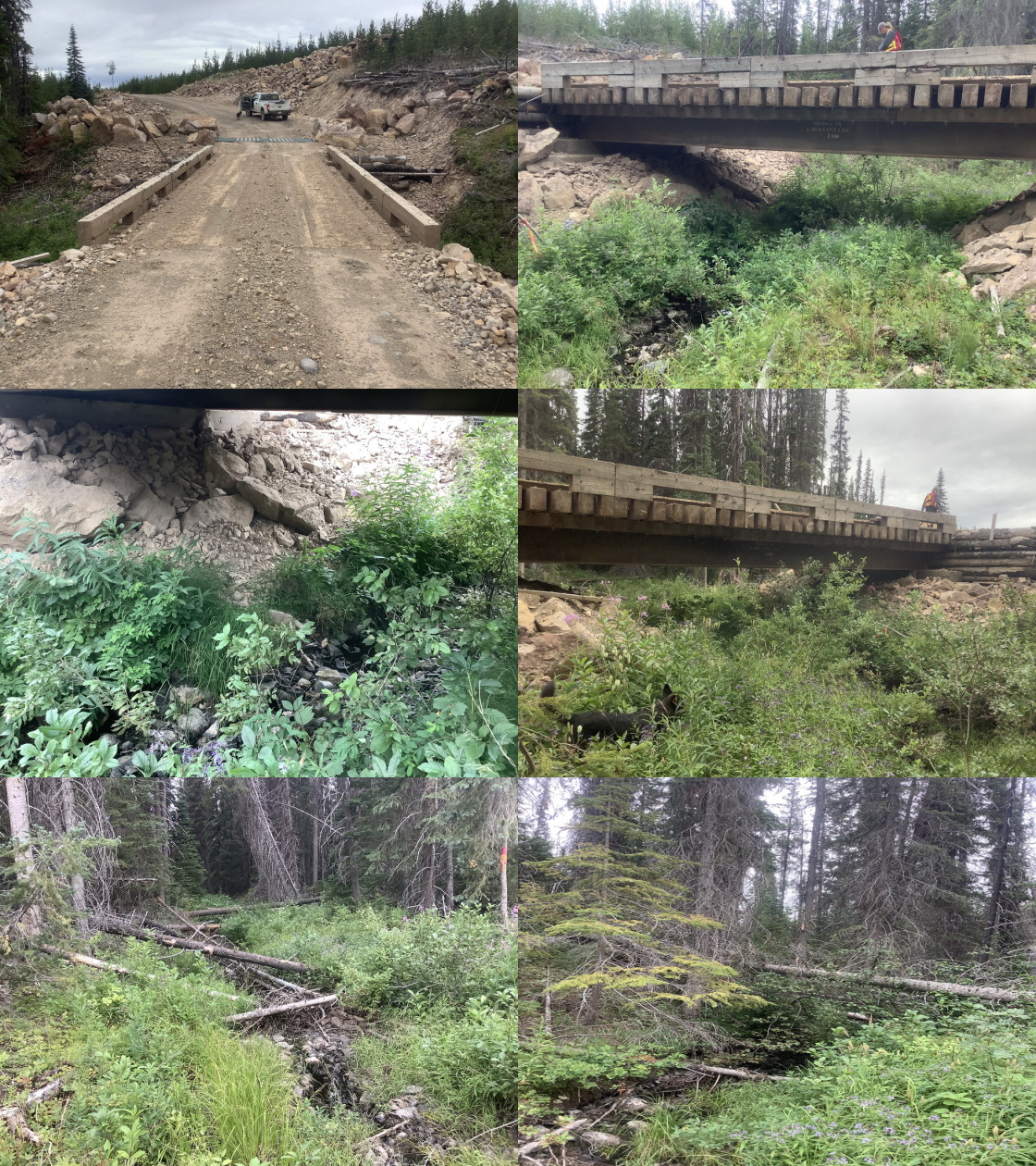
|
|||
| Comments: Al #03, post code recent build |
| Location and Stream Data |
|
Crossing Characteristics | – |
|---|---|---|---|
| Date | 2021-08-10 | Crossing Sub Type | Bridge |
| PSCIS ID | 198078 | Diameter (m) | 12 |
| External ID | 14000897 | Length (m) | 5 |
| Crew | LRH DM | Embedded | – |
| UTM Zone | 9 | Depth Embedded (m) | – |
| Easting | 622108 | Resemble Channel | – |
| Northing | 5990680 | Backwatered | – |
| Stream | Tributary to Lamprey Creek | Percent Backwatered | – |
| Road | Bill Nye spur | Fill Depth (m) | – |
| Road Tenure | Canfor R10987 | Outlet Drop (m) | – |
| Channel Width (m) | – | Outlet Pool Depth (m) | – |
| Stream Slope (%) | – | Inlet Drop | – |
| Beaver Activity | – | Slope (%) | – |
| Habitat Value | – | Valley Fill | – |
| Final score | 0 | Barrier Result | Passable |
| Fix type | – | Fix Span / Diameter | – |
Photos: PSCIS ID 198078. From top left clockwise: Road/Site Card, Barrel, Outlet, Downstream, Upstream, Inlet.
|
|||
| Comments: Post Code |
| Location and Stream Data |
|
Crossing Characteristics | – |
|---|---|---|---|
| Date | 2021-08-10 | Crossing Sub Type | Round Culvert |
| PSCIS ID | 198079 | Diameter (m) | 1 |
| External ID | 14000890 | Length (m) | 13 |
| Crew | LRH DM | Embedded | No |
| UTM Zone | 9 | Depth Embedded (m) | – |
| Easting | 620641.4 | Resemble Channel | No |
| Northing | 5990771 | Backwatered | Yes |
| Stream | Tributary to Lamprey Creek | Percent Backwatered | 50 |
| Road | Spur | Fill Depth (m) | 1.5 |
| Road Tenure | Canfor R10987 | Outlet Drop (m) | 0 |
| Channel Width (m) | 0.9 | Outlet Pool Depth (m) | 0 |
| Stream Slope (%) | 2 | Inlet Drop | No |
| Beaver Activity | No | Slope (%) | 3 |
| Habitat Value | Medium | Valley Fill | Deep Fill |
| Final score | 20 | Barrier Result | Barrier |
| Fix type | Replace Structure with Streambed Simulation CBS | Fix Span / Diameter | 3 |
Photos: PSCIS ID 198079. From top left clockwise: Road/Site Card, Barrel, Outlet, Downstream, Upstream, Inlet.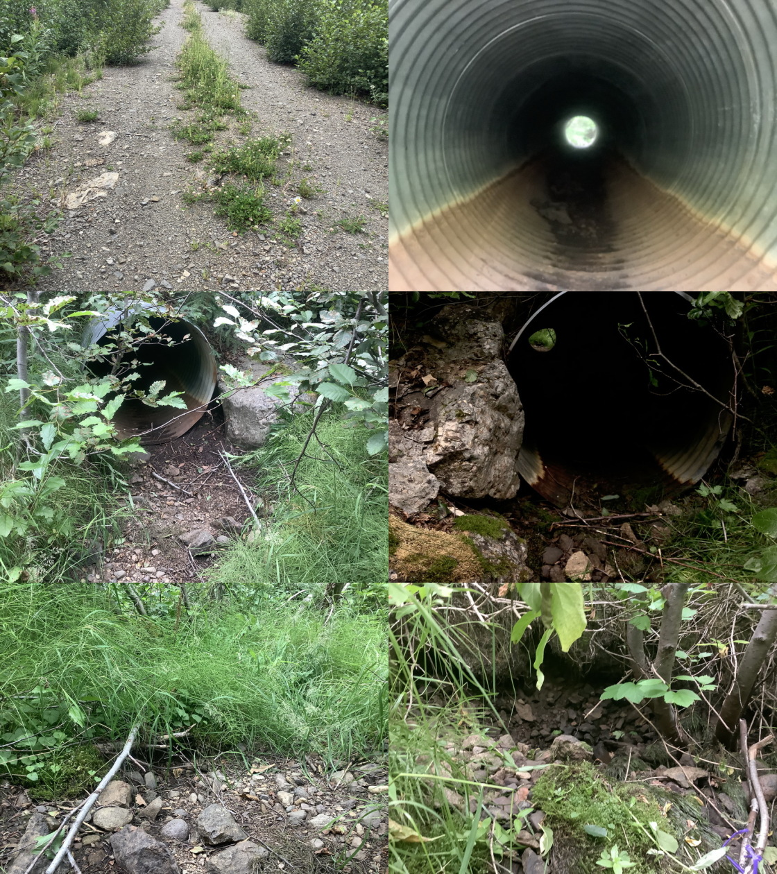
|
|||
| Comments: Confirm fish value, small intermittent streams with high habitat values? Post Code |
| Location and Stream Data |
|
Crossing Characteristics | – |
|---|---|---|---|
| Date | 2021-08-10 | Crossing Sub Type | Round Culvert |
| PSCIS ID | 198080 | Diameter (m) | 0.5 |
| External ID | 14000894 | Length (m) | 10 |
| Crew | LRH DM | Embedded | No |
| UTM Zone | 9 | Depth Embedded (m) | – |
| Easting | 620681.5 | Resemble Channel | No |
| Northing | 5990583 | Backwatered | No |
| Stream | Tributary to Lamprey Creek | Percent Backwatered | – |
| Road | Spur | Fill Depth (m) | 1 |
| Road Tenure | Canfor R10987 | Outlet Drop (m) | 0 |
| Channel Width (m) | 0.6 | Outlet Pool Depth (m) | 0.2 |
| Stream Slope (%) | 3 | Inlet Drop | No |
| Beaver Activity | No | Slope (%) | 4 |
| Habitat Value | Medium | Valley Fill | Deep Fill |
| Final score | 23 | Barrier Result | Barrier |
| Fix type | Replace Structure with Streambed Simulation CBS | Fix Span / Diameter | 3 |
Photos: PSCIS ID 198080. From top left clockwise: Road/Site Card, Barrel, Outlet, Downstream, Upstream, Inlet.
|
|||
| Comments: Channel has ponded water/wetland up and down stream - Post Code |
| Location and Stream Data |
|
Crossing Characteristics | – |
|---|---|---|---|
| Date | 2021-08-10 | Crossing Sub Type | Round Culvert |
| PSCIS ID | 198081 | Diameter (m) | 1 |
| External ID | 14000592 | Length (m) | 13 |
| Crew | LRH DM | Embedded | No |
| UTM Zone | 9 | Depth Embedded (m) | – |
| Easting | 620084.6 | Resemble Channel | No |
| Northing | 5994112 | Backwatered | No |
| Stream | Tributary to Lamprey Creek | Percent Backwatered | – |
| Road | 07 Road | Fill Depth (m) | 1 |
| Road Tenure | Resource | Outlet Drop (m) | 0.3 |
| Channel Width (m) | 1.6 | Outlet Pool Depth (m) | 0.55 |
| Stream Slope (%) | 5 | Inlet Drop | No |
| Beaver Activity | No | Slope (%) | 2 |
| Habitat Value | Low | Valley Fill | Deep Fill |
| Final score | 31 | Barrier Result | Barrier |
| Fix type | Replace Structure with Streambed Simulation CBS | Fix Span / Diameter | 3 |
Photos: PSCIS ID 198081. From top left clockwise: Road/Site Card, Barrel, Outlet, Downstream, Upstream, Inlet.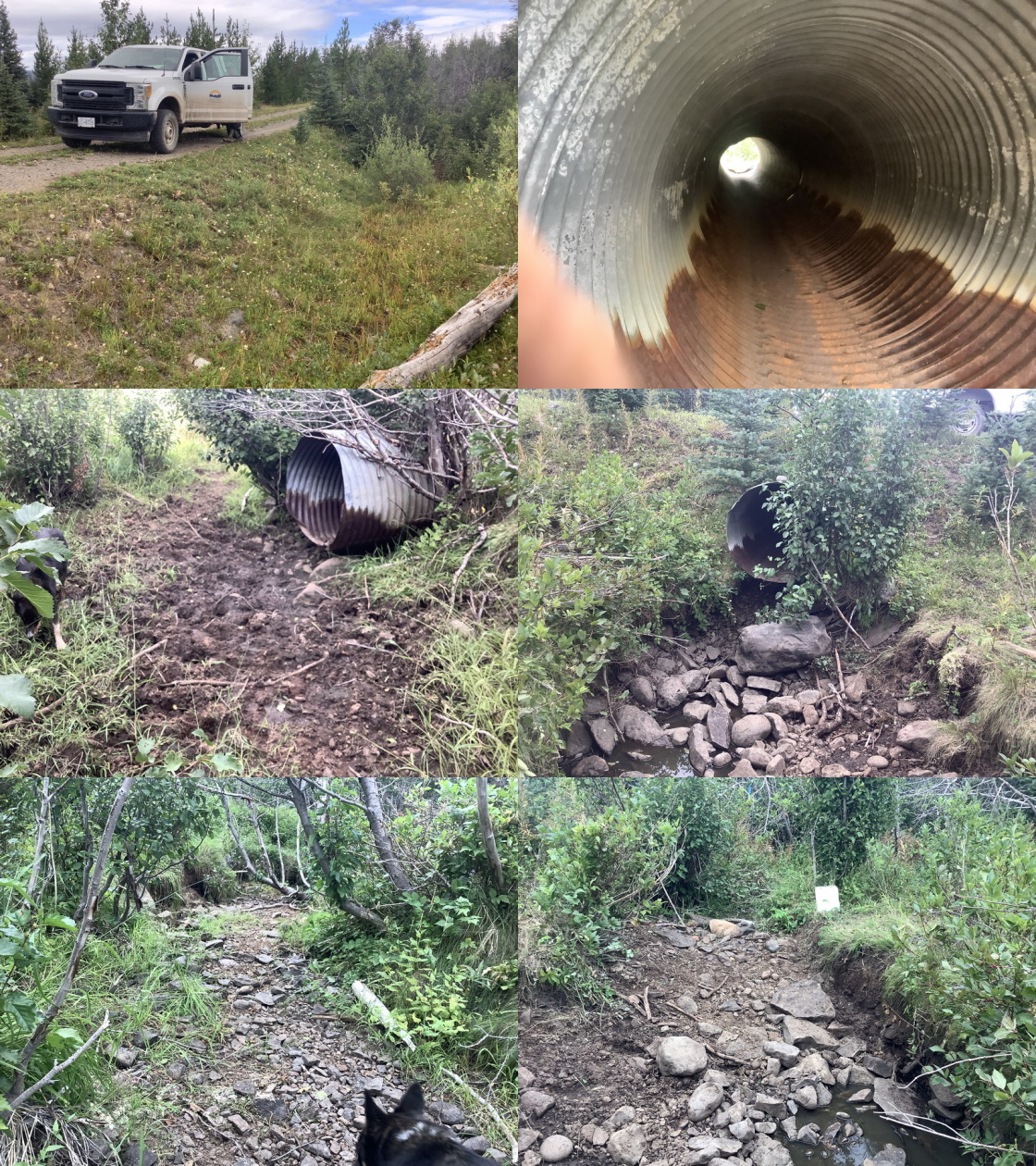
|
|||
| Comments: Inlet 35cm above channel, inlet and outlet damaged by cows, Post Code |
| Location and Stream Data |
|
Crossing Characteristics | – |
|---|---|---|---|
| Date | 2021-08-10 | Crossing Sub Type | Round Culvert |
| PSCIS ID | 198082 | Diameter (m) | 0.6 |
| External ID | 14001062 | Length (m) | 15 |
| Crew | LRH DM | Embedded | No |
| UTM Zone | 9 | Depth Embedded (m) | – |
| Easting | 622408 | Resemble Channel | No |
| Northing | 5997287 | Backwatered | No |
| Stream | Tributary to Lamprey Creek | Percent Backwatered | – |
| Road | Bill Nye | Fill Depth (m) | 1.5 |
| Road Tenure | Canfor R05233 | Outlet Drop (m) | 0.1 |
| Channel Width (m) | 0.6 | Outlet Pool Depth (m) | 0.15 |
| Stream Slope (%) | 1 | Inlet Drop | No |
| Beaver Activity | No | Slope (%) | 3 |
| Habitat Value | Medium | Valley Fill | Deep Fill |
| Final score | 26 | Barrier Result | Barrier |
| Fix type | Replace Structure with Streambed Simulation CBS | Fix Span / Diameter | 3 |
Photos: PSCIS ID 198082. From top left clockwise: Road/Site Card, Barrel, Outlet, Downstream, Upstream, Inlet.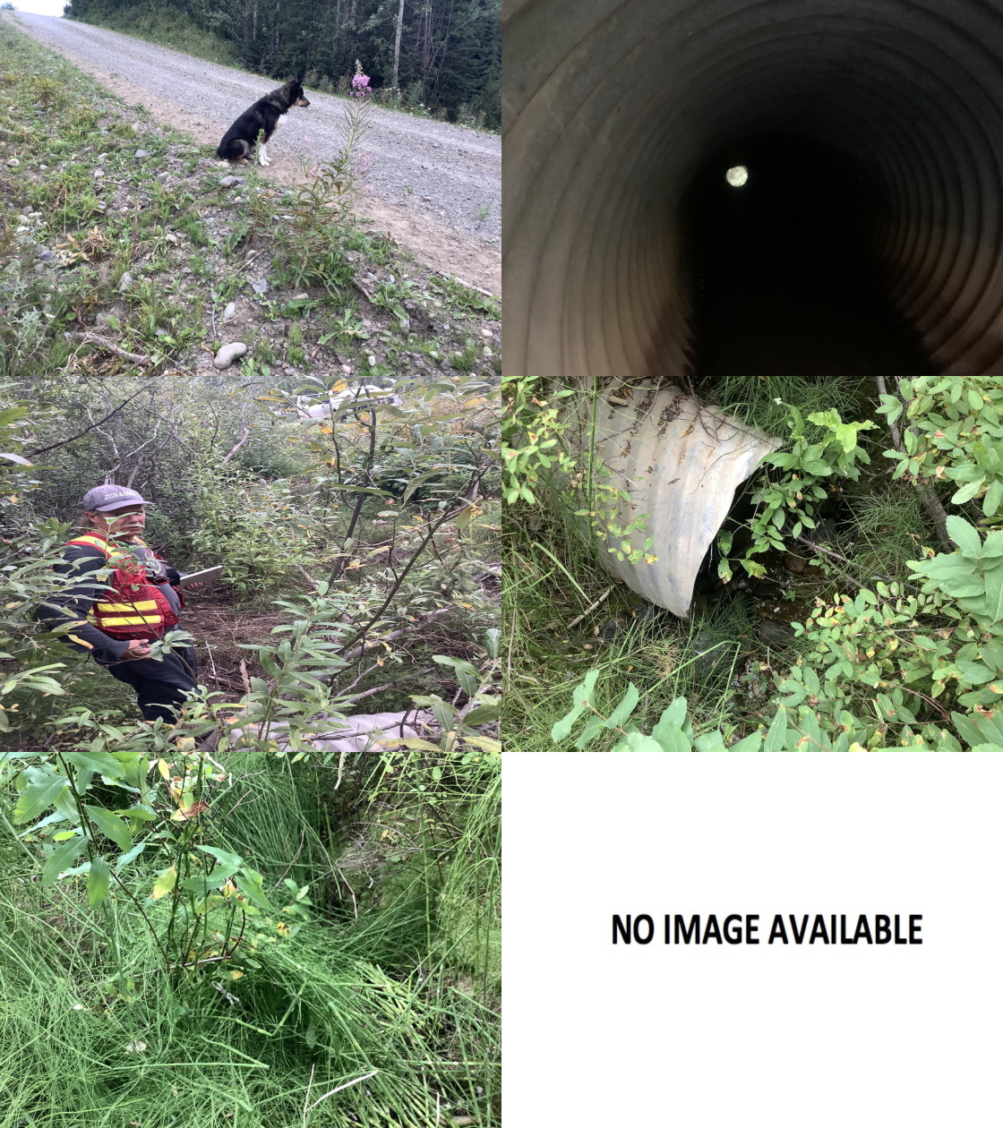
|
|||
| Comments: pooled water above crossing, pre code road, post code culvert |
| Location and Stream Data |
|
Crossing Characteristics | – |
|---|---|---|---|
| Date | 2021-08-11 | Crossing Sub Type | Ford |
| PSCIS ID | 198083 | Diameter (m) | – |
| External ID | 14001112 | Length (m) | – |
| Crew | LRH DM | Embedded | – |
| UTM Zone | 9 | Depth Embedded (m) | – |
| Easting | 627288.6 | Resemble Channel | – |
| Northing | 6003665 | Backwatered | – |
| Stream | Tributary to Lamprey Creek | Percent Backwatered | – |
| Road | 11 Road | Fill Depth (m) | – |
| Road Tenure | Resource | Outlet Drop (m) | – |
| Channel Width (m) | – | Outlet Pool Depth (m) | – |
| Stream Slope (%) | – | Inlet Drop | – |
| Beaver Activity | – | Slope (%) | – |
| Habitat Value | – | Valley Fill | – |
| Final score | 0 | Barrier Result | Unknown |
| Fix type | – | Fix Span / Diameter | – |
Photos: PSCIS ID 198083. From top left clockwise: Road/Site Card, Barrel, Outlet, Downstream, Upstream, Inlet.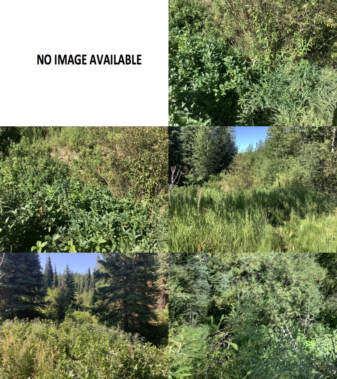
|
|||
| Comments: Deactivated spur, dry channel |
| Location and Stream Data |
|
Crossing Characteristics | – |
|---|---|---|---|
| Date | 2021-08-10 | Crossing Sub Type | Oval Culvert |
| PSCIS ID | 198084 | Diameter (m) | 1.5 |
| External ID | 14000968 | Length (m) | 14 |
| Crew | LRH DM | Embedded | No |
| UTM Zone | 9 | Depth Embedded (m) | – |
| Easting | 623986 | Resemble Channel | No |
| Northing | 6001191 | Backwatered | No |
| Stream | Tributary to Lamprey Creek | Percent Backwatered | – |
| Road | Spur | Fill Depth (m) | 1 |
| Road Tenure | Canfor R05233 | Outlet Drop (m) | 0.15 |
| Channel Width (m) | 0.9 | Outlet Pool Depth (m) | 0.18 |
| Stream Slope (%) | 9 | Inlet Drop | No |
| Beaver Activity | No | Slope (%) | 7 |
| Habitat Value | Medium | Valley Fill | Deep Fill |
| Final score | 25 | Barrier Result | Barrier |
| Fix type | Replace Structure with Streambed Simulation CBS | Fix Span / Diameter | 3 |
Photos: PSCIS ID 198084. From top left clockwise: Road/Site Card, Barrel, Outlet, Downstream, Upstream, Inlet.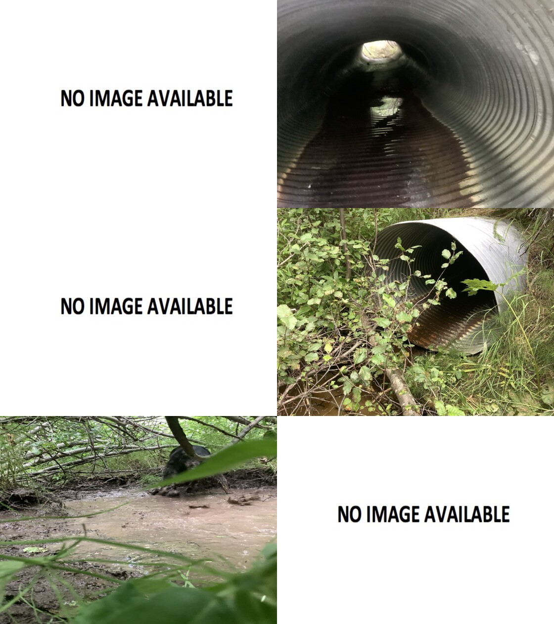
|
|||
| Comments: Water in channel (pooled) above and below, Post Code |
| Location and Stream Data |
|
Crossing Characteristics | – |
|---|---|---|---|
| Date | 2021-08-11 | Crossing Sub Type | Round Culvert |
| PSCIS ID | 198085 | Diameter (m) | 0.9 |
| External ID | 14000799 | Length (m) | 13 |
| Crew | LRH DM | Embedded | No |
| UTM Zone | 9 | Depth Embedded (m) | – |
| Easting | 623422 | Resemble Channel | No |
| Northing | 6001388 | Backwatered | No |
| Stream | Tributary to Lamprey Creek | Percent Backwatered | – |
| Road | Morice FSR | Fill Depth (m) | 1 |
| Road Tenure | FLNR DND 4656 | Outlet Drop (m) | 1.6 |
| Channel Width (m) | 1.4 | Outlet Pool Depth (m) | 0.3 |
| Stream Slope (%) | 8 | Inlet Drop | Yes |
| Beaver Activity | No | Slope (%) | 5 |
| Habitat Value | Medium | Valley Fill | Deep Fill |
| Final score | 36 | Barrier Result | Barrier |
| Fix type | Replace Structure with Streambed Simulation CBS | Fix Span / Diameter | 3 |
Photos: PSCIS ID 198085. From top left clockwise: Road/Site Card, Barrel, Outlet, Downstream, Upstream, Inlet.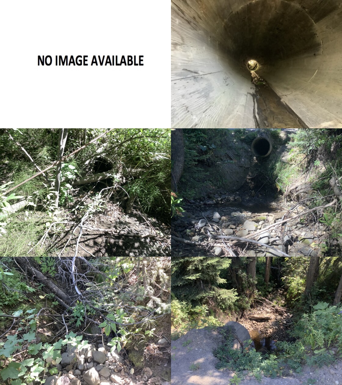
|
|||
| Comments: Flowing water in channel up and down stream, Inlet 75% blocked by debris and sediment |
| Location and Stream Data |
|
Crossing Characteristics | – |
|---|---|---|---|
| Date | 2021-08-11 | Crossing Sub Type | Round Culvert |
| PSCIS ID | 198086 | Diameter (m) | 1.2 |
| External ID | 14001170 | Length (m) | 9 |
| Crew | LRH DM | Embedded | Yes |
| UTM Zone | 9 | Depth Embedded (m) | 0.1 |
| Easting | 627520.8 | Resemble Channel | Yes |
| Northing | 6004423 | Backwatered | Yes |
| Stream | Tributary to Lamprey Creek | Percent Backwatered | 100 |
| Road | spur (overgrown) | Fill Depth (m) | 0.5 |
| Road Tenure | Canfor R06460 | Outlet Drop (m) | 0 |
| Channel Width (m) | 2 | Outlet Pool Depth (m) | 0 |
| Stream Slope (%) | 7 | Inlet Drop | No |
| Beaver Activity | No | Slope (%) | 4 |
| Habitat Value | Low | Valley Fill | Deep Fill |
| Final score | 21 | Barrier Result | Barrier |
| Fix type | Replace with New Open Bottom Structure | Fix Span / Diameter | 10 |
Photos: PSCIS ID 198086. From top left clockwise: Road/Site Card, Barrel, Outlet, Downstream, Upstream, Inlet.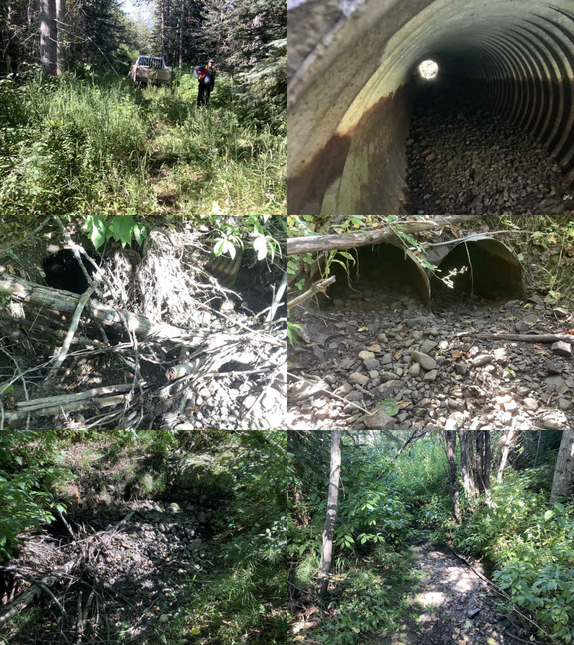
|
|||
| Comments: Dry channel |
| Location and Stream Data |
|
Crossing Characteristics | – |
|---|---|---|---|
| Date | 2021-09-02 | Crossing Sub Type | Round Culvert |
| PSCIS ID | 198087 | Diameter (m) | 2 |
| External ID | 14000453 | Length (m) | 25 |
| Crew | AI | Embedded | No |
| UTM Zone | 9 | Depth Embedded (m) | – |
| Easting | 649728 | Resemble Channel | No |
| Northing | 6029328 | Backwatered | No |
| Stream | Tributary to Nanika River | Percent Backwatered | – |
| Road | Cutthroat 1 | Fill Depth (m) | 1.5 |
| Road Tenure | Houston Highway | Outlet Drop (m) | 0.41 |
| Channel Width (m) | 1.9 | Outlet Pool Depth (m) | 0.6 |
| Stream Slope (%) | 6 | Inlet Drop | Yes |
| Beaver Activity | No | Slope (%) | 7 |
| Habitat Value | Low | Valley Fill | Deep Fill |
| Final score | 33 | Barrier Result | Barrier |
| Fix type | Replace Structure with Streambed Simulation CBS | Fix Span / Diameter | 3 |
Photos: PSCIS ID 198087. From top left clockwise: Road/Site Card, Barrel, Outlet, Downstream, Upstream, Inlet.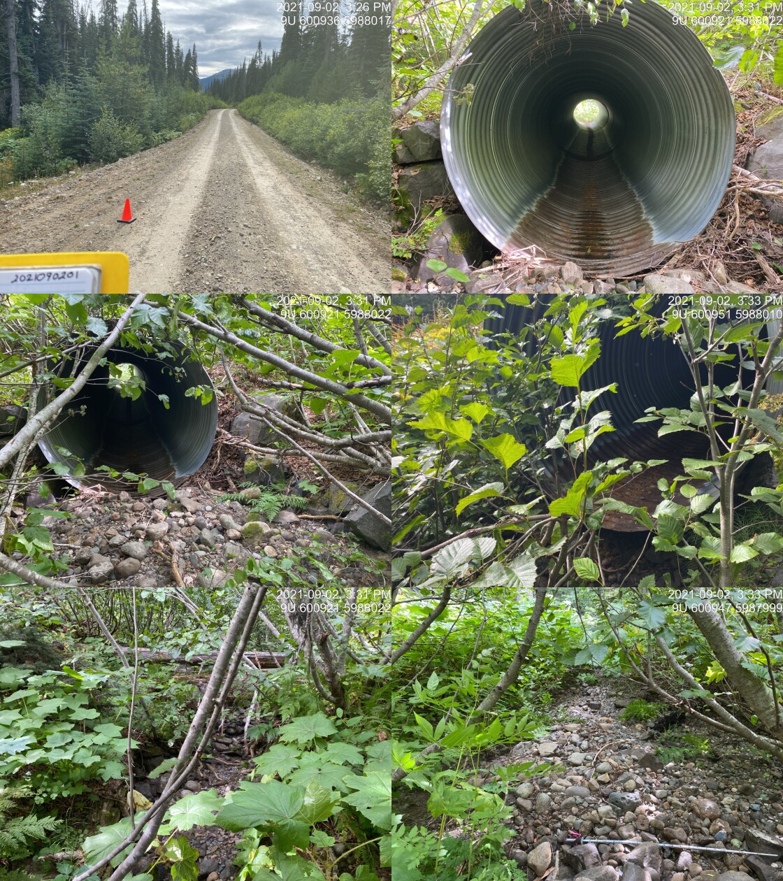
|
|||
| Comments: At modelled crossing location but no map label. Dry. 15:25 |
| Location and Stream Data |
|
Crossing Characteristics | – |
|---|---|---|---|
| Date | 2021-08-09 | Crossing Sub Type | Bridge |
| PSCIS ID | 198088 | Diameter (m) | 10 |
| External ID | 14000196 | Length (m) | 5 |
| Crew | LRH DM | Embedded | – |
| UTM Zone | 9 | Depth Embedded (m) | – |
| Easting | 617726 | Resemble Channel | – |
| Northing | 5998774 | Backwatered | – |
| Stream | Tributary to Collins Lake | Percent Backwatered | – |
| Road | Spur | Fill Depth (m) | – |
| Road Tenure | Unclassified | Outlet Drop (m) | – |
| Channel Width (m) | – | Outlet Pool Depth (m) | – |
| Stream Slope (%) | – | Inlet Drop | – |
| Beaver Activity | – | Slope (%) | – |
| Habitat Value | – | Valley Fill | – |
| Final score | 0 | Barrier Result | Passable |
| Fix type | – | Fix Span / Diameter | – |
Photos: PSCIS ID 198088. From top left clockwise: Road/Site Card, Barrel, Outlet, Downstream, Upstream, Inlet.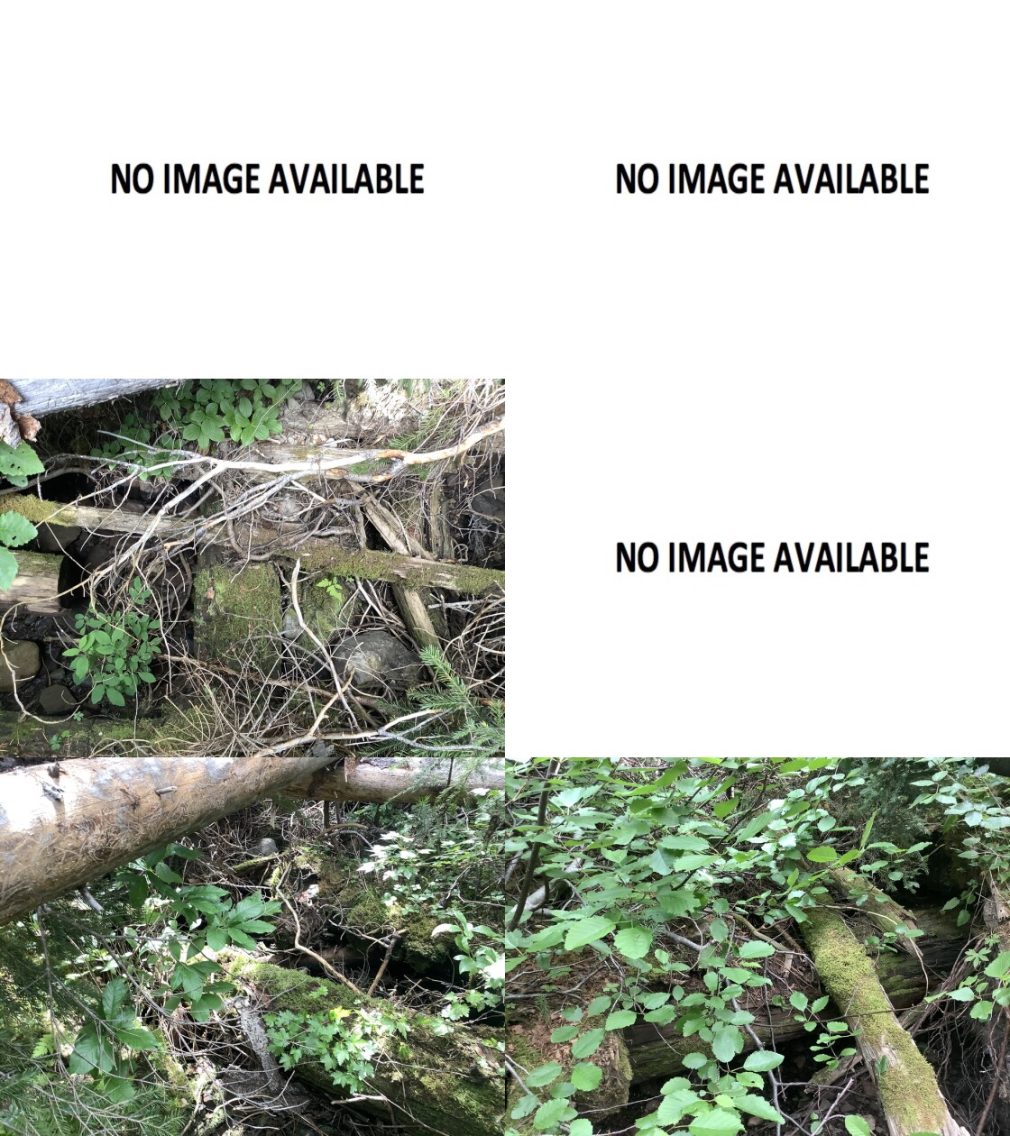
|
|||
| Comments: old wooden bridge, overgrown failed into stream channel, not a barrier but providing structure for aquatics/fish, dry channel, old pre-code logging |
| Location and Stream Data |
|
Crossing Characteristics | – |
|---|---|---|---|
| Date | 2021-08-09 | Crossing Sub Type | Wood Box Culvert |
| PSCIS ID | 198089 | Diameter (m) | 0.9 |
| External ID | 14000217 | Length (m) | 9 |
| Crew | LRH DM | Embedded | – |
| UTM Zone | 9 | Depth Embedded (m) | – |
| Easting | 617051 | Resemble Channel | – |
| Northing | 5997021 | Backwatered | – |
| Stream | Tributary to Collins Lake | Percent Backwatered | – |
| Road | Morice R FSR | Fill Depth (m) | – |
| Road Tenure | Unclassified | Outlet Drop (m) | – |
| Channel Width (m) | – | Outlet Pool Depth (m) | – |
| Stream Slope (%) | – | Inlet Drop | – |
| Beaver Activity | – | Slope (%) | – |
| Habitat Value | – | Valley Fill | – |
| Final score | 0 | Barrier Result | Passable |
| Fix type | – | Fix Span / Diameter | – |
Photos: PSCIS ID 198089. From top left clockwise: Road/Site Card, Barrel, Outlet, Downstream, Upstream, Inlet.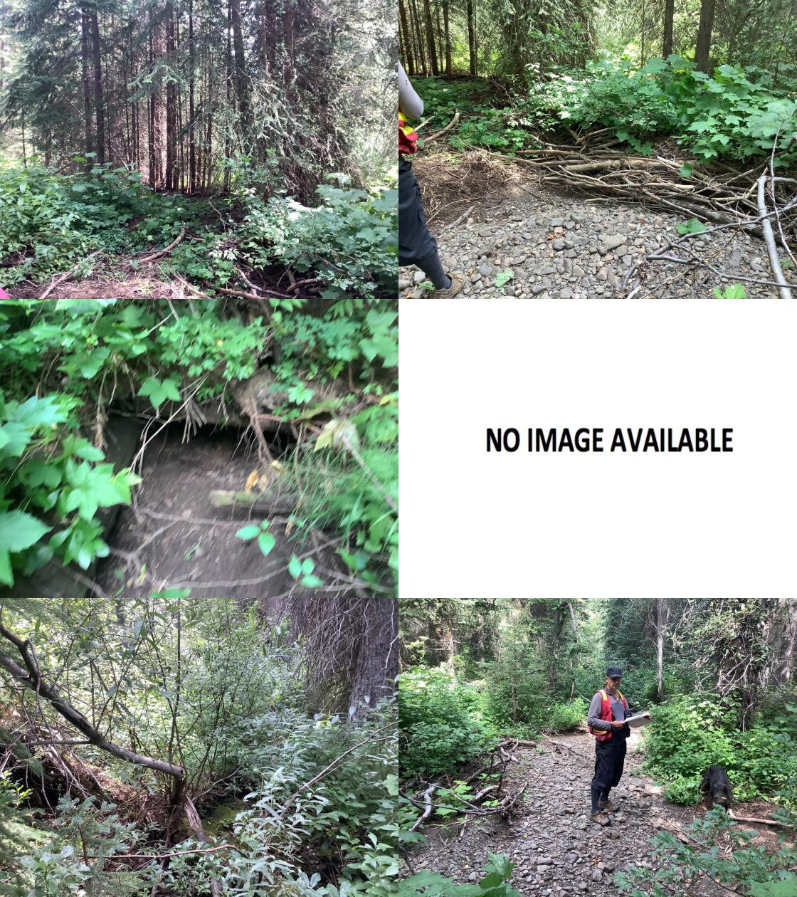
|
|||
| Comments: Overgrown road, wood box culvert complete blockage, access required to deactivate/restore channel |
| Location and Stream Data |
|
Crossing Characteristics | – |
|---|---|---|---|
| Date | 2021-09-05 | Crossing Sub Type | Round Culvert |
| PSCIS ID | 198090 | Diameter (m) | 0.1 |
| External ID | 2021090551 | Length (m) | 15 |
| Crew | KP | Embedded | No |
| UTM Zone | 9 | Depth Embedded (m) | – |
| Easting | 673235 | Resemble Channel | No |
| Northing | 6043218 | Backwatered | No |
| Stream | Cesford Creek | Percent Backwatered | – |
| Road | Railway | Fill Depth (m) | 2 |
| Road Tenure | Canadian National | Outlet Drop (m) | 0 |
| Channel Width (m) | 5 | Outlet Pool Depth (m) | 0 |
| Stream Slope (%) | 1 | Inlet Drop | No |
| Beaver Activity | No | Slope (%) | 3 |
| Habitat Value | High | Valley Fill | Deep Fill |
| Final score | 29 | Barrier Result | Barrier |
| Fix type | Replace with New Open Bottom Structure | Fix Span / Diameter | 10 |
Photos: PSCIS ID 198090. From top left clockwise: Road/Site Card, Barrel, Outlet, Downstream, Upstream, Inlet.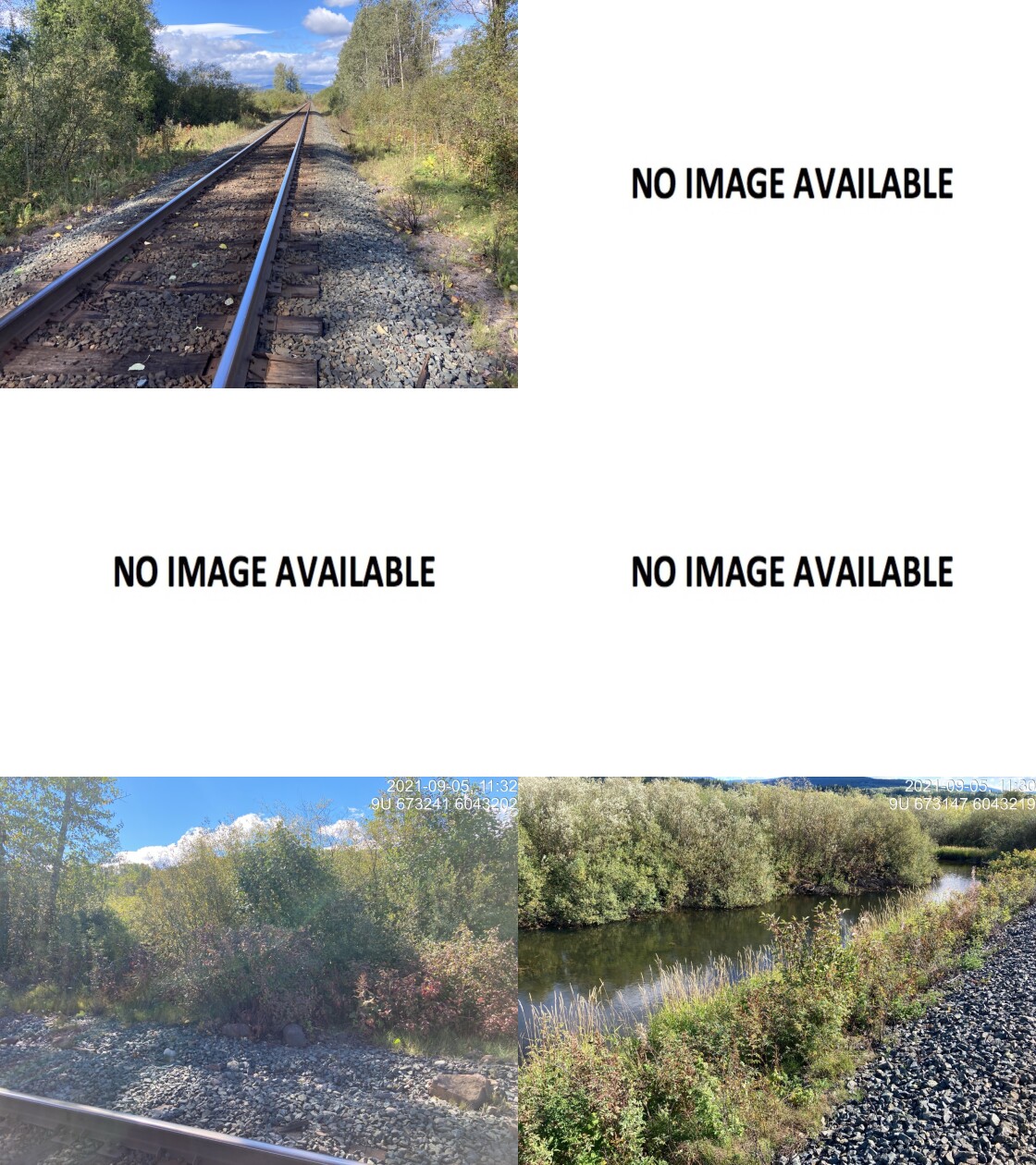
|
|||
| Comments: No crossing actually exists in the field however site entered as a placeholder because there should be connection between Bulkley and Cesford at this location. Survey found no culvert and landowner reported none present. 11:22 |