McDowell Creek - 123544 & 58151 - Appendix
Site Location
PSCIS crossing 123544 and 58151 are located on McDowell Creek approximately 3.5km south-east of Telkwa, BC. PSCIS crossing 123544 is located on a private road and 58151 is located on Woodmere Road. Crossing 123544 was located 0.9km upstream from the confluence with the Bulkley River and crossing 58151 was located a further 1773m upstream. Crossing 123544 is located on private land so likely the responsibility of the landowner. Crossing 58151 is the responsibility of the Ministry of Transportation and Infrastructure.
Background
McDowell Creek drains McDowell Lake (35ha), Dorsay Lake (4ha) and one other unnamed lake (9ha) flowing from McDowell Lake in a south then west direction for approximately 9km to the confluence with the Bulkley River adjacent to the Woodmere Nursery. At crossing 123544, McDowell Creek is a third order stream with a watershed area upstream of the crossing of approximately 15.9km2. The elevation of the watershed ranges from a maximum of 1038m to 576m near the crossing (Table 5.5).
Upstream of crossing 123544, rainbow trout have previously been recorded (MoE 2020b; Norris 2020). An adjacent landowner reports that historic high flow events in the watershed were likely related to beaver dam failures in the upper reaches of the stream network.
A habitat confirmation assessment downstream of 123544 PSCIS stream crossing 58159 (Woodmere Nursery private road) was assessed with by Irvine (2021) in 2020 and the reader is directed there for detailed background, habitat assessment and fish sampling information from 2020 surveys. 58151 was ranked as a moderate priority for follow up by Irvine (2018) due to significant quantities of upstream habitat suitable for salmonid rearing. A total of 54ha of lake and 18ha of wetland is modelled upstream with a summary of additional habitat modelling outputs presented in Table 5.6. A map of the watershed is provided in map attachment 093L.118.
fpr::fpr_table_wshd_sum(site_id = my_site) %>%
  fpr::fpr_kable(caption_text = paste0('Summary of derived upstream watershed statistics for PSCIS crossing ', my_site, '.'),
           footnote_text = 'Elev P60 = Elevation at which 60% of the watershed area is above',
scroll = F)| Site | Area Km | Elev Site | Elev Min | Elev Max | Elev Median | Elev P60 | Aspect |
|---|---|---|---|---|---|---|---|
| 123544 | 15.9 | 553 | 576 | 1038 | 850 | 810 | SSW |
| * Elev P60 = Elevation at which 60% of the watershed area is above |
| Habitat | Potential | Remediation Gain | Remediation Gain (%) |
|---|---|---|---|
| ST Network (km) | 9.6 | 1.8 | 19 |
| ST Lake Reservoir (ha) | 4.4 | 0.0 | 0 |
| ST Wetland (ha) | 0.0 | 0.0 | – |
| ST Slopeclass03 Waterbodies (km) | 0.3 | 0.0 | 0 |
| ST Slopeclass03 (km) | 3.1 | 0.0 | 0 |
| ST Slopeclass05 (km) | 3.0 | 1.8 | 60 |
| ST Slopeclass08 (km) | 1.7 | 0.0 | 0 |
| ST Spawning (km) | 0.0 | 0.0 | – |
| ST Rearing (km) | 7.0 | 1.8 | 26 |
| CH Spawning (km) | 0.0 | 0.0 | – |
| CH Rearing (km) | 0.0 | 0.0 | – |
| CO Spawning (km) | 3.5 | 1.8 | 51 |
| CO Rearing (km) | 6.1 | 1.8 | 30 |
| CO Rearing (ha) | – | 0.0 | – |
| SK Spawning (km) | 0.0 | 0.0 | – |
| SK Rearing (km) | 0.0 | 0.0 | – |
| SK Rearing (ha) | – | 0.0 | – |
| All Spawning (km) | 3.5 | 1.8 | 51 |
| All Rearing (km) | 7.4 | 1.8 | 24 |
| All Spawning Rearing (km) | 7.4 | 1.8 | 24 |
| * Model data is preliminary and subject to adjustments. |
| Habitat | Potential | Remediation Gain | Remediation Gain (%) |
|---|---|---|---|
| ST Network (km) | 7.8 | 2.2 | 28 |
| ST Lake Reservoir (ha) | 4.4 | 0.0 | 0 |
| ST Wetland (ha) | 0.0 | 0.0 | – |
| ST Slopeclass03 Waterbodies (km) | 0.3 | 0.0 | 0 |
| ST Slopeclass03 (km) | 3.1 | 2.2 | 71 |
| ST Slopeclass05 (km) | 1.2 | 0.0 | 0 |
| ST Slopeclass08 (km) | 1.7 | 0.0 | 0 |
| ST Spawning (km) | 0.0 | 0.0 | – |
| ST Rearing (km) | 5.3 | 2.2 | 42 |
| CH Spawning (km) | 0.0 | 0.0 | – |
| CH Rearing (km) | 0.0 | 0.0 | – |
| CO Spawning (km) | 1.8 | 0.6 | 33 |
| CO Rearing (km) | 4.3 | 2.2 | 51 |
| CO Rearing (ha) | – | 0.0 | – |
| SK Spawning (km) | 0.0 | 0.0 | – |
| SK Rearing (km) | 0.0 | 0.0 | – |
| SK Rearing (ha) | – | 0.0 | – |
| All Spawning (km) | 1.8 | 0.6 | 33 |
| All Rearing (km) | 5.6 | 2.2 | 39 |
| All Spawning Rearing (km) | 5.6 | 2.2 | 39 |
| * Model data is preliminary and subject to adjustments. |
Stream Characteristics at Crossing
McDowell Creek was dewatered at both culverts at the time of the surveys. Additionally, the stream was dry at Highway 16 and the Woodmere Nursery private road. PSCIS crossing 123544 was not backwatered, un-embedded and ranked as a barrier to upstream fish passage according to the provincial protocol (MoE 2011b) (Table 5.8). The culvert was perched above the stream at the inlet approximately 2m and road fill had caused a steep slope (>25%) just below the culvert for 5 - 10m.
PSCIS crossing 58151 was not backwatered, not embedded and ranked as a barrier to upstream fish passage according to the provincial protocol (Table 5.9).
| Location and Stream Data |
|
Crossing Characteristics | – |
|---|---|---|---|
| Date | 2021-09-13 | Crossing Sub Type | Round Culvert |
| PSCIS ID | 123544 | Diameter (m) | 1.5 |
| External ID | – | Length (m) | 14 |
| Crew | AI | Embedded | No |
| UTM Zone | 9 | Depth Embedded (m) | – |
| Easting | 628286.7 | Resemble Channel | No |
| Northing | 6060648 | Backwatered | No |
| Stream | McDowell Creek | Percent Backwatered | – |
| Road | Private Road | Fill Depth (m) | 1.5 |
| Road Tenure | Unclassified | Outlet Drop (m) | 0 |
| Channel Width (m) | 2.7 | Outlet Pool Depth (m) | 0 |
| Stream Slope (%) | 1 | Inlet Drop | No |
| Beaver Activity | No | Slope (%) | 18.5 |
| Habitat Value | Medium | Valley Fill | Deep Fill |
| Final score | 26 | Barrier Result | Barrier |
| Fix type | Replace with New Open Bottom Structure | Fix Span / Diameter | 10 |
Photos: From top left clockwise: Road/Site Card, Barrel, Outlet, Downstream, Upstream, Inlet.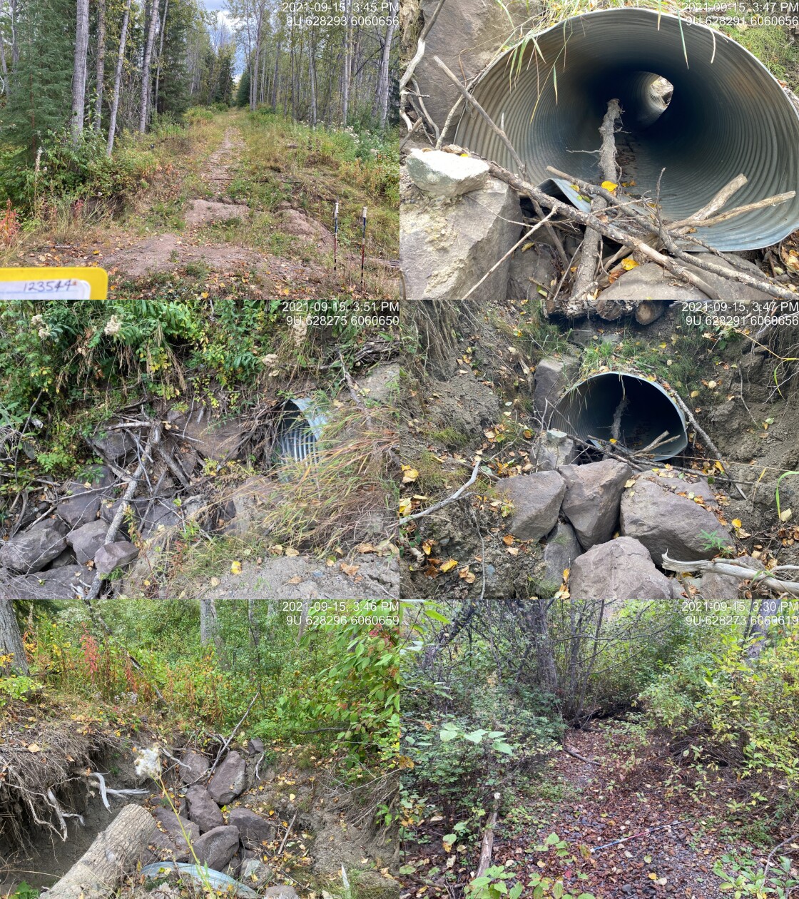
|
|||
| Comments: Inlet of culvert is ~5m elevation more than upstream channel. Road has filled in the creek. 15:44 |
| Location and Stream Data |
|
Crossing Characteristics | – |
|---|---|---|---|
| Date | 2021-09-15 | Crossing Sub Type | Round Culvert |
| PSCIS ID | 58151 | Diameter (m) | 1 |
| External ID | – | Length (m) | 14 |
| Crew | KP | Embedded | No |
| UTM Zone | 9 | Depth Embedded (m) | – |
| Easting | 629753.3 | Resemble Channel | No |
| Northing | 6061126 | Backwatered | No |
| Stream | McDowell Creek | Percent Backwatered | – |
| Road | Woodmere Road | Fill Depth (m) | 0.5 |
| Road Tenure | MoTi Local | Outlet Drop (m) | 0.25 |
| Channel Width (m) | 1.8 | Outlet Pool Depth (m) | 0.64 |
| Stream Slope (%) | 1.5 | Inlet Drop | No |
| Beaver Activity | No | Slope (%) | 5 |
| Habitat Value | Medium | Valley Fill | Deep Fill |
| Final score | 31 | Barrier Result | Barrier |
| Fix type | Replace Structure with Streambed Simulation CBS | Fix Span / Diameter | 3 |
Photos: From top left clockwise: Road/Site Card, Barrel, Outlet, Downstream, Upstream, Inlet.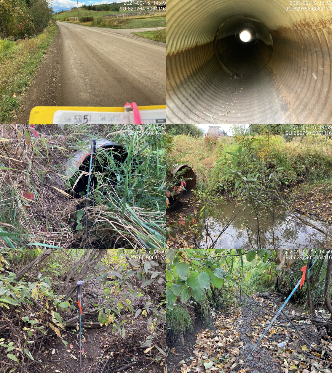
|
|||
| Comments: Channel dry. Current pool water depth is 0.31, outlet drop measured using long tape to simulate riffle crest height. 14:48 |
Stream Characteristics Downstream of 123544
The stream was surveyed downstream from crossing 123544 for 300m (Figures 5.9 - 5.10). Total cover amount was rated as abundant with undercut banks dominant. Cover was also present as small woody debris, large woody debris, boulders, deep pools, and overhanging vegetation. The dominant substrate was gravels with fines sub-dominant. The average channel width was 2.6m, and the average gradient was 2%. Although dry, the channel was well defined with frequent gravels throughout. The undercut banks were deeply cut an riparian vegetation was comprised of thick red-osier dogwood understory and open mature cottonwood forest. Habitat was rated as low value for salmonid rearing and spawning.
At the time of the survey, PSCIS culvert 58158 on Highway 16 located approximately had been recently replaced with a baffled structure embedded with a natural cobble and gravel substrates. Although ranked as a barrier to upstream fish passage using the provincial metric the crossing is likely not a barrier during most flows for adult anadromous salmon and fluvial salmonids migrating upstream from the Bulkley River.
Stream Characteristics Upstream of 123544 and downstream of 58151
The stream was surveyed upstream of crossing 123544 for 25m and downstream from crossing 58151 for 120m (Figures 5.11 - 5.12). The average channel width was 1.7m, and the average gradient was 2%. The dominant substrate was fines with gravels sub-dominant. Total cover amount was rated as abundant with overhanging vegetation dominant. Cover was also present as small woody debris and undercut banks. With the exception of the culvert outlet pool, the channel was dry throughout the area surveyed. Riparian vegetation was primarily grass. Habitat value was rated as low as the surveyed area was dry with extensive agricultural development adjacent.
Stream Characteristics Upstream of 58151
The stream was surveyed upstream from crossing 58151 for 70m (Figures 5.13 - 5.14). The average channel width was 1.7m, and the average gradient was 2%. Total cover amount was rated as abundant with overhanging vegetation dominant. Cover was also present as small woody debris and undercut banks. The dominant substrate was fines with gravels sub-dominant. Survey notes indicate the well defined channel bed was dry and contained fines and sediment likely from the high amount of development of yards, roads, and agriculture adjacent to the stream. Habitat value was rated as low.
Structure Remediation and Cost Estimate
Should restoration/maintenance activities proceed, replacement of PSCIS crossing 123544 with a bridge (10m span) is recommended. The cost of the work is estimated at $200,000 for a cost benefit of 30.4 linear m/$1000 and NA m2/$1000.
Should restoration/maintenance activities proceed, replacement of PSCIS crossing 58151 with a bridge (3m span) is recommended. The cost of the work is estimated at $160,000 for a cost benefit of 26.9 linear m/$1000 and 45.7 m2/$1000. Relocation of the driveway accessing the private land from the other side of the stream and removal of the crossing could also be considered.
Conclusion
There was 6.1km of habitat modelled upstream of crossing 58151 with areas surveyed rated as low value for salmonid rearing and spawning. Crossing 123544 was ranked as a low priority for proceeding to design due to low flows and highly impacted habitats upstream. Crossing 58151 was ranked as a low priority for proceeding to design for replacement. In the upper reaches of McDowell Creek, impacts are apparent due to adjacent land use (cattle trampled banks and grazed/removed riparian vegetation). It is recommended that a plan be developed to work with adjacent landowners and tenure holders to exclude cattle from the riparian area, implement stream restoration actions and explore possibilities related to progressive beaver management in the watershed.
tab_hab_summary %>%
  filter(Site  == my_site |
           Site  == my_site2) %>%
  # select(-Site) %>%
  fpr::fpr_kable(caption_text = paste0('Summary of habitat details for PSCIS crossing ', my_site, '.'),
scroll = F) | Site | Location | Length Surveyed (m) | Channel Width (m) | Wetted Width (m) | Pool Depth (m) | Gradient (%) | Total Cover | Habitat Value |
|---|---|---|---|---|---|---|---|---|
| 58151 | Downstream | 120 | 1.8 | – | – | 1.2 | abundant | low |
| 58151 | Upstream | 70 | 1.7 | – | – | 0.8 | abundant | low |
| 123544 | Downstream | 300 | 2.6 | – | – | 2.0 | abundant | low |
| 123544 | Upstream | 25 | – | – | – | – | – | low |
my_photo1 = fpr::fpr_photo_pull_by_str(str_to_pull = '_d1_')

my_caption1 = paste0('Habitat downstream of PSCIS crossing ', my_site, '.')


# fpr::fpr_photo_flip(site_id = 1802488, str_to_pull = '6257')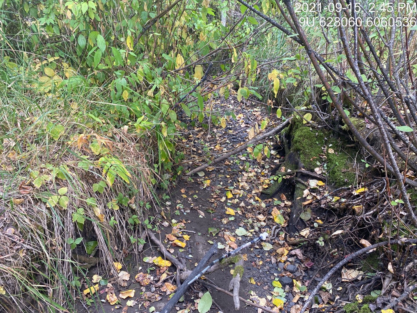
Figure 5.9: Habitat downstream of PSCIS crossing 123544.
my_photo2 = fpr::fpr_photo_pull_by_str(str_to_pull = '_d2_')

my_caption2 = paste0('Habitat downstream of PSCIS crossing ', my_site, '.')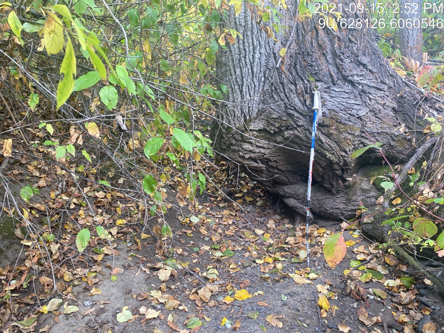
Figure 5.10: Habitat downstream of PSCIS crossing 123544.
my_caption <- paste0('Left: ', my_caption1, ' Right: ', my_caption2)

knitr::include_graphics(my_photo1)
knitr::include_graphics("fig/pixel.png")
knitr::include_graphics(my_photo2)
my_photo1 = fpr::fpr_photo_pull_by_str(site = my_site2, str_to_pull = '_d1_')
my_caption1 = paste0('Habitat downstream of PSCIS crossing ', my_site2, '.')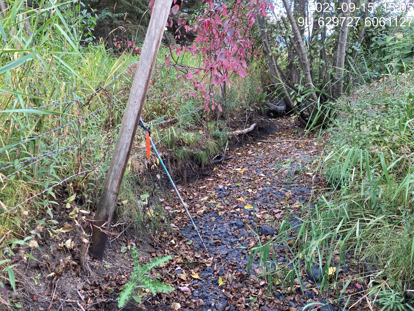
Figure 5.11: Habitat downstream of PSCIS crossing 58151.
my_photo2 = fpr::fpr_photo_pull_by_str(site = my_site2, str_to_pull = '_d2_')

my_caption2 = paste0('Typical habitat upstream of PSCIS crossing ', my_site, '.')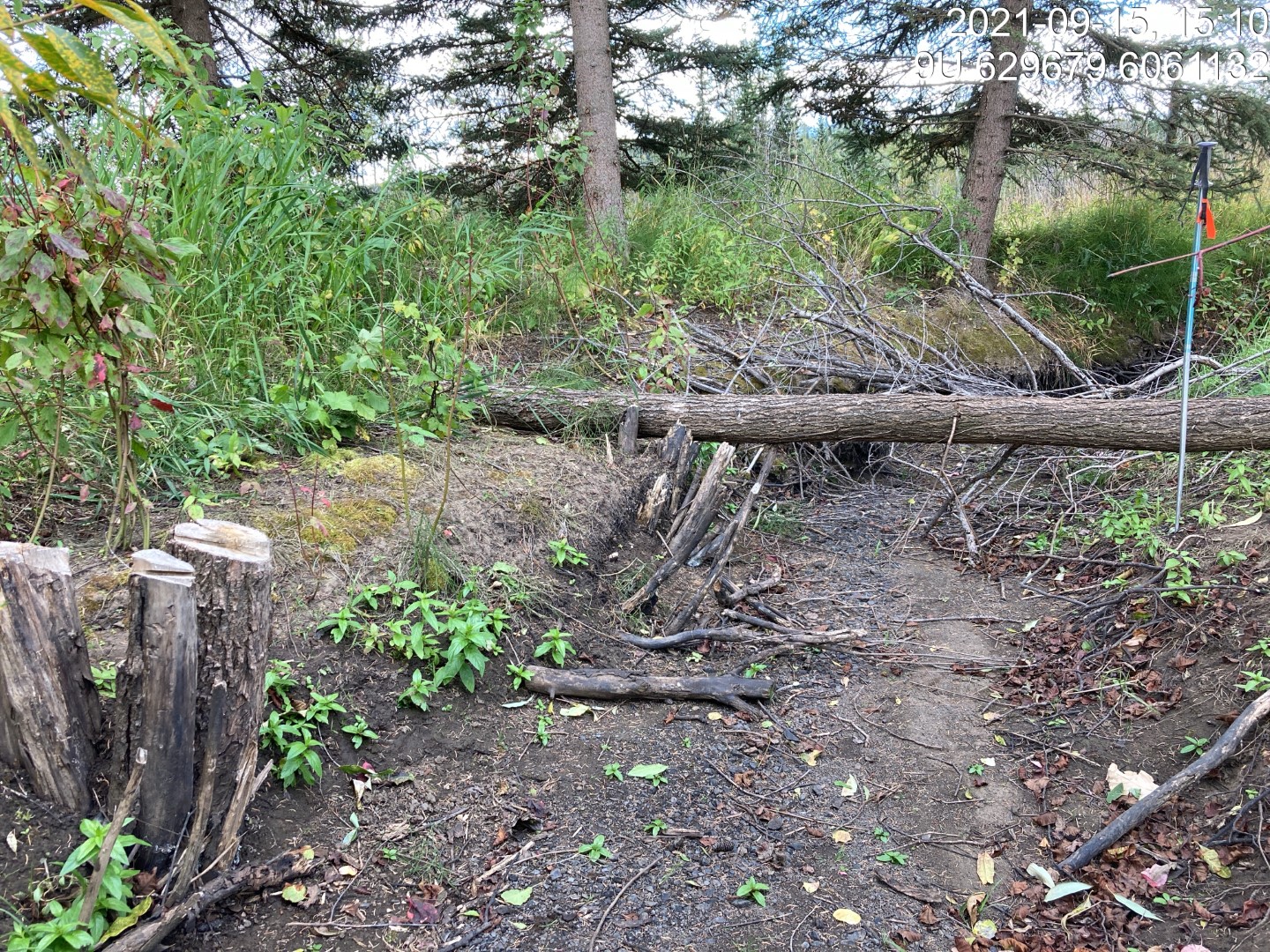
Figure 5.12: Typical habitat upstream of PSCIS crossing 123544.
my_caption <- paste0('Left: ', my_caption1, ' Right: ', my_caption2)

knitr::include_graphics(my_photo1)
knitr::include_graphics("fig/pixel.png")
knitr::include_graphics(my_photo2)
my_photo1 = fpr::fpr_photo_pull_by_str(site = my_site2, str_to_pull = '_u1_')
my_caption1 = paste0('Typical habitat upstream of PSCIS crossing ', my_site2, '.')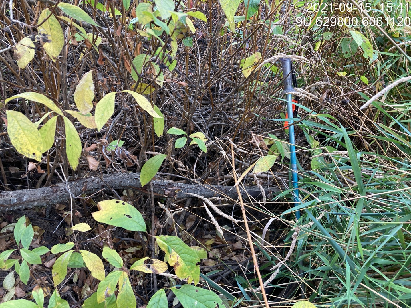
Figure 5.13: Typical habitat upstream of PSCIS crossing 58151.
my_photo2 = fpr::fpr_photo_pull_by_str(site = my_site2, str_to_pull = '_u2_')

my_caption2 = paste0('Typical habitat upstream of PSCIS crossing ', my_site2, '.')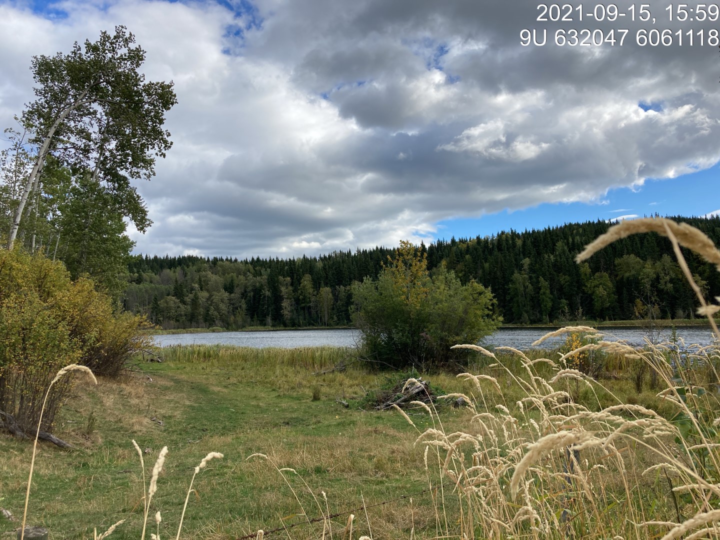
Figure 5.14: Typical habitat upstream of PSCIS crossing 58151.
my_caption <- paste0('Left: ', my_caption1, ' Right: ', my_caption2)

knitr::include_graphics(my_photo1)
knitr::include_graphics("fig/pixel.png")
knitr::include_graphics(my_photo2)