Tributary to Nanika River - 198008 - Appendix
Site Location
PSCIS crossing 198008 is located on Tributary to Nanika River, on a spur road. The site was located approximately 2km upstream from the confluence with the Nanika River, which flows north west for approximately 10km before draining into Morice Lake. This crossing is the responsibility of Canfor Corporation.
Background
At crossing 198008, Tributary to Nanika River is a second order stream with a watershed area upstream of the crossing of approximately 1.6km2. The elevation of the watershed ranges from a maximum of 1605m to 912m at the crossing (Table 5.72). Upstream of crossing 198008, dolly varden have previously been recorded (MoE 2020b; Norris 2020).
fpr::fpr_table_wshd_sum(site_id = my_site) %>%
  fpr::fpr_kable(caption_text = paste0('Summary of derived upstream watershed statistics for PSCIS crossing ', my_site, '.'),
           footnote_text = 'Elev P60 = Elevation at which 60% of the watershed area is above',
scroll = F)| Site | Area Km | Elev Site | Elev Min | Elev Max | Elev Median | Elev P60 | Aspect |
|---|---|---|---|---|---|---|---|
| 198008 | 1.6 | 912 | – | 1605 | 1221 | 1150 | NW |
| * Elev P60 = Elevation at which 60% of the watershed area is above |
The Nanika River is the largest tributary within the Morice watershed, with a total watershed area of 895km2. The only notable sockeye run in the Morice watershed is the Morice-Nanika sockeye. The Babine watershed sockeye stock makes up 91% of the Skeena watershed escapement, while the Morice-Nanika stock makes up only 1% to 2% on average. This makes the Morice-Nanika stock vulnerable to over harvesting. Sockeye escapement numbers averaged 50,000 in the 1950’s, but numbers have generally been in decline since then and remained low through to 2001. The low nutrient levels in Morice Lake, low spawner recruitment, climate conditions that cause flooding, redd dewatering and freezing, predation, and the availability of quality spawning habitat during high escapement years are thought to be the factors influencing production and possibly contributing to the decline of Morice-Nanika sockeye. The Nanika River also provides the most important rearing habitat for rainbow trout in the Morice watershed (G. Tamblyn and Croft 2003).
PSCIS stream crossing 198008 was ranked as a moderate priority for follow up by the Society for Ecosystem Restoration in Northern BC. A summary of habitat modelling outputs is presented in Table 5.73. A map of the watershed is provided in map attachment 093L.102.
| Habitat | Potential | Remediation Gain | Remediation Gain (%) |
|---|---|---|---|
| ST Network (km) | 0.6 | 0.6 | 100 |
| ST Lake Reservoir (ha) | 0.0 | 0.0 | – |
| ST Wetland (ha) | 0.0 | 0.0 | – |
| ST Slopeclass03 Waterbodies (km) | 0.0 | 0.0 | – |
| ST Slopeclass03 (km) | 0.0 | 0.0 | – |
| ST Slopeclass05 (km) | 0.0 | 0.0 | – |
| ST Slopeclass08 (km) | 0.1 | 0.1 | 100 |
| ST Spawning (km) | 0.0 | 0.0 | – |
| ST Rearing (km) | 0.0 | 0.0 | – |
| CH Spawning (km) | 0.0 | 0.0 | – |
| CH Rearing (km) | 0.0 | 0.0 | – |
| CO Spawning (km) | 0.0 | 0.0 | – |
| CO Rearing (km) | 0.0 | 0.0 | – |
| CO Rearing (ha) | 0.0 | 0.0 | – |
| SK Spawning (km) | 0.0 | 0.0 | – |
| SK Rearing (km) | 0.0 | 0.0 | – |
| SK Rearing (ha) | 0.0 | 0.0 | – |
| All Spawning (km) | 0.0 | 0.0 | – |
| All Rearing (km) | 0.0 | 0.0 | – |
| All Spawning Rearing (km) | 0.0 | 0.0 | – |
| * Model data is preliminary and subject to adjustments. |
Stream Characteristics at Crossing
At the time of the survey, PSCIS crossing 198008 was un-embedded, non-backwatered and ranked as a barrier to upstream fish passage according to the provincial protocol (MoE 2011b) (Table 5.74). Water temperature was 9\(^\circ\)C, pH was 7.8 and conductivity was 258uS/cm.
| Location and Stream Data |
|
Crossing Characteristics | – |
|---|---|---|---|
| Date | 2021-09-02 | Crossing Sub Type | Round Culvert |
| PSCIS ID | 198008 | Diameter (m) | 0.9 |
| External ID | – | Length (m) | 11 |
| Crew | KP | Embedded | No |
| UTM Zone | 9 | Depth Embedded (m) | – |
| Easting | 606426.2 | Resemble Channel | No |
| Northing | 5986782 | Backwatered | No |
| Stream | Tributary to Nanika River | Percent Backwatered | – |
| Road | Spur | Fill Depth (m) | 0.2 |
| Road Tenure | Canfor R10644 | Outlet Drop (m) | 0.18 |
| Channel Width (m) | 1.8 | Outlet Pool Depth (m) | 0.6 |
| Stream Slope (%) | 7 | Inlet Drop | Yes |
| Beaver Activity | No | Slope (%) | 6 |
| Habitat Value | Medium | Valley Fill | Deep Fill |
| Final score | 31 | Barrier Result | Barrier |
| Fix type | Replace Structure with Streambed Simulation CBS | Fix Span / Diameter | 3 |
Photos: From top left clockwise: Road/Site Card, Barrel, Outlet, Downstream, Upstream, Inlet.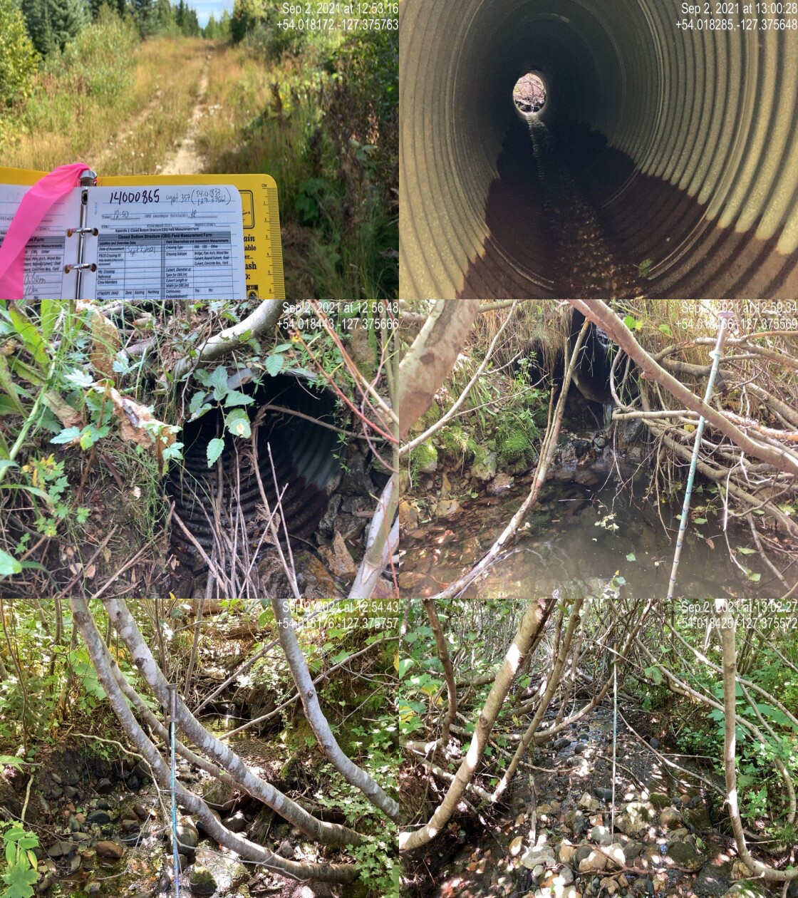
|
|||
| Comments: Stream has good flow, well developed channel. 12:50 |
Stream Characteristics Downstream
The stream was surveyed downstream from crossing 198008 for 400m (Figures 5.92 - 5.93). The dominant substrate was gravels with fines sub-dominant.The average channel width was 2.3m, the average wetted width was 1.3m, and the average gradient was 5.2%.Total cover amount was rated as abundant with overhanging vegetation dominant. Cover was also present as small woody debris, large woody debris, and undercut banks. This was a small stream with low, consistent flows and shallow pools. There were few undercut banks but abundant overhanging vegetation. Gravels were present throughout with fines near the bottom half of the survey and more cobbles near the top. The gradient was steeper in the top half of the survey and decreased further downstream. A few functional large woody debris clusters created drops up to 0.6m high. Overall, the habitat was rated as medium value for salmonid rearing and spawning.
Stream Characteristics Upstream
The stream was surveyed upstream from crossing 198008 for 800m (Figures 5.94 - 5.97). The average channel width was 2m, the average wetted width was 0.9m, and the average gradient was 7.5%.Total cover amount was rated as abundant with undercut banks dominant. Cover was also present as small woody debris, large woody debris, and overhanging vegetation.The dominant substrate was gravels with cobbles sub-dominant. There were multiple channels. The non-dominant channel was most likely surveyed here. The bottom 100m was low gradient, with patches of gravel and good flow for the time of year. Dolly Varden are known to be present upstream. There are no lakes upstream, indicating the stream was passable to Dolly Varden. The habitat was rated as medium value as an important migration corridor containing suitable spawning habitat and having moderate rearing potential.
Structure Remediation and Cost Estimate
Should restoration/maintenance activities proceed, replacement of PSCIS crossing 198008 with a bridge (3m span) is recommended. The cost of the work is estimated at $40,000 for a cost benefit of 0 linear m/$1000 and 0 m2/$1000.
Conclusion
There was 1km of habitat modelled upstream of crossing 198008 with areas surveyed rated as medium value for salmonid rearing and spawning. 198008 was ranked as a moderate priority for proceeding to design for replacement. Electrofishing upstream and downstream of the culvert is recommended to provide insight into fish community composition and density. Due to low historical numbers of sockeye salmon in the Nanika watershed, it would be important to find out if they are using this tributary for spawning and/or rearing.
tab_hab_summary %>%
  filter(Site  == my_site) %>%
  # select(-Site) %>%
  fpr::fpr_kable(caption_text = paste0('Summary of habitat details for PSCIS crossing ', my_site, '.'),
scroll = F) | Site | Location | Length Surveyed (m) | Channel Width (m) | Wetted Width (m) | Pool Depth (m) | Gradient (%) | Total Cover | Habitat Value |
|---|---|---|---|---|---|---|---|---|
| 198008 | Downstream | 400 | 2.3 | 1.3 | 0.2 | 5.2 | abundant | medium |
| 198008 | Upstream | 800 | 2.0 | 0.9 | 0.2 | 7.5 | abundant | medium |
my_photo1 = fpr::fpr_photo_pull_by_str(str_to_pull = '_d1_')

my_caption1 = paste0('Typical habitat downstream of PSCIS crossing ', my_site, '.')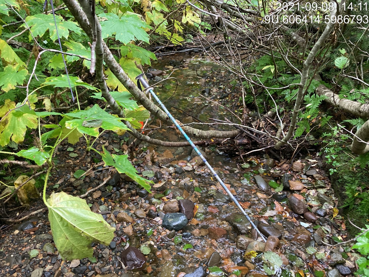
Figure 5.92: Typical habitat downstream of PSCIS crossing 198008.
my_photo2 = fpr::fpr_photo_pull_by_str(str_to_pull = '_d2_')

my_caption2 = paste0('Typical habitat downstream of PSCIS crossing ', my_site, '.')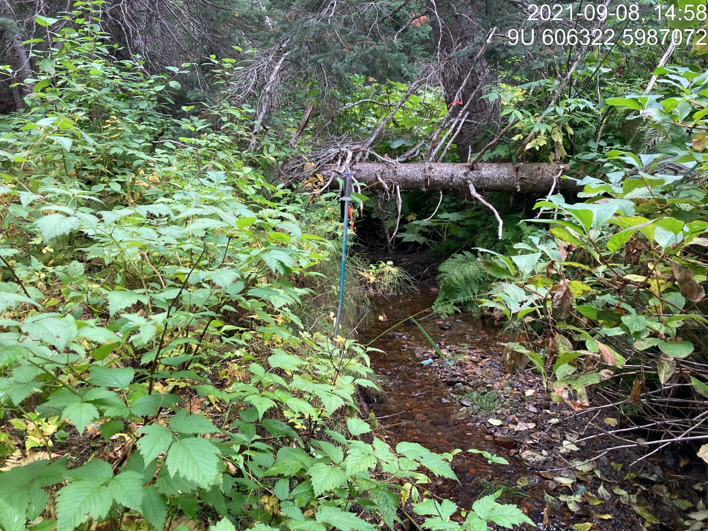
Figure 5.93: Typical habitat downstream of PSCIS crossing 198008.
my_caption <- paste0('Left: ', my_caption1, ' Right: ', my_caption2)

knitr::include_graphics(my_photo1)
knitr::include_graphics("fig/pixel.png")
knitr::include_graphics(my_photo2)
my_photo1 = fpr::fpr_photo_pull_by_str(str_to_pull = '_u1_')
my_caption1 = paste0('Typical habitat upstream of PSCIS crossing ', my_site, '.')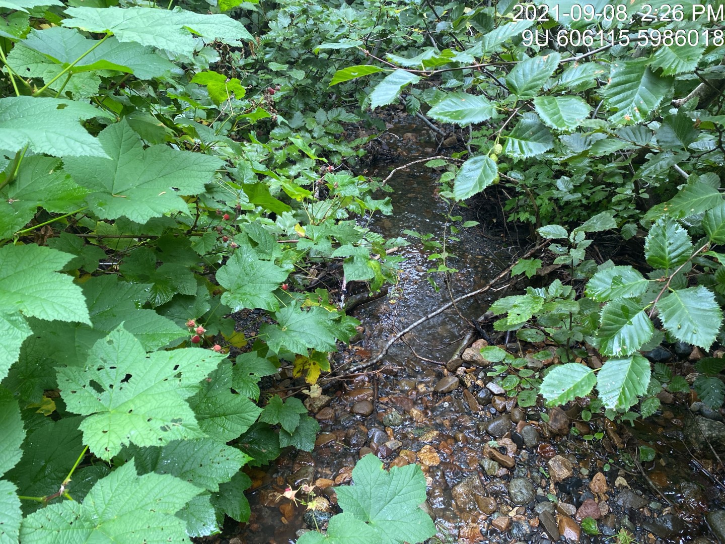
Figure 5.94: Typical habitat upstream of PSCIS crossing 198008.
my_photo2 = fpr::fpr_photo_pull_by_str(str_to_pull = '_u2_')

my_caption2 = paste0('Typical habitat upstream of PSCIS crossing ', my_site, '.')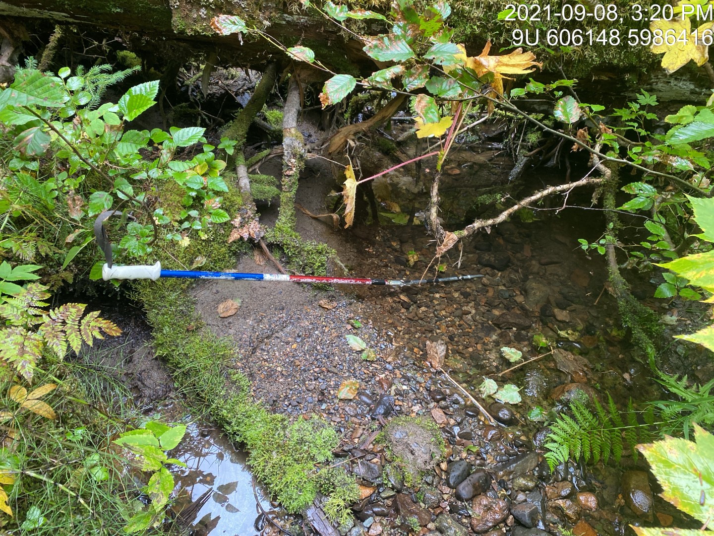
Figure 5.95: Typical habitat upstream of PSCIS crossing 198008.
my_caption <- paste0('Left: ', my_caption1, ' Right: ', my_caption2)

knitr::include_graphics(my_photo1)
knitr::include_graphics("fig/pixel.png")
knitr::include_graphics(my_photo2)
my_photo1 = fpr::fpr_photo_pull_by_str(str_to_pull = '_u3_')
my_caption1 = paste0('Typical habitat upstream of PSCIS crossing ', my_site, '.')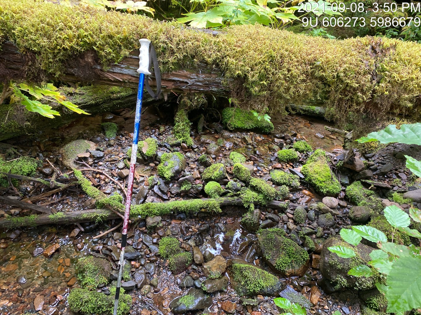
Figure 5.96: Typical habitat upstream of PSCIS crossing 198008.
my_photo2 = fpr::fpr_photo_pull_by_str(str_to_pull = '_u4_')

my_caption2 = paste0('Typical habitat upstream of PSCIS crossing ', my_site, '.')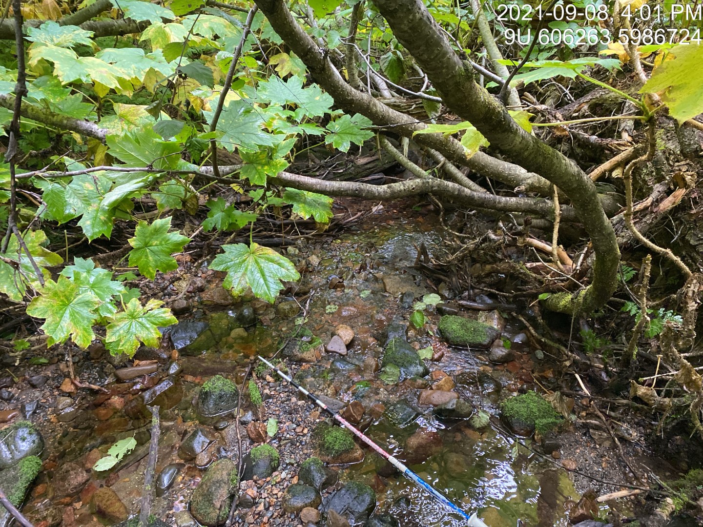
Figure 5.97: Typical habitat upstream of PSCIS crossing 198008.
my_caption <- paste0('Left: ', my_caption1, ' Right: ', my_caption2)

knitr::include_graphics(my_photo1)
knitr::include_graphics("fig/pixel.png")
knitr::include_graphics(my_photo2)